News   Jun 26, 2024
 48     0 
News   Jun 25, 2024
 1.4K     1 
News   Jun 25, 2024
 1K     0 

Street Naming (Avenue 7?)

I don't get what's so terrible about having a numbered street? I love the name 16th Avenue and actually hate Carville and Rutherford Rds. In fact, I'd love it if they would rid the pathetic three name changes in the span of two blocks and just call it all 16th Ave. It's easy to remember, to say, and to write.
 
^^ I agree. But I think that Highway 7 needs some spice. Something that integrates well with the current name, and I think Group of Seven Avenue is beautiful.

It reflects on the history of the street, sounds elegant, and it integrates surpassingly well into the current name. With the 7, I imagine that people will feel no shame in continuing to call it Highway 7 or 7, and they could also call it Avenue 7 or 7th Avenue or 7th. The awesome thing is that you'll always know what they're talking about!

I'm totally sold on Group of Seven now!
 
What naming convention? Where's 1-13?

Perhaps...
  1. Lakeshore
  2. Queensway/Queen
  3. College/Carlton/Gerrard
  4. Bloor/Danforth
  5. Burnhamthrope/Annette/Dupont/Mortimer
  6. Rathburn/O'Connor/St Clair
  7. Eglinton
  8. Lawrence
  9. Wilson/York Mills/Ellesmere
  10. Sheppard
  11. Finch
  12. Drewry/Cummer/McNicoll
  13. Steeles
  14. Centre/John/14th
  15. Queen/Highway 7
  16. Bovaird/Rutherford/Carville/16th
  17. Major Mackenzie
  18. Elgin Mills
  19. Gamble/19th

Works, no?

Nope. See conversation above. Lakeshore would have been under water when the concessions were laid out. Front st. was where the shoreline used to be, everything south of that is land fill. Queen was the first concession
 
Correct. Queen was first called Lot Street - as that was where the first "Park Lots" - the the original concession system - were started from northwards. Also note Queen makes it all the way to the border to Scarborough, which as its own township was surveyed differently.

The concession roads were:
Lot Street/Queen Street
Bloor/Danforth
St. Clair
Eglinton
Lawrence
Wilson/York Mills
Sheppard
Finch
Steeles

You can tell that Markham and Vaughan Townships were laid out differently at the Town Line (Steeles) as you can easily tell the shifts in Bathurst Street and Kennedy Road, for example.

Scarborough was laid out differently as well - you can tell by the shifts in Finch and Sheppard.
 
Peel and Halton Counties look like they were done together to, as our streets are pretty much perpendicular to the lake.
 
Toronto Township (most of it became 95% of the land mass that is now City of Misissauga), Trafalgar Township (Oakville), and Nelson Township (Burlington) were indeed laid out the same south of Eglinton Avenue, apart from some early tracts surrounding Port Credit (explaining the diagionals in some of the property lines and 'north-south' streets.

Eglinton Avenue was called Base Line Road/Lower Base Line across the entire length all the way to Wentworth County (East Flamborough Township) where it changed again.

North of Eglinton, there were differences. Toronto Township north of Eglinton, Chinguacousy Township and Caledon Township (Airport Road in east, Winston Churchill in west, Dufferin County to north) were based on Hurontario Road - hence 1st Line West (McLaughlin), 1st Line East (Kennedy). There was a shift at Old Base Line (Peel Regional Road 12), where Chinguacousy ended and Caledon Twp started.

Note how McLaughlin doesn't line with Mavis (the first laid road east of Hurontario south of Eglinton), Kennedy doesn't line up with Cawthra? Toronto Township was interesting because it had two different survey systems within one township.

Toronto Gore (now part of Brampton) and Albion Townships followed a similar pattern, but in that triangular wedge with York County. Why Highway 7 makes a curve in the far west of Brampton to line up with Highway 7 in Vaughan.
 
For whatever the reason, Peel County/Region never assumed Base Line/Eglinton. Maybe because it wasn't an original boundary between municipalities like Steeles (the City of Mississauga ceded some of its land, at the "greenbelt corridor" to Brampton).

The exisiting regional roads in Peel (Cawthra, Mississauga Road/Queen Street [rather shited to Erin Mills] Britannia were major corridors between the highways, connecting larger settlements in the county to them other.
 
Nope. See conversation above. Lakeshore would have been under water when the concessions were laid out. Front st. was where the shoreline used to be, everything south of that is land fill. Queen was the first concession

Well I knew that, lol. I was just coming with with a way to justify any claim that concessions in York Region around the Yonge baseline are in a way continuous from those in Toronto. As such making 19th Avenue the 19th concession from Lake Ontario, 16th Ave the 16th, Hwy 7 the 15th and so on. The addition of minor but nonetheless continuous east-west corridors such as McNicoll-Cummer-Drewry or Dupont-Annette (which conceivably goes on as Mortimer Ave through East York and Burnhamthope through Etobicoke) props up the total number through the 416.
 
For whatever the reason, Peel County/Region never assumed Base Line/Eglinton. Maybe because it wasn't an original boundary between municipalities like Steeles (the City of Mississauga ceded some of its land, at the "greenbelt corridor" to Brampton).

The exisiting regional roads in Peel (Cawthra, Mississauga Road/Queen Street [rather shited to Erin Mills] Britannia were major corridors between the highways, connecting larger settlements in the county to them other.

Then where did "Regional Road 12" come from?
 
Public meetings in lead up to Hwy. 7 name change.

Vaughan
January 13, 2010 01:35 PM
by David Fleischer

York Region is set to rename Hwy. 7, recognizing it more as an urbanized street than the highway it once was.

Bt you will have a chance to voice your opinion on the proposed name change at a series of public meetings next week.

While Hwy. 7 runs from Sarnia to Ottawa, many sections were downloaded by the province to municipalities in the 1990s. Technically, Hwy. 7's name these days is Regional Road 7.

In June 2007, both Markham and Vaughan asked the region to consider renaming the road.

Richmond Hill has watched from the sidelines, but there are very few addresses on its side of the road that would need to change.

Regional council has already voted in support of the change that will see a new name for the entire regional length, from Hwy. 50 to east of Donald Cousens Parkway.

A final decision is expected later this year following public input.

Avenue 7 is the preferred option and councillors rejected the idea of having a renaming contest but residents can attend the meetings or submit comments online via a survey at yorkrename7.lura.ca


City of Vaughan
January 18th, (7 to 9 p.m.), Woodbridge College, Cafeteria
71 Bruce Street (East of Inslington Avenue, off Highway 7)

Town of Richmond Hill
January 19th, (7 to 9 p.m.), Alexander Mackenzie High School, Cafeteria
300 Major Mackenzie Drive West

Town of Markham
January 20th, (7 to 9 p.m.), Markville Secondary School, Cafeteria
1000 Carlton Road
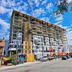
 
If it's to reflect the nature of the street, they might want to wait a few years more before changing the name of the street :rolleyes:

I'm still in love with Group of Seven Avenue. Avenue Seven sounds both lame and like they didn't try to be creative when renaming the street.
 

Back
Top