doady
Senior Member
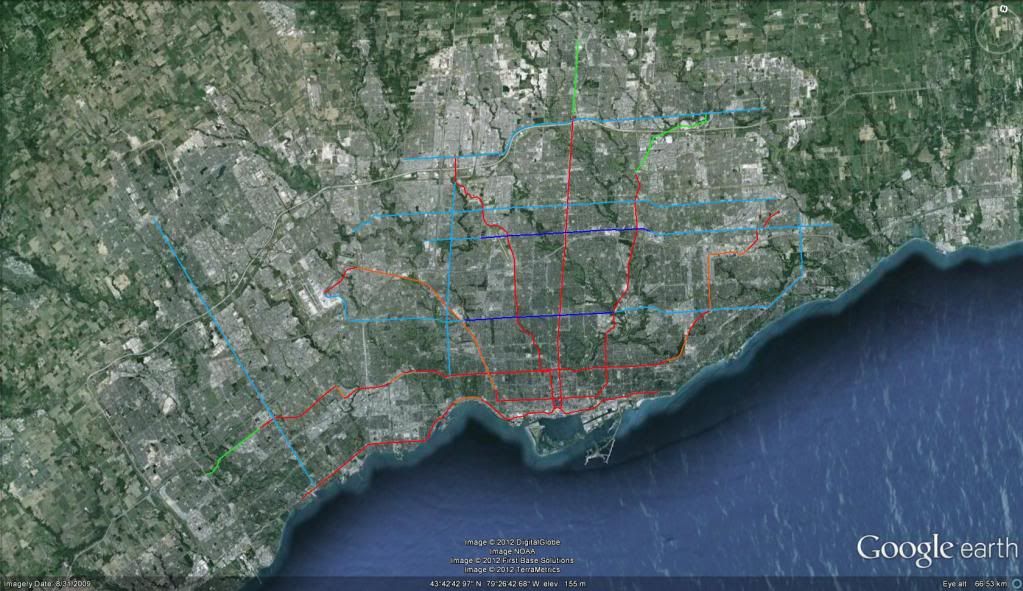
Gweed and I have a similar concept of future rapid transit in GTA, maybe the same inspiration. My map was basically rip off of Berlin U-Bahn/S-Bahn.
Rapid transit at both local and regional scales integrated into one system was the idea. Of course, we both added LRT as well, which is semi-rapid transit, not true rapid transit, but it's not too out-of-place either.
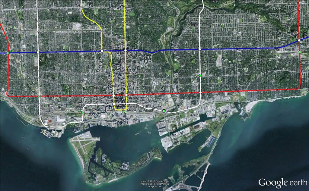
I don't think BRT fits though, because it is not rail. Even if it did fit, they would be hard to represent on the same map. Just look at the planned service for Mississauga Transitway for example:

Not only are there a huge amount of lines overlapping, even with GO buses excluded, but the distinction between what is a rapid transit line and what is not rapid transit line here is very blurred.
For the record, true "rapid transit" means limited stops, high frequency, all day, all week service, all door boarding, grade-separation, and other priority measures if needed. Commuter trains are not rapid transit. My map does not show any commuter rail service.
Rapid transit at both local and regional scales integrated into one system was the idea. Of course, we both added LRT as well, which is semi-rapid transit, not true rapid transit, but it's not too out-of-place either.
I don't think BRT fits though, because it is not rail. Even if it did fit, they would be hard to represent on the same map. Just look at the planned service for Mississauga Transitway for example:
Not only are there a huge amount of lines overlapping, even with GO buses excluded, but the distinction between what is a rapid transit line and what is not rapid transit line here is very blurred.
For the record, true "rapid transit" means limited stops, high frequency, all day, all week service, all door boarding, grade-separation, and other priority measures if needed. Commuter trains are not rapid transit. My map does not show any commuter rail service.
Last edited: