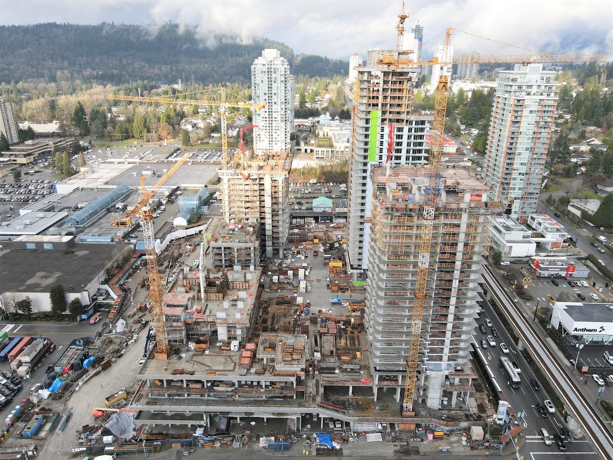
Yeah, a median allignment for a elevated guideway tends to be the most imposing
- but
the bulk only appears at station sites, so those sites and integration would have to be chosen carefully
(ie near or integrated with newer buildings).
The guideway will have to be taller to allow a mezzanine level to provide ciculation to both platforms (assuming outside platforms to keep the guideway columns straight). Ideally, you would tie the mezzanine walkway into adjacent office buildings, so station entrances are in existing facades.
Another option is to reconfigure RL Blvd to create a park down one side with the REM Est above and "side-of-road" stations which are shorter and more human scale..
For SkyTrain, the nicest median station (there aren't many) is Brentwood Town Centre (80m platform) - which also shows that the platform supports can be cantilvered from the guideway structure. Note how tall it is to allow a mezzanine below.
For the REM Est, with 40m platforms, the escalators and stairs could be at the ends of the platforms, reducing the bulk directly under the platforms (but having the mezzanine below allows easier elevator access).
PS - Honolulu has some of the most convoluted median/mezzanine stations.
Brentwood Station:

www.canadianarchitect.com
Burnaby at Brentwood has gone full urban. This is the Lougheed Highway at Willingdon – one the signature crossroads of our region. On the right, a massive mixed-use development called (awful…

pricetags.ca
I don't know Montreal that well, but looking at GoogleMaps and this system diagram, it looks like Dufesne could be a "side of road" station on greenspce, so there would be 4 median / mezzanine stations - Cartier, LaBelle, St. Urbain and Robert Bourassa. Cartier looks to be a disytrct, so hard to tell where the station might be located. There are lots of CBC studios in the area.
At Robert Bourassa, I could see a mezzanine landing either into the podium of Place Ville Marie (though probbaly heritage protected) or onto the adjacent parkette (one side of street only):
Find local businesses, view maps and get driving directions in Google Maps.

www.google.com
At St. Urbain, I could see the station mezzanine landing in the blank concrete podium on the right of this shot:
Find local businesses, view maps and get driving directions in Google Maps.

www.google.com
At LaBelle, I could see the peach coloured hotel being demolished for a station entrance.
Find local businesses, view maps and get driving directions in Google Maps.

www.google.com
Everegreen Line in the median of North Road on the right of this shot.
Not a massive presence away from stations (but this is a low level guideway).
Lougheed Mall (City of Lougheed) redevelopment from Glotman Simpson twitter via ITC posted Dec 22nd:
https://twitter.com/GlotmanSimpson


