News   Jul 08, 2024
 294     0 
News   Jul 08, 2024
 889     4 
News   Jul 08, 2024
 552     0 

Miscellany Toronto Photographs: Then and Now

Then and Now for June 10, 2013.


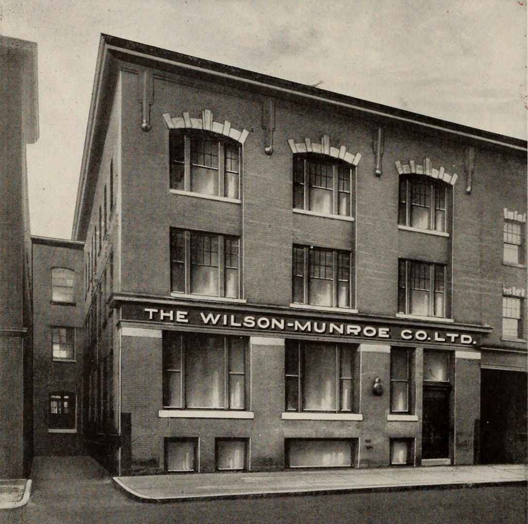
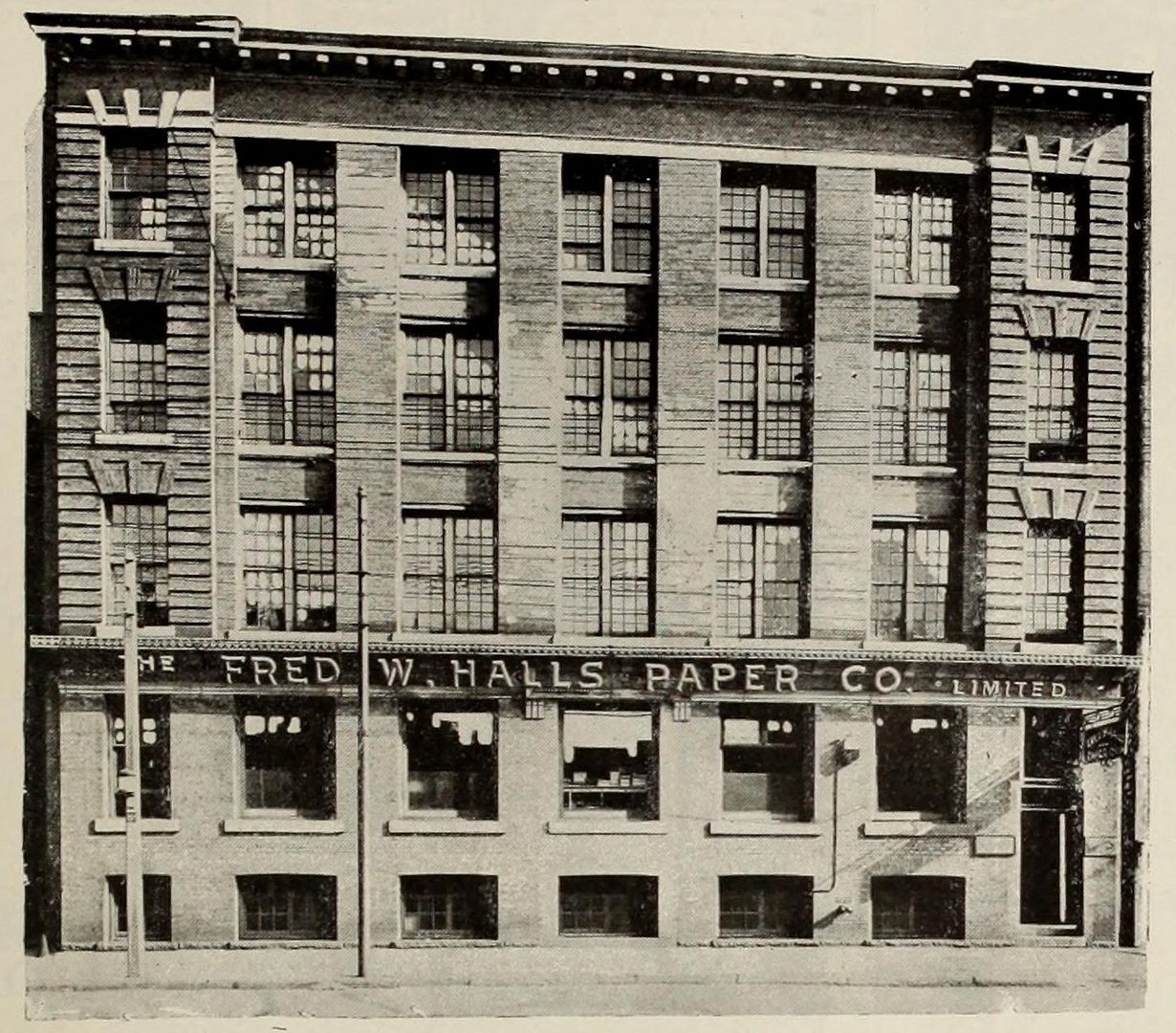
Then. 261 Adelaide Street W. c1921. The Fred W. Halls Paper Company Limited.

1123257261AdelaideWc1921_zpsde93ef18.jpg


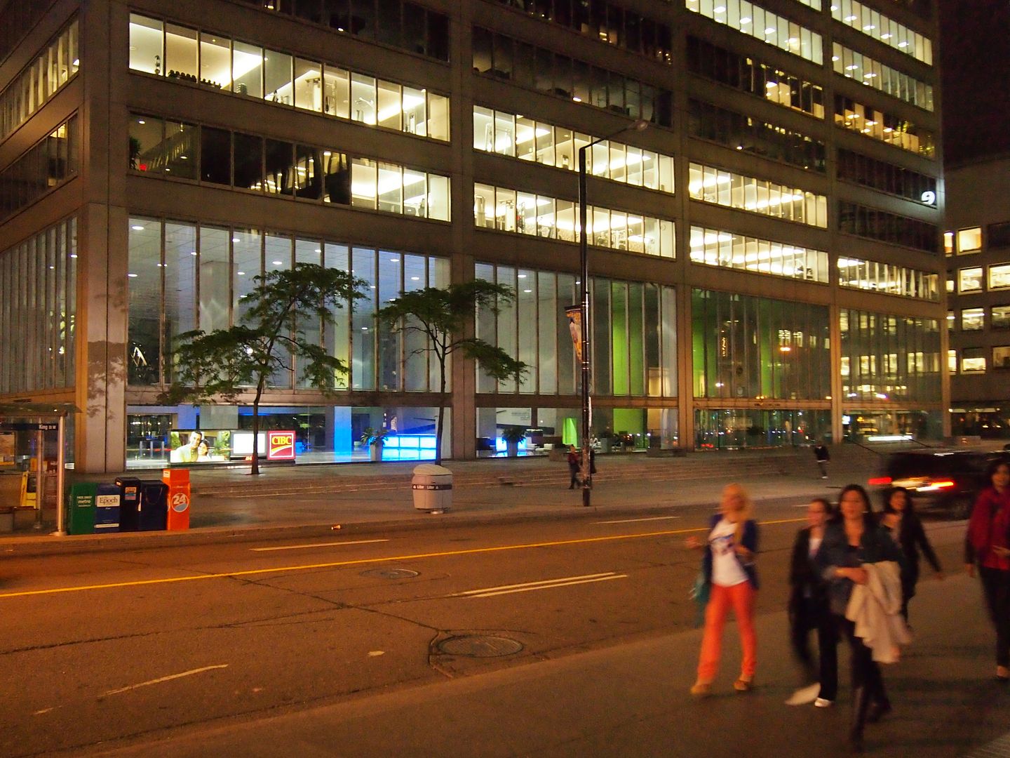
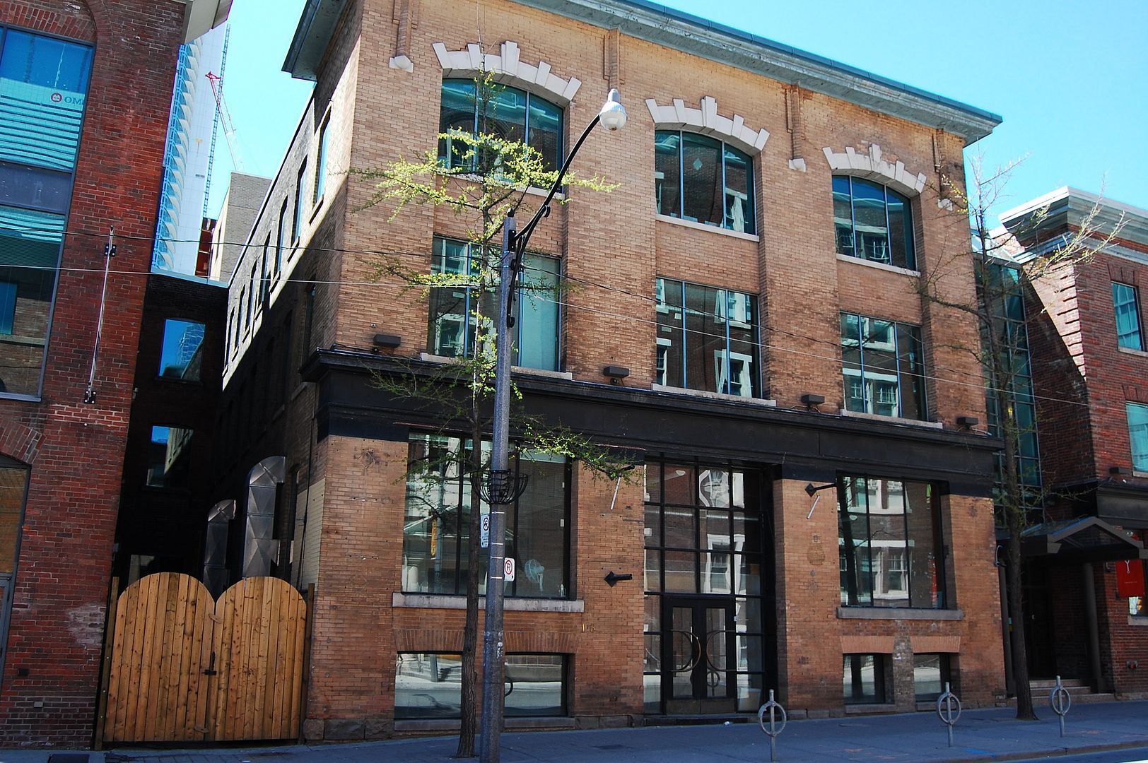
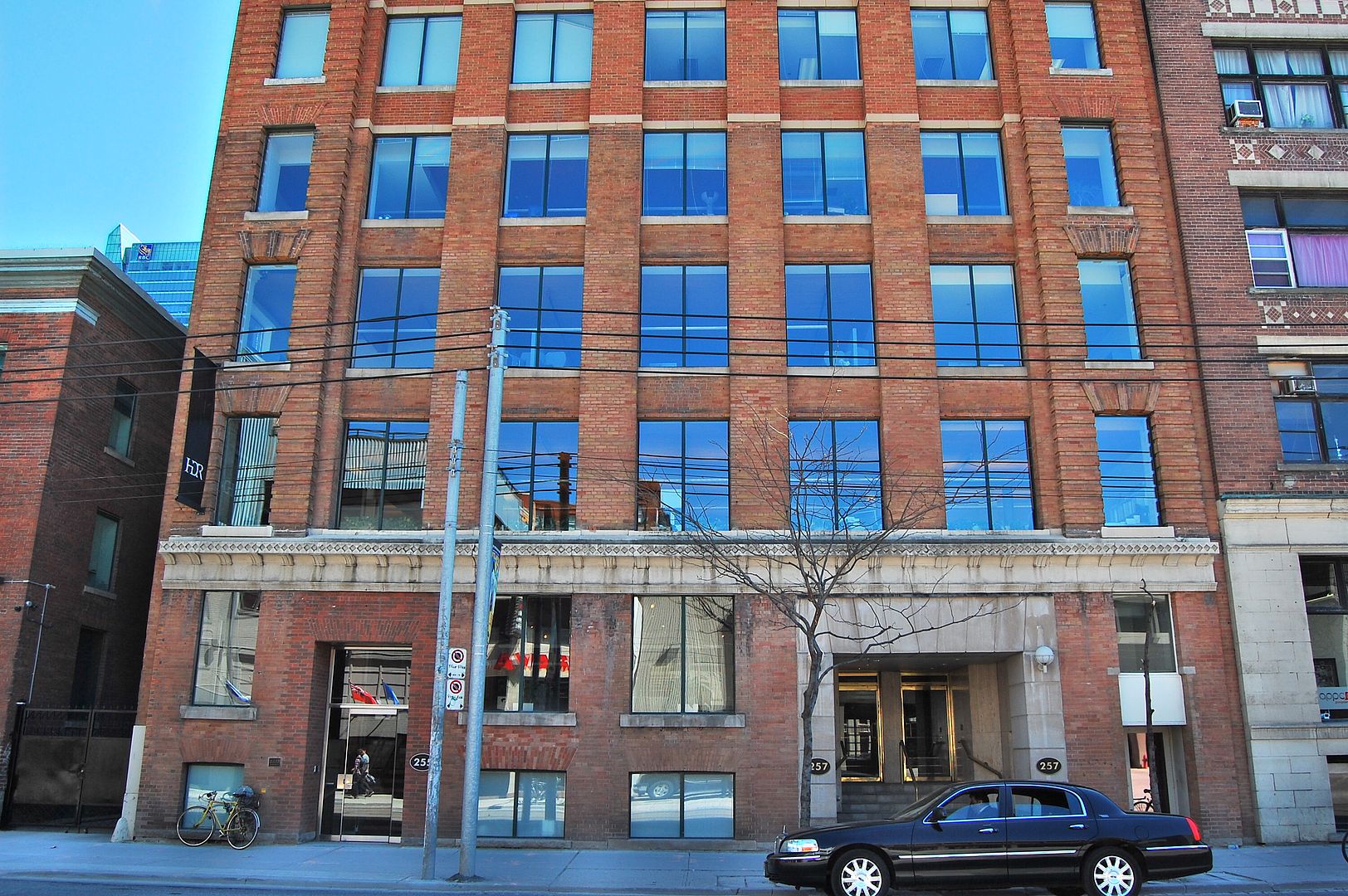
Now. 255 and 257 now - I suppose they might have renumbered the buildings on this street? April 2013.

1124257261adelaidew_zpsf5a1418d.jpg
 
Thank you so much J T and k10ery.


As a completely unrelated reward for your efforts :) here is a 1942 aerial map of the area bound by Yonge (left margin), Carlton (top margin), Parliament (right margin), and Queen (bottom margin).

UT-ers, put yourselves into a helicopter in 1942 and imagine yourself hovering over this area.

Lots to see here. Mutual street arena, the Mutual Street loop (a Then and Now topic of a few days ago), an entire row of long gone shops on the NW corner of Queen and Sherbourne, the Ryerson school area before Ryerson U, etc. Hours of amusement here.

http://commons.wikimedia.org/wiki/File:TorontoGardenDistrictAerial1942.jpg

If you right mouse click twice you get a magnified view but lose access to the file annotations.

It also shows an unwidened Jarvis Street, almost intact in its 19thC builtform:

jarvis.jpg


jarvis2.jpg
 

Attachments

  • jarvis.jpg
    jarvis.jpg
    99.1 KB · Views: 637
  • jarvis2.jpg
    jarvis2.jpg
    98.6 KB · Views: 636
Last edited:
Then and Now for June 11, 2013.


Then. An atmospheric night time picture from June 8, 1908. 'Elections Ontario.' Looks like everyone is gathered to see the results - perhaps projected onto a wall behind the photographer, I am guessing. The location is Bay Street just a few steps south of King Street; we are looking SE. That's the Toronto Telegram building centre right. Our Goldie may weigh in on this but I am imagining this picture was taken with the aid of some sort of monstrously bright flash.

1186ElectionsOntario1908June8LookingsonBaySttoMelindaSt1_zps9bd22e6a.jpg


Now. June 8, 2013. Commerce Court West Tower.

1187_zps8c68c365.jpg
 
Then and Now for June 11, 2013.

Then. An atmospheric night time picture from June 8, 1908. 'Elections Ontario.' Looks like everyone is gathered to see the results - perhaps projected onto a wall behind the photographer, I am guessing. The location is Bay Street just a few steps south of King Street; we are looking SE. That's the Toronto Telegram building centre right. Our Goldie may weigh in on this but I am imagining this picture was taken with the aid of some sort of monstrously bright flash.

1186ElectionsOntario1908June8LookingsonBaySttoMelindaSt1_zps9bd22e6a.jpg

Would have been "flash powder" in those days.
That projection beam over the crowd looks faked. Probably added in the darkroom.

flash powder.jpg
 

Attachments

  • flash powder.jpg
    flash powder.jpg
    32.7 KB · Views: 917
Last edited:
Would have been "flash powder" in those days.
That projection beam over the crowd looks faked. Probably added in the darkroom.

View attachment 13997

Thanks Goldie,

That is a impressive and slightly scary picture. I suppose powder flash was used indoors only with express permission. :)

The Then picture - I've just noticed a sign for 15 cent meals. My grandfather used to talk about 25 cent meals in his recollections from 1918, the year of his arrival in Toronto. I also notice a sign for 'KODAKS' - in 1908 that would have been a 'Brownie' [introduced in 1900].


http://library.ryerson.ca/asc/sc/heritage-cameras/
 
Last edited:
Thank you so much J T and k10ery.


As a completely unrelated reward for your efforts :) here is a 1942 aerial map of the area bound by Yonge (left margin), Carlton (top margin), Parliament (right margin), and Queen (bottom margin).

UT-ers, put yourselves into a helicopter in 1942 and imagine yourself hovering over this area.

Lots to see here. Mutual street arena, the Mutual Street loop (a Then and Now topic of a few days ago), an entire row of long gone shops on the NW corner of Queen and Sherbourne, the Ryerson school area before Ryerson U, etc. Hours of amusement here.

http://commons.wikimedia.org/wiki/File:TorontoGardenDistrictAerial1942.jpg

If you right mouse click twice you get a magnified view but lose access to the file annotations.

Woah, there was a public school on George Street, between Dundas and Gerrard. Might think twice about signing my little one up for a school in that location today!
 

This building perplexes me. The NOW article says that it’s 126 years old (last year; 127 now). However, no schoolhouse or building of any kind
appears there on any Goad’s plans until 1912. Also, I was not able to find it listed there in the Directories until 1913, as the “Allan†school.

I’m assuming this building was moved to this site from somewhere else, but I can’t think where it might have been originally.
 
Then and Now for June 12, 2013.


Then. The Wilson-Munroe Co. Ltd. 20 Duncan Street. c1921.

Thank you wwwebster for scouring the internet for all these rare images. :)

110818-20Duncanc1921_zps11356fef.jpg


Now. April 2013.

11091820duncan_zps7e03d1b4.jpg
 

Back
Top