
JasonParis
Moderator
This was a live music venue for a few years around 1993-1995. It was called The Palladium. Smashing Pumpkins played here for one. I remember seeing Suede and Frente there as well.October 7th addition.
Now: October 6, 2009.
|
|
|
This was a live music venue for a few years around 1993-1995. It was called The Palladium. Smashing Pumpkins played here for one. I remember seeing Suede and Frente there as well.October 7th addition.
Now: October 6, 2009.
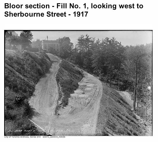
These recent photos of the area around Rosedale valley put me in mind of the oft overlooked covered bridge between Sherbourne and Castle Frank subway: probably the most beautiful brutalist structure in the city…

Those are marvelous images of the Sherbourne-Parliament area.
Here's some more.
It's funny you should say that. I've recently been digging into the history of the house below, identified by the Toronto Archives as "Sherbourne opposite Bloor." From the front, 1913:
http://gencat4.eloquent-systems.com...esource/ser372/ss0010/s0372_ss0010_it0172.jpg
From the rear (1908?):
http://gencat4.eloquent-systems.com/webcat/systems/toronto.arch/resource/fo1244/f1244_it7244.jpg
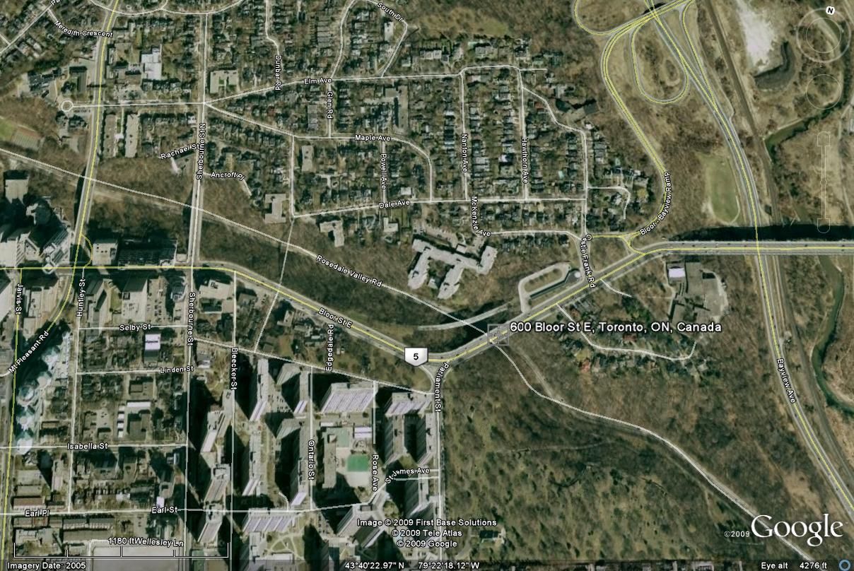
In fact, it's 631 Sherbourne, Registered Plan 44, Lot 1, and Sherbourne Station stands there now:
http://upload.wikimedia.org/wikipedia/commons/c/c5/Sherbourne_Station_-_TTC.jpg
Prof. Jacob M. Hirschfelder lived on the lot, in an older structure, from the 1850s until about 1888, when he moved to Maple Ave. The older structure was replaced with this one around 1890, and sometime after 1894 Lady Anne Thompson moved in, apparently dubbing it "Derwent Lodge":
http://www.archive.org/stream/cihm_00769#page/n47/mode/2up
http://www.archive.org/stream/bluebook190200tyrruoft#page/n93/mode/2up
http://www.archive.org/stream/torontodirec190500midiuoft#page/240/mode/2up
More on Lady Thompson:
http://www.biographi.ca/009004-119.01-e.php?&id_nbr=7168
http://en.wikipedia.org/wiki/Annie_Affleck
Around 1905 Lady Thompson moved out and Dr. Horace E. Eaton moved in, commissioning Burke & Horwood to redesign the front room and windows to accommodate his practice (see Fig. 7):
http://www.pubmedcentral.nih.gov/articlerender.fcgi?artid=2329857
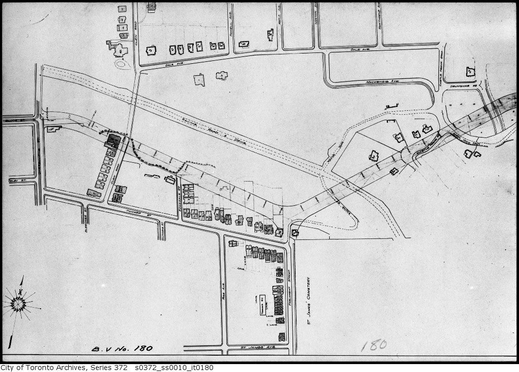
The house stood until around 1918, when it had to make way for the Bloor Viaduct:
http://gencat4.eloquent-systems.com...esource/ser372/ss0010/s0372_ss0010_it0180.jpg
Annnnnd Google Streetview
I really enjoy your efforts, Mustapha!
I think it's neat that we can ALSO see a Google Streetview version, but are you worried that may make your 'job' obsolete!? hahaha
I hope not b/c I actually look forward to these daily updates every day!
 Streetview or Mustapha's ChoiceTM . Tell me, what would you rather take home to mom?
i once read that the reason Bloor jogs east of Sherbourne on its way to meet the Viaduct was because of neighbourhood pressure put on the route by Rosedale residents. I think it's clear from WWWebster's map below and Goldie's photos, that the route was chosen because it was cheaper to follow the tableland south of the Rosedale ravine and avoid a longer bridge going easterly:

Poor Castle Frank Road. Many grand houses were demolished to accommodate the Bloor Street extension. The residents on the south stump (now Castle Frank Crescent) are still trying to figure out whether they actually live in Rosedale or not.


Tell borrow a line from urbandreamer, where are we?
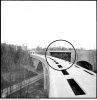
There certainly does appear to be a rail platform under the Bloor/Rosedale Valley Bridge.
Millions could have been saved if it was used!