News   Mar 28, 2024
 200     0 
News   Mar 27, 2024
 2K     1 
News   Mar 27, 2024
 1.3K     2 

Miscellany Toronto Photographs: Then and Now

Unfortunately, that little food court Queen street market seems to be virtually abandoned now. Most of the vendors seem to have gone under recently.

A shame but not a surprise. The hordes of freshly scrubbed teens and 20 somethings swarming this section of Queen seem to prefer sushi as their go-to choice of fare.
 
RE: 311 JARVIS STREET.


Am I to supose that the gentleman standing by the centre window is the good

Prof. Andrew Smith, Principal of The Toronto Veterinary College, 40 - 46

Temperance Street? More than likely however, I believe he to be the Butler,

along with a Maid, standing to his right in the northerly window of

that bay.


C' mon Gang! Rather than just posting a pic, what about a little digging in

the Might's Toronto Directories for some background.

http://www.archive.org/search.php?query=MIGHT'S DIRECTORY


I use the above to augment the "hard copy", I collect, and not only

that, they don't cost $300.00 - $400.00 each.

(Nothing like the "real thing", however.)


Regards,
J T
 
Last edited:
Amazing that these city directories are available online! Do you know until when they were published in Toronto? I remember seeing similar ones for Halifax in the public library there when I was growing up c. 1980. Haven't seen any for a while - I wonder exactly when and why they stopped publishing them...
 
Amazing that these city directories are available online! Do you know until when they were published in Toronto? I remember seeing similar ones for Halifax in the public library there when I was growing up c. 1980. Haven't seen any for a while - I wonder exactly when and why they stopped publishing them...

The most recent one at Toronto Public Library is 2000-2001.
 
There is an entire whack of social directories available to the collector

EG:

DAU'S BLUE BOOK. (Toronto & Hamilton)

TYRELL'S SOCIETY BLUE BOOK.

THE SOCIAL REGISTER OF CANADA. (Volumes 1, 2, 3)

THE TORONTONIAN SOCIETY BLUE BOOK AND CLUB MEMBERSHIP REGISTER.

(THE) CANADIAN WHO'S WHO.

WHO'S WHO IN CANADA.

WHO WAS WHO IN CANADA.

WHO'S WHO IN CANADIAN BUSINESS.

(THE CANADIAN) DIRECTORY OF CANADIAN DIRECTORS.

(THE) DIRECTORY OF DIRECTORS IN CANADA.


("Hard copy", goes retail between $50.00 - $100.00)


Some of which are on line, many not; keep digging.


Regards,
J T
 
Last edited:
Isabella Hotel (Isabella & Sherbourne):

fo1257_ser1057_f1257_s1057_it0526.jpg
isabellahotel.jpg


Lovely survivor; and they didn't remove the 'hat'.:)


October 12 addition.


How about something more personal today? Hopefully a precedent, and an appeal...

Then: 2616 Yonge, W side between Albertus and Craighurst. c1973. That's not me, that's cousin Johnny.

A look in the Might's Directories of the past will show hundreds of Chinese laundries in Toronto. My grandfather's laundry was opened in 1926, with three founding partners. 'Sam' was an Anglicisation of the Chinese pronunciation for three [pronounced as 'sum']. Over the years, my grandfather - Yuen - became known as Sam as the original partners died. He closed it in 1976. By then, automatic home washers had already been in use for years, but he hung on.

The appeal: If any of us here have exterior 'then' photos of our homes or neighbourhoods why not post them here?

Johnny03.jpg


Now: October 2009.

DSCF1232.jpg
 
I had a look at Mitchell's City Directory of 1863-64 to see who lived at 311 Jarvis then, only to discover there was a series of house numbers missing around Carlton. I assume it hadn't been built yet. Should have known from the architecture.
 
what the hell happened to all the beautiful trees on jarvis?

The end of the trees on Jarvis began in the late 1940's with the decision by the City to construct a new north-south arterial called the Huntley Road Extension, which was intended to relieve the traffic congestion on Yonge Street. At this point there was no through route from North Toronto to downtown east of Yonge Street. Plans were drawn up to link Mt. Pleasant Road from St. Clair down through the ravine to Bloor. Jarvis was the logical connector (as opposed to Sherbourne), given its expansive right-of-way. The bridge east of Jarvis was constructed and Jarvis (which no longer had the social status it once had) was widened to accomodate the traffic. It also tells you something of the post-war decline of Rosedale (rooming houses, infill apartment buildings, etc.) that the roadway was allowed to cut right through its heart, south of Roxborough.

Construction of the Bloor/Mt.Pleasant bridge 1949 (Ontario Archives):

1949.jpg
1949mtPleasant.jpg
 
Last edited:
Anna:

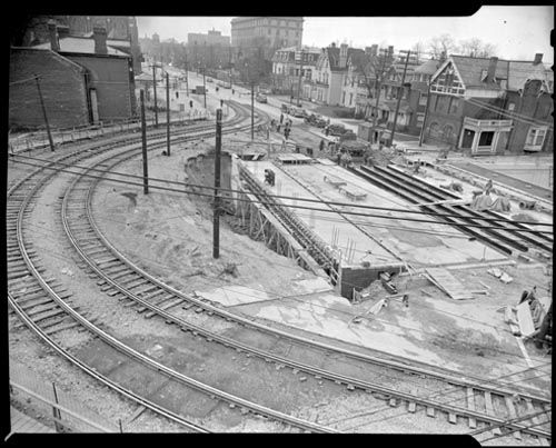
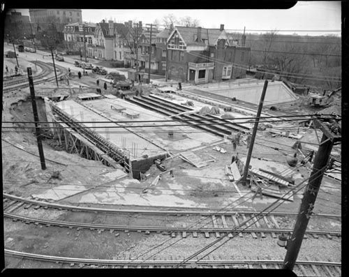
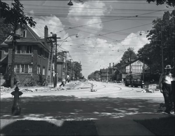
My hat off to you! What an incredible group of photos. They really represent a time long past, the kind of thinking that would lead to the Spadina Expressway. It was the same post-war thinking that laid waste to the chestnut trees of University Avenue, and widened Avenue Road into a mini-highway (at least until it hit Forest Hill).

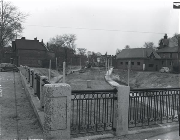
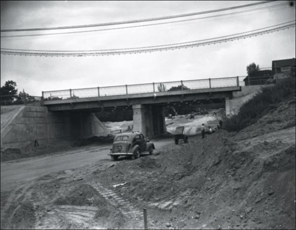
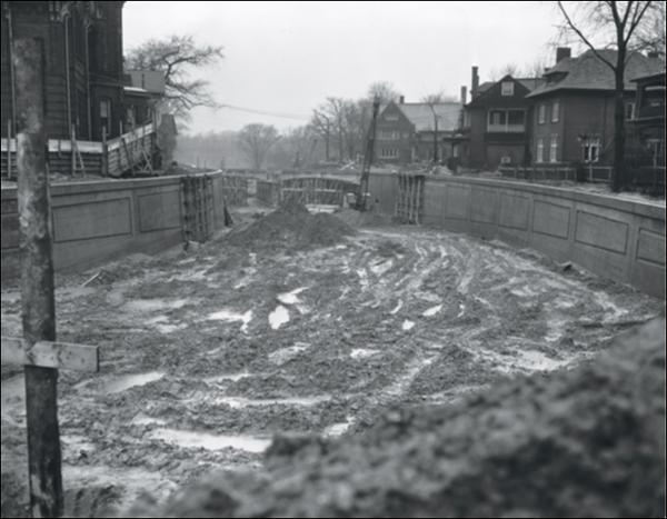
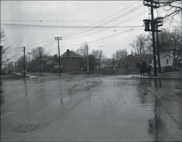
In typical Toronto fashion, the extension of Mount Pleasant through Rosedale was more of a "muddling"-along approach in improving traffic, that followed the path of least resistance, through ravines (similar to Rosedale Valley Road) and a neighbourhood without (at that point) a lot of political clout.

If we connect the dots, we can also see a relationship between this suburban commuter link and the ultimate proliferation of parking lots in the east downtown resulting in the destruction of the historic "Old Town".
 
Last edited:
I like your suggestioh, mustapha: "If any of us here have exterior 'then' photos of our homes or neighbourhoods why not post them here?"

Here's my birthplace at 147 Donlands Ave., then in East York.
When my parents arrived (c.1930?) there was no house next door.
My earliest recolection of the area is the Donlands Dairy a short distance north - between Mortimer and Cosburn - we walked there for the ice cream.
North and east of the dairy was mainly farmland!
 

Attachments

  • 147 Donlands - Then & Now.jpg
    147 Donlands - Then & Now.jpg
    54.3 KB · Views: 495
Anna:
My hat off to you! What an incredible group of photos.

Thank Google.

There is another one that I couldn't post, from the Toronto Star Photo site, that can be found by searching for "Clifton extension". The description says "Home of Mrs. R.S. Pentecost on N.E. corner of Clifton Rd. and Inglewood Drive, showing how angle at which the new highway in foreground enters Clifton Rd. creates traffic hazard. Original plans called for purchase of Pentecost home and carrying new road across Clifton Road to Mt. Pleasant in wide sweeping curve. Photo taken by Norman James circa Oct. 1948"

I believe Mrs. Pentecost's house was situated straight ahead in this picture.
asc03390.jpg.preview.jpg
 

Back
Top