News   Jul 09, 2024
 771     1 
News   Jul 09, 2024
 1.6K     3 
News   Jul 09, 2024
 607     0 

Finch West Line 6 LRT

What longer walk? Since the words aren't sufficing as an explanation, I'll use visuals.

Weston Road to Tobermory:
WestonRoadtoTobermory.jpg

Tobermory to Alness:
TobermorytoAlness.jpg

Alness to Bathurst:
AlnesstoBathurst.jpg

Bathurst to Yonge:
BathursttoYonge.jpg

See all the buildings, houses, offices, stores immediately flanking the F.H.C. and many more within 3-7 minutes walk of a BRT station?

Actually, pictures of the F.H.C. portion of your route demonstrate the access problems that I (and others here) mentioned. Areas south of Finch are, for the most part, shut off the busway. For example, the Finch / Wilmington cluster (south of Finch, between Dufferin and Bathurst), or the hospital south of Finch and just west of Bathurst. To get to the busway, one needs not only to cross the strip of land between the Finch proper and F.H.C. (which is 3-5 min indeed), but also to walk along Finch to reach the point, or street, where a walk towards F.H.C. is possible.

Furthermore, future intensification is more likely to happen on-street rather than near the Hydro Corridor.

Also from the same BCA report:

"The capacity along the corridor could be increased through the use of higher capacity articulated buses which could increase the capacity from approximately 1,200 passengers per direction per hour to 1,800 passengers per direction per hour (90 passenger capacity for an articulated bus)."

A-ha! So again folks, 36 Finch West could be substantially improved in service quality just by the mere introduction of longer buses. No overcrowding, no periodic bunching/stalling, just faster, more reliable transit. And reducing the number of stops west of Hwy 400 would further enhance the efficiency of the route.

The report talks about capacity, and that is exactly what would be improved by longer buses.

They won't be noticeably faster or more reliable if they still run in mixed traffic, since most of delays are caused by general traffic jams.
 
I illustrated above how precisely 104 Faywood, for instance, could utilize the right-of-way to improve its service quality.

OK, running 104 Faywood through the Torresdale / Robert Hicks enclave is a small bonus of your plan. But this bus is very infrequent, and does not make much difference.

The stops at Humber College, Albion, Islington, Weston Rd, Jane, Keele, Bathurst and Yonge- will all be major interchanges where the passenger turnover ratio is expected to be very high. Those stops at least are worthy of some expense. All stations should at least have passenger amenities such as shelters, benches, lighting, ticket vending machines, security features and next vehicle arrival information.

Of the above, only Keele and Yonge stops would qualify as major interchanges (with subway lines). All others will be just like intersections between two busy bus routes.

Smoothness, lol. Methinks Drum's 512 ROW photos have illustrated just how smooth a LRT ride will be when trying to navigate unevenly laid trackbeds at top optimal speeds. Sure it may not be the case for FWLRT, but such issues aren't even a factor when designing busways.

The method of taking those photos made the problem look worse than it really is (http://stevemunro.ca/?p=2947#comments).

Hopefully, FWLRT will have less bends.

And, rails do not develop cracks like the pavement does over time. Even the much-maligned downtown streetcars run smoother than buses.

... according to the Canadian Transit Fact Book, the cost of running bus rapid transit is $90 per hour compared to $250 per hour for LRT. Because it is so much less expensive, for the same budget BRT can cover about ten times the area and support ten times as much Transit Oriented Development ("walkable" neighborhoods) as LRT.

I am surprised with that $90 versus $250 ratio ... the driver's salary is about same; LRV might incur higher energy cost since it is larger, but maintenance should be cheaper ... I'll try to dig it out.

Anyway, even if the ratio is 90:250 or 1:2.8, how do you conclude that BRT can cover 10 times the area?

And there seems to be a rationale that the cost of diesel is the pervading factor in choosing LRT over BRT. What seems to have been ignored is that the other sources of energy will follow in close step. There is little question that the future of energy in Ontario must be nuclear, if the obnoxious coal-fired generating plants are to be phased out. The cost of electricity will then rise exponentially. In the short term, the cost of electricity in the peak hours will be at a premium just when people are going to and from work. The city has made no provision for this cost.

There will be a correlation between the cost of all forms of energy, but they still can diverge quite a bit. Electricity production is more flexible than diesel production.

Metrolinx claims Humber College to Don Mills Stn will be 65 minutes, 46 mins to Yonge only. But they also warn of likely delays and with its 42 stations total, at roughly 2 mins interval between stops when factoring in dwell times at stops, 80 minutes sounds about accurate.

You assume that the Yonge - Don Mills portion will be built, but this is not certain at all.

Building massively long rapid feeder lines just to dump large volumes of people off onto the subway is ill-conceived. Ongoing transfer-free RT speeds are needed and the mileage and funds available for tracks/rails can only go so far.

This is why we need DRL subway, and REX to downtown. Whether we get F.H.C. busway or Finch W LRT, they will have similar effect on the load of downtown-bound subway lines: they will increase the load.

Every YRT route that feeds into Yonge-Finch Stn from Bathurst to Warden would utilize the BRT right-of-way eliminating hundreds of vehicles from the Yonge St corridor daily.

Bathurts and Bayview will use the busway, but only if Yonge line is not extended even to Steeles. If it reaches Steeles (and it might be same timeframe as the busway), those routes will use Steeles.

88 Hilda route might continue south of Steeles and on the busway, but it is a very infrequent route anyway.

For Markham routes east of Leslie, Sheppard is the closest subway, and the majority of buses will run there. However, YRT might run a route or two, say from Downtown Markham, along the busway, for more direct connection to NYCC, YorkU, and the Airport.

Why do we need a separate FWLRT, running so closeby? Convince me that 42,600 daily users would still ride the 36 bus let alone a LRT line and we'll talk.

Well, of course if you divert half or more of Finch West vehicles to the busway, there will be not enough users left for parallel LRT.

However, if you carry most of local riders on LRT, and use the busway for smaller-scale, but faster, long haul trips - then both have place.

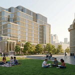
To carry whom exactly, or is it not apparent that residents living in those apartment buildings and townhouse cul-de-sacs blocks north of Finch are just as inconvenienced by walking south and then crossing through busy, pedestrian unfriendly traffic to go stand on a narrow exposed platform and laywait the streetcar? Why am I being made out as the villain here, I want to improve area residents quality of life. Reexamine the above images. Observe the walking distance radius rings.

If there was a lot of density just north of F.H.C., then your point would hold: inconvenience those south of Finch, but balance that with improvements for those north of F.H.C. But in reality, this is certainly not the case for the Weston - Jane, Keele - Dufferin, and Dufferin - Bathurst sections. There is a lot more stuff south of Finch.

Even the high-density apartment/condo cluster around Antibes (just west of Bathurst and north of F.H.C.) does not have convenient approach to F.H.C.

Jane - Keele and Bathurst - Yonge sections are better; at least it looks like the densities south of Finch and north of F.H.C. are comparable.

If this was about serving the most densely populated transit usage corridors they'd be putting a LRT on Dufferin, on Finch East, on Lawrence East, on Kingston Road, on McCowan- all these corridors each carry more overall riders.

All those streets are LRT candidates, but Lawrence East, Kingston Road, McCowan carry fewer riders than Finch West (http://www3.ttc.ca/PDF/Transit_Planning/service_improvements_2008.pdf, table in Appendix C).

Finch East carries a little more than Finch West, but the existence of Sheppard subway makes it lesser priority. Especially, if Sheppard subway does get extended.

Dufferin is a very busy bus route, but the cost of LRT there would be astronomical, since most of the street is not wide enough to accomodate 6 lanes. (Obviously, I am talking about Dufferin south of Wilson. Allen / Dufferin north of Sheppard is quite the opposite: plenty of room for ROW, but no density to justify LRT.)

No, this is shortsighted transit planning 101 that'll eat up $1.2 billion dollars in a time when 4-5 kilometres of new subways are desperately needed to alleviate congestion. That it'd benefit another part of the city is irrelevant, what Finch West is posed to get in exchange is a far-superior busway, a surface subway line at a fraction of the cost or elapsed duration of a streetcar ride end-to-end.

$0.8 billion west of Yonge, not $1.2. What happens east of Yonge, is uncertain.

I understand that you would like to save money for subways, and do not object to that goal. However, if you replace Finch West LRT with properly constructed busway, you won't save much. Perhaps $300 million or so, which will not make any difference to subway plans.
 
Last edited:
Actually, pictures of the F.H.C. portion of your route demonstrate the access problems that I (and others here) mentioned. Areas south of Finch are, for the most part, shut off the busway. For example, the Finch / Wilmington cluster (south of Finch, between Dufferin and Bathurst), or the hospital south of Finch and just west of Bathurst. To get to the busway, one needs not only to cross the strip of land between the Finch proper and F.H.C. (which is 3-5 min indeed), but also to walk along Finch to reach the point, or street, where a walk towards F.H.C. is possible.

The North York Branson Hospital is directly south of Virgilwood, significantly west of Bathurst St. To the immediate left is the North York Centennial Centre, a public free-access space that runs all the up into the F.H.C. from Finch. Notice in the picture I created a pedestrian link through this community space, which just as wll could have ran alongside the eastern periphery. So patrons of the hospital are still within 5-7 minutes direct walking distance of Torresdale Stn.

The isolated community of Robert Hicks Dr today suffers an even longer walk in order to access the 36 bus (and likewise FWLRT). Per my proposal, the whole neighbourhood would be within 3 mins walking distance mass public transit. And finally I've demonstrated how the 104 Faywood bus (which runs relatively frequent) in light of recent realignment could run two blocks east and enter the F.H.C. busway via Torresdale further improving local access to the line.

To add, you yourself have mentioned that this stretch is lower-density by contrast to the demand levels further west, and unlike the FWLRT, the busway in no way affects the routing of 36 Finch West and all its locally spaced stops could remain. So even if the implementation of the busway leads to an overall decline in bus frequency along Finch proper, the average waittime would still be short enough that locals are not inconvenienced and get a stop right at their doorstep. That's how you ought to cater to your customer base, not take out stops and offer only marginal speed gains over the replaced bus service in return. BRT in an exclusive ROW at least delivers on speed and matches waiting every 5 mins for the FWLRT and/or walking further to one's local LRT stop.

Furthermore, future intensification is more likely to happen on-street rather than near the Hydro Corridor.

Where precisely? Most areas along Finch proper cannot be redeveloped without mass expropriation of single-dwelling detached houses. Look at the stretch of F.H.C. around York U and see just how much intensification is possible. While Sentinel/Finch is parkland, up by the Hydro Corridor is multiple high-rises and a commercial zone. Jane/Finch area apartments and York Gate Mall more easily affront the F.H.C. than Finch and what's to stop further integration as development moves westward? Norfinch/F.H.C. already has adjacent hotel properties and as this area (along with the Keele-Dufferin strip) gradually de-industrializes there's greater potential to develop these areas. What can be built on-site at the Finch/400 interchange? TOD can be more than an accidental result of BRT development, but how with attention to design elements and partnerships, BRT actually shapes communities and achieves the same developmental objectives of its steel-wheeled cousins. Maybe now that it is beyond obvious that railways cannot go everywhere, Toronto ought to embrace different ideas, you know, so that public spending can go towards other civic services as well, not just outlandish transit projects.

The report talks about capacity, and that is exactly what would be improved by longer buses.

They won't be noticeably faster or more reliable if they still run in mixed traffic, since most of delays are caused by general traffic jams.

Then tell me this, why won't the LRT be subjected to the traffic jams and delays? In the absence of a segregated ROW is it not in the exact same boat? The plain fact is that Bus Rapid Transit on exclusive lanes has more capacity than heavy rail let alone light rail systems. The reason for this is that the capacity of any transit system is determined at the stations. With rail a train cannot, of course, enter the station unless the one before it has left. The time between trains is invariably two or three minutes at a minimum, more on surface streets and therefore prone to auto and truck interference. Transit City is proposaed to operate headways of every 5 minutes. With BRT, however, the transit unit (bus) pulls off the right of way to discharge and take on passengers. Under these circumstances, you can put a transit unit down the right of way every few seconds rather than every few minutes. Note that local buses on busways also have the ability to unload and load passengers "off-line" in the manner of BRT, minimizing dwell times for all routes that feed into them.

Stuck in traffic? As demonstrated around the world, BRT lanes flow at highway speeds at all times. And because buses and vanpools always have absolute priority, their travel time is guaranteed. Off the busway, buses on bus-only lanes with traffic signal preemption move without being subject to undue traffic interference. And of course local service buses on busways or guided-bus structures move at their design speed. So F.H.C. local serving all stops would still operate faster than the average top speeds of he Bloor-Danforth subway line (35kph vs. B-D's 30kph).
 
The North York Branson Hospital is directly south of Virgilwood, significantly west of Bathurst St. To the immediate left is the North York Centennial Centre, a public free-access space that runs all the up into the F.H.C. from Finch. Notice in the picture I created a pedestrian link through this community space, which just as wll could have ran alongside the eastern periphery. So patrons of the hospital are still within 5-7 minutes direct walking distance of Torresdale Stn.

The isolated community of Robert Hicks Dr today suffers an even longer walk in order to access the 36 bus (and likewise FWLRT). Per my proposal, the whole neighbourhood would be within 3 mins walking distance mass public transit. And finally I've demonstrated how the 104 Faywood bus (which runs relatively frequent) in light of recent realignment could run two blocks east and enter the F.H.C. busway via Torresdale further improving local access to the line.

To add, you yourself have mentioned that this stretch is lower-density by contrast to the demand levels further west, and unlike the FWLRT, the busway in no way affects the routing of 36 Finch West and all its locally spaced stops could remain. So even if the implementation of the busway leads to an overall decline in bus frequency along Finch proper, the average waittime would still be short enough that locals are not inconvenienced and get a stop right at their doorstep. That's how you ought to cater to your customer base, not take out stops and offer only marginal speed gains over the replaced bus service in return. BRT in an exclusive ROW at least delivers on speed and matches waiting every 5 mins for the FWLRT and/or walking further to one's local LRT stop.


Where precisely? Most areas along Finch proper cannot be redeveloped without mass expropriation of single-dwelling detached houses. Look at the stretch of F.H.C. around York U and see just how much intensification is possible. While Sentinel/Finch is parkland, up by the Hydro Corridor is multiple high-rises and a commercial zone. Jane/Finch area apartments and York Gate Mall more easily affront the F.H.C. than Finch and what's to stop further integration as development moves westward? Norfinch/F.H.C. already has adjacent hotel properties and as this area (along with the Keele-Dufferin strip) gradually de-industrializes there's greater potential to develop these areas. What can be built on-site at the Finch/400 interchange? TOD can be more than an accidental result of BRT development, but how with attention to design elements and partnerships, BRT actually shapes communities and achieves the same developmental objectives of its steel-wheeled cousins. Maybe now that it is beyond obvious that railways cannot go everywhere, Toronto ought to embrace different ideas, you know, so that public spending can go towards other civic services as well, not just outlandish transit projects.


Then tell me this, why won't the LRT be subjected to the traffic jams and delays? In the absence of a segregated ROW is it not in the exact same boat? The plain fact is that Bus Rapid Transit on exclusive lanes has more capacity than heavy rail let alone light rail systems. The reason for this is that the capacity of any transit system is determined at the stations. With rail a train cannot, of course, enter the station unless the one before it has left. The time between trains is invariably two or three minutes at a minimum, more on surface streets and therefore prone to auto and truck interference. Transit City is proposaed to operate headways of every 5 minutes. With BRT, however, the transit unit (bus) pulls off the right of way to discharge and take on passengers. Under these circumstances, you can put a transit unit down the right of way every few seconds rather than every few minutes. Note that local buses on busways also have the ability to unload and load passengers "off-line" in the manner of BRT, minimizing dwell times for all routes that feed into them.

Stuck in traffic? As demonstrated around the world, BRT lanes flow at highway speeds at all times. And because buses and vanpools always have absolute priority, their travel time is guaranteed. Off the busway, buses on bus-only lanes with traffic signal preemption move without being subject to undue traffic interference. And of course local service buses on busways or guided-bus structures move at their design speed. So F.H.C. local serving all stops would still operate faster than the average top speeds of he Bloor-Danforth subway line (35kph vs. B-D's 30kph).

Gaaa huuuh??? :confused:

Lets tear up the YUS subway and build BRT's then!
 
Then tell me this, why won't the LRT be subjected to the traffic jams and delays? In the absence of a segregated ROW is it not in the exact same boat?

The dedicated lanes, such as those planned for FWLRT, eliminate almost all delays. I've never experienced a delay in the bus-lane portion of 105 / 117 bus routes.

The plain fact is that Bus Rapid Transit on exclusive lanes has more capacity than heavy rail let alone light rail systems. The reason for this is that the capacity of any transit system is determined at the stations. With rail a train cannot, of course, enter the station unless the one before it has left.

A typical capacity of a heavy rail line like Yonge subway is in the 30,000 pphpd range. Even if you operate BRT with artics that can carry 150 people each, you will need 200 buses per hour, or 3.3 buses per minute. Assuming that each bus needs 2 min to decelerate, approach the platform, unload / load, accelerate, and re-enter the main busway - you will need 7 platforms for each direction, or 14 in total. Imagine the size and cost of such station. And, imagine the amount of exhaust from those 200 buses per hour.
 
OK, running 104 Faywood through the Torresdale / Robert Hicks enclave is a small bonus of your plan. But this bus is very infrequent, and does not make much difference.

Every 14 minutes is more frequent than most 905-area bus scheduling. And it makes a lot of difference when there’s the presumption that a 5-7 minutes’ walk from the Torresdale/Finch apartments or the hospital is somehow a major life-affecting inconvenience.

Of the above, only Keele and Yonge stops would qualify as major interchanges (with subway lines). All others will be just like intersections between two busy bus routes.

Wrong! Humber College by today’s standards is a major interchange. More bus routes will terminate there than the number that'll pass through Finch West Stn and if the Yonge Line's extended, Finch Stn as well. Why subject commuters to go miles out of their way in order to transfer onto high-quality service? While the FWLRT will not generate as much incentive for long-haulers to transfer, F.H.C. BRT in its own exclusive ROW whereby station facilities akin to any GO or TTC subway can be implemented, would attract riders. If Jane-Finch is soon to be the crossroads of two major LRT lines would you not build a station there or would you subject transferees to dangerous on-street crossings? How would timely boarding and fare collection work? A station at least offers off-board fare collection options.

And, rails do not develop cracks like the pavement does over time. Even the much-maligned downtown streetcars run smoother than buses.

Ask yourself, just how many times in the past eight years alone has at least one major streetcar ROW (and ergo the entire adjacent corridor) had to have been shut down from all vehicular traffic or suffer lane restrictions because of the constant track maintenance and repairs that are required?
BRT has paved road and buses, that are essentially no different from other buses which operate on the street, thus simplifying maintenance facilities, and employees needed. There is less infrastructure and simplified vehicle maintenance; whereas LRT has overhead catenary, a signaling system and rails/ties which constantly need reworking.

I am surprised with that $90 versus $250 ratio ... the driver's salary is about same; LRV might incur higher energy cost since it is larger, but maintenance should be cheaper ... I'll try to dig it out.

Anyway, even if the ratio is 90:250 or 1:2.8, how do you conclude that BRT can cover 10 times the area?

There's a reason why streetcars/LRT presently only represent 8.7% of the TTC's fleet compared to 67.2% for buses. This only raises to 12.4% for light rail provided the full 120 kms of TC are built. It’s elementary, if something costs less to build than the other, you can yield more mileage out of the former than the latter. TTC current operations: buses cover 6,934.1 kilometres (4,308.6 mi) compared to 305.8 km (190 miles) of light-rail, and the subway, 68.3 kilometres (42.4 mi) of track. Why is this so? We can provide better coverage area to the public via integrating the trunk subway lines and priority areas with a high-quality trunk busway line. These routes can go into neighborhoods and office parks, thus bringing transit to the people, rather than forcing people to get to a rail station by driving or via feeder bus systems. Once passengers are delivered to these “off-line†stations, the BRT vehicle can return to its dedicated ROW. This is not possible with rail. That is why Transfer City is f'ed up!

Take what I’m proposing and compare it to the TTC’s scheme. The TTC wants to build the FWLRT ($1.2 billion), SELRT ($1.030 billion) and SRT extension to Malvern ($1.2 billion). That’s nearly 3.5 billion dollars for 44kms of new LRT or $80 million/km. I’ve discussed here before the int’l average for BRT ($10M) and even citing local 905 examples we’ve come across examples of $8.14 M (for Brampton Zum) and $14.3 M (for Mississauga Transitway). When transit systems are being built for the sake of transporting people quickly from place to place and not just for the sake of attracting developers **cough** York Region**cough**; you’ll come to find they can be built within budget. BRT systems are among the few transit modes in the world that do not need to be subsidized by federal/provincial gov’ts:

“In a recent study, the United States General Accounting Office (GAO) and other studies confirm the real-world experience of BRT, particularly in South America. In both Bogota, Columbia and Curitiba, Brazil, BRT systems are operating without subsidies, achieving 100% or more cost recovery from fares. Even the best rail systems receive substantial operating subsidies and will never recover their costs.â€
[B]http://www.gobrt.org/BRTFlyer.pdf[/B]

So you see, indicators of operating efficiency such as passengers per revenue hour, subsidy per passenger mile and subsidy per passenger can improve when BRT service is introduced to a corridor.

Now let’s examine the busway running from Humber College all the way to Scarborough Town Centre via Malvern. On-street operations through Etobicoke followed by exclusive ROW through the F.H.C. to Morningside Avenue (32 kms), preceded by 4.5 kms to the Scarborough via the Belleville Sub and following a similar alignment to the SRT’s preferred route. We can then assume 36.5 kms can be built for $365 million dollars. We can however double this amount, with a reserve $365 million as contingent/provisional funding for the more complex aspects of building the ROW, namely: overpasses, underpasses, the Lord Ross bridge, brief tunneled sections where applicable and stations such as Jane-Finch and Humber College which would comprise bus terminals. This totals $730 million or just $20 million/km, even less than Phase 1 FWLRT which comes in at $0.8 billion, as you like to point out. These are fair and factual estimates, not TTC’s overindulgent spending habits which are evident in virtually every transit project they tackle.

So sparing $0.73 billion from $3.5 billion, that would leave $2.77 billion dollars that otherwise, would have gone towards LRT that’s neither as rapid nor capable of interconnecting major nodal areas because of the limitations of where rails can run. In light of these savings, the Bloor-Danforth subway line could be extended from Kennedy via Lawrence-McCowan to SCC and the Sheppard subway line to Agincourt. The appeal of a grand trunk line for buses through northern Scarborough and North York would mean that several local routes could also take advantage of it, improving route efficiency and higher quality of service for all.

There will be a correlation between the cost of all forms of energy, but they still can diverge quite a bit. Electricity production is more flexible than diesel production.

Gas is still cheaper than electric for generating heat/energy and provides a higher energy content. And electric prices will probably rise too. CNG-equipped BRT vehicles would come with their own self-contained energy generation and would not require an external source (i.e. overhead catenary and wiring) wherein supply interruptions and component failure rates are common. A high percentage of electricity in Canada is generated from natural gas and petroleum. So an increase in those prices will tend to raise electric costs.

  • Compressed Natural Gas = $5.00/MMbtu (Million British Thermal Units)
  • Electric = $31.61/MMbtu or 10.79 cents/kWh

Generally CNG costs less than electricity because it combusts directly and doesn't need to be transformed before being able to power vehicles.

You assume that the Yonge - Don Mills portion will be built, but this is not certain at all.

If it is not built then that is only proof that FWLRT was an ill-conceived idea from the get-go because commutes don’t magically start and end at the Yonge subway line. Lack of a true Crosstown route north of B-D leads to up to 3 hr one-way trips via regular bus to get from Rexdale to Malvern. The three-ring circus of the LRT routing 2kms south to Sheppard to continue one’s journey east is absurd and worse yet transferring off at Finch incurs three unnecessary transfer points in order to sustain a “rapid†way across (FWLRT to YUS, YUS to Sheppard subway, Sheppard subway to SELRT; with a fourth -fifth even- most likely when the SELRT passes by the periphery of Malvern).
 
Gaaa huuuh??? :confused:

Lets tear up the YUS subway and build BRT's then!

Did you hear me suggesting that? I want to enhance the existing network, Transfer City aims to catastrophize the situation via creating even more transfer points, more offloading onto overtaxed subways, longer wait-times and walking distances for the nearest transit serivce stop along TC-prioritized corridors. Why would crosstown commuters need for the subway at all, if they could bypass everything via a crosstown busway system? You make the service comparable to rail and people will flock to it in droves. Every city that currently has operating BRTs is receiving higher patronage than forecasted. I can confidently say that BRT, if implemented correctly, could conceivably carry more pphpd than the Yonge subway. Bogota's Transmileno carries 40,000pphpd during peak hours, for instance. F.H.C. may never see that much usage but the per capita ridership would far greatly exceed FWLRT, SELRT and SRT combined- the three light-rail routes it'd be replacing.

Bathurts and Bayview will use the busway, but only if Yonge line is not extended even to Steeles. If it reaches Steeles (and it might be same timeframe as the busway), those routes will use Steeles.

Except people don’t necessarily want to get off at Steeles. They want as close into the city as possible, particularly if they already work in the NYCC area anyway. The area also is already has a preexisting transit hub so less expenditure would be required to accommodate the new east-west influx vs. traditional north-south via Yonge.

88 Hilda route might continue south of Steeles and on the busway, but it is a very infrequent route anyway.

Um, the 88 bus is 88 Bathurst. I think you meant Route 23 Thornhill Woods.

For Markham routes east of Leslie, Sheppard is the closest subway, and the majority of buses will run there. However, YRT might run a route or two, say from Downtown Markham, along the busway, for more direct connection to NYCC, YorkU, and the Airport.

All the following YRT routes are better served by the busway to Yonge, which if they've all primarily bound for the Yonge subway anyway, better to take them there directly rather than enforce two transfer points via Sheppard subway:

2A, 23, 88, 91, 160, 224, 68B, 300, 301, 302, 303, 340 and VIVA Green. TTC routes 39, 42 and 60 could handle all their express, non-stop sections of operations more easily via F.H.C. than on-street as well.

Well, of course if you divert half or more of Finch West vehicles to the busway, there will be not enough users left for parallel LRT.

However, if you carry most of local riders on LRT, and use the busway for smaller-scale, but faster, long haul trips - then both have place.

Eating up a chunk of money for a redundant rapid service, when local bus service could suffice. That less than 20,000 daily users would still have a use for on-street rapid transit along North York's Finch corridor post F.H.C. BRT makes a weak case for even limited stop bus express routes, let alone TC.

If there was a lot of density just north of F.H.C., then your point would hold: inconvenience those south of Finch, but balance that with improvements for those north of F.H.C. But in reality, this is certainly not the case for the Weston - Jane, Keele - Dufferin, and Dufferin - Bathurst sections. There is a lot more stuff south of Finch.

Are we looking at the same images here? I see a sweeping highway interchange between Weston and Jane. The hospital buildings’ are far-removed from Finch proper and cannot be easily served via the LRT either. Six high rise apartment buildings surround F.H.C./Jane as well a major shopping mall. Within 5 minutes walk 12 more high-density buildings are accessible. It’s also the most advantageous locale to juxtapose a station whereby the 108 Downsview can drop-off/let-on passengers without warranting a second station at Driftwood. York U residencies are concentrated around the location of the F.H.C. I question the density you speak of between Keele and Dufferin. Workers immediately at Keele-Finch as far over as Alexdon could just walk to the subway. Then there’s nothing significant til east of Chesswood. An industrial park extends from this point north into the F.H.C. so workers inside wouldn’t have much difficulty walking from a BRT Stn to the north. And the Dufferin-Bathurst stretch has already been discussed at length. The commute of thousands shouldn’t be slowed down for a handful of daily users. Those unable to access Torresdale Stn are better off just waiting for 36 Finch West bus bound for same places, which would retain all of its stops through North York per my proposal.

Even the high-density apartment/condo cluster around Antibes (just west of Bathurst and north of F.H.C.) does not have convenient approach to F.H.C.

Now that you mention it, the 125 Drewry bus could also be extended into the F.H.C., doing a reverse loop of Bathurst/Finch/Torresdale/F.H.C./Bathurst to compliment the 104’s loop.

$0.8 billion west of Yonge, not $1.2. What happens east of Yonge, is uncertain.

I understand that you would like to save money for subways, and do not object to that goal. However, if you replace Finch West LRT with properly constructed busway, you won't save much. Perhaps $300 million or so, which will not make any difference to subway plans.

How do you arrive at $300 million savings? Even using the template of $20 million/km for busways, that’s still only $140 million for the 17 kilometres from Humber College to Yonge, 82.5% less expensive than LRT covering the same length. And that's with proper stations and true right-of-way, not exposed streetcar sheds and questionable mixed-traffic TSP. I'm suggesting better quality service at less expense that would distribute mass transit to other parts of the city as well. 120kms of LRT is peanuts when 1200km of BRT can be built at a fraction of the cost, with bus lanes down every major artery. This gives all Torontonians access to high quality service, not just the "lucky" few whom happen to live nearby a selected LRT corridor, since no one's going to go out of their way to commute towards a LRT line of minimal time advantage in order to commute into the subway.
 
Did you hear me suggesting that? I want to enhance the existing network, Transfer City aims to catastrophize the situation via creating even more transfer points, more offloading onto overtaxed subways

So you admit that Transit City will increase ridership substantially. Your hypothetical FHC busway would also create more offloading onto overtaxed subways while creating an artificial transfer point at every intersection along its route. No one ever wants to go to the Finch Hydro Corridor -- it's just a pointless transfer.

longer wait-times and walking distances for the nearest transit serivce stop along TC-prioritized corridors.

As opposed to even longer wait-times and even longer walking distances to the hypothetical busway along FHC that you are pushing?

Why would crosstown commuters need for the subway at all, if they could bypass everything via a crosstown busway system?

Because they would have to take a bus to the FHC, a bus on the FHC, and bus from the FHC. Each of those buses would have stinky diesel exhaust, a roaring diesel engine, a gut-shaking susceptibility to potholes, and a stop at every non-grade separated intersection -- and at $10m/km, not a lot of those intersections would be grade separated.

F.H.C. may never see that much usage but the per capita ridership would far greatly exceed FWLRT, SELRT and SRT combined- the three light-rail routes it'd be replacing.

When the Sheppard subway opened, ridership of the Finch bus didn't change at all. I highly doubt that a route along the FHC would take any riders off Sheppard.

I don't want to know what line on the map you are drawing that replaces SRT between Scarborough Town Centre and Kennedy with a busway. I'm hoping it's not an elevated concrete busway between Ellesmere and STC and another between STC and Finch.

120kms of LRT is peanuts when 1200km of BRT can be built at a fraction of the cost, with bus lanes down every major artery.

A major artery isn't a hydro corridor.

Bus lanes down a major artery is 40m+/km. It is at least as expensive as LRT because BRT lanes need to be wider to allow for driver error. The lanes need to be A LOT wider at every turn.

Take a look at the design for the Viva Purple BRT design. The lanes are super-wide at every right turn in the busway as it weaves off Highway 7 towards Enterprise. That's fine in greenfield country, but it would be ridiculously expensive the built-up Toronto context.

Here's map of street widths in Toronto. The only downtown street wide enough to handle a new BRT/LRT is University from Bloor to Front.

BRT in Toronto is a non-starter.
 
Last edited:
So you admit that Transit City will increase ridership substantially. Your hypothetical FHC busway would also create more offloading onto overtaxed subways while creating an artificial transfer point at every intersection along its route. No one ever wants to go to the Finch Hydro Corridor -- it's just a pointless transfer.

Arguably, no one wants to go to Warden/St Clair, Denton/Victoria Park, Bramalea/Steeles, Kipling/Belfields, St Albans/Aukland and a myriad of other artificial transfer points where the rapid transit lines happen to intersect a corridor. TC as a whole will increase passenger offloads onto the limited capacity remaining on our trunk subway lines. It offers no real solution, like pooling all those billions towards a DRL stretching from the airport to Seneca College would, hypothetically. Major nodes such as Jane-Finch, Finch West subway, Finch subway, Old Cummer GO and Seneca College all have direct proximity to F.H.C., same as Finch proper.

As opposed to even longer wait-times and even longer walking distances to the hypothetical busway along FHC that you are pushing?

Virtually everything along Finch itself is within 5 mins walk of the corridor. South of Finch residents have two options: walk to the F.H.C. or await the 36 Finch West bus (which would still operate via this plan). The only people out to inconvenience locals is the TTC via its removal of closely-spaced bus stops from Finch.

Because they would have to take a bus to the FHC, a bus on the FHC, and bus from the FHC.

Of course not all buses have to travel the full distance. Several short turns options are possible with BRT whereby buses can penetrate the actual communties where people live, office parks where they work, schools where they learn, collect a load then re-enter the busway. One-seat direct transit as near or far as one needs to go.

Each of those buses would have stinky diesel exhaust, a roaring diesel engine, a gut-shaking susceptibility to potholes, and a stop at every non-grade separated intersection --

LOL. How many major arterials have you been on recently that had to shut down because there was too many potholes? How many bus routes had to be detoured? I have however witnessed too many times to count track maintenance of the downtown streetcar ROWs lead to the disruption of streetlife and continuous travel. Businesses going out of business. And I wish that I knew how to upload audio tracks on here so I could play for you sample recordings of streetcar noise compared to buses. The rattle, clang, banging I've heard is several decibels louder than that of modern hybrid electric-diesel buses which quietly hum so soft that they're hardly noticable coming down the roadway right up until they reach your stop.

and at $10m/km, not a lot of those intersections would be grade separated.

I've told the forum several times now that $10 million/km is a mode template for BRT. I least I'm being upfront. If you separate the standard costs of the whole ROW from the case specific add-ons required for parts of the ROW, you'll find that the overall budgeting is far cheaper and that everything's properly accounted for. No astronomic hyperinflated estimating that will likely encounter an overrun anyway.

When the Sheppard subway opened, ridership of the Finch bus didn't change at all. I highly doubt that a route along the FHC would take any riders off Sheppard.

It doesn't have to. F.H.C. would intercept commuters coming inbound from the north (i.e. Richmond Hill and Markham), and those from along Steeles East, Cummer/McNicoll and Finch East prior to them reaching Sheppard. Those whom truly need to go to the Sheppard subway will continue to do so. My aim is merely to reduce transfer points when one wants to commute a significant distance across the 416, be it Humber College to Malvern, Gracedale to Woodside Sq, Jane-Finch to Brideletowne or York U to Seneca College. These trip patterns do exist and their numbers are skewed by the several unnecessary transfers and connections required today to complete a one-way commute via the TTC.

I don't want to know what line on the map you are drawing that replaces SRT between Scarborough Town Centre and Kennedy with a busway. I'm hoping it's not an elevated concrete busway between Ellesmere and STC and another between STC and Finch.

I said nothing about Kennedy. I want the SRT scraped and replaced by a Bloor-Danforth extension to SCC. Progress Ave can accomodate a busway between SCC and Markham-Sheppard and not all the ROW would necessarily have to be grade-separated. Beyond there buses enter their own guideway adjacent the Belleville Sub to Morningside/Finch then enter into the F.H.C.

A major artery isn't a hydro corridor.

Go tell that to Ottawa where transit oriented development abounds nearby where its busways run through hydro corridors. Kitchener's soon to follow. The densest i.e. most populated segment of Jane-Finch is north of Finch. Sentinel apartment cluster affronts the F.H.C. York U campus residencies affront the F.H.C. Old Cummer GO is best accessed from the F.H.C. Seneca's major campus buildings affront it. Several GO Stations, TTC subway stations all exist in hydro corridors. If you're going to attempt to discredit something, at least know your geography.

And never forget at any point buses can depart and re-enter the F.H.C. busway to more directly serve nodes and neighbourhoods. Referring to the previous page you'd observe how I have 36 Finch West and the F.H.C. BRT share on-street bus lanes through Etobicoke to Humber College. But because it is a higher-order mode it will command better transit priority along the roadway than what the 36 bus alone could achieve. 20 minutes from Martin Grove to Signet today could be reduced down to 13.5 minutes.

Bus lanes down a major artery is 40m+/km. It is at least as expensive as LRT because BRT lanes need to be wider to allow for driver error. The lanes need to be A LOT wider at every turn.

F.H.C is a straight line with no competing traffic to speak of. If trains can follow a guided routeway, why can't buses? And look at the scale of continuous rapid transit coverage involved:

FWLRT = 17kms; $0.8 B
F.H.C. Humber College to SCC via = 40kms; $0.8 B

Nuff said. One feeds into multiple nodes with relative ease, the other is limited by where the tracks end. For everyone not going to just the subway and desire direct ongoing rapid crosstown travel, this is a major inconvenience. If you think the City can really afford to spoil rotten the marginally few people whom are too lazy to walk a couple minutes to/from a higher-order transit service that'd benefit the whole region, then keep on dreaming.

Take a look at the design for the Viva Purple BRT design. The lanes are super-wide at every right turn in the busway as it weaves off Highway 7 towards Enterprise. That's fine in greenfield country, but it would be ridiculously expensive the built-up Toronto context.

Here's map of street widths in Toronto. The only downtown street wide enough to handle a new BRT/LRT is University from Bloor to Front.

BRT in Toronto is a non-starter.

Two-lane busways require a street width of 23 meters (75 feet). Three-lane busways require even greater width, but permit buses to pass one another. Obviously I'd only recommend passing lanes for the F.H.C. busway part of the ROW. Queue jump lanes at some intersections would work for on-street operations. According to the link you've provided, granted the average car width will take 2m per direction, if corridors were reduced to two driving lanes and no on-street parking; bus lanes could go down virtually every corridor outside the Old City of Toronto and the Former City of York. Not that I'm suggesting that, but it's possible. What I was thinking was more to implement bus lanes across all the major E-W arteries north of Eglinton, on Kingston Rd (feeding into Danforth/Main), along Kipling-Islington, Markham Rd, McCowan, Warden and the Queensway. Greater coverage area than what TC provides.
 
Did you hear me suggesting that? I want to enhance the existing network, Transfer City aims to catastrophize the situation via creating even more transfer points, more offloading onto overtaxed subways, longer wait-times and walking distances for the nearest transit serivce stop along TC-prioritized corridors. Why would crosstown commuters need for the subway at all, if they could bypass everything via a crosstown busway system? You make the service comparable to rail and people will flock to it in droves. Every city that currently has operating BRTs is receiving higher patronage than forecasted. I can confidently say that BRT, if implemented correctly, could conceivably carry more pphpd than the Yonge subway. Bogota's Transmileno carries 40,000pphpd during peak hours, for instance. F.H.C. may never see that much usage but the per capita ridership would far greatly exceed FWLRT, SELRT and SRT combined- the three light-rail routes it'd be replacing.

The plain fact is that Bus Rapid Transit on exclusive lanes has more capacity than heavy rail let alone light rail systems

Read that sentance again, slowly. You imply that BRT has more capacity (and thus is an upgraded servce vs subway) than subway or heavy rail. So by logical extension, if we are at capacity with our subways we need to go up to the next service level. Which according to you is BRT.
 
Read that sentance again, slowly. You imply that BRT has more capacity (and thus is an upgraded servce vs subway) than subway or heavy rail. So by logical extension, if we are at capacity with our subways we need to go up to the next service level. Which according to you is BRT.

I never said BRT is "the next service level", or whatever misinterpretation of my comments you wish to believe. BRT doesn't work in isolation. The busway aims to compliment the rapid speeds and reliability of the subway, Transfer City LRT aims to create numerous transfer points and longer waittimes for connecting services when attempting to do a one-way commute. Don't we already experience this substandard today? Tell me how else to get across northern 416 (Rexdale to Malvern) in under one hour via local transit and then we'll talk. FWLRT + YUS + Sheppard Subway + SELRT + SRT isn't the solution.

Mumbai, Beijing, Brisbane, São Paulo, Bogota, Curitiba, Mexico City, Los Angeles, Pittsburg, Ottawa, among others are known to achieve high capacity and low emissions on their systems. Please do some research for yourself. For BRT, a bus of capacity 250 and a headway of 30 seconds, gives a capacity of 30,000 pphpd (if one works to 24 seconds with bus capacity of 300 [for bi-artics, seated and standees] gives a capacity of 45000 pphpd). These cost as little as 15 cents/km as against the LRT cost of $1.20/km. Buses are more efficient than rails because each train has to wait in sequence til the train ahead of it disembarks. So unless you're suggesting express tracks for all the subway lines and light-rail corridors, BRT in this context is inherently faster.
 
Somewhere a few pages back, a post along the lines of:

"39 (Finch East) is one of the few decent bus routes in the city" ...

wow ... the 39 is probably close to unparalleled (for a single route) in North America in terms of both frequency on and off peek. If every TTC route has to live up to this standard on every route were doomed. It faces its share of problems. As someone who admittedly now drives along this stretch bunching should be counted in groups of 4 buses, 5 maybe :).

The structure of express / non express branches works well to and other routes can benefit from this, so that argument I can by.
 
I think the reason the 39 is so successful is because Finch East is a thoroughfare and not a main street. With the exception of the congestion around the 404 area, and a bit around Yonge, Finch traffic is pretty smooth, and the structure of the express/local service seems to be just right.

Now, back to the FWLRT, I'm glad they are finally going to city council for approval of this project and to get the MOE approval so that construction can begin within the next year to year and a half.

What I don't get is why these projects tend to start construction in the fall (end of construction season and not start in April, at the beginning of the season).
 

Back
Top