News   Jul 31, 2024
 150     0 
News   Jul 31, 2024
 201     0 
News   Jul 30, 2024
 1.4K     5 

Discontinuous streets

maps-swansea-1890-709x1024.jpg


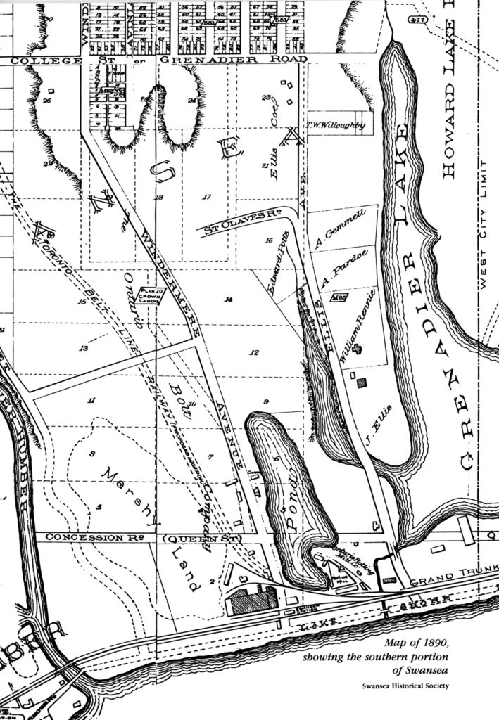
In 1894, College Street was envisioned to continue on into Swansea (today's Morningside Avenue), from link.

Swansea-map-from-Toronto-Library.jpg

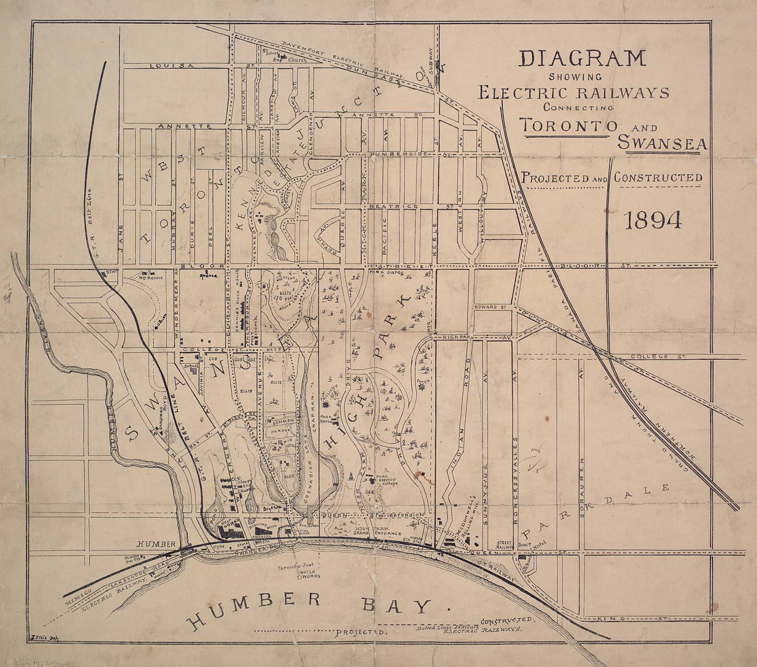
Elizabeth Street was renamed Runnymede Road. However, in the 1894 map, the plans were for Elizabeth Street (Runnymede Road) to be extended down to the lake. Never happened.
 
I wonder why the southernmost part of Jane St. was interlined with The Kingsway and later separated into South Kingsway only to be separated again to make a link of an extended Bloor St?

It looks like the powers that be felt they made a mistake with the street grid the first and decided to change it. You'd think they would have thought that a linked Bloor (and an intact Jane) was more important from the beginning.

I'm guessing that 'back in the day' traffic flow patterns we not as much of a consideration - if considered at all. Connecting roads and dealing with terrain as cheaply as possible with the largely manual methods available were likely the prime criteria. That and keeping local gentry and aldermen happy.
 
I wonder why the southernmost part of Jane St. was interlined with The Kingsway and later separated into South Kingsway only to be separated again to make a link of an extended Bloor St?

It looks like the powers that be felt they made a mistake with the street grid the first and decided to change it. You'd think they would have thought that a linked Bloor (and an intact Jane) was more important from the beginning.

Topography is very important near here. Lots of steep hills/ravines.

I believe that Jane St (south) is now called Mossom Rd & Riverside Dr (normally a beautiful drive...right now you only can go North on Riverside due to construction). This follows the ridgeline above the Humber River

The Beltline Railway was close to where South Kingsway is now and followed the bottom of the hill.

At that time I think the only access across the river was at Dundas (Bloor was not a major street)

Subsequently they built a bridge near Bloor. However, it is the Old Mill Bridge. You had to drive Old Mill Dr/Catherine St/Old Mill Rd to get over the river.

I think that's how it went but not 100% sure.
 

Back
Top