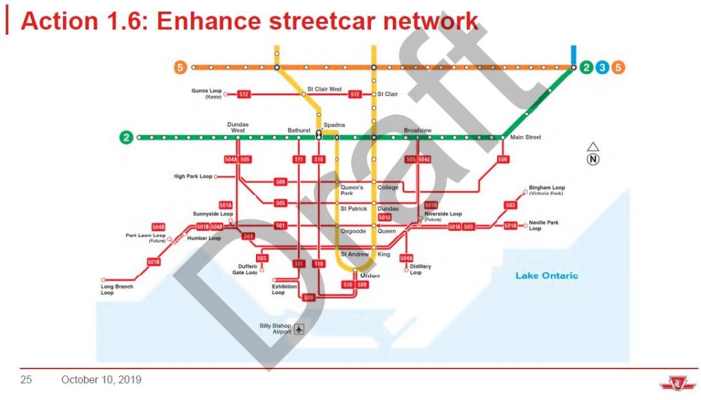
Where will the streetcar stops be located at The Queensway, Queen Street West, Roncesvalles Avenue, and King Street West intersection?
Currently, the 501 westbound stops on Queen Street West, at the northeast corner. The 501 eastbound stops at The Queensway, at the southwest corner. The 504A westbound stops on Roncesvalles Avenue, the northeast corner. The 504A eastbound stops on Roncesvalles Avenue, at the northwest corner.
Where would the 501A & 501B & 504A stop, going westbound on The Queensway? Where would the 501A & 501B stop, going eastbound on Queen Street West? Where would the 504A & 504B stop, going eastbound on King Street West?
The following is the January, 2019 intersection plan from
link.
View attachment 219543