I was getting impatient waiting for the HFR report, so I decided to do my own armchair analysis.
The whole description ended up being pretty long so I just posted it on my blog here:
https://ontariotrafficman.wordpress.com/2020/08/17/mythbusting-vias-hfr-travel-time-claims/
but here's the summary:
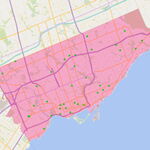
These are the segments which appear to be upgradeable to 110 mph operation using curve widening and some relatively feasible realignments.
The biggest challenge is the 102 kilometres between Kaladar (east of Tweed) and Smiths Falls.
For the 87 kilometres from Kaladar to Glen Tay (just west of Perth), the line traverses rough rocky terrain dotted with lakes. As a result, the line follows a meandering path with frequent tight curves, with a radius of about 550 metres. This would only allow speeds around 80 km/h (50 mph) or so. Basically none of the existing ROW is useable for 110 mph operation since the curves are too close for the realigned route to rejoin the existing ROW before the next curve.
Big circle is 1300m (approx radius for 110 mph), small circle is the existing radius: 570m
For the 15 kilometres from Glen Tay to Smiths Falls, the route follows CP’s main line. Given that the whole point of the HFR project is to avoid interference from freight trains, this segment will need a new ROW, whether it be adjacent to the CP line, or along a completely different route.
Given these challenges it seems like it’s a question of all or nothing for the 102 kilometres between Kaladar and Smiths Falls. If the line is to be improved at all, an entirely new alignment is required. Given the terrain, the new railway would need to make extensive use of bridges and cuttings.
But the plus side of all that grading is that the net cost of fully grade-separating the line becomes relatively low, especially since there are hardly any crossing roads in the first place. A fully grade-separated railway could operate well above the 110 mph limit that would be imposed by level crossings. VIA’s new fleet can operate at up to 125 mph (200 km/h), and it would probably be prudent to use an even higher design speed to accommodate even faster trains in the future.
To get an order-of-magnitude estimate for travel time, I assigned a speed for each segment and simply calculated the travel time at that speed. This provides the theoretical minimum travel time given those speed limits. It is not possible to achieve this travel time in the real world because it does not account for acceleration/deceleration, miscelaneous slowdowns (e.g. through switches), stops (stations, meeting trains in the opposite direction) or schedule padding.
The speed limits in the slower segments were roughly based on the radius of existing curves, except for the segments within Toronto and Ottawa, which are based on existing GO Transit and VIA Rail schedules, and within Peterborough where I assigned a 50 km/h (30 mph) limit due to the numerous awkward level crossings.
I examined three options, which include varying degrees of new alignments. The first scenario only upgrades the easiest segments. The second scenario also fills in the gaps around Havelock and around Tweed. And the third scenario adds in the big-ticket item: a new 102-kilometre high-speed railway from Kaladar to Smiths Falls.
The interesting thing here is that in either of the options without the new 102-km high speed line (HSL), it is physically impossible to achieve the 3:15 travel time that VIA
has been touting. Even if the trains had infinite acceleration, infinite deceleration, never stopped at stations, never slowed to switch tracks and never stopped in sidings to let trains pass in the opposite direction, those scenarios would still take longer than 3:15.
The HSL would cost several billion dollars on its own, so I don't get the impression that it's included in VIA's current concept. But I'd love to be proven wrong.
But on the flipside, if that line does get built, it may be possible to even beat the 3:15 estimate. Including the real-world factors, maybe the 2:47 theoretical minimum could plausibly correspond to a real-world scheduled time in the ballpark of 3:00-3:10.
Personaly I'd like to see the third option persued right off the bat, rather than reinstalling tracks along the crappy segment of the CP ROW and then abandoning them later. The project could be phased to first upgrade Toronto to Peterborough, and start a basic service on that segment to develop ridership and interest (a.k.a ribbon cuttings for politicians) while works continue on the HSL further east. That would be similar to how Brightline started its operation with service on the upgraded line from Miami to West Palm Beach, while work continues on the new 125 mph railway to Orlando.