News   Dec 11, 2024
 563     2 
News   Dec 11, 2024
 1.2K     1 
News   Dec 11, 2024
 173     0 

Urban Wilderness!

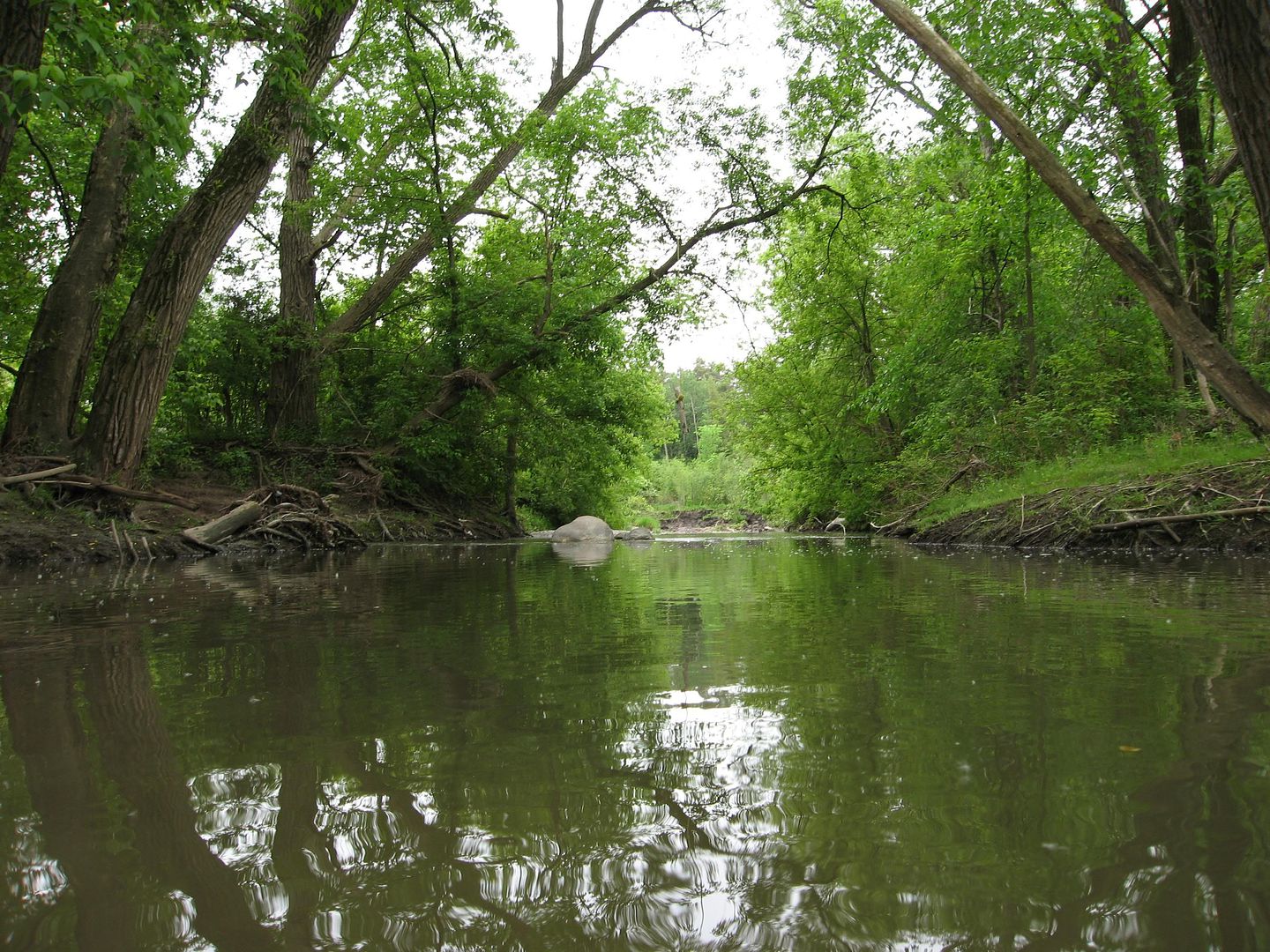
Highland Creek, West Branch - left fork

I flip a coin and head west under McCowan Road:

60176434.jpg
60176433.jpg


60176435.jpg
60176422.jpg


Trekking towards the CP rail culvert:

60176427.jpg
60176417.jpg


60176326.jpg


60176414.jpg
60176314.jpg


Turning north through the mighty Brimley Cataracts:

60176305.jpg
60176298.jpg


60176292.jpg


60176282.jpg
60176285.jpg


Into North Agincourt Park:

60176271.jpg
60176277.jpg


60176263.jpg
60176165.jpg


60176163.jpg
60176159.jpg


60176155.jpg
60176151.jpg


North from Huntingwood to the branch terminus at Finch Ave:

60176144.jpg
60176139.jpg


60176132.jpg
60176120.jpg


60176125.jpg
 
Highland Creek, West Branch - right fork

The lure of the other stream proves too tantalizing, so I head back to the forks, and north under Nugget Ave:

60177328.jpg
60177330.jpg


Just south of the CP marshalling yards I encounter "The Great Baffler":

60177336.jpg
60177341.jpg


60177343.jpg
60177346.jpg


60177351.jpg
60177359.jpg


60177364.jpg
60177367.jpg


60177477.jpg
60177484.jpg


Continuing north towards Middlefield Road:

60177497.jpg
60177501.jpg


60177508.jpg
60177512.jpg


60177519.jpg
60177522.jpg


Under McCowan Road, and into Iroquois Park:

60177524.jpg
60177527.jpg


60177590.jpg
60177593.jpg


From Finch Ave, through Brimley Woods, ending just south of McNicoll:

60177594.jpg
60177599.jpg


60177603.jpg
60177607.jpg


60177610.jpg
60177616.jpg


60177617.jpg
 
And I thought I knew everything about Scarborough. Thank you so much for the trip EVCco. I walk across a bridge every day in the s/e section of Bayview/Steeles. If you are ever looking for a new area to shoot start there and head south , I'm sure you will like the wilderness.
 
^I hope to get out to the East Don Parklands area soon! It's one of the few areas of the city I've yet to explore. Unfortunately, it may be a while as I ran into another, much more serious camera mishap on my latest trip....


Highland Creek, Central Branch - river of woe

Beginning north of the 401, through Burrows Hall Park. Perhaps I should have heeded this ominous warning sign at the outset of my journey:

60444264.jpg
60444269.jpg


60444274.jpg
60444279.jpg


Under Sheppard Avenue, into Pine Tree Park:

60444292.jpg
60444298.jpg


60444286.jpg
60444304.jpg


60444309.jpg


Past McLevin and the CP line, into an industrial no-man's-land east of Markham Road:

60444313.jpg
60444385.jpg


60444390.jpg


60444395.jpg
60444398.jpg


Through a series of culverts at Brownes Corners (Finch & Markham):

60444406.jpg
60444416.jpg


60444410.jpg
60444422.jpg


60444426.jpg


The creek suddenly divides just east of Tiffield Road:

60444578.jpg
60444573.jpg


Looking down the west stream one sees the South Milliken skyline, resplendent in the colours of an early autumn's eve:

60444554.jpg
60444562.jpg


Looking up the north branch, another concrete culvert:

60444583.jpg
60444587.jpg


I head north, and shortly after taking this final photo my camera somehow manages to slide its way out of my pocket, falling to its doom in this very creek :( :

60444594.jpg


Rest In Peace Sanyo VPC-CG9.
You were a cheap camera, but a dependable one.
You will be missed.
 
Last edited:
Sixteen Mile Creek - suburban wilderness

I'm back, and a little further afield than usual - exploring the northern stretches of 16 Mile Creek in the town of Milton; starting just north of Evergreen Cemetery:

62651610.jpg
62651612.jpg


62651617.jpg
62651618.jpg


The creek forks just north of Main Street:

62651621.jpg
62651627.jpg


62651630.jpg
62651633.jpg


Down the west fork to Rotary Park:

62651642.jpg
62651647.jpg


62651684.jpg
62651685.jpg


62651689.jpg
62651692.jpg


62651698.jpg


Up the east fork to Woodward Avenue:

62651700.jpg
62651705.jpg


62651711.jpg
62651712.jpg


62651715.jpg
62651756.jpg


62651760.jpg
62651761.jpg


62651763.jpg
62651764.jpg


62651767.jpg


...even in the most remote locations the graffiti people always find a way there first :p
 
Well, I wasn't actually in Milton to photograph the creek...
I just took those pics to waste an hour while waiting for the GO bus back to Toronto.


But rest assured, I will one day photograph every inch of every waterway in the GTA - or die trying!
 
Well, I wasn't actually in Milton to photograph the creek...
I just took those pics to waste an hour while waiting for the GO bus back to Toronto.


But rest assured, I will one day photograph every inch of every waterway in the GTA - or die trying!

Fair enough, I was just wondering because the Sixteen Mile is infinitely more picturesque in its Oakville stretch.
 
Taylor Massey Creek - winter return

Clearing up some unfinished business before the start of the new year - heading north from the tip of Warden Woods at Warden and St. Clair:

64118403.jpg
64118366.jpg


64118387.jpg
64118413.jpg


64118431.jpg
64118452.jpg


64118467.jpg
64118478.jpg


In behind Warden Station:

64118486.jpg
64118497.jpg


64118688.jpg
64118699.jpg


East through St. Clair Ravine:

64118707.jpg
64118715.jpg


64118727.jpg
64118736.jpg


64118750.jpg
64118789.jpg


64118760.jpg
64118774.jpg


Into Pine Hills Cemetery:

64119033.jpg
64119047.jpg


64119058.jpg
64119066.jpg


64119076.jpg
64119086.jpg


64119097.jpg
64119107.jpg


64119133.jpg
64119121.jpg


64119267.jpg
64119272.jpg


64119277.jpg
64119279.jpg


64119286.jpg


Winding north through Farlinger Park:

64119422.jpg
64119429.jpg


64119438.jpg
64119445.jpg


64119453.jpg
64119461.jpg


64119472.jpg
64119481.jpg


64119494.jpg
64119504.jpg


64119707.jpg


Flashback to July - one of the hottest days of the year, with the humidity nearing 40 degrees - I head through Ionview, from Eglinton Ravine to Maida Vale Park:

64118045.jpg
64118069.jpg


64118081.jpg
64118094.jpg


Back to December - and one of the coldest days of the year, with wind chills as low as negative 17 degrees - I head due north, parallel with Crockford Boulevard:

64119712.jpg
64119718.jpg


64119726.jpg
64119737.jpg


64119746.jpg
64119751.jpg


64119759.jpg
64119762.jpg


64119769.jpg
64119985.jpg


64119993.jpg
64120004.jpg


64120010.jpg
64120017.jpg


64120026.jpg
64120036.jpg


64120045.jpg


The creek goes underground at Lawrence Avenue, but re-emerges a few blocks north at Manhattan Park and continues northwest through the backyards of Wexford:

64120249.jpg
64120255.jpg


64120261.jpg
64120254.jpg


64120265.jpg
64120266.jpg


64120271.jpg
64120277.jpg


64120281.jpg
64120284.jpg


Under the CP Rail culvert and into the Ellesmere neighbourhood:

64120474.jpg
64120483.jpg


64120490.jpg
64120499.jpg


64120503.jpg
64120510.jpg


64120516.jpg
64120517.jpg


The creek widens significantly at Willowfield Gardens, then terminates in a scenic pond at Terraview Park:

64120520.jpg
64120527.jpg


64120661.jpg
64120672.jpg


64120676.jpg
 
I love this series. Thank you for the pictures.


Alas, poor Snowball I. Run over by the mayors beer-swilling brother Dou.... errr.... Clovis.

Snowball_in_Heaven.png
 
All new to me EVCco , great job. I live at V.P. and Ellesmere and didn't even know about the Terraview Pond , I'll have to wander over there and hopefully not fall in.
 
These are shots of the East Don north of Finch Avenue and the Old Cummer Avenue bridge. I think it's one of the loveliest parts of town.

f66a105e.jpg


90828c32.jpg


8cfde8c9.jpg


9dd65cbe.jpg


0a204fa2.jpg


b64705a5.jpg


dc1ad828.jpg


51cb357d.jpg


a86d5ad5.jpg


fe6c5391.jpg


06c445ed.jpg


88d00100.jpg


deadfad3.jpg


cb2ae542.jpg


f03723b7.jpg


fa855dc5.jpg


e825bb3a.jpg
 
Last edited:
These are shots of the East Don north of Finch Avenue and the Old Cummer Avenue bridge. I think it's one of the loveliest parts of town.

Ya, it's wonderful. I loved it back in the early 70's when I was attending YMCA day camps down there. The bridge was a disaster in those days so it is so nice to see it saved. Much of this has been discussed in past threads I believe. Camp DON-VA-CA and Camp EE-YO-CA I believe they were called.
 

Back
Top