The five greatest ideas Toronto never built
From a 1929 scheme to give the downtown a Parisian flare to the first lieutenant governor’s intention to keep the waterfront for the public, here are five ideas that would have changed Toronto.
Mathew Borrett's illustration of Vimy Circle, from Queen St. and University Ave. looking south, as it would look today.
If you’re searching for a stunning view of downtown, visit the Toronto Archives and ask for Box 83705.
Within, you’ll find details of a 1929 plan to transform Toronto’s downtown into a slice of Paris, with grand boulevards, wide streets and an architecturally splendid traffic circle.
This plan died at the birth of the Great Depression.
“If you step back and you ask, ‘How many truly beautiful, really beautiful streets does Toronto have?’ there is going to be a long hesitation,” says University of Toronto architecture professor Larry Richards.
Here and there, small streets are lovely for a few blocks, he says. Queen Street is incredible, University Avenue is great but doesn’t last long.
“After that, you really have to scratch your head,” he continues. “Toronto just has not been very good at building a system of truly beautiful, pleasant, enduring boulevards. That one moment it could have happened,” he says of the 1929 plan.
Toronto’s history is filled with grand ideas killed by politics, economics and petty parochialism, ideas now buried in history books and boxes at the Toronto Archives.
From 1954 until amalgamation in 1998, large infrastructure projects like the Gardiner Expressway were handled by Metropolitan Toronto, but for most of its history Toronto has been run by a decentralized government where power is shared equally by wards.
“Because of that, we haven’t done any great good things, but we also haven’t done any great bad things,” says Joe Berridge, partner at Urban Strategies, noting that most major cities have a mechanism to develop a citywide agenda.
Toronto has had remarkable chapters — the building of Canada’s first subway in the 1950s, or later in the decade when architects from around the world vied to design a new city hall, says Mark Osbaldeston.
“If you look at my books it might seem like all we do is fail to build things,” continues the author of the
Unbuilt Toronto series, noting that the city has dodged both uninspiring plans as well as the grand schemes.
Because the unbuilt is intriguing in the same way that silence can be deafening, the Star sifted through Toronto’s past to find five great ideas that fizzled.
No idea is perfect or universally loved in its time — they are simply choices that would have fundamentally changed the way we experience our city. Some have earned a second chance, others seem to exist in a perennial state of study.
And there are the others — the grand boulevards that will never happen, because you get only a brief chance to build a downtown.
1. Vimy Circle, Cambrai Avenue
There was a moment, in 1929, when Toronto could have been a North American Paris.
Toronto’s near-makeover came about because the province wanted a better approach on University Ave. South of Queen St., it was “really a mess,” says Ken Greenberg, the former director of urban design and architecture for the city.
The 1929 plan called for a southward extension of University Ave., diagonal streets named for First World War battles and a few grand additions.
Most striking was Vimy Circle, at the modern intersection of Richmond and University. The centrepiece of the traffic circle would be a war memorial that would attract Beaux-Arts beauties of the same calibre as the newly built Union Station and Royal York.
The plan involved expropriating land and demolishing parts of Toronto’s “ramshackle” downtown to create new streets, widen old ones, and add “nobility” to the city, as the Star reported. It was a natural progression of the City Beautiful movement popular in the U.S., wherein planners transformed their utilitarian cities into something more European, with formal vistas and parkland, developed with symmetry along classical lines.
“A hundred years hence the people of Toronto will point to 1930 as the year in which the citizens decided that their city should take its place among the great cities of the continent, properly equipped for the handling of modern traffic, with wide streets lined by business places and public buildings of stately architecture, or, on the other hand, the year in which the citizens of Toronto deliberately doomed future generations to the most oppressive form of traffic bondage,” the Star wrote in an editorial.
“This was a period of enormous exuberance and excitement about the possibility of the automobile,” Greenberg says — a time when what happened inside the buildings and how such a traffic circle would impact pedestrians were not really considered.
Cambrai Avenue would be the “gateway street” from Union Station — a vista of commerce joining Front Street to Queen Street between Bay and York. The idea was similar to a street proposed by architect John Lyle in 1911.
The plan was the main issue in the 1930 election. The board of trade, TTC, motor league, local unions and incumbent Mayor Sam McBride supported the plan. (So did the Toronto Star, whose King St. offices would have flanked Cambrai Avenue).
The Toronto Telegram was against the idea. One of its editors, Bert Wemp, thought the money had better uses and entered the race to defeat the plan.
Then the stock market crashed in October.
“Mr. Mayor you can laugh as you like, as a taxpayer I feel it. Less than a month ago we all put our money in the stock market … We thought it was bound to go up, but we all had our day of reckoning,” said Alderman Harry Hunt, spooked by the $19 million price tag.
The makeover plan was on the ballot at election time. The voters defeated it by 2,000 votes and elected Wemp as mayor.
“The campaign to arouse outer districts against downtown had its success,” the Star wrote.
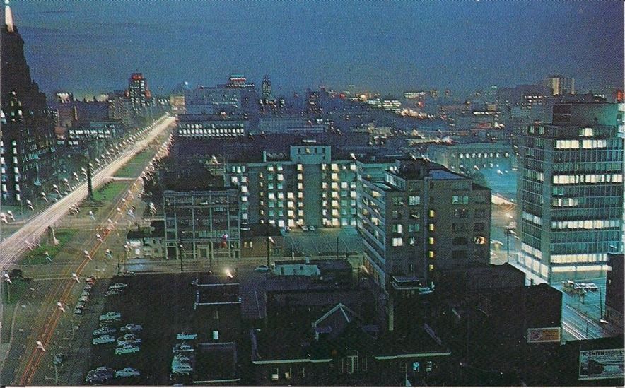
The expansion of University Avenue southward was eventually funded by a local improvement fee. As a result, Toronto business types are Bay Streeters, not Cambrai Avenuers.
Years later, a different sort of grandeur would rise in Cambrai’s place: Mies van der Rohe’s TD centre.
But as a new year dawned in 1930, a few people on King Street, interviewed by the Star, seemed cinematically downtrodden.
“It’s a shame to turn down a plan like that,” a tall stranger said. “They’ll pay for it, by George.”
Another chimed in: “He may be right ... he may be right. Guess maybe Toronto pulled a boner.”
2. T. Eaton Co. buildings
In 1928, the T. Eaton Co. went on a media blitz, unveiling plans for the ultimate in retail extravagance, a sprawling Art Deco shopping complex, bordered by Yonge, Bay, College and Hayter Sts. Construction would be a “colossal task,” the Star reported.
There would be more than four million square feet of space, with close to three million square feet reserved for retail alone. The building would also include a public arcade and 32-storey tower, with the higher floors reserved for administration, stock and warehousing.
In
Unbuilt Toronto, Mark Osbaldeston writes that the company intended to build the skyscraper — even bought a quarry to ensure a continuous supply of limestone. But like Vimy Circle and Cambrai Ave., this was a plan that couldn’t succeed in the Great Depression. The company also decided to keep their Queen St. store open, so the large complex at College wasn’t needed.
The surviving seven-storey part of the plan — now known as College Park — was magnificent in its own right, with decorative embellishments and an Auditorium and Round Room that drew Toronto high society.
3. Toronto Walks and Gardens
In 1793, what is now Toronto was chosen as the site for the capital of the new colony of Upper Canada because of its superior harbour. It was named York, and its lieutenant governor, John Graves Simcoe, wanted to save the land along the waterfront for the pleasures of the populace.
“I think anybody who is given a blank canvas aspires to produce something that is salubrious,” says historian
Stephen Otto. “But even in his time, some of the merchants in York thought he was a little bit touched to be talking about such airy concepts. A little bit crazy in espousing walks and gardens.”
By 1800, a small town was developing along the water, with two garrisons of Crown land set aside — the Garrison Reserve to the west and the King’s Reserve just east of Berkeley St. In between, a 30-acre strip on the waterfront between Berkeley and Peter Sts. was formally reserved for the public with a Crown patent in 1818, held by a group in trust. The trust was transferred to the city in 1853.
The 30 acres of waterfront land was always vulnerable to industry because it separated the harbour from the city. It was never a manicured leisure ground. Otto notes that the land was often used for storage of lumber and other goods.
The city began to make good on Simcoe’s vision in 1840 with the Fair Green, a fenced-off park near Berkeley St. where people could show their cattle at the fair or visit a travelling circus.
In 1852, the city surveyor published a plan for Toronto’s north shore, complete with “Pleasure Drives, Walks and Shrubbery for the Recreation of the Citizens.”
Otto calls that park — never built — the “very last gasp of a plan.”
The song of the future had been sung, and the railways were fulfilling their eventual destiny as Gordon Lightfoot ballad, an iron road from sea to sea — across Toronto’s waterfront.
“Defending it became not possible; the city was just not about to say, ‘Look we don’t need ships landing here, we don’t want railways.’ It was the economic lifeblood of the city; they weren’t going to slit their wrists,” Otto says.
In 1857, the trust was changed so the city could sell or lease the lands, as long as the money went into a trust to pay for other parks across the city.
Green was traded for a more lucrative green, as the rail system further industrialized Toronto’s waterfront, entrenching the city as an economic hub — not a disastrous outcome but frustrating to those who dream of downtown parkland.
“You’d think if they were better at planning they could have done the two, they could have worked the railways in, but not to the point of just annihilating all the open space downtown,” says Rollo Myers, the manager of the Architectural Conservancy of Ontario.
The money from the trust helped establish parks such as Allan Gardens and High Park. In 1916, the city merged the trust into the budget of the Parks Department, where it became untraceable. While nearly all the land associated with the original trust had been sold, a portion of Union Station sits on the original trust lands.
About 15 years ago, a group led by Otto and Myers asked the city for an accounting of the Walks and Gardens trust. While Toronto has more than 1,400 parks, Myers feels the downtown is underserved, especially with a residential condo boom. Corktown Common to the east and High Park to the west are not exactly central. And Toronto Island is a ferry ride away.
“We pointed out to them the act is still active; not only is money missing, council members are personally liable. That really got their attention,” Myers says.
In 2001, a working group recommended a trade: City council would establish a $7 million legacy fund and the legislation that governed the trust would be cancelled. The city argued that it spends more money on parks than would have accrued to the trust.
In 2012, the chief financial officer reiterated the city’s position: no money is owing. That year council asked the province to dissolve the trust. The province is reviewing the matter.
Simcoe’s ideals have not been forgotten. In 2013, a Belgian art studio won a city competition to create a 70-metre long “garden of light” at Union Station to commemorate our first lieutenant governor’s vision.
“That’s terrific and we appreciate it, but we’re talking tens of millions of dollars that belongs in park improvement,” Myers says. “Where is the 50-acre park we can go out and get lost in?”
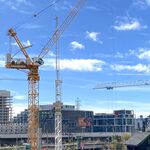
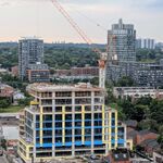
4. Downtown relief line
When you’re elbow deep in an inadvertent game of Twister on an overcrowded downtown streetcar, consider the downtown relief line.
The elusive subway that weaves through the city’s planning history has been a “persistent vision” not yet realized because of decades of “wasteful dithering,” transit consultant and historian Ed Levy writes in his 2013 book,
. Rapid Transit in Toronto: A Century of Plans, Progress, Politics and Paralysis.
The first time you see a wisp of it is 1910.
The New York engineering firm Jacob and Davies presented a report calling for a network of “streetcar subways” with a north-south route on Yonge St., an east-west above-ground line along St. Clair and an underground U-shaped route anchored near Weston Rd. to the west and Broadview Ave. in the east, dipping through downtown.
In 1969, a subway expansion along Queen St. in a northeasterly direction toward Eglinton and Don Mills was proposed. A 1975 study suggested a U-shaped urban railway joining the northeast and northwest parts of Toronto through Union Station.
In the 1980s, the Network 2011 plan called for a relief line from either Pape or Donlands station that would travel into the downtown core, ending at Spadina and Front Sts. The same plan called for a Sheppard subway line.
“Once the other suburbs got political power, the essential area was put on the back burner, the amalgamation in 1998 sealed the fate of that,” Levy says. “The downtown was essentially ignored, the first piece to be kicked out.”
Much to Levy’s frustration, it usually goes like this: Study, plan, election, study, plan, election. Babies grow into adults and have babies, each generation finding it more difficult with a stroller at rush hour.
“People don’t realize, it’s a hard concept to convince them, if you have that line, it will benefit the whole network,” Levy says.
The purpose of a downtown relief line is to ease congestion on the main subway line. If it terminated at a different transit hub, it could relieve pressure on Union Station.
If the planned Yonge subway extension to Richmond Hill is built without a downtown relief line, what bureaucrats call “significant overcrowding” and Torontonians know more colloquially as “please remove your elbow from my spine” is certain to happen by 2031, especially for long-distance trips in the north and east.
A 2012 TTC report suggests the first phase of a relief line could come in the form of a subway from Pape Station to downtown, or “more intensive use” of existing GO Rail corridors.
The line is a priority project for Metrolinx. Leslie Woo, vice-president of policy, planning and innovation, says more detailed studies in the past five years have shown that regional relief needs to be in place “sooner rather than later.”
Transit agencies and cities affected by a relief line are studying the project and co-ordinating with one another, not the “most nimble of processes,” acknowledges Woo.
“If you’ve had a chance to look at the history of all the different analyses that have been done, I’m not sure any have tried to attack this issue as comprehensively as we’re trying to do it now,” she says.
5. Toronto Museum
Many generations have fought the Toronto museum wars.
“My first time was the use of the Old City Hall, when the new city hall was built and opened up,” says former mayor David Crombie, a “very young guy” in the late 1960s. “A number of us thought that should be a place for the city museum … they decided to rent it to the courts where they can make money.”
Toronto has several smaller museums but no nucleus where people can learn about the city’s cholera epidemic of 1832 to 1834, historic slums and development, among other things.
“It’s so annoying. How many civilized cities don’t have a civic museum?” asks Scott James, the man who arguably came closest in the 1980s when he was managing director of the Historical Board of Toronto.
Pacing his kitchen, he is still animated by that plan.
“That’s what historical records are supposed to be for. They’re not just cute. They are a record of people’s thoughts and decisions; they should be available to help you make decisions in the future,” he says.
In 1986, the Toronto Museum had the support of mayor Art Eggleton and $120,000 from all three levels of government for a feasibility study.
“I can’t tell you how exciting it was, the whole city came out to public meetings on the subject,” he says.
Three sites were prime candidates — Old City Hall (after it was free from its lease with the provincial courts), the Canada Malting site on the waterfront (about to be vacated) and a parcel of land just off the Gardiner where the York off ramp was potentially going to be dismantled.
Every now and again, mayor Eggleton would approach the Historical Board and suggest a place, like the current Hockey Hall of Fame or the Lillian Massey Building, now a Club Monaco on Bloor St.
But they wanted a bigger site — 150,000 square feet.
“We were being fussy,” James says. “If I had to do it over, I would take whatever site (was offered) and get something started.”
The $40 million project was deemed excessive with the recession in the late 1980s. The lack of a private-sector champion sealed its fate.
Crombie is part of a group still working on the idea of creating an online museum with pop-up points around the city.
Toronto’s director of cultural services, Terry Nicholson, says a Toronto Museum is one of the options being considered for the north portion of the Casa Loma complex where the stables are located. The south portion, the actual Casa Loma house, is now operated by Liberty Entertainment Group.
Liberty president Nick Di Donato thinks the stables should be maintained as stables. He sees Casa Loma as a hub for a changing exhibit about Toronto’s history on the third floor. Di Donato and his team are already working on exhibits throughout the house with the help of the Toronto Archives.
“If you’re just going to come to Toronto as a tourist and see the history of Toronto, I’m not sure that’s going to resonate and really work, but if its parallel to a few things were doing at Casa Loma ... we can implement this Toronto component,” he says. “Perhaps one day Toronto will have a fairly large historical museum. This could be a catalyst.”
http://www.thestar.com/news/gta/2014/01/26/the_five_greatest_ideas_toronto_never_built.html