News   Apr 24, 2024
 741     1 
News   Apr 24, 2024
 976     1 
News   Apr 24, 2024
 569     0 

Transit Fantasy Maps

43197_York.jpg


I think that's a curved station....
 
London has many curved stations. Hence the constant "Mind the Gap".


I don't think I was questioning why we don't have lines that zig zag. Obviously that serves no purpose. However, I meant why not have lines that hit certain intersections/neighbourhoods along the way, but are on angles that would necessitate breaking from following the street map? Cut and cover costs was mentioned, but as we saw in the Madrid report, we have other options that might be economically viable.
 
Yes jn, I wasn't suggesting a zig-zag either. More of a gradual diversion of lines in order to hit certain nodes. Take the diagonal approach for instance. Theoretically a line could begin at St Lawrence Market (Front and Jarvis) and at a diagonal hit CBD (King/Yonge/Bay), Queen/Osgoode, Chinatown-Kensington (Dundas/Spadina) and Little Italy (to the west of Bathurst/College). As such a single line hits several trip generators without having to build a mutlitude of subways to preform the same service. Furthermore this would not only intercept nodes, but surface routes as well.

Dentrobate, you can't build a station on a curve, and subway trains can't turn at 90 degree angles.

Um, the current system's full of sharp right angle curviatures: St Clair, Broadview, Dufferin and Union just to name a few. What excuse is that not to build subways where they'd benefit the greatest number of riders (i.e. transit with local + long distance ridership demand)?
 
Just because you can connect dots on a map doesn't mean people want or need to travel between these points...you need a good reason to break off from a straight path in this city.

jn_12: It would be helpful to suggest a few places where you think more or less straight lines aren't good enough. Proposed/future extensions of all of the subway lines in Toronto aren't grid-straight (even Yonge will probably veer off to the east to hit the YRT terminal at the end). Eglinton's tunnel needs to be straight. Whatever gets built south of Bloor/Danforth, either a DRL or some kind of continuation of Transfer City Don Mills/Jane lines, will not be straight. The RT extension won't be straight.
 
Without looking at a density map or future development, there are countless intersections in Toronto with the required density or attractiveness to merit a subway stop (Queen and Spadina or Bay and Adelaide for example). Draw a line between them and you won't always have a road to build them under. I'm not concerned with straight lines (I think you somehow took my point to be that I dislike that all our subways run in straight lines, which isn't the case), and in many cases they're warranted, but in many cities, pockets are connected by subways even if they aren't on the same road (if you have Google Earth you can see where London's tube lines are in relation to the roads). Of course some lines in London are built under roads, but lines like the Victoria, Bakerloo and Piccadilly connect various intersections around the city.

We seem to pre-occupied with creating corridors, but one of the great things about subways is that there are no boundaries and they're capable of linking various neighbourhoods and places to one another without many limitations.
 
Just because you can connect dots on a map doesn't mean people want or need to travel between these points...you need a good reason to break off from a straight path in this city.

jn_12: It would be helpful to suggest a few places where you think more or less straight lines aren't good enough. Proposed/future extensions of all of the subway lines in Toronto aren't grid-straight (even Yonge will probably veer off to the east to hit the YRT terminal at the end). Eglinton's tunnel needs to be straight. Whatever gets built south of Bloor/Danforth, either a DRL or some kind of continuation of Transfer City Don Mills/Jane lines, will not be straight. The RT extension won't be straight.

So which is it, follow straight grids or divert where necessary? How come you have no qualms with diversions on all those lines but are adverse to an intercity line that does paractically the same? You don't see the need to connect intercity nodes which more or less line up, with the major exception of not all being along the same stretch of roadway. Unimaginative told me it'd take several lines to link up Toronto's major intercity nodes if adhering to straight-line policy. A little unconventional thinking in me thinks not all lines have to adhere to street grids, and using the argument that the city centre already is as it'll always be translates to 'streetcars forever' sub-par service. Every dot I've eledgedly connected is leaps and bounds ahead, in terms of walk-in and long distance commuter demand, of Wilson or Bessarion or Ellesmere/Midland or Old Mills or Greenwood... see where I'm going with this :rolleyes:.
 
We seem to pre-occupied with creating corridors, but one of the great things about subways is that there are no boundaries and they're capable of linking various neighbourhoods and places to one another without many limitations.

Ingenious deduction :cool:! Why we're so focused about immutable surface strret grids when the underground allots the flexibility to be tunneled anywhere demand warrants is beyond me. We need a diversity of opinions and viewpoints like yours here at UT, keep it up!
 
Doady,

An excellent map. One of the best I've seen. It's great to see people break free from the false dichotomy of "bus or subway". I feel like all the quibbles I have are minor. Though, one thing I don't get is why the Airport is served by a separate line, rather than being a continuation of either line 5 or 7?

I like your GTTA logo, too.

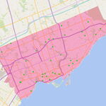
BTW, where did you get the base map from?

An idea I've had was to re-route the Barrie GO line though a tunnel to serve Dundas West, and still run the DRL through Dundas West. That could give us 2 subway lines, 4 GO lines, VIA service, and at least 4 surface routes at one place. Almost a second Union station. There's a good amount of redevelopable land around there too for office and condo developments. Rename it from "Dundas West" to "Davis Transportation Centre" or something similar.

I couldn't find many real-life example of subways serving airports. Even Tokyo doesn't have any subways to its airports; it is the regional rail system and a monorail line that serves the airports instead. I thought it was best just to have one separate line for airport that connects to as many other important rail lines as possible so that, if needed, it is able to have different trains (designed for large amounts of people carrying luggage?) and frequencies. Or instead perhaps it is actually light-rail or it uses standard gauge... none of these are specified on the map for a reason.

What is important that someone getting off of the Airport line can then take a train to almost all the major downtowns and centres in the GTA: Downtown Toronto, Brampton, Bramalea, MCC, Yonge-Eglinton, NYCC, SCC, ECC, Markham, Richmond Hill, Oakville...

Anyways, I might be wrong.

As for the base map, I drew it myself, partly based on Google maps. This is a fantasy map so it shows some roads that don't exist yet (like the future extension of Creekbank Road in Mississauga) and some others have been modified. And of course Google is quite outdated to begin with and GTA is growing very quickly. The base map also shows a complete Terminal 1 at the airport which I found the plan for at the GTAA website.

Anyways thanks for the comments everyone. I am surprised there so much opposition to the Bay subway line yet none at all for Hurontario subway! In fact one person even called for the Hurontario line to be even longer!:D
 
If the Eglinton line is going 95% of the way to the airport, there's no harm in going the final 5%.

Two more quibbles:

North York Centre station must be at Empress, not Finch...might as well have a Yonge & Finch station (this holds true for other stations at intersections like Yonge & Eglinton) since that's what lots of people call the area, and it is an explicit description of where the station is, which is good.

And you need to rename Oriole station as Peanut station :)
 
doady, have you figured out an approximate cost of implementing your system?
 
There are several subways to the airport that I know of and used in North America alone:

- BART to SFO (though BART is more of a regional rail/metro hybrid)
- Washington Metro to National
- Cleveland RTA Red Line (first in North America)
- Chicago Blue Line to O'Hare
- Chicago Orange Line to Midway
- Atlanta
- Mexico City

Plus several "near misses" where a bus or rail shuttle completes a short gap)
- Airtrain JFK to the A Train, New York
- Boston Blue Line to Logan Airport

And direct airport-downtown light rail connections:
- Baltimore BWI
- St. Louis
- Minneapolis
- Portland
 
Toronto does not build subway stations on curves. It's an absolute rule for the TTC.

Um, the current system's full of sharp right angle curviatures: St Clair, Broadview, Dufferin and Union just to name a few. What excuse is that not to build subways where they'd benefit the greatest number of riders (i.e. transit with local + long distance ridership demand)?

I'm not sure what you're talking about with those stations, but a subway train is not capable of 90 degree turns. Union is the absolute bare minimum curvature, and it swings out over a deceptively large distance. We wouldn't likely build like that anymore, either.

You've got to remember that the point of a transit route isn't to connect the dots between nodes. It's to get people where they want to go. Are there really large numbers of people going from St. Lawrence to Little Italy? Probably not, and definitely not enough to justify an underground subway route. Established travel patterns in the city are east-west and north-south.
 
I was thinking of New York, which has a huge subway system but no airport connection, and New York is the only American city that has better transit than Toronto.

A branch of London's Picadilly (sp?) line does connects to all terminal at Heathrow Airport. Berlin has no U-bahn to its airport. Of course, Vancouver is currently building a subway that will have branch to its airport, but it only has one track.

ScarberianKhatru:

I renamed Finch as North York Centre simply because has a regional connections. Maybe it is not accurate. I tried to make all the local stations named after streets and regional stations after neighbourhood.
 
I was thinking of New York, which has a huge subway system but no airport connection, and New York is the only American city that has better transit than Toronto.

What about the airTrain which uses the same kind of technology as Vancouver? Or that doesn't really count?
 

Back
Top