It's nice, but you will need more than 2 tracks for GO. CN needs 1 track, with go needing 8 at union, and dropping 2 at each point the line spurs off. (Barrie, Milton, etc)
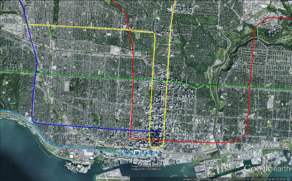
You'll notice on the track diagram that I have not changed anything south of Bloor. There are still a total of 8 tracks, with Milton and Barrie each having their own pair. The only change is the part where the subway takes away two tracks (one in each direction).
CN does not need its own tracks, since the amount of freight service south of the Weston Station is small enough that it can be simply accommodated off-peak. Note that most of the freight trains running along the Kitchener line exit onto the York Sub east of Bramalea. In my proposal, CN would have its own tracks from where the passenger trains would dip into the tunnel to the airport, in order to serve the sidings in that segment.
The reason we needed 4 tracks for the Kitchener Line was not for sheer capacity, but rather to in order to maintain capacity despite differing service patterns. Having services with different average speeds causes a severe hit to line capacity.
For example, take a segment of single track (one direction) with two services, one of which takes 15 min longer to traverse the segment of track. Assuming a minimum separation of 3 minutes and alternating services, the fast service needs to enter the segment 3 minutes ahead of a slow service, and a slow service needs to enter the segment 18min ahead of a fast service.
The capacity would be roughly 5.7 trains per hour per direction (6 trains every 63 minutes).
If, on the other hand, all the services had the same average speed, the capacity would be 20tph.
In my proposal, GO trains would take roughly 3 min longer than VIA trains through the 2-track section (1 additional station). Let's say the peak service pattern is Express, Regional, Express, Intercity.
Here's what the operations in an hour would look like at the start of the bottleneck:
00: Express
03: Regional
06: Express
12: Intercity
15: Express
18: Regional
21: Express
27: Intercity
30: Express
33: Regional
36: Express
42: Intercity
45: Express
48: Regional
51: Express
57: Intercity
60: Express (cycle restarts)
So, 12 trains per hour per direction (6 Express, 3 Regional, 3 Intercity), or an average headway of 5min. With GO using 12 car bilevels (crush load of 300 each) and VIA using 10 car single levels (80 seated each), the line capacity would be 34800 people per hour per direction, which is as much as the Yonge Subway.
I just made up the 15 minute time difference, but the point is how significantly speed differences affect capacity. The subway in the Weston corridor allows us to eliminate stops on the mainline, reducing the speed difference between the fastest and slowest services.
A capacity of 6 trains per hour per direction is definitely well below what we need in the Weston Corridor, hence the 4 track plan from Metrolinx.
But if those 2 tracks had a capacity of 12 trains per hour per direction, I think that would more or less cover it, especially considering that it is in addition to >20tph per direction on the subway tracks.