Developer: Metrolinx
  
Address: Hurontario Street, Mississauga
Category: Transit
Status: ConstructionCrane(s): 0
Height: ? ft / ? mStoreys: ? storeys
Project Forum 7.6K posts
Real Estate Forum
Follow 12 followingUpload 1369 photos
Official WebsiteReport Error


Mississauga Hurontario-Main Line 10 LRT | ?m | ?s | Metrolinx

That does raise the question: Are they going to try to at least greenify the median between the tracks in places like this?
The northern sections are exactly like this and none of them are gonna be green track. The upside is that it could probably be done in the future but I suspect it would have to be paid for by the city
 
Aug 23
As noted, where there is 4 curbs between tracks, greenery will be place in the centre two. This does not apply to the whole line and no idea what is plan for sections with no curbs. If one looks at the current corridor from Topflight to Eglinton, the section from Eglinton to Bristol and from Britannia to the north side of the 401 have no curbs.

If you want grass, you will have to wait tell the guideway has to be rebuilt and most likely not happen then as its very costly to put in the draining system that is require for grass. One reason Mobilinx chose not to go grass as well not liking it as well.

Had a quick look at the guideway between Elm and CP after getting home tonight and it doesn't match any of the current platforms built so far and no idea why the change. It looks like Burnhamthorpe station will be the same as CP. If someone has access to any renderings for the corridor, it will help to see what is been plan for these changes.

As for the Rathburn connection to the mainline, the wye will be on earth filling on the northside of the 403 off ramp that is currently has the retaining wall in place for the backfilling shown in the photo above. The Rathburn track section has taken over the north side of the street and sidewalk and will stop at Station Gates until the extension happens. The ramp walls are in place and waiting backfilling once the elevated section is complete.

Pouring of the concrete for Square One Dr to place as plan and great shots.

Surprise no one has posted info on the Burnhamthorpe intersection and its the worse fear for the line and everyone. Straight track in place with the north section opening up next week once the backfilling and asphalt is in place, This mean the line and intersection will be out of service for at least 4 months to rip out what was built and building the wye connection. I guess Mobilinx has decided to ask an arm and leg cost to rebuilt the intersection to cover some of their losses so far on this project that do it right as first stated at the beginning of the project.

Minneola intersection should be open now as it was almost ready at 5:30pm today with a small section of the curb lane being pave. I suspect the intersection would open after traffic had die down.

The southbound lane from Minneola to Pinetree will be stake next week along with the curb being pour as the curb machine is there now.

No idea what is plan for the removal of poles in the new southbound lane as well the northbound ones. The northbound poles will have a major impact on building the new lane as well delay building the guideway to a point with only one lane of traffic in place of 2.

The northbound curb from the Queensway to King St has been poured, but the lane will remain close until they replace the sidewalk with temporary asphalt or build the concrete one.

The northbound curb from the Dundas to Hillcrest is also poured.
 
Surprise no one has posted info on the Burnhamthorpe intersection and its the worse fear for the line and everyone. Straight track in place with the north section opening up next week once the backfilling and asphalt is in place, This mean the line and intersection will be out of service for at least 4 months to rip out what was built and building the wye connection. I guess Mobilinx has decided to ask an arm and leg cost to rebuilt the intersection to cover some of their losses so far on this project that do it right as first stated at the beginning of the project.

Where does the 4 month figure come from? The track intersection can be rebuilt in under a week so the line can run. The surrounding work will disrupt car traffic for longer but I just don't see how it can take months to do. They can build several intersections in that time.
 
Where does the 4 month figure come from? The track intersection can be rebuilt in under a week so the line can run. The surrounding work will disrupt car traffic for longer but I just don't see how it can take months to do. They can build several intersections in that time.
What intersection to date has been built in one week??? This is not TTC method for intersections trackwork. Fully close intersections are supposed to be 4 weeks and end up being 5-6 weeks, Two sections intersections are are supposed to be 6-8 weeks and end up being 9 weeks

It took them 3 months to build Topflight that was fully close to all traffic that is opposite hand for Burnhamthorpe. You got to rip out most what is there now and not a simple job doing the switches and crossovers.

Don't think intersections take long to do, look at my photos in this thread to see when work started and finished on them that are dated or view my site and search for X intersection photos that will give you a timeline from start to finished.
 
I don't think Matthews Gate, Elm or Central Parkway were closed anywhere near 4 months. Maybe one month each? But those are straightforward, straight tracks.

If they're building one thing at Burnhamthrope, and then it needs to be torn up and done again to allow a turn, I could definitely see that taking longer than a month.
 
Random question. Any idea why they’re calling this Line 10? Do they consider this part of the GTHA/Metrolinx system? Nothing wrong with it, just found it interesting.

What are the remaining lines going to be?

Line 1, 2, 4, 5, and 6 are already known.


Leaves us with Line 3, 7, 8 and 9.

Line 3 will likely become the Ontario Line
Line 7 is supposed to become the Scarborough East LRT.
Line 8 ?
Line 9 ?

Interesting…
I thought it was because Main/Hurontario was formerly known as Highway 10 in the older days. I could be entirely wrong and the answer you're looking for is somewhere in the other 490 something pages.
 
Random question. Any idea why they’re calling this Line 10? Do they consider this part of the GTHA/Metrolinx system? Nothing wrong with it, just found it interesting.

What are the remaining lines going to be?

Line 1, 2, 4, 5, and 6 are already known.


Leaves us with Line 3, 7, 8 and 9.

Line 3 will likely become the Ontario Line
Line 7 is supposed to become the Scarborough East LRT.
Line 8 ?
Line 9 ?

Interesting…
It's in reference to Highway 10. Line 7 would be the Eglinton East LRT assuming it ends up going forward (which is its own discussion), and the TTC did refer to the proposed Jane LRT as Line 8 back in 2018, but that's obviously fallen out of the long-term plans since then. And it'll (unfortunately) be a long time before we have to worry about what Line 9 would be.

I suppose if Metrolinx were feeling especially galaxy-brained they could demand that the TTC not use the "Line 7" name to reserve it for a conversion of the Highway 7 Rapidway to rail—something that's never really been talked about and would be not just years but generations away. Maybe stranger things have happened but ultimately naming the Hurontario LRT Line 10 just seems to have been a uniquely convenient opportunity that presented itself.
 
Got a good look this evening at the sidewalk + bike lane as it runs underneath the reconfigured QEW underpass. I was pleasantly surprised - looks wide enough, and with a nice setback from the motor vehicle lanes on 10. There's also a new paved path that links to the older pedestrian tunnel east of the underpass.

PXL_20240825_204039856.MP.jpg
 
Aug 24
As for Line 10, I have yet to hear why it is number this way other being highway 10. ML still calling it the Hazel Line. It been call Hurontario Line from day one.

Had a look at Square One Dr intersection and it still not finished considering concrete was poured on the 13th. Still got to backfill and asphalt the road area which is very narrow and not the norm for the gap. I was expecting it to be open, not close.

The 2nd wall is being built for the north pier for 403.

Burnhamthorpe Intersection has a timeframe from July 11 to Sept 19 to build the guideway across it and today is the 24th, This leaves 26 days to complete the intersection. Crews were removing the form work for the poured area on Sat as I drove by. This will allow the backfilling and paving of the lanes to open it up sometime this week to start on the 2nd haft.

Absolute Rd, Matthew Gates, Elm Dr, and Central Parkway where full closure that were to take 4 weeks to do, but all of them ran from days to a week late opening up.

As to the centre curbs between tracks, Central Parkway station north end goes from 4 to 2 as well south of Matthew Gates. There will support greenery of some sort and no idea why the change compared to what has been built to the north.

Nothing has taken place for Courtneypark Station since I saw it a few weeks ago with centre columns in place then.

Not sure if there will be 2 lanes for turning left at the Queensway, but the current setup for 3 is backing up traffic in both directions at this time. The left turning traffic is backed up into the through lanes.
 
Drove on the 407 heading towards work earlier today. Passed Hurontario and it looks like Westbound / Eastbound lanes indicate that demolition is mostly completed for the existing roadway based on the boards and gaps of light I can see through on both sides.. They appear to be piling up dirt along the open section around the East / West entry loops for what may either be more retaining walls, or as support for the girder(s). I'm in the process of getting a drone, I just need to make my mind up on what I want to get. I'll have one eventually.

Additionally, I did notice more work being done on the 403 with what looks like the second wall as Drum mentioned. Pretty interesting stuff.
There will be a pier support between the southbound lanes and the northbound being demo to support the girders for the Guideway. The east side has retaining wall and pier support for the new westbound on ramp to the 407.

Aug 28
In early 2000's, I came upon a 1987 report for Hurontario St widening from 5 lanes to 9 lanes stated the city had the land to build the highway then, yet doesn't seem to be the case today. This is why the area between Burnhamthorpe and Central Parkway not been built with 4 curbs between the tracks like north of Bristol. It been stated there is not enough room in many places to maintain the 4 curb between tracks. Real odd that the 1987 report said there was room for 9 lanes, but not today.

More formwork for the future station extension for Central Parkway taking place.

All the curb for the southbound lane south of Pinetree is now pour with steel plates over it at driveways. The section from Pinetree to the QEW off ramp being dug up for X that will be follow by curb.

The area from Mary Fix Creek to where the tracks move to the centre of the road is having sound barrier install there.

Forming is underway on both side of Hurontario south of Mineola for sidewalk. Once the sidewalk is pour on the west side, the barriers will be remove to shift traffic and then move to the north end.

Square One and Burnhamthorpe has seen no one this week yet doing any backfilling before been pave to get that area open to traffic.

All of the southbound curb south of the Queensway is now pour, except for the North Service Road area on the north side that is dug up. They need the sidewalk built first before they can open any curb lane on both side before thinking on doing the guideway.

2025 will be nothing but building the guideway at this time.

At the rate the guideway is going as well stringing the overhead, let alone have the LRV's for testing, the test bed will be at Square One Station than the plan Matheson one.
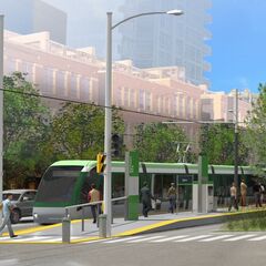
 
They’ve been pouring a lot of these curbs between the LRT row and the street. From the looks of it, a car wouldn’t be able to just drive onto the ROW outside of intersections, correct?
 

Back
Top