Transportfan
Senior Member
^^ Car haters think even four-lane (not even six) streets without turning lanes are ruined by cars, not just the prototypically suburban ones you described.
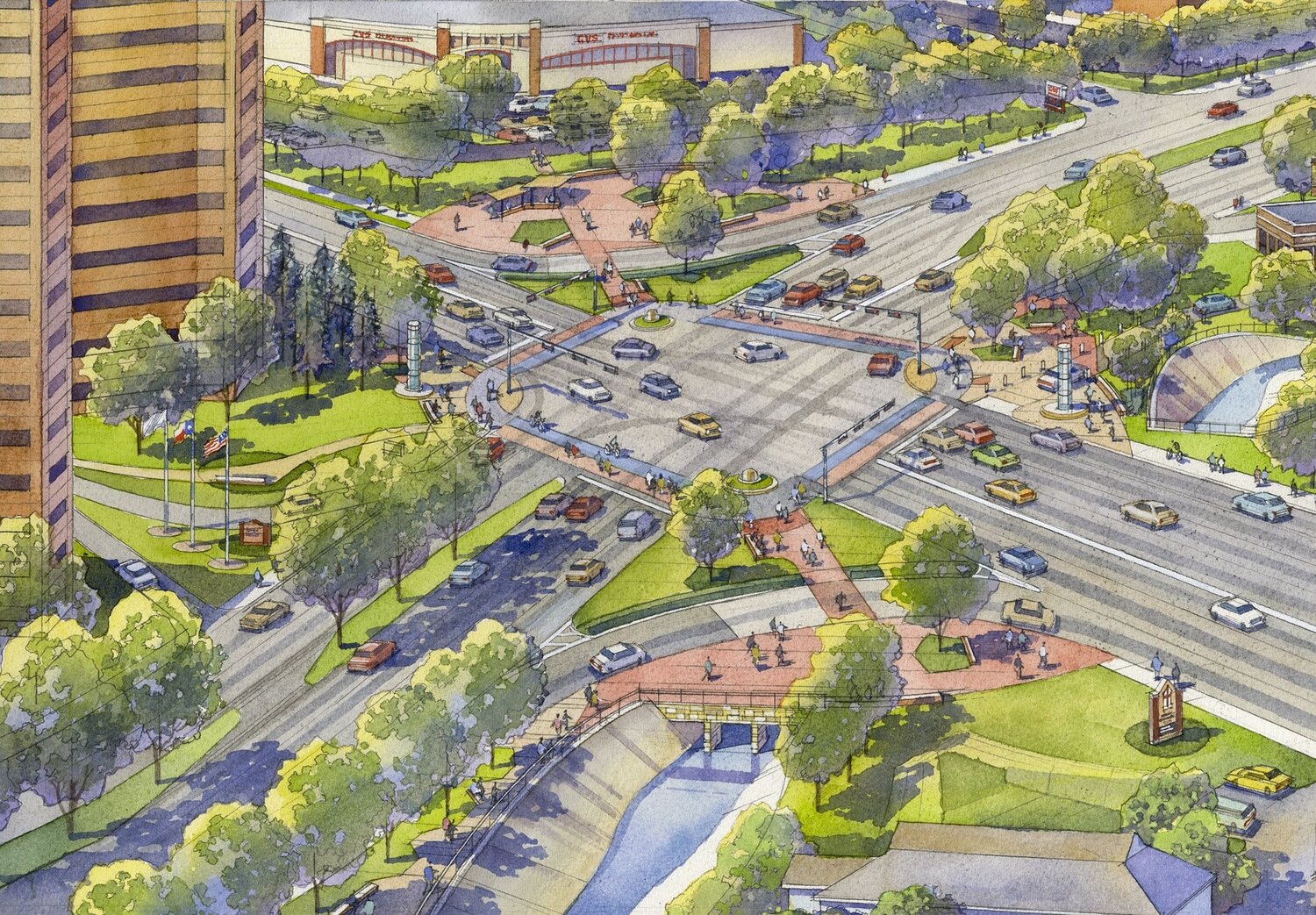
hmm..How many lively, pleasant, walkable streets can you name that also happen to be 6+ lane 60km/h arterial roads with turn lanes at intersections?
After you complete that exercise, how many lively, pleasant, walkable intersections can you find between 4-6+ lane 60km/h arterials with turn lanes?
After you complete that, how many lively, pleasant, walkable neighborhoods can you find with *three* 4-6+ lane 60km/h arterials with turn lanes and 3 intersections between them, all within 400m of each other?
You may be right, but the Champs-Élysées will be rebuilt to accommodate less vehicles and a focus on pedestrians & cyclists. Many Parisians feel that the avenue is too basic and not friendly enough for people. So perhaps less vehicle space is a factor for the enjoyability of streets.hmm..
Park Avenue, NYC
Champs Elysees, Paris
Avenida 9 Julio, Buenos.. just to name a few..
It is not how many traffic lanes that matters, it is what the pedestrian environment along them can add to street life and overall experience..
You may be right, but the Champs-Élysées will be rebuilt to accommodate less vehicles and a focus on pedestrians & cyclists. Many Parisians feel that the avenue is too basic and not friendly enough for people. So perhaps less vehicle space is a factor for the enjoyability of streets.


The exhibition itself presented a look back at the 350-year-old history of the Champs-Élysées and then presented the metamorphic re-planning. The transition from the past to the future is not arbitrary, and relies on meticulous documentation and study. Working in collaboration with researchers, historians, scientists, engineers, artists, and economic and cultural participants from France and abroad, Chiambaretta traced and analysed the current usages, and development of the Avenue to propose a new vision. Part of the exhibition even invited its viewers to participate in the feedback process. Community support and engagement is possibly one of the reasons why the proposal was eventually green-lit.
Two of the biggest concerns raised were the abandonment of the gardens along the avenue, and what was titled “problems associated with its contemporary ambitions”. This is a direct reference to the popularisation of the avenue as a tourist destination. Populated with expensive cafes and luxury stores, the study proclaimed the following estimate, “About two thirds of the pedestrians walking along the Champs‑Élysées are tourists, 85 per cent of whom come from abroad. If we subtract the people who work in the neighbourhood and those who are simply passing through (i.e., who spend less than 15 minutes in the area), Parisians represent a mere five per cent of the avenue’s users”. With such a large mass of the population to be accounted for during specific times of the day, a more dynamic and adaptable planning structure is required.

One could argue that all cities, irrespective of being tourist hubs or not, exhibit daily migratory patterns. Different sections of the city are active at different times of the day. The thing to keep in mind with urban foci such as this Parisian avenue is that the shift in volume is very dramatic. Chiambaretta’s study and proposal set up an operational framework defined by five urban layers: nature, infrastructure, mobilities, uses, and buildings. The proposal breaks the avenue down into distinct areas namely; Place de l’Étoile, the upper stretch of the avenue, the lower stretch of the avenue, the Champs Élysées gardens, and the Place de la Concorde. Each of them then individually addresses the issues of nature, use and mobility, while infrastructure and building create an interconnection that ties the entire proposal together.

The official statement of the re-envisioning states: “Our vision to re-enchant the avenue by 2030 invites us to bring together the research and resources of all public and private stakeholders in order to make this urban space a laboratory of excellence for more sustainable, desirable, and inclusive cities”. This is perhaps the best summary of the proposal's intentions and desires.
They need to be rid of the single-story, single-use buildings along Dundas Street West and Kipling Avenue. Currently, they generate traffic congestion (usually by single-occupant vehicles) to get from one store or office to another store or office. Better if they park in one place, or take transit, and walk around instead because everything is in one, two, or three blocks of each other (walking distance).^I wonder how the residents on adjoining Parisian streets will react when they realise how much vehicular infiltration this plan will create. Taking cars off one roadway does not make the cars disappear.
This is exactly the challenge for Six Points. Dundas is a major artery. Many trucks go by - which are after all delivering goods to people and business, and can’t be eliminated. I am hopeful that the district that emerges will be interesting, but it won’t ever be quiet parkland.
The solution is in part the roadway design, but it’s also a street design. We have to change setbacks and limit the footprint of buildings. Create backstreets and interesting spaces off of, but connected to, the main thoroughfare. Leave enough space for outdoor patios so these aren’t crammed up against the sidewalk or adjacent to the noisy roadway. Six Points appears to be prepped for overbuilding.
Funny how we are so willing to shrug about making things harder for vehicular traffic (or making simplistic replies like “better transit will make all the cars disappear”) but we don’t dare tell developers to make their buildings smaller and less demanding of space so that there is enough room for the roadway we need and the people space we need.
As much as I support making streets walkable, we seem to be making cars the sole enemy. Perhaps there are others who have to share the pain.
PS I have in fact tried to take a photograph while standing in the middle of the Champs Elysees. It’s a pleasant street to walk even now, but that was scary.
- Paul
My guess is that those volumes won’t ride as much as you imagine (also - what is the increase you expect? 50%? 100%? 10%?)^I wonder how the residents on adjoining Parisian streets will react when they realise how much vehicular infiltration this plan will create. Taking cars off one roadway does not make the cars disappear
My guess is that those volumes won’t ride as much as you imagine (also - what is the increase you expect? 50%? 100%? 10%?)
Part of this is because Paris is becoming less car friendly overall.
Very true. A high percentage of the low density commercial right there to the west along the south side of Dundas at least currently has projects on the go to replace it with condos. Most of them have at least token amounts of retail fronting the street and some of them have a decent amount plus office space. It will be interesting how this area transforms as those projects go up and walkability hopefully increases. I imagine the north side will be a lot slower to change though due to the development challenges of single family homes right behind. Honeydale also seems to be stagnant.. and operating as a metro truck parking lot.They need to be rid of the single-story, single-use buildings along Dundas Street West and Kipling Avenue. Currently, they generate traffic congestion (usually by single-occupant vehicles) to get from one store or office to another store or office. Better if they park in one place, or take transit, and walk around instead because everything is in one, two, or three blocks of each other (walking distance).

Well, I was thinking of something more creative and more space-making than one of those contrived walkovers. Like (to be extreme) completely burying the roads, Rail Deck Park style. Or join the buildings underground - on a scale sloser to PaTH than say a GO station tunnel, something that can be an actual people friendly space.^ The above comment reminded me of these two articles (specifically the reference to a pedestrian bridge):

City Observatory - The myth of pedestrian infrastructure in a world of cars
The City Observatory is a study of modern-day cities and urban development practices.cityobservatory.org

Most “Pedestrian Infrastructure” Is Really Car Infrastructure
Houston’s “Energy Corridor” gets a pedestrian makeover, but just one thing seems to be missing: Pedestrians.www.strongtowns.org
The moment we need a bridge for pedestrians to cross a road we’ve failed in the design of the streetscape.
I happen to believe (without proof at this moment!) that even after the redesign this will be a car-dominated environment with low pedestrian usage.


