

Mustapha
Senior Member
Nice self-portrait, Mustapha!
And even worse,
") I'm obviously in baggy old pants and a white t; I was helping a friend with some gardening. How observant Goldie!!
I'm obviously in baggy old pants and a white t; I was helping a friend with some gardening. How observant Goldie!!
|
|
|
Nice self-portrait, Mustapha!
I'm obviously in baggy old pants and a white t; I was helping a friend with some gardening. How observant Goldie!!Now. April 2012.
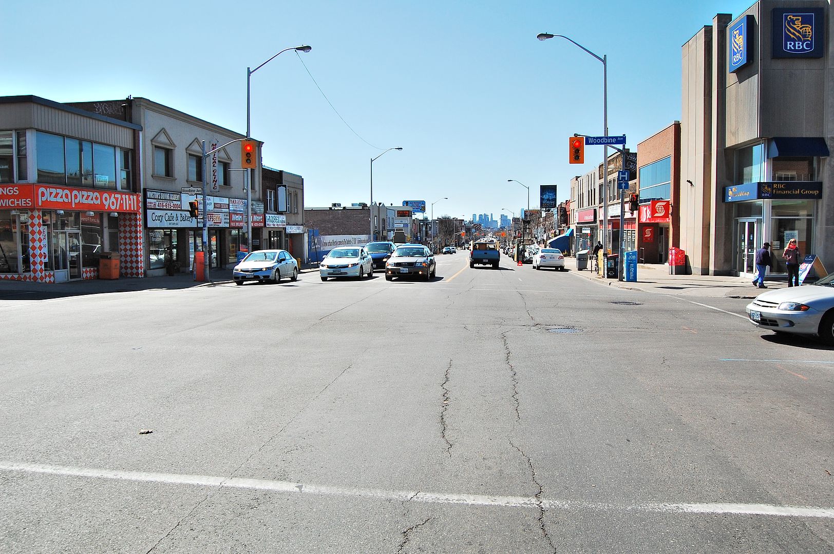
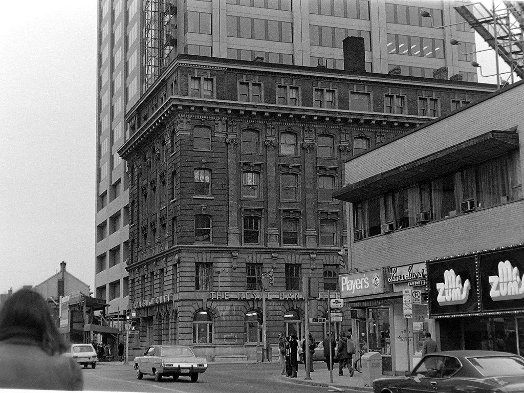
I like the Brutalist Royal Bank branch on the right hand side of this photo. It's a remarkably mature and confident design for a neighbourhood branch.
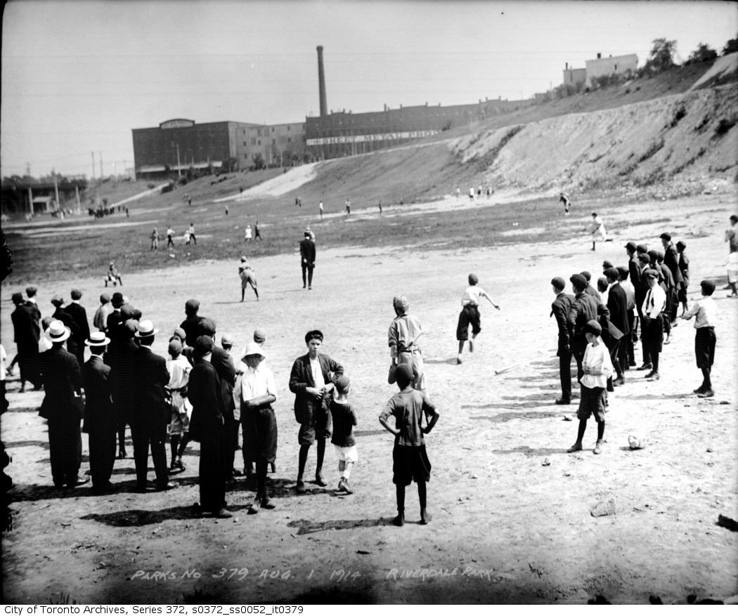
Check waa-y back to page 31 of this thread to see another picture of the Sheet Metal Products company and a comment by Earlscourt_Lad that his great-grandfather worked there.
Then and Now for June 26.
Then. June 26, 1955. More old Chinatown. 173-77 Dundas Street West.
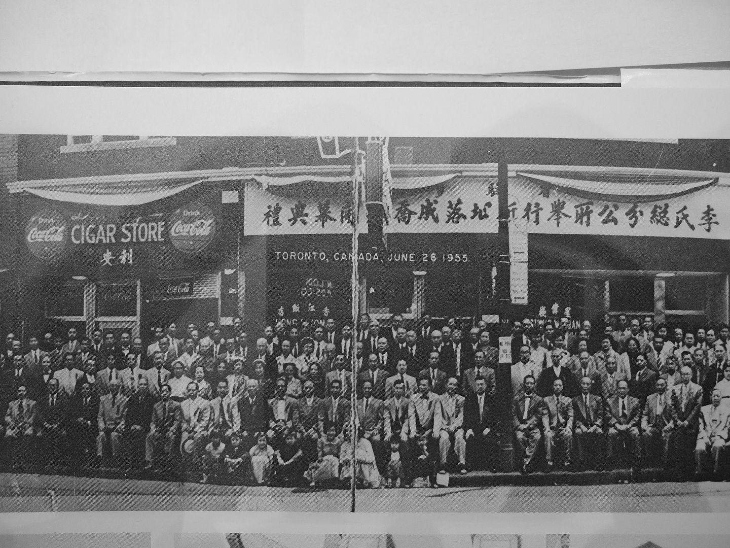
Do you know what the occasion was?
I had seen that photo before, but couldn't figure out what side, and what perspective, of Riverdale Park we were looking at. Thanks M!
Ha! I had forgotten all about that earlier post. Apparently he saved enough working there during the war to buy two houses and set up a steamfitting business specializing in school heating systems. Fellow UTer JT kindly gave me a great gauge, which I keep on the mantle as a tribute of sorts. JT being an aficionado of all things steam related...
March 17 addition:
A walk thorough Regent Park. Lots happening in this area. Let's call it 'Regent Park Then and Now'.
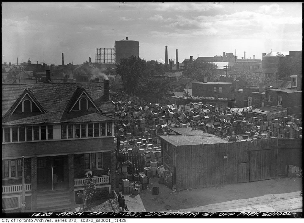
Shuter looking S from Park (now Nelson Mandela Park) school. I couldn’t get to the school’s 3rd floor window..from where the original pic was shot.
Great set, Mustapha. I've used two of his pics to illustrate the evolution of the NE corner of Bloor and Yonge (and the SE). The first pic is from the archives and is from 1926:
Sorry for the delay Anna; I know your question dates way back to June...
The 'occasion' for this gathering was the purchase of this block of buildings by the Lee Family Association - their administrative offices were to be located upstairs. I assume most of those in the picture are Lees; a numerically large group worldwide given the prevalency of this surname.
The other great Chinese tribe are the Wongs. You know the old saw about how 1 billion Chinese can't be Wong; right, Anna?
Sorry to drag up an old T&N like this but I can't seem to reconcile this one with the old maps. It looks like Park School was on the south side of St David (i.e., not as close to where Shuter is now) and that Sydenham extended east of Sackville at the time. To see from Sydenham opposite the Park School at the time, would you not have to be somewhere inside the block bounded by Queen, Sumach, Shuter and Sackville rather than on Shuter itself?

Right
I think Mustapha has this one right too. Is that the 1910 Goad's? Here is the 1924 Goad's showing the new Park School where it is now, on the north side of Sydenham (now Shuter).