

BeeRich
Active Member
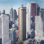
I would have expected a high rise instead of that "petrol" station long before this -- or would it have spoiled the view of UCC?
The first road south is College View Ave. Hehe.
|
|
|
I would have expected a high rise instead of that "petrol" station long before this -- or would it have spoiled the view of UCC?


Duncannon and Eglinton West


Hmm... A self serve grocery! What a novel concept. Hating the self checkouts we have now, just hire another person will ya.
First pic, Loblaw's


Interesting that in this case the retail was built after the housing was, with space left for the retail buildings.
Reminds me of Vegas circa 2009; half-built housing (usually gated) developments, bordered by a giant swath of land off the main road for big-box plaza purposes.. cept in Vegas' case, nothing's gettin built!
Google Streetview Visual Aid
Yes, that photography from the U.S. Library of Congress is truly wonderful.
Particularly the work of FSA (Farm Security Administration) photographers during the depression years.
Much work by the famous photographers: Dorthea Lange, Arthur Rothstein, Russell Lee, and many more
The comments at the end to the above site are also worth reading.
Canada has a photo library (National Archives) at: http://www.collectionscanada.gc.ca/02/020115_e.html
However, I found it difficult to browse and the photography is somewhat plain.
Attached are a couple of photos I found - nothing comparable to the US site!
Our own, City of Toronto Archives, is one of the best!
Great site Mustapha! Type in Toronto , lots of city images that I have not seen before , many on the Avro Arrow.
")
This one looks like the one at Don Mills and Eglinton, although they all look alike. Like an aircraft hanger inside - they are sure to have the 18 different kinds and sizes of chicken fingers/nuggets that one is looking for.
Dufferin and Eglinton looking west. A 20 foot ladder would have come in handy. The Dominion Bank on the right might have been torn down or is unrecognizable in the strip of stores on the north side. It looks like Vaughan road did go north of Eglinton at the time.
Dufferin north of Eglinton was Vaughan Road (the road to Vaughan), so Dufferin north of Eglinton connected to Vaughan south of Eglinton. I'm not sure when Dufferin was extended up to Eglinton but I remember when Vaughan Road was closed off.
Was Dufferin ever non-existent south of Eglinton? At the very least, its ROW always existed as part of Governor Simcoe's concession-road gridiron. (And the diagonal-ish cross-road aspect reflects how Dufferin jogs here.)