News   Jul 12, 2024
 1.5K     0 
News   Jul 12, 2024
 1.2K     1 
News   Jul 12, 2024
 423     0 

Miscellany Toronto Photographs: Then and Now

At one time in Toronto (many, many, many years ago) it would have been considered unthinkable for any church to be demolished.
Today we well-know that dozens have turned to dust!
And, in some cases, the religions along with them.

Too true! One of my favourites was the Central Presbyterian Church, 1876-77, designed by H. B. Gordon, which fell victim to the Terauley Extension which extended Bay Street to Davenport. Situated near today's intersection of Bay and Grosvenor, in my alternate universe it would have been preserved and Bay would have been laid out around it.

1910:

f1568_it0365.jpg


1920. View up St. Vincent Street (eliminated by Bay Street):

f1244_it1178.jpg


February 17, 1921:

f1231_it0322.jpg


The route (if it had only gone slightly to the east....):

s0372_ss0003_it0107a.jpg
 
Last edited:
In the "Now" photograph, the building on the southeast corner is a great example of EIFS being removed. While it may look the similar to the "Then" photograph, for many years its brickwork was buried under that awful styrofoam and plaster.

I've often thought of writing the owner a thank you letter.
 
At one time in Toronto (many, many, many years ago) it would have been considered unthinkable for any church to be demolished.
Today we well-know that dozens have turned to dust!
And, in some cases, the religions along with them.

When was this era? One thing which surprised me when reading Eric Arthur's No Mean City was just how many attractive churches and buildings in general were demolished in the 19th century.
 
The Victorians were far less sentimental about demolishing second rate Victorian architecture than we are.

It's one thing to replace a building with a better version of the same style than to demolish a building built in a style which can no longer be replicated. We demolished a lot of first-rate Victorian architecture several decades ago including buildings that were comparable to those in European cities, which explains our sentimentality. We're fortunate that Arthur's prediction of a Toronto in 2000 in which the only buildings from the nineteenth century that remain standing are Osgoode Hall, St. James Cathedral and University College was ultimately inaccurate.
 
It's one thing to replace a building with a better version of the same style than to demolish a building built in a style which can no longer be replicated. We demolished a lot of first-rate Victorian architecture several decades ago including buildings that were comparable to those in European cities, which explains our sentimentality. We're fortunate that Arthur's prediction of a Toronto in 2000 in which the only buildings from the nineteenth century that remain standing are Osgoode Hall, St. James Cathedral and University College was ultimately inaccurate.

I wonder if there was any determined effort to save the former Cyclorama when its time came.
This was certainly a unique structure (see attached). Perhaps our IMAX theatres are the equivalent.
Built in the days before movies as a visual entertainment centre and later converted into a parking garage.
 

Attachments

  • Cyclorama.jpg
    Cyclorama.jpg
    76.9 KB · Views: 403
thecharioteer's post showing the Beard building in the distance and Goldies post of the Cyclorama reminds me that I've never come across any images of the interiors of these buildings.


June 24 addition.


Then. Looking E across Ossington again, this time from Hepbourne. March 22, 1934.


s0071_it10183.jpg


Now. May 2010.


Quite a splendid re-adaptive re-use of the grocery store. Almost as if it could be destined to become a corner store again or perhaps a restaurant in the future. The rose coloured paint is attractive too.


DSC_0219.jpg
 
The Victorians were far less sentimental about demolishing second rate Victorian architecture than we are.

Or Georgian architecture (as we've discussed before) resulting in no Georgian churches remaining in Toronto that I can think of.

St. Andrews on the SW corner of Adelaide and Church:

SWchurchadelaide1867standrews.jpg


2009-01-16-2334-43_edited.jpg


2009-01-16-2339-24_edited.jpg


Aerial_view_of_Toronto_-_looking_so.jpg
 
Cyclorama on Front St.

Goldies post of the Cyclorama reminds me that I've never come across any images of the interiors of these buildings.
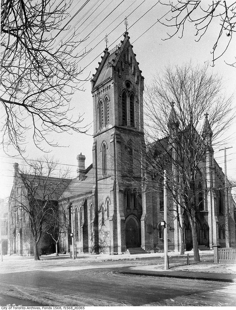
I, too, have never seen any depiction of the displays within the Cyclorama. Perhaps the panoramas were too large to be photographed.
Here's a brief description:
"Inside this giant sixteen-sided domed structure, massive paintings of famous battles or geographical wonders were hung on the surrounding walls. The four-hundred-foot-long canvas encircled the spectators, placing them in the midst of the scene. Hailed as an 'immense success ... the best of all cycloramas,' Toronto's Cyclorama first opened on 12 September 1887, with The Battle of Sedan (Toronto World, 13 September 1887). The Battle of Gettysburg followed in 1889, to be succeeded four years later by Jerusalem: The Crucifixion. But as the 1890s progressed, the Cyclorama's eminence as one of the city's greatest 'amusements' began to fade. In 1897, attractions such as Lumiere's Cinematograph had begun to eclipse the Cyclorama's popularity."

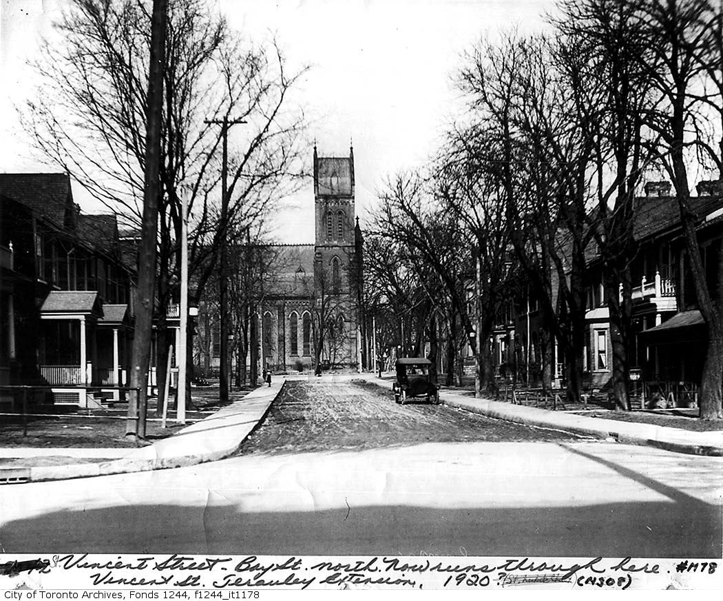
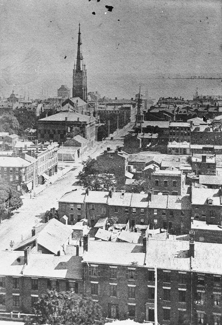
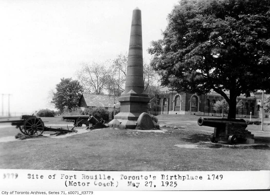
As you can see, I've become intrigued by this building. Here's another view (1919) from the south which shows the location - before University Ave. was extended south of Queen St.
 

Attachments

  • Cyclorama-Front St.jpg
    Cyclorama-Front St.jpg
    45.9 KB · Views: 447
  • Cyclorama 1919.jpg
    Cyclorama 1919.jpg
    102.4 KB · Views: 418
Last edited:
June 26 addition.


Then. May 27, 1925. Fort Rouillé Monument on the Canadian National Exhibition grounds.

"Fort Rouillé was a French trading post located in Toronto, Ontario, Canada, that was established around 1750 but abandoned in 1759."

"Its construction was ordered by the Marquis de la Jonquière, then governor of New France, in order to further establish a French presence in the area, and to intercept the trade of Indians travelling towards an English fur-trading post in present-day Oswego. It was a small palisaded fort with a bastion at each of its four corners, and containing five main buildings: a corps de garde, storeroom, barracks, blacksmithy, and a building for the officers. A drawing ... from 1749 shows the fort adjacent to Lake Ontario, whereas today it is situated on top of a small hill a hundred metres or so from the lake's current shoreline.

The fort was abandoned and burned by the French garrison in July 1759, who were retreating from invading English forces."

http://en.wikipedia.org/wiki/Fort_Rouillé


s0071_it3779.jpg


21907.jpg


Now. May 2010.


DSC_0215.jpg


In the right background of the Then picture can be seen the Transportation Building, built 1905; destroyed by fire in 1974. The site is now a parking lot.


Transportation Building. Pictures from http://www.cnearchives.com/q3.htm


q14_08.jpg


q14_09.jpg
 
June 27 addition.


Then. "Alice Street School [after 1900]" says the online Toronto Archives archival citation. I knew that Alice is a disappeared street built over by the Eaton Centre (it ran east/west just south of Dundas). I was looking at this picture when it dawned on me that peering out from the right side behind the school is the Church of The Holy Trinity.

alicestreetschool.jpg


Now. May 2010. Getting a picture from the same location as the Then isn't possible anymore. You'd have to be standing inside the Eaton Centre in a space that is presently vacant (however, Mr. Greenjeans restaurant is on the floor above you). Capeche?

DSC_0210.jpg


Here is a shot showing roughly where I think the Alice street school was located... it would have been where all that renovation is going on.

DSC_0094.jpg

Mustapha: Good sleuthing but what you've revealed is a mislabelling of the archival photo. The view is clearly from the south, but according to the Goad 1910, Alice Street was to the north of Trinity Square. The answer? The school was actually on Louisa Street to the south as identified on the City website http://www.toronto.ca/archives/rules/edlouisa.htm:

e010696077_a2-v8-1.jpg


The Louisa Street Public School 1906:

louisastreetschool1906.jpg


"Louisa Street Public School
1906
Toronto District School Board Sesquicentennial Museum & Archives; Schools - Louisa 3

Louisa Street Public School (established 1852) was a typical Victorian school site: it began small, and was reduced in size due to building additions and reconstruction. The "playsheds" around the planked yard were often converted into temporary classrooms or used to store wood, coal, and other supplies."
 

Back
Top