News   Jan 09, 2025
 1.1K     2 
News   Jan 09, 2025
 373     0 
News   Jan 09, 2025
 886     0 

Miscellany Toronto Photographs: Then and Now

Further Googling has resulted in finding out that the Louisa Street Public School was designed by architect William Thomas, most famous for the St. Lawrence Hall (as well as St. Michael's Cathedral, the Don Jail, Oakham House and the Brock Monument in Queenston).

" His civic architecture also included public schools, which were just beginning to be designed in Canada as architecturally distinctive institutions. His Union School in London (1849), described two years later in a government report as “by far the finest school house in the Province,” was followed by designs for two schools in Toronto. In 1851 the city’s first elected school-board, under the chairmanship of Dr Joseph Workman*, launched a school-design competition. Thomas’s plan was used in 1852–53 for the Park and Louisa Street schools. These were designed in the Tudor style, which was popular for institutional buildings because it afforded ample lighting and ventilation as well as an interesting silhouette, all within a reasonable budget. All three schools have been demolished."

from http://www.biographi.ca/009004-119.01-e.php?BioId=38339
 
Last edited:
More good detective work, Charioteer.
The 'for sale' sign in the archives photo, and the lack of identification of the school on the 1910 Goad's might mean that it was no longer in use as a school by then. Those Eaton's warehouses/annexes might have something to do with it, as you showed back in December.
http://urbantoronto.ca/showthread.php?6947-Miscellany-Toronto-Then-Now&p=357383#post357383

Here is the 1890 Goad's, with the school marked.
e010759244-v8.jpg
 
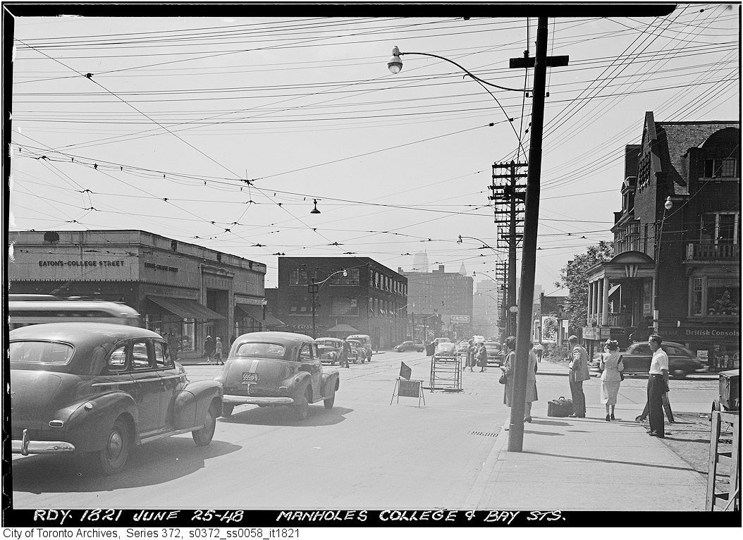
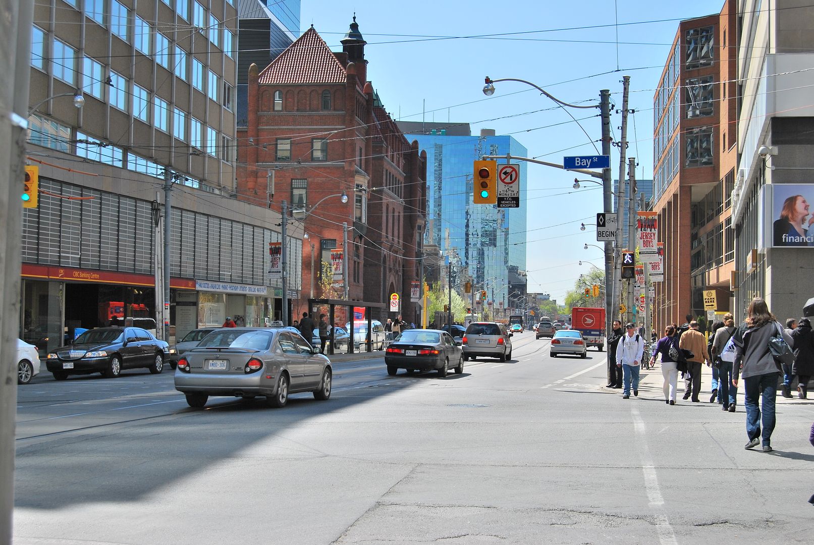
Then. June 25, 1948. College and Bay looking S on Bay.


s0372_ss0058_it1821.jpg


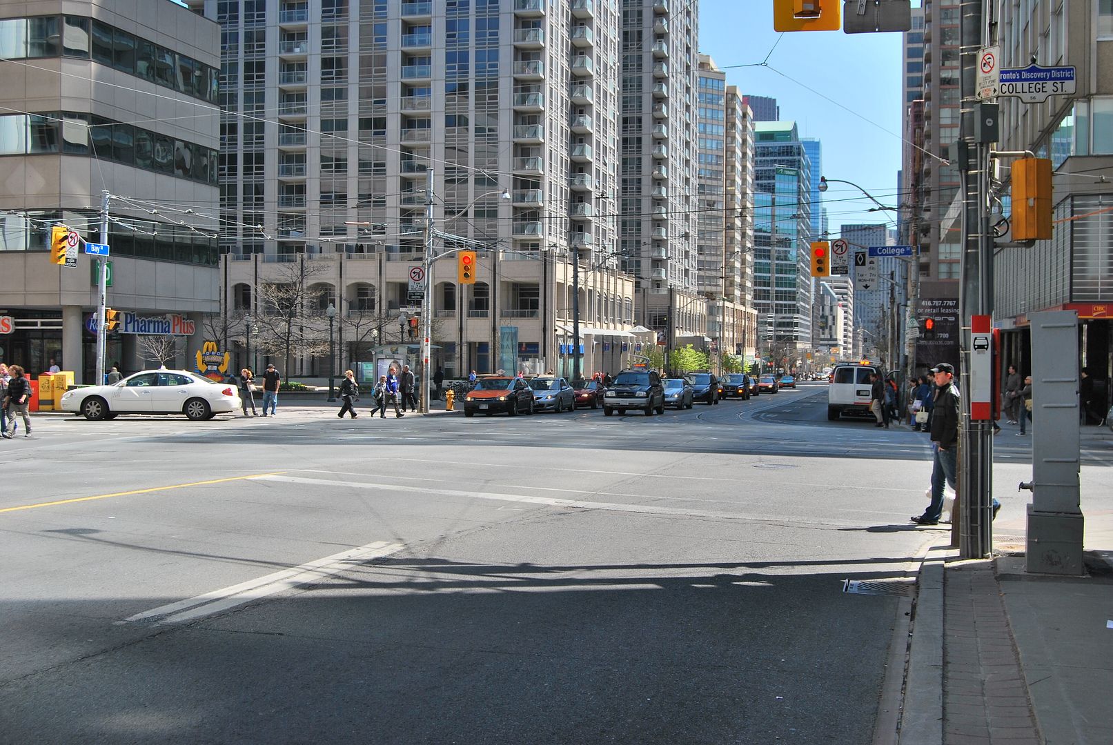
Now. May 2010.


CSC_0172.jpg

Interesting to see how long the house on the SW corner of College and Bay survived:

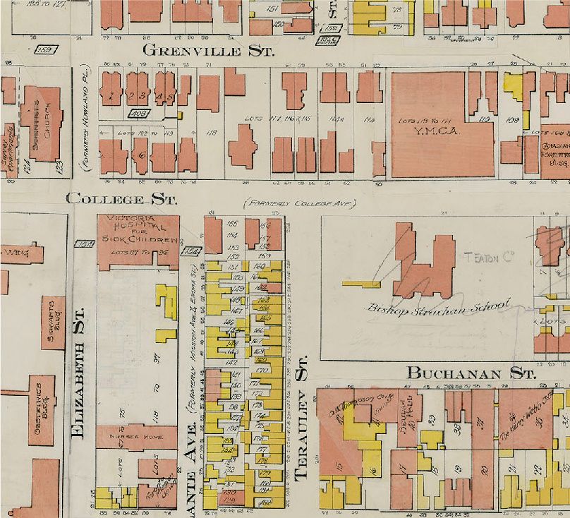
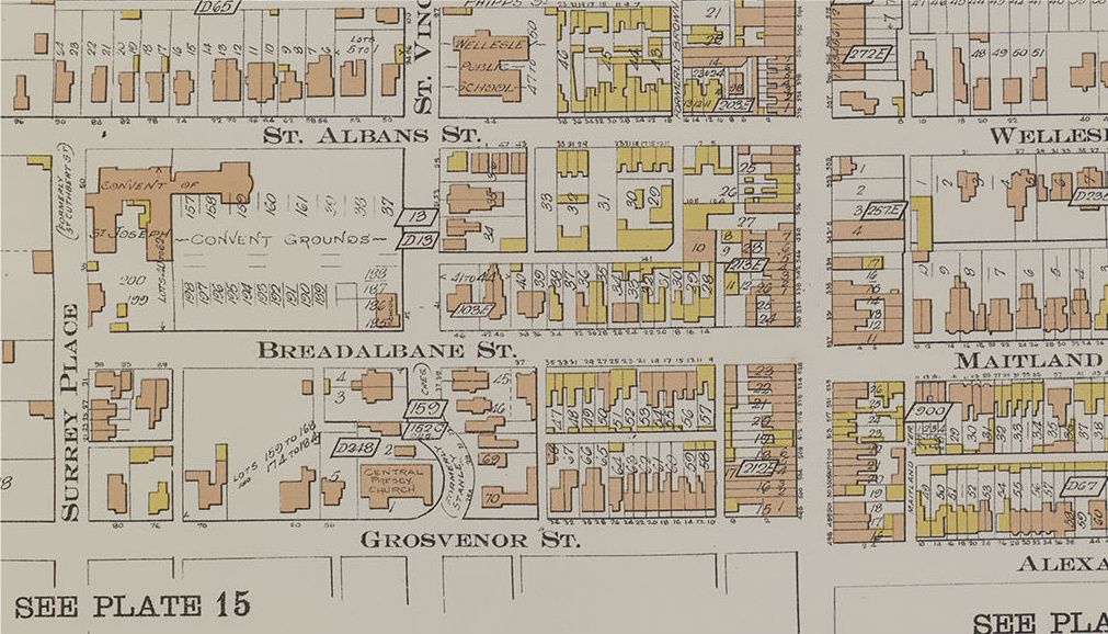
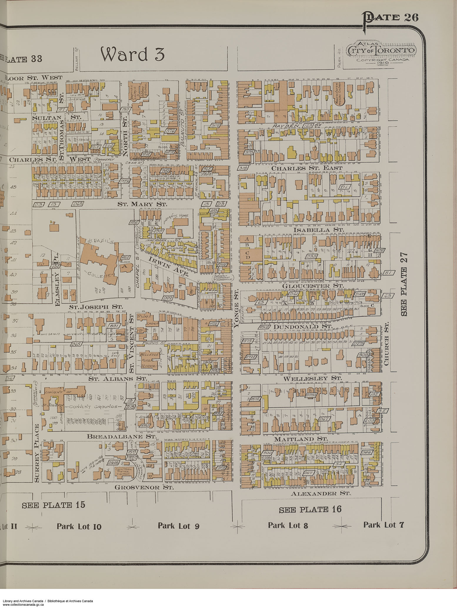
From the 1910 Goad Atlas (showing how Bay, formerly Terauley, ended at College);

goadcollege-1.jpg


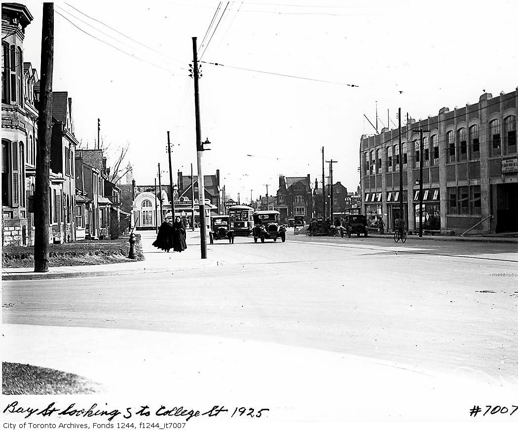
View south 1925:

bay1925.jpg


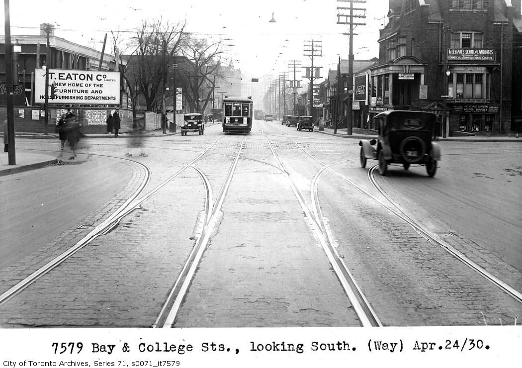
View south 1930:

bay1930.jpg
 
The picture immediately below the map must have been taken from the Grosvenor-Bay intersection. St Vincent Street (as it was) started at Grenville and went north to Davenport. The College to Grenville block is almost invisible here and yet it is not that much shorter than the Grosvenor to Grenville one.

My great-grandmother, my grandmother, and the rest of the family as then was, lived at 5 St Vincent Street in 1900, but moved away before 1909. My grandmother worked at Eaton's before she was married in 1901 and ever after spoke of going downtown as going "down street". It wasn't until many years after her death that I stood in front of Addison Pontiac and realized the significance. It was downhill all the way.

I love these stories! It looks like in the 1925 photo that some of the College Street houses have been demolished to link up Terauley to St. Vincent. Also noticed the nuns in the 1925 photo; no suprise given the location of Convent of St. Joseph a few blocks away (now the site of the Ontario Government buildings at Bay and Wellesley):

stjoseph-2.jpg
 
Interesting to see how long the house on the SW corner of College and Bay survived:

Though to be fair, on stylistic grounds (i.e. Arts & Crafts-cum-Edwardian a la Lutyens/Shaw) it doesn't look *that* much older than the 1910 Goad's. (And on the right edge of the 1948 shot, would there be preliminary work for the BA building at 800 Bay?)

View south 1925:

bay1925.jpg

Well, I suppose the bombast of that Imperial Oil station has a "worthy" successor on the same site today...
 
Small correction. St. Vincent was just one of a few streets that were joined/widened to create Bay up to Davenport. There was nothing north of Bloor except Ketchum Ave from Scollard to Davenport.
Plans & photos of houses in the path can be found on the Archives site by searching for Terauley.
e010696094_a2-v8.jpg
 
First in that building was McLaughlin Motors, then Beatty Cadillac, lastly, Addison.

Regards,
J T
 
Last edited:
June 29 addition.


Myself; I have been amazed at the condo-ization of Bay street generally.


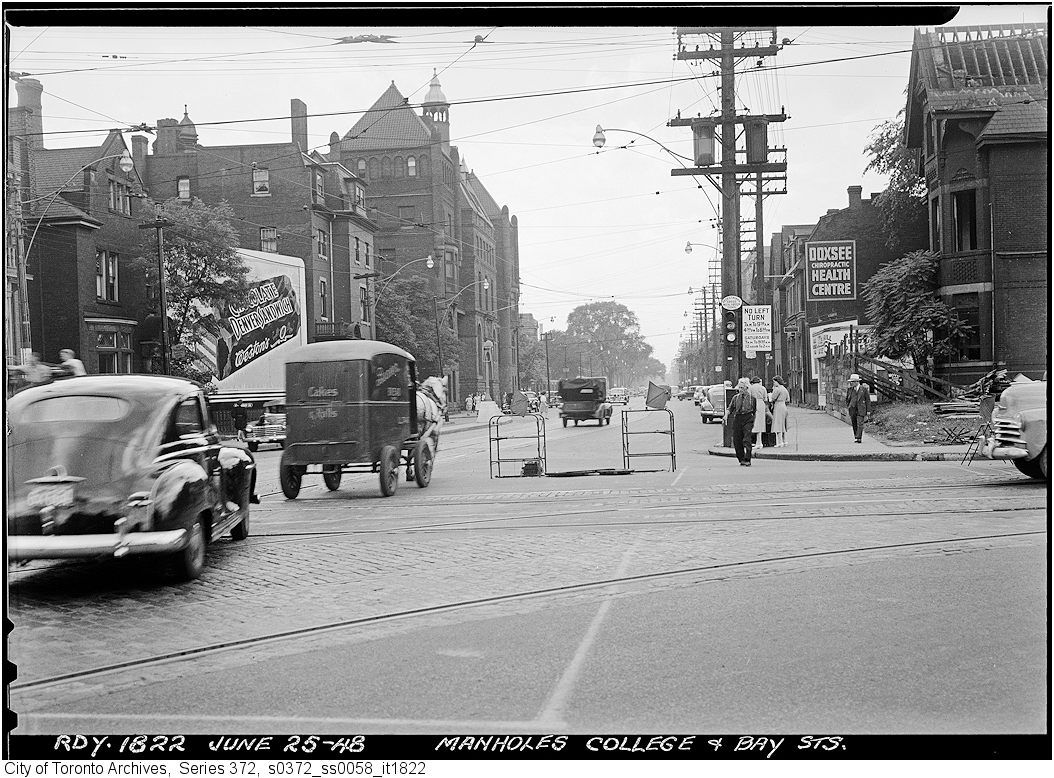
Then. College looking W across Bay. June 25, 1948 again.


s0372_ss0058_it1822.jpg


Now. May 2010.


CSC_0173.jpg
 
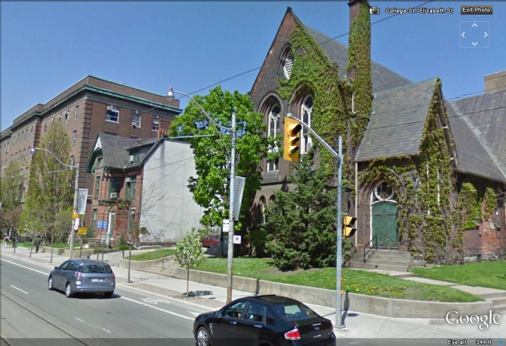
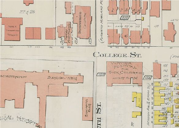
Speaking of houses on College Street, it would appear that the sole survivor (or at least 1/2 survivor) is on the north side, just west of Elizabeth.

college-1.jpg


goadcollege-2.jpg
 

Back
Top