News   Jun 21, 2024
 1.9K     4 
News   Jun 21, 2024
 854     0 
News   Jun 21, 2024
 1K     0 

Miscellany Toronto Photographs: Then and Now

Once again I'll ask this question...

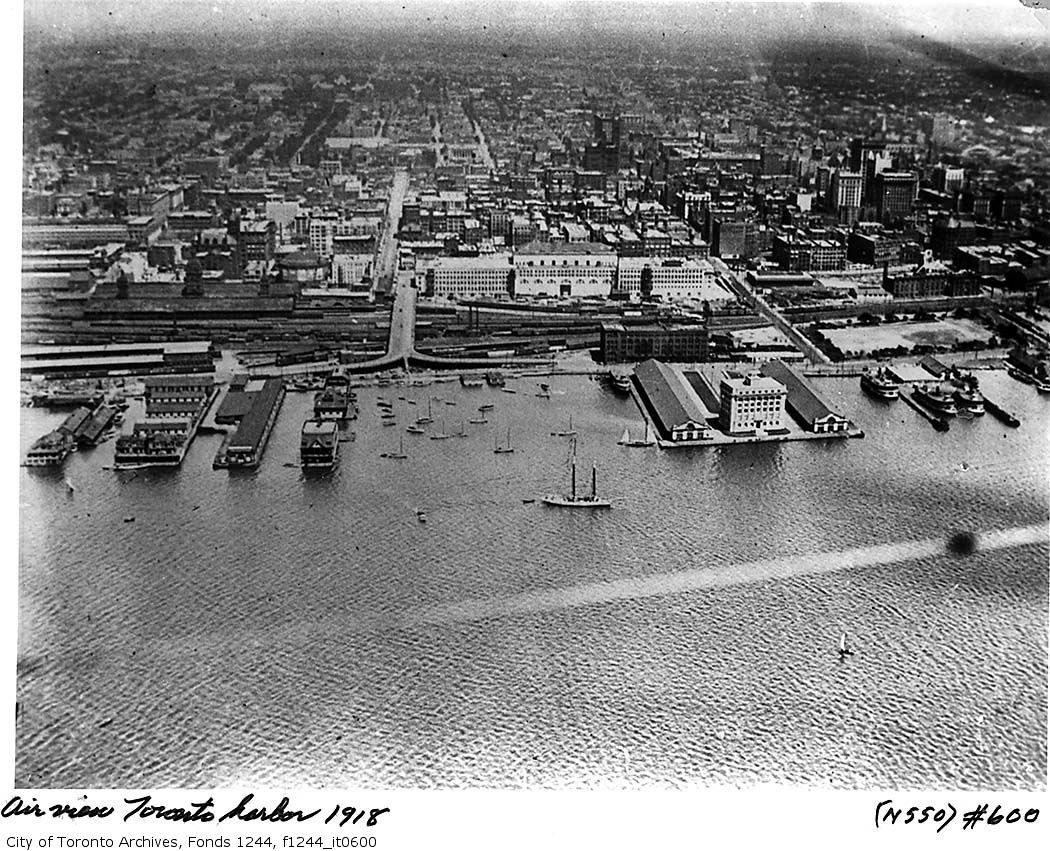
Obviously Wellington was a two-way street at this time. What happened to the traffic when it reached the Five-point intersection at Church? How was this intersection controlled safely? On a green light, some Westbound Front traffic would go on Front and some to Wellington, but the Eastbound Wellington traffic would be crossing the Front traffic as it did so.
Front was two-way and Wellington was two-way... I don't get this and I'm too young to remember it that way.
From other pictures I've seen, there was no special traffic light as complex as the ones we have today. Does anyone know? I am curious.

Still unanswered after 3 days. :confused: I'm wondering if there was some sort of 'clock work' traffic signal system that managed this.


DSC_0001-1.jpg


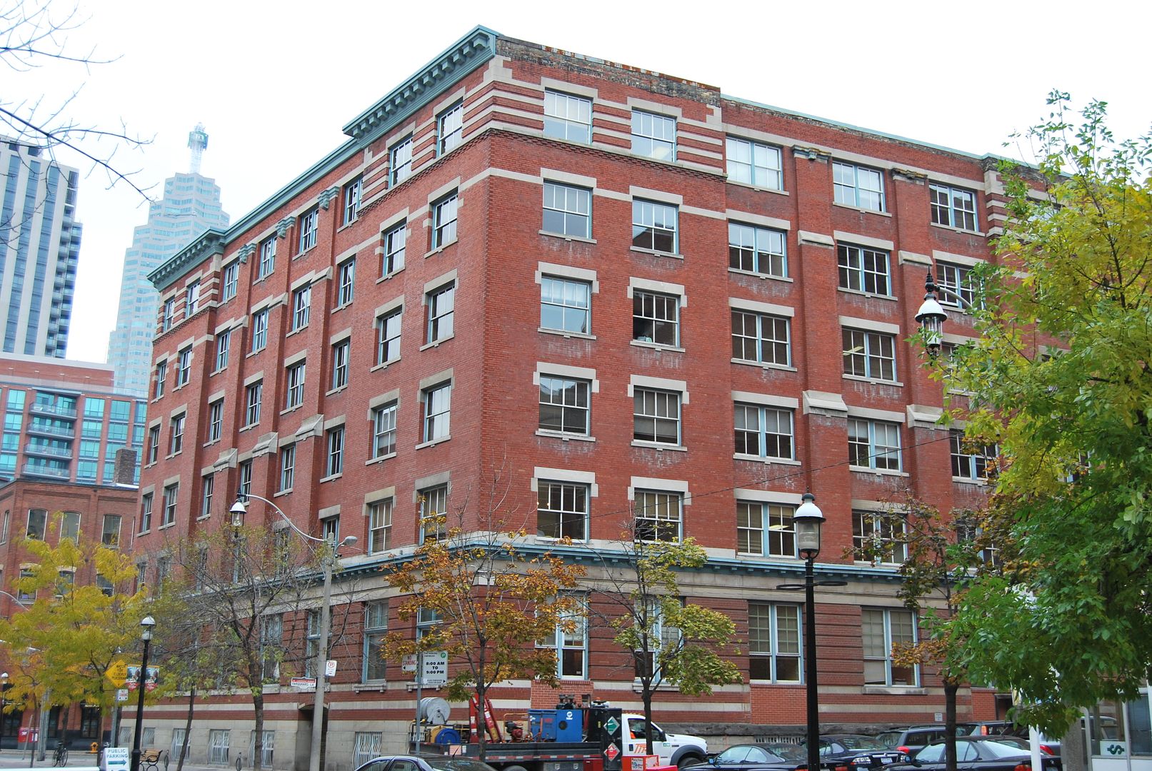
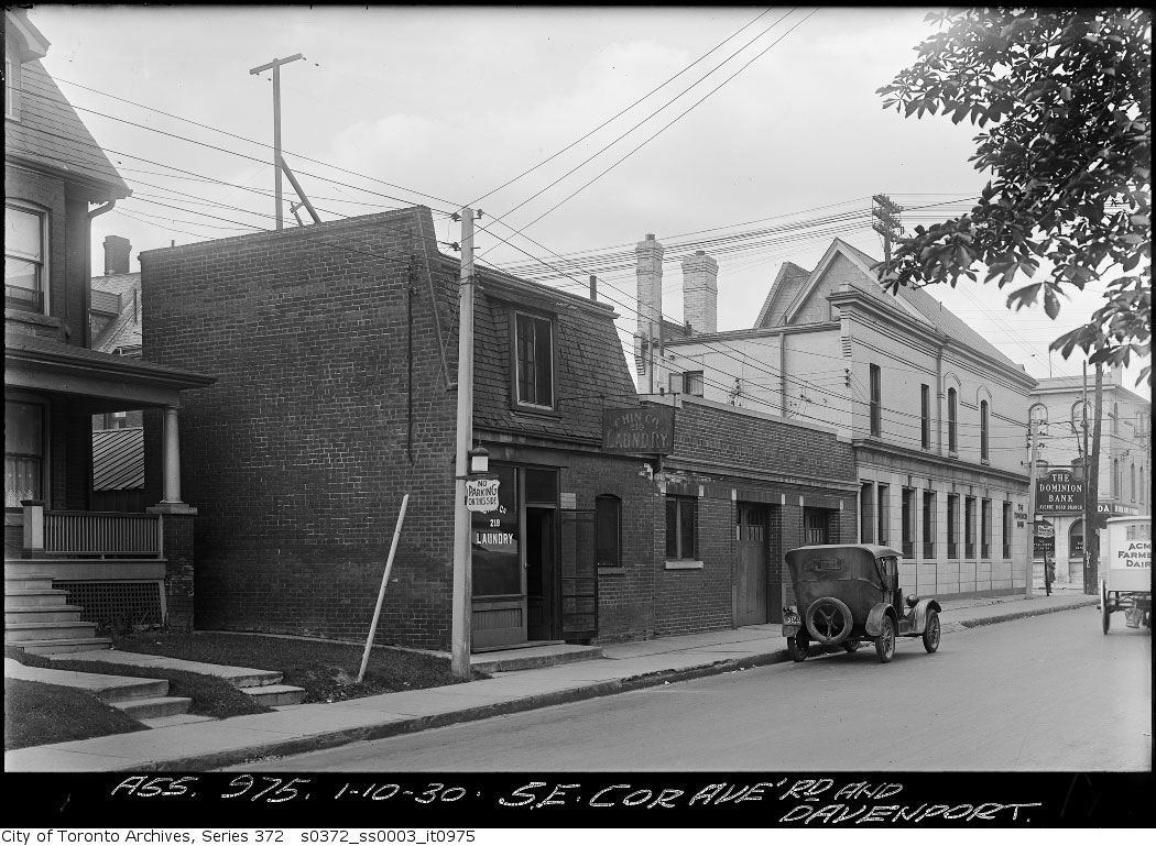
That's 3 Church Street. Now, somewhat coincidently, home to Bousfields Inc (Planning Consultants) www.bousfields.ca and N. Barry Lyon Consultants Ltd. (market analysis) www.nblc.com

I have to duck in for a look. I wonder if the interior has been sympathetically treated.

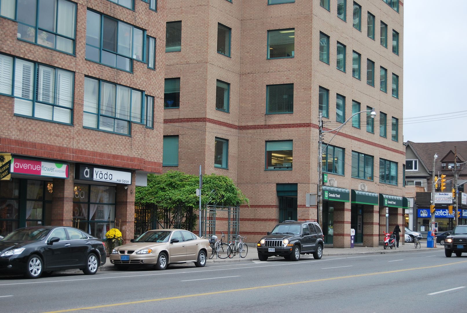
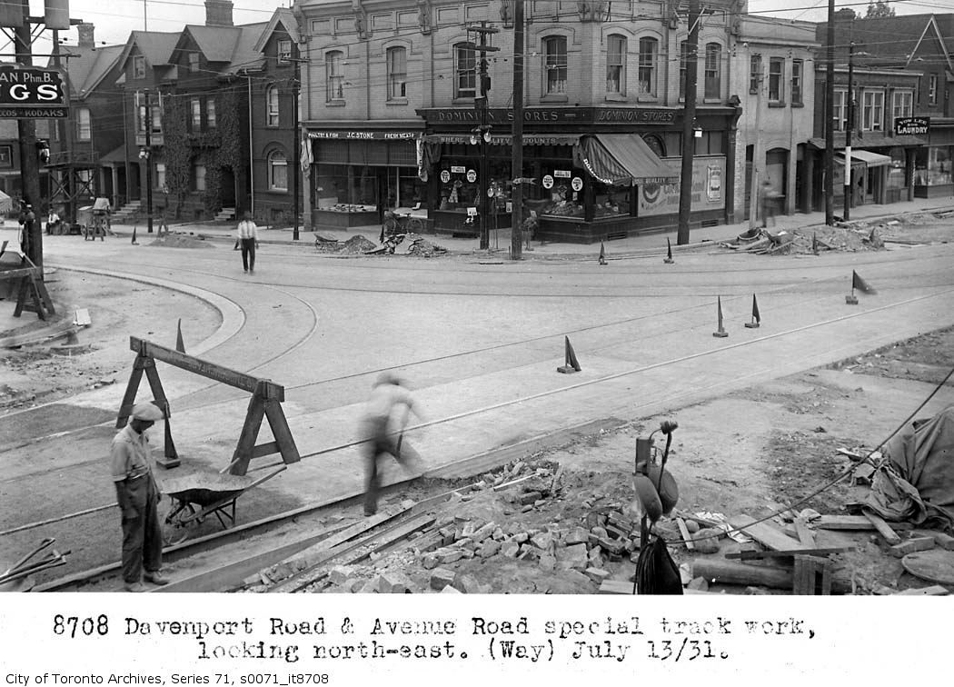
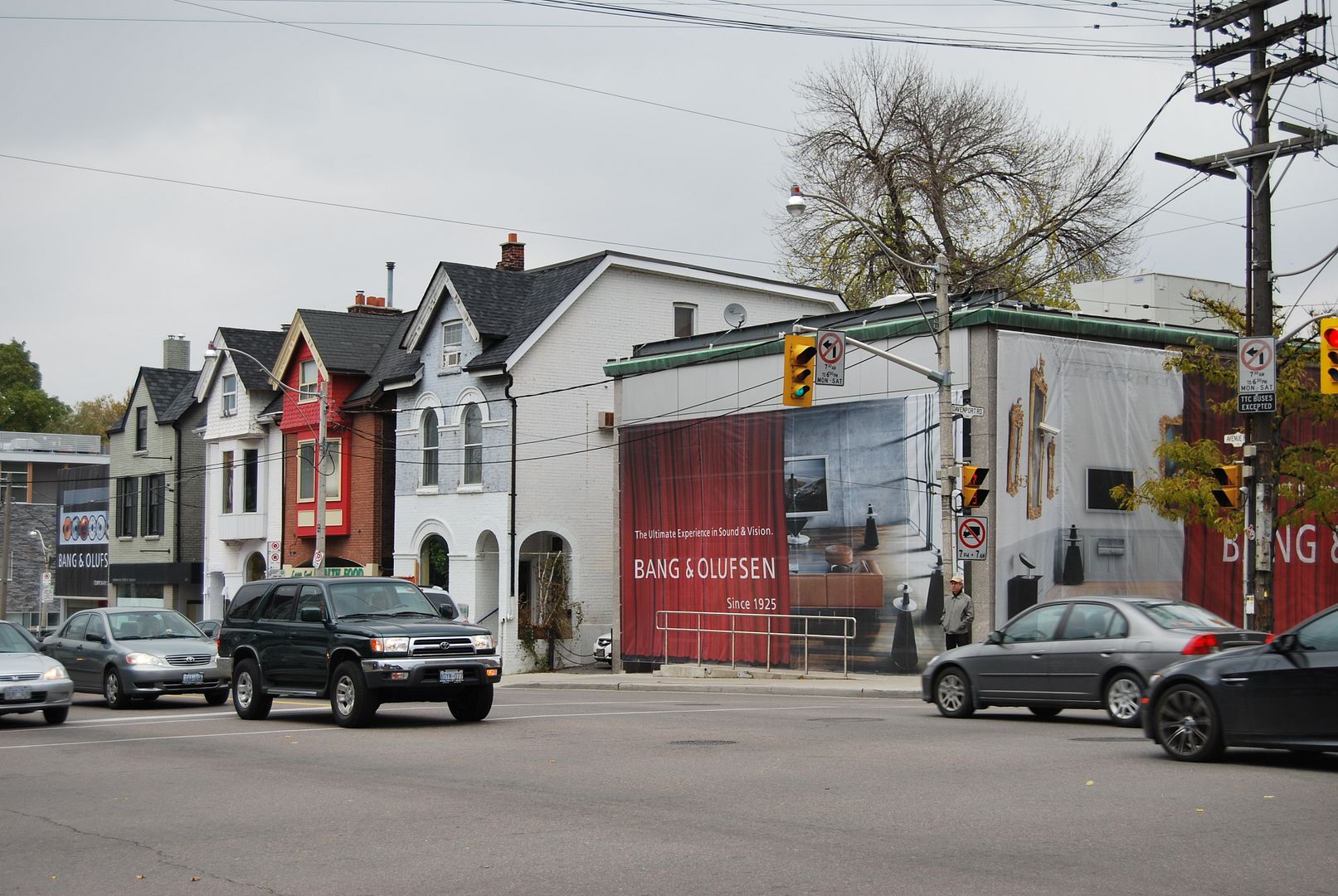
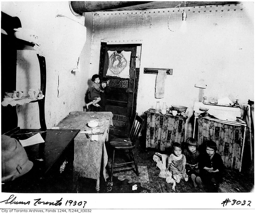
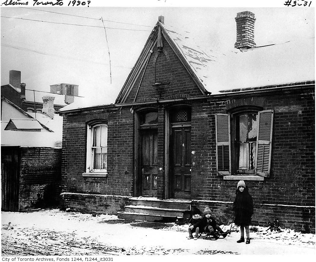
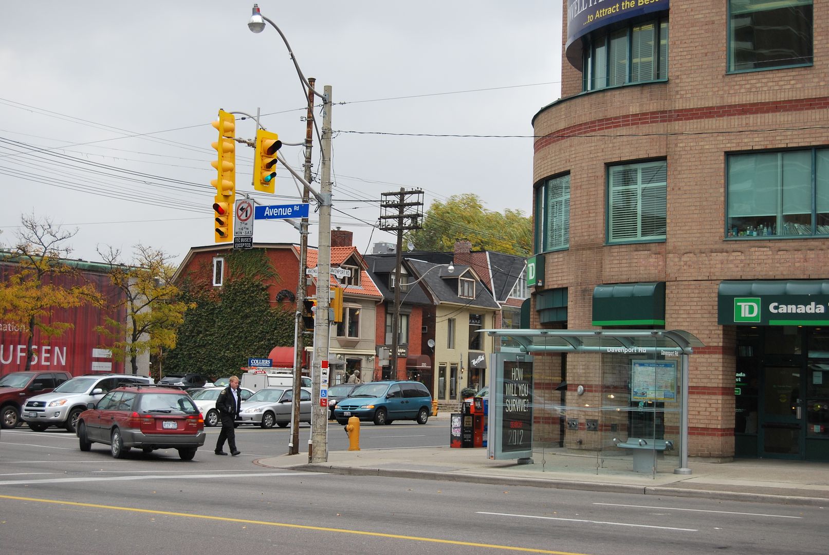
Directly across the street, the SE corner of Av & Dav, other buildings lost in the widening (and TD has still maintained a presence!). It's quite amazing to consider the number of houses demolished through road improvements such as the Davenport widening, the extension of Bay Street to Davenport and the linking of Davenport to Church:

avdav2.jpg


:eek::)


DSC_0018-2.jpg


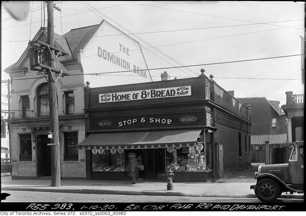
Food for thought: the replacement for said Dominion Bank was by John Lyle--demolished in the 1980s (though the very Lyle-esque reliefs were incorporated into the midrise replacement)

I can't even remember the pre80s building; anyone have a picture?
 
I have to duck in for a look. I wonder if the interior has been sympathetically treated.

I've been in the barry lyon officies. very nice. a great interior restoration. very neat. little half steps throughout the floor space. two steps up to the board room. three steps up to a little washroom. really putting the closet in "WC". neat stuff like that.

but if i remember correctly.. someone raped the lobby/foyer of the building at some point.

maybe tore out a grander staircase for modern elevators?
 
Last edited:
Still unanswered after 3 days. :confused: I'm wondering if there was some sort of 'clock work' traffic signal system that managed this.

Thanks Mustapha for trying to find the answer for this. I still can't figure it out myself. The Five-Points of Church,Wellington and Front was a weird intersection when they were all two-way streets. Someone must be on here that is old enough to remember how this worked.
 
Thanks Mustapha for trying to find the answer for this. I still can't figure it out myself. The Five-Points of Church,Wellington and Front was a weird intersection when they were all two-way streets. Someone must be on here that is old enough to remember how this worked.

Similarly (I suppose), King/Queen/Roncy back when Lake Shore Road also plugged into the intersection (pre-Gardiner).
 
Thanks Mustapha for trying to find the answer for this. I still can't figure it out myself. The Five-Points of Church,Wellington and Front was a weird intersection when they were all two-way streets. Someone must be on here that is old enough to remember how this worked.

I am far too young - so I tried looking in the 1950's Toronto Star for 'dangerous intersection must be fixed' articles - but couldn't find anything. Wouldn't a three-stage traffic signal have worked - one stage for Church, one for Front, and then another one for Wellington? (which doesn't look like a direct route in the oldest picture)

f0124_fl0001_id0043.jpg

f0124_fl0002_id0065.jpg

f0124_fl0002_id0149.jpg


What I did find in the Star Pages of the Past was a lot of discussion about one-way streets downtown as a solution to reduce traffic congestion. The TTC was always opposed, because of the impact on their routes, however, this one was dated Jan 7, 1953:

Plans for a Queen St subway will be laid before Toronto city council this year, Mayor Lamport said today.
The plans were drawn up by TTC engineers and envisage a 15-block underground running from McCaul St. to George St. Present surface lines along Richmond and Adelaide would be run through the underground downtown section. Both Adelaide and Richmond would be freed for one-way operation.
Two other east-west downtown streets, probably Front and Wellington, would also be turned to one-way traffic.

There was a series of articles about one-way streets - comparing Toronto to what had been done in other cities - St. Louis, for example. Richmond and Adelaide went one-way before Duke & Duchess did and the jogs were eliminated. There was a mention of making Bay and Church one way in opposite directions, as well as a one-way Avenue Road switching direction in rush hour. There was an article about the DVP which mentioned huge parking lots - one under the Bloor Viaduct - where drivers would park their cars and then take transit to the downtown core.

I swear I have seen a 'don't drink and drive' commercial - where a TTC bus, on Wellington, pulls up on the north side of the flatiron building - facing east.
I have also seen more than one driver, in rush hour, go north on Scott Street, turn left on Front, and live.
 
f0124_fl0002_id0149.jpg


Interesting thing about this shot is that it must date from just about when Commerce Court was being completed, and right before the old Bank of Commerce lost its aerial...
 
f0124_fl0002_id0149.jpg


Interesting thing about this shot is that it must date from just about when Commerce Court was being completed, and right before the old Bank of Commerce lost its aerial...

Thank you adma for all your wonderful research. I still don't have my answer but this last picture shows an island built between the east and west lanes of Front east of Church... At least having that it would preclude the eastbound Wellington traffic from crossing the westbound trying to access Front.

But in the oldest photo... any kind of mayhem could happen at this intersection!

Thanks again.

M.T.
 
And re traffic islands and everything, also notice that Front St was de-streetcar-tracked by this point...
 
December 20 addition.

thecharioteer and I are talking about Ave and Dav and I get up and go for a drink and what happens? :) Everyone changes the subject. Let me finish up Ave and Dav.:eek:

ser372_ss0003_s0372_ss0003_it0975.jpg


DSC_0013-1.jpg


ser71_s0071_it8708.jpg


DSC_0017-1.jpg
 
Thank you adma for all your wonderful research. I still don't have my answer but this last picture shows an island built between the east and west lanes of Front east of Church... At least having that it would preclude the eastbound Wellington traffic from crossing the westbound trying to access Front.

But in the oldest photo... any kind of mayhem could happen at this intersection!

Thanks again.

M.T.

Anna, not adma - but thanks for the compliment ;). According to Transit Toronto, Front/Wellington went one way on or about July 15, 1960 (requiring route changes to the Church bus) but I can't find anything in either paper (Lyndon Johnson was JFK's surprise choice for VP).

Now back to Ave & Dav - at least two Chinese Laundries - three if you include Chow Keong Hand Laundry. Mustapha, was your grandfather's shop on Yonge the one that was referred to in 'good old days' articles in the North Toronto Post? - I believe the writer's father was a tailor?
 
On another former topic, also in the news on July 15, 1960
The Globe and Mail page 13 - by Harry Brown
Children Cheer Demolition of Ramshackle Dwellings
Moss Park to Start Face-Lifting Monday


In one of the seediest ramshackle pockets of Toronto, a collection of natty government officials will gather on Monday to watch a machine smash and splinter a rotting shack.
When the first blow is struck - these men and women - representatives of three levels of government - will probably join in a cheer with the tanned urchins who become regulars each city summer at the John Innes Memorial Centre.
They will cheer because the act of squashing the shack will symbolize the beginning of the Moss Park housing redevelopment project and the end of one of Toronto's ugliest slum neighbourhoods....

The contract is not large. Advance Lumber and Wrecking Co. is charging the city $2,100 for demolishing a row of half a dozen two-story combination shops and living quarters. These are clothed in grubby brown imitation brick and could never have looked very permanent anyway. They face Queen St. E. and above the soaped windows only five television aerials, one askew, show that anybody ever lived upstairs...

The area is laced by old lanes and the lanes are walled by collapsing, patched garages and shacks, and paved with dust and specks of glass. By day they are populated by small children, by night by dirty cats. Women have been attacked on these lanes in the morning and afternoon...

The architecture varies. Many rambling houses sport ornate metal fences above the yellow lace curtains of the windows. Dull, pebbled stained glass - fashionable in the Moss Park of decades ago - still stares at the tired streets...

The doomed shops specialized in quick service. You could get your radio or your pants repaired on the same day...

By this time next year the city will own the entire Moss Park site and by this time in 1962 all the stores and homes will be gone from the face of the neighbourhood...
 
i beg your indulgence in order to make a Mustaphic contribution. i happened on this while out shopping…

there aren't all that many Queen West images on the archive site that i've come across, so this was rather interesting to me. in part because both Dufflet and Quasi Modo are such long standing institutions in this part of Queen Street, and both buildings appear to have their original upper story windows.

(Bruce Mau lived above Dufflet forever--and it is [was?] a gorgeous original early 20th century apartment…)

in any case, all the buildings are still largely intact except for loss of lovely narrow windows on 2-story block in center, which is a shame. i wonder if the peculiar cracking in the asphalt on Manning is due to the presence of the cobblestones underneath?

i like how there is a bike parked in almost the same spot in both pictures!

i also like how the sewer cover in center left is the same...

queenmanning.jpg


IMG_4073-1.gif
 
On another former topic, also in the news on July 15, 1960
The Globe and Mail page 13 - by Harry Brown
Children Cheer Demolition of Ramshackle Dwellings
Moss Park to Start Face-Lifting Monday


In one of the seediest ramshackle pockets of Toronto, a collection of natty government officials will gather on Monday to watch a machine smash and splinter a rotting shack.
When the first blow is struck - these men and women - representatives of three levels of government - will probably join in a cheer with the tanned urchins who become regulars each city summer at the John Innes Memorial Centre.
They will cheer because the act of squashing the shack will symbolize the beginning of the Moss Park housing redevelopment project and the end of one of Toronto's ugliest slum neighbourhoods....

The contract is not large. Advance Lumber and Wrecking Co. is charging the city $2,100 for demolishing a row of half a dozen two-story combination shops and living quarters. These are clothed in grubby brown imitation brick and could never have looked very permanent anyway. They face Queen St. E. and above the soaped windows only five television aerials, one askew, show that anybody ever lived upstairs...

The area is laced by old lanes and the lanes are walled by collapsing, patched garages and shacks, and paved with dust and specks of glass. By day they are populated by small children, by night by dirty cats. Women have been attacked on these lanes in the morning and afternoon...

The architecture varies. Many rambling houses sport ornate metal fences above the yellow lace curtains of the windows. Dull, pebbled stained glass - fashionable in the Moss Park of decades ago - still stares at the tired streets...

The doomed shops specialized in quick service. You could get your radio or your pants repaired on the same day...

By this time next year the city will own the entire Moss Park site and by this time in 1962 all the stores and homes will be gone from the face of the neighbourhood...

Though the tone of the article is both soemwhat offensive (the officials are "natty", the neighbourhood is "seedy") and simple-minded (the analysis of number of dwelling units related to TV antennae) it does give us a glimpse into the post-war mindset that would eliminate entire neighbourhoods in the quest for decent housing and doing "good" (Jane Jacobs Death and Life of Great American Cities, one of the first protests against this thinking, came out in 1961, a year after this article).

At the same time, there were pockets of sub-standard housing in Toronto (though the pictures previously posted of Moss Park did not look so bad). The Archives contain dozens of pictures of such places:

f1244_it0682.jpg


f1244_it3029.jpg


f1244_it3032.jpg


f1244_it3031.jpg


s0372_ss0032_it0320.jpg


s0372_ss0032_it0259.jpg


s0372_ss0032_it0326.jpg
 

Back
Top