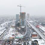
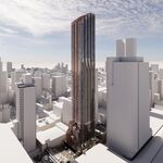
What scarborough lacks in housing density it makes up for with surface transit, allowing dense corridors of commuters heading downtown, and it's clear there's at least a case for a (only 1 at the moment) subway line in Scarborough to funnel commuters to the rest of the system. This would all be supported if costs for such a line weren't so outrageously high.
Only 23% of all transit trips beginning in Scarborough are heading downtown. The solution is regional rail. If only the city was planning regional rail expansion...perhaps it could run more frequently. Something like Regional Rail, but faster...like a Regional Express Rail?
Although there is a lot of housing density downtown, the vast majority of people living downtown will walk, bike, or use the streetcar network to get around, especially since up until very recently, you'd be more likely to find housing units on the outskirts of downtown (ie Corktown). For this reason, aside with building the DRL, the city really needs to expand the downtown streetcar network because it's so imperative to mobility (like the buses are in the suburbs).
There are about 250,000 people living downtown, and almost 800,000 living in the Old City of Toronto (pre-amalgamation boundaries). What about the other 550,000? Are they all just walking and cycling too?
Furthermore, there are residents downtown who don't actually work downtown, who will take a combination of transit to arrive at their destination. The downtown portions of the subway are busy almost continuously now - it isn't strictly a rush hour phenomenon.
This all goes back to my original point - areas with a high density of both population and employment are best suited for subway infrastructure.
If the problem for people in Scarborough is getting downtown, then what needs to be addressed is the regional rail situation. Spending $5 billion on a subway extension that cripples local transit and does little to improve a trip downtown is a foolish idea.
Sheppard is confusing because population density along the subway corridor at the stations is relatively high (with the exception of Leslie station) and is growing because of all the development there. However, it's so close to the 401 that many people choose to drive everywhere since it's fairly convenient if you're not going downtown. If you had the choice of taking the subway and bus to Yorkdale or driving the 22 lane freeway there, you're more likely to drive.
Why would someone living on the Sheppard Line want to drive to Yorkdale? They could just wait a few stops and get to Yonge.
The Sheppard corridor doesn't have great population density - and it isn't much of an employment destination either.
East of Fairview is even worse.
Here is Victoria Park & Sheppard:
https://www.google.com/maps/place/Victoria+Park+Ave+&+Sheppard+Ave+E,+Toronto,+ON/@43.7751968,-79.3230738,3a,75y,349.31h,105.61t/data=!3m7!1e1!3m5!1sIc5JDVGiEmhuNt7nYcstpg!2e0!6s//geo3.ggpht.com/cbk?panoid=Ic5JDVGiEmhuNt7nYcstpg&output=thumbnail&cb_client=search.TACTILE.gps&thumb=2&w=392&h=106&yaw=341.88342&pitch=0&thumbfov=100!7i13312!8i6656!4m5!3m4!1s0x89d4d245472c1403:0xc071f82bc4cacfc4!8m2!3d43.7752313!4d-79.32308
Why are we considering putting a subway here? Are Pizza Pizza, Eggsmart and Shoppers major destinations?
How about Warden & Sheppard:
https://www.google.com/maps/@43.7788931,-79.3077985,3a,75y,183.16h,88.4t/data=!3m7!1e1!3m5!1sZgC4iKANj7LPhSTlLPzZ_w!2e0!6s//geo0.ggpht.com/cbk?panoid=ZgC4iKANj7LPhSTlLPzZ_w&output=thumbnail&cb_client=maps_sv.tactile.gps&thumb=2&w=203&h=100&yaw=244.46985&pitch=0&thumbfov=100!7i13312!8i6656
Kennedy & Sheppard looks like the 'downtown' stop on the Sheppard Line
 https://www.google.com/maps/@43.7833411,-79.2882619,3a,75y,321.02h,95.93t/data=!3m7!1e1!3m5!1s7dUk7QArOVBQ9lNXpxwURg!2e0!6s//geo3.ggpht.com/cbk?panoid=7dUk7QArOVBQ9lNXpxwURg&output=thumbnail&cb_client=maps_sv.tactile.gps&thumb=2&w=203&h=100&yaw=104.512794&pitch=0&thumbfov=100!7i13312!8i6656
We need to stop wasting money.


