

Was there really a shipping channel near the race track back in the day?
|
|
|
You are using an out of date browser. It may not display this or other websites correctly.
You should upgrade or use an alternative browser.
You should upgrade or use an alternative browser.
Rare Maps of Toronto
- Thread starter thecharioteer
- Start date
adma
Superstar
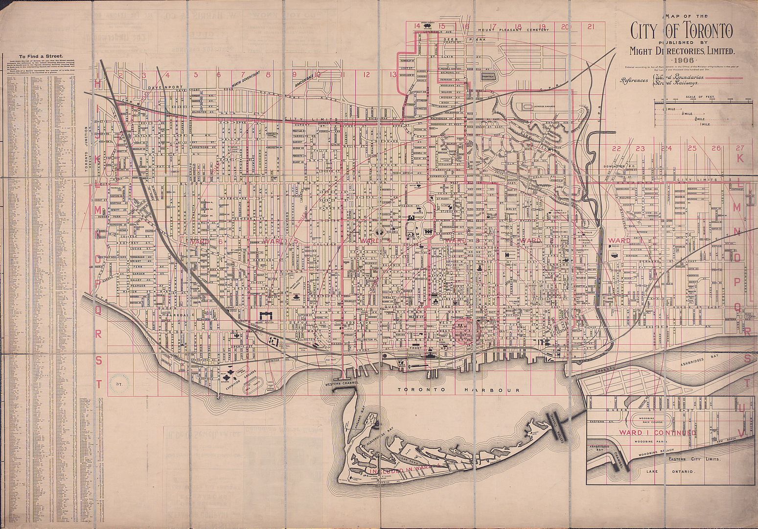
I thought the Coatsworth Cut was that which drains what's left of Ashbridge's Bay (i.e. btw/the sewage plant and the park)
thecharioteer
Senior Member
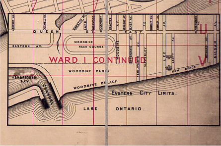
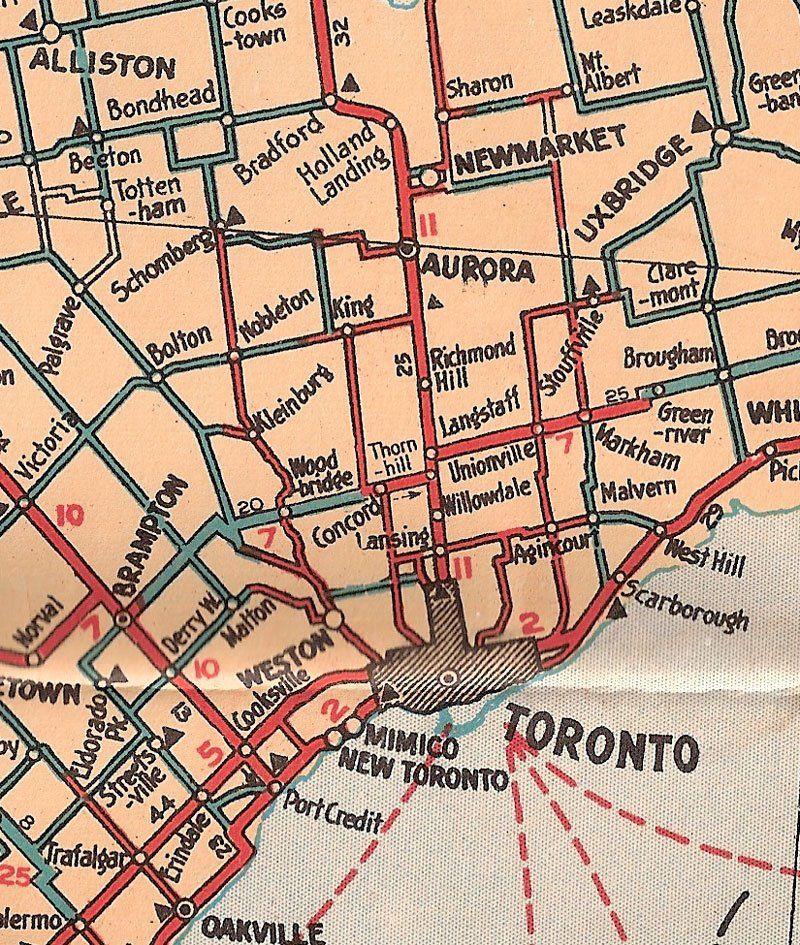
Was there really a shipping channel near the race track back in the day?
From a 1906 map:
thecharioteer
Senior Member
I thought the Coatsworth Cut was that which drains what's left of Ashbridge's Bay (i.e. btw/the sewage plant and the park)
A lot of reports on this subject:
http://www.toronto.ca/involved/projects/coatsworth_cut_sewershed/
thecharioteer
Senior Member
Centre Island:

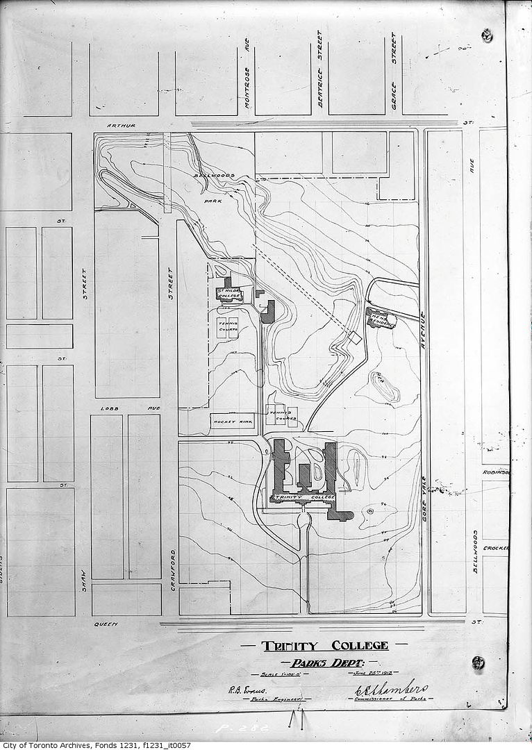
Trinity-Bellwoods:
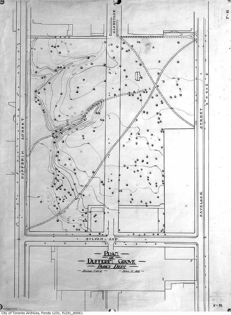
Dufferin Grove:
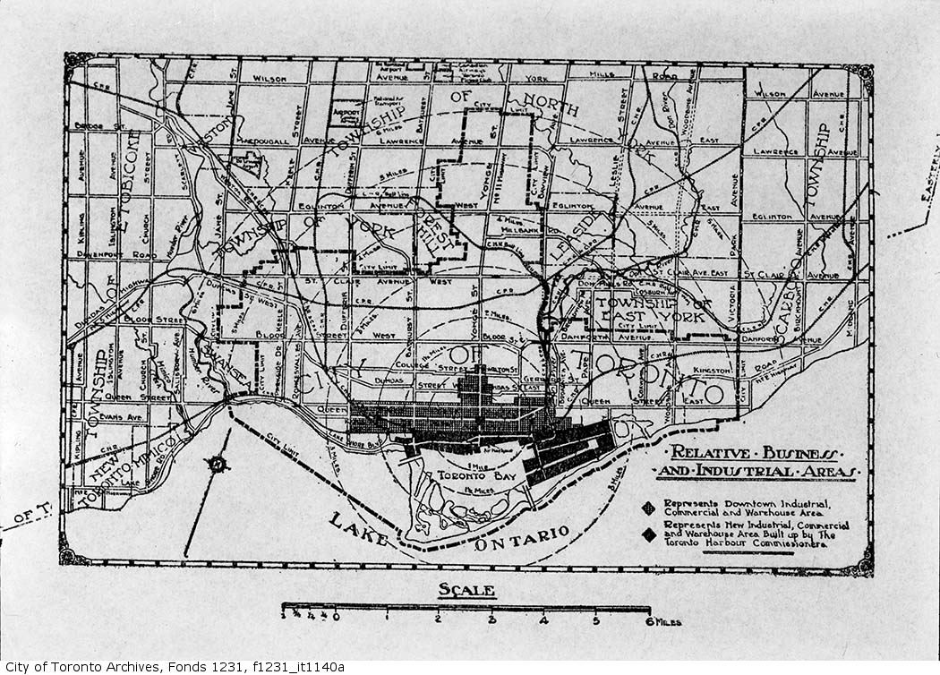
Downtown (1939):
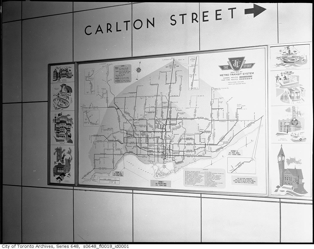
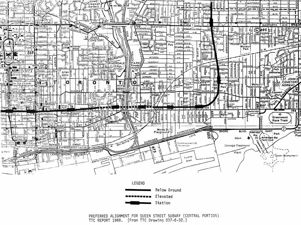
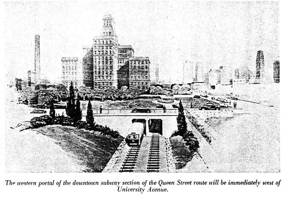
Subway map 1958:
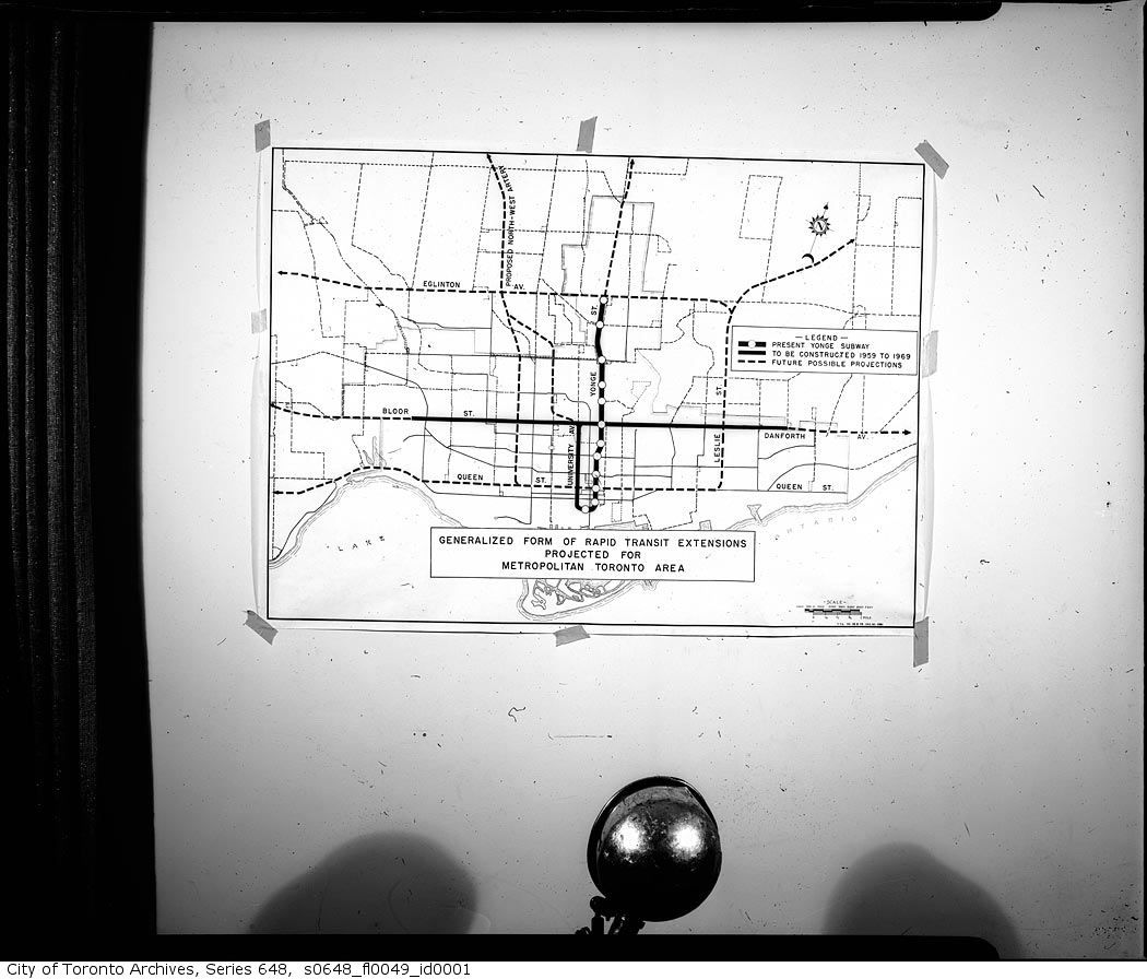
Subway expansion plans 1959:
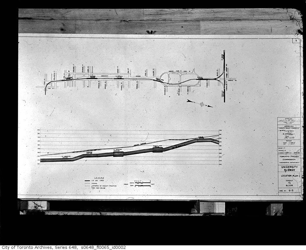
The University line:
Trinity-Bellwoods:
Dufferin Grove:
Downtown (1939):
Subway map 1958:
Subway expansion plans 1959:
The University line:
Last edited:
Goldie
Senior Member
Downtown (1939):
Subway expansion plans 1959:
Great fun to study such old maps - thanks, thecharioteer.
I was particularly interested to find that Ellesmere Rd. in Scarborough was once referred to as Wilson Ave. (1939).
And that a rapid transit line was proposed to run on Donlands Ave. - oddly named Leslie St. here (1959).
Last edited:
thecharioteer
Senior Member
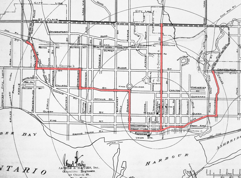
Speaking of transit:
From the Evening Telegram November 25, 1911:
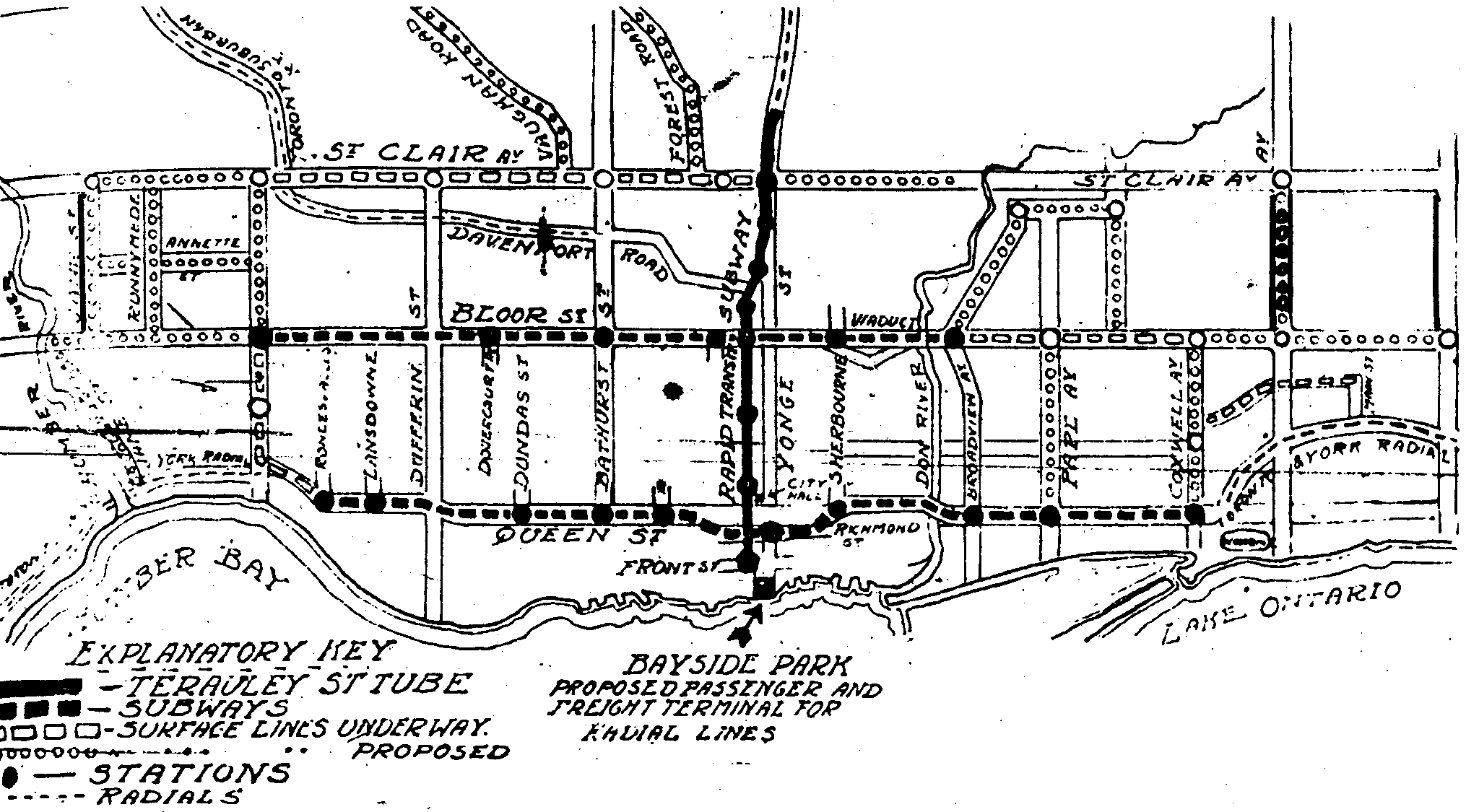
http://transit.toronto.on.ca/subway/5101.shtml
And roads:
From the Evening Telegram November 25, 1911:
http://transit.toronto.on.ca/subway/5101.shtml
And roads:
Last edited:
thecharioteer
Senior Member
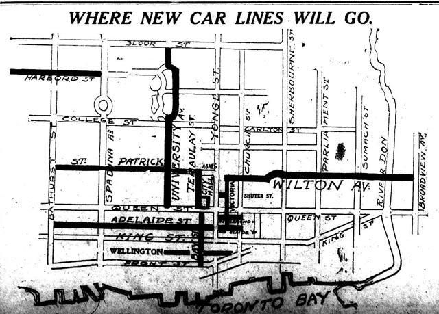
Another early subway proposal from 1910 (http://www.blogto.com/city/2011/11/the_route_the_toronto_subway_might_have_taken/):
And for Goldie, a railroad map from 1954:
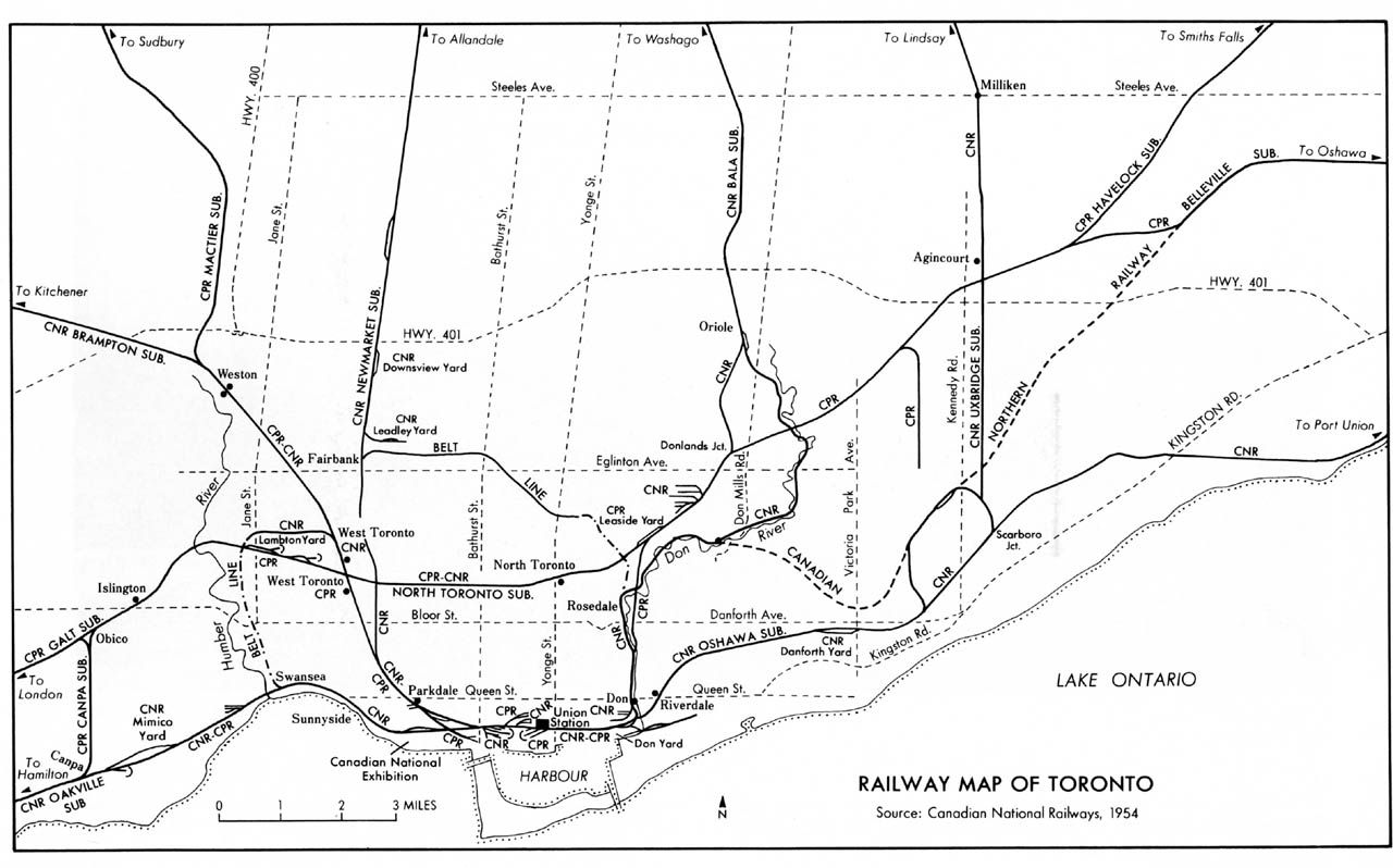
And for Goldie, a railroad map from 1954:
Last edited:
Goldie
Senior Member
And for Goldie, a railroad map from 1954:
Thank you - much appreciated.
thecharioteer
Senior Member
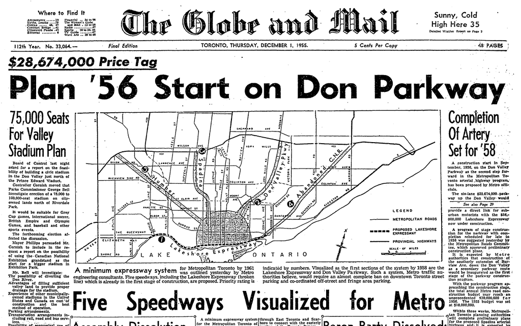
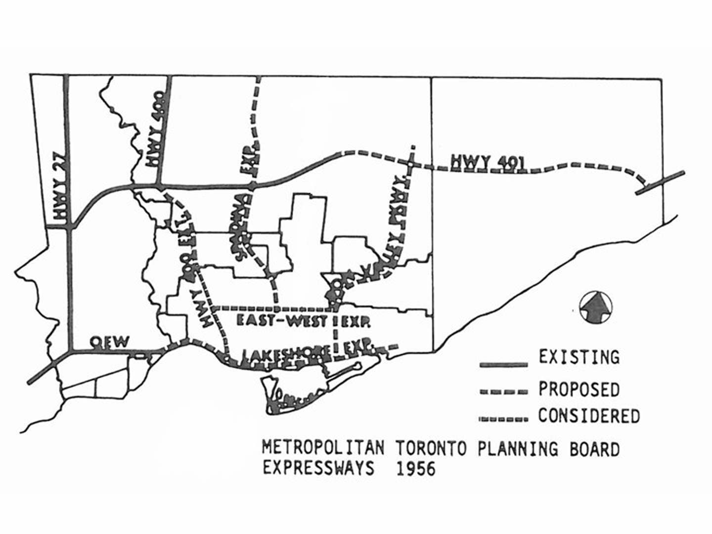
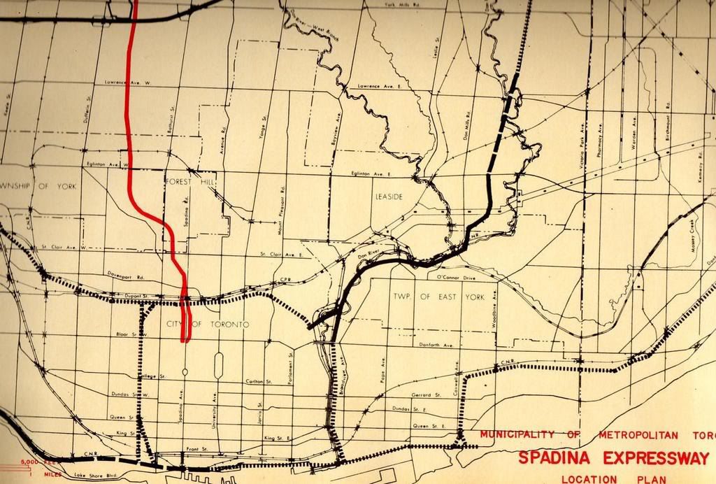
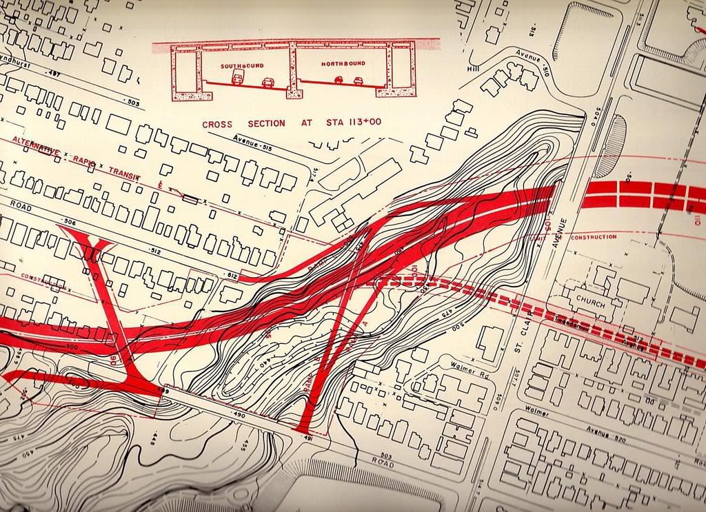
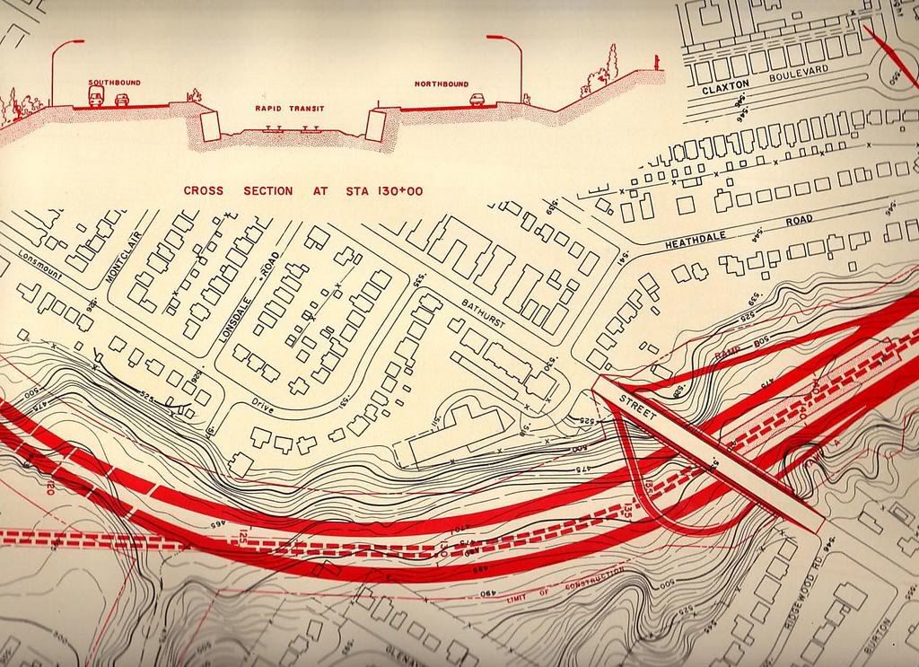
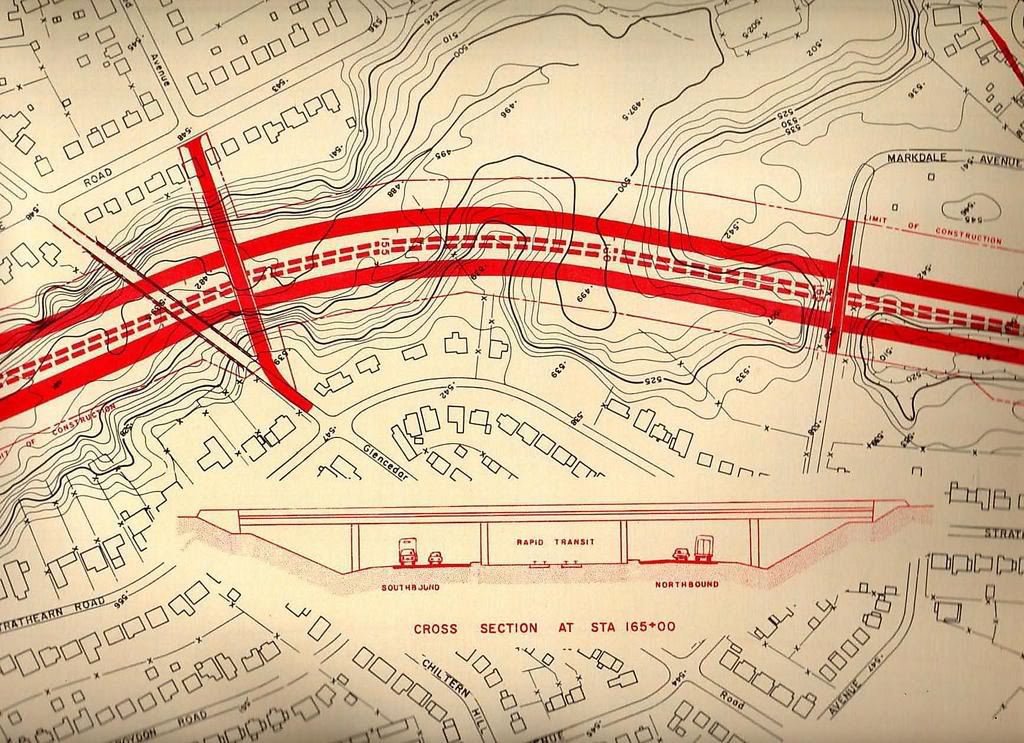
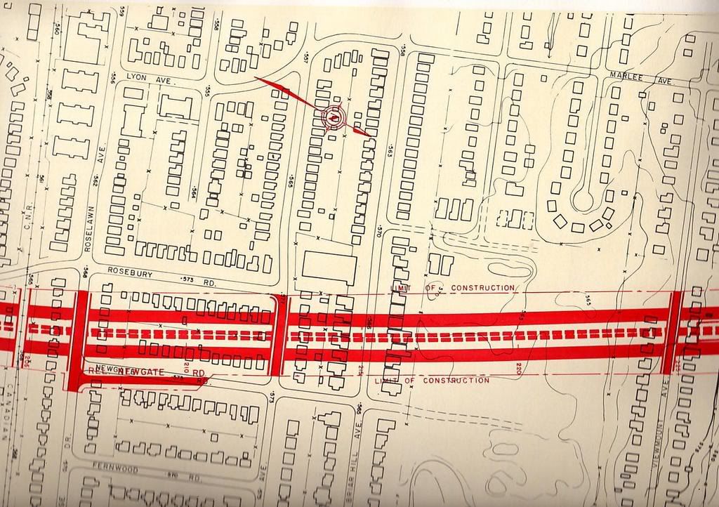
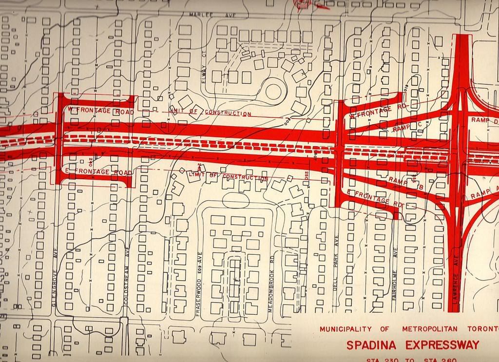
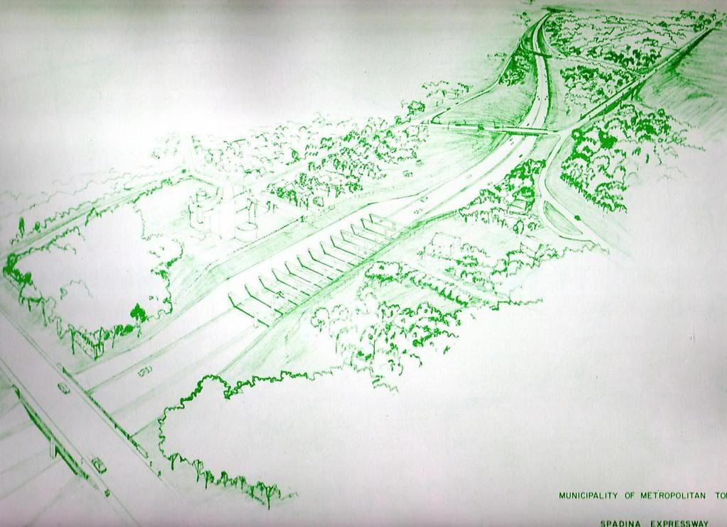
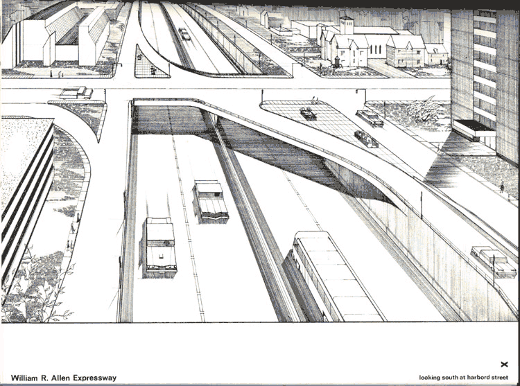
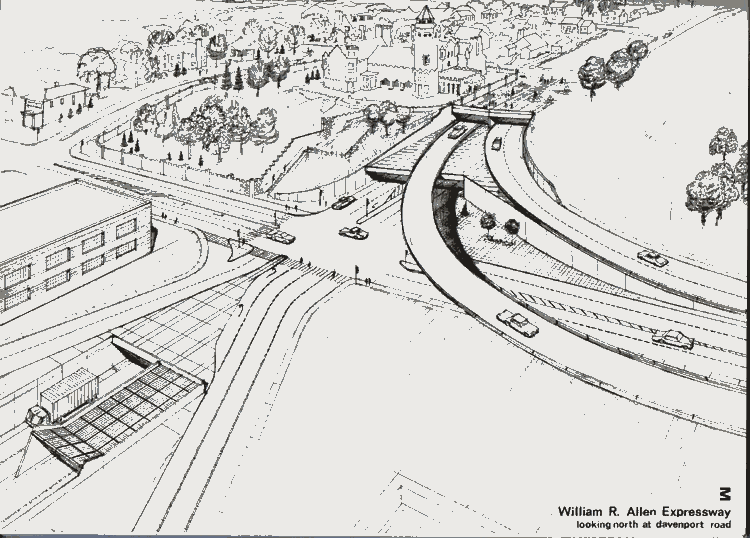
Expressway dreams from the 50's (from http://www.gettorontomoving.ca/Gardiner_Expressway.html)
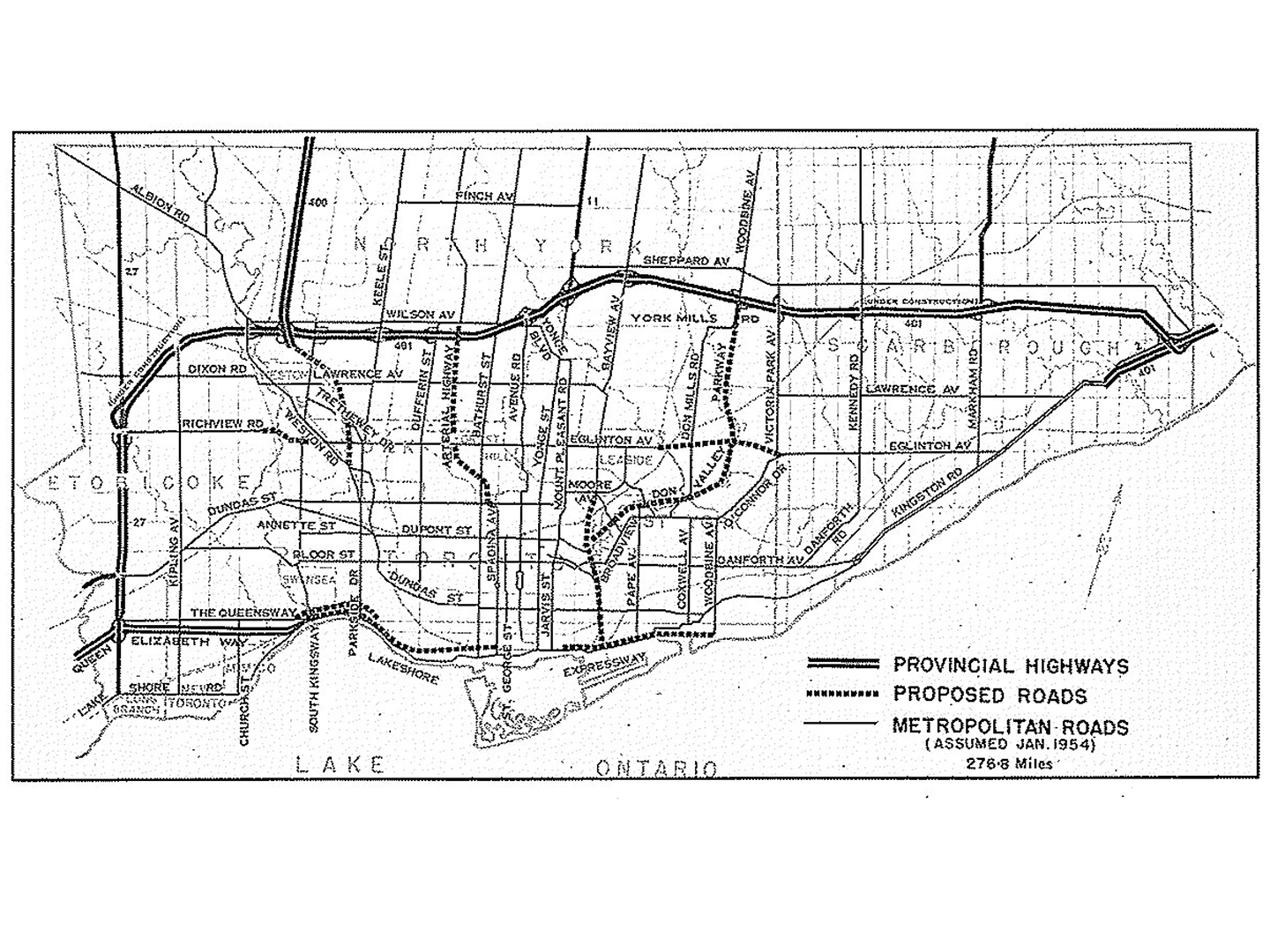
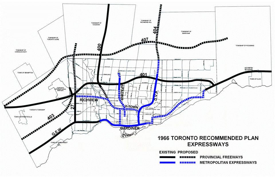
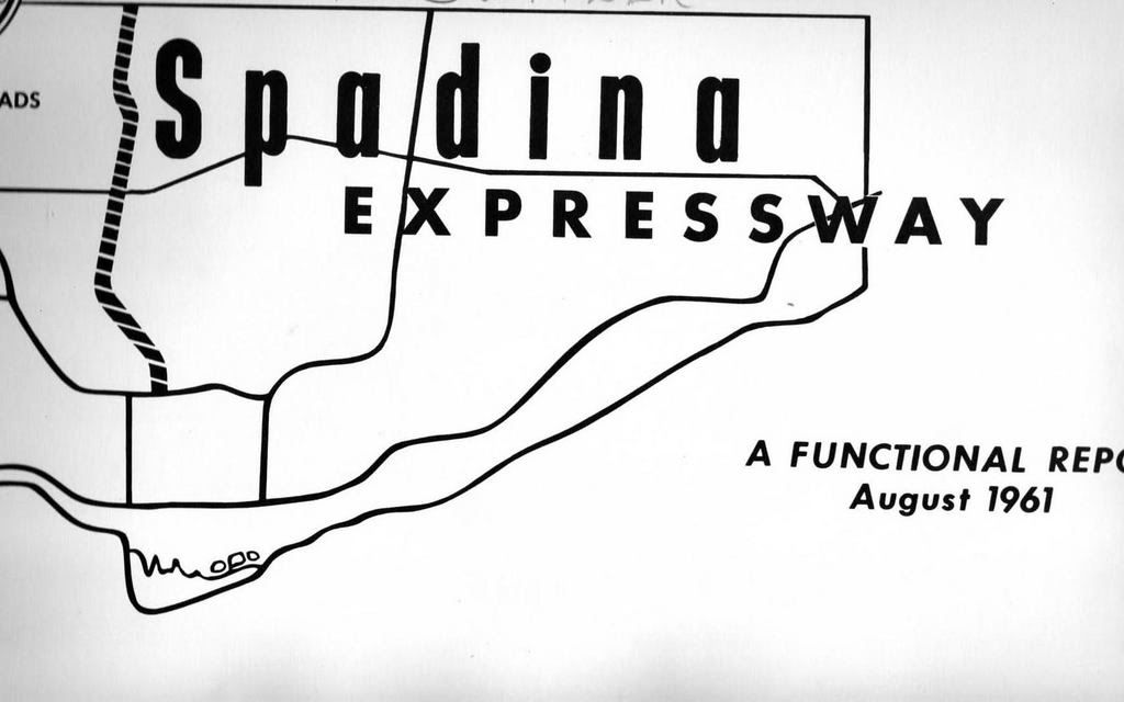
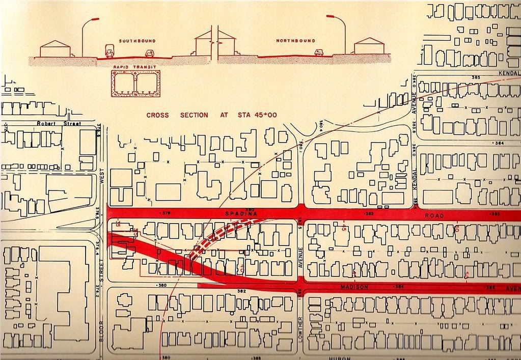
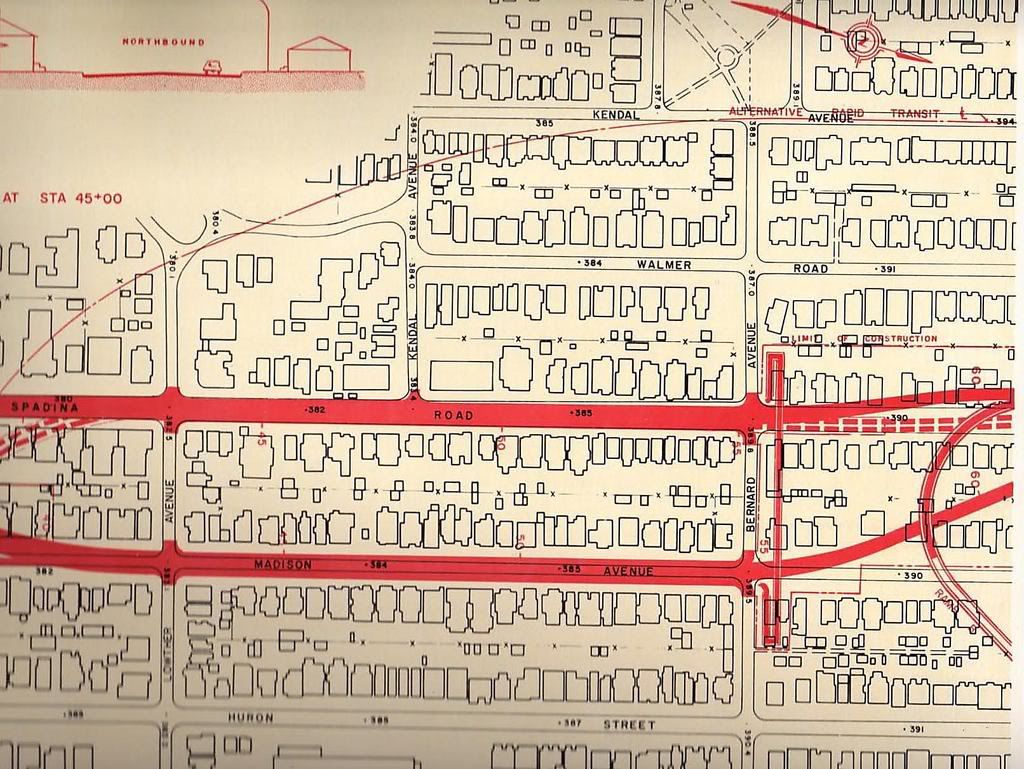
And the 60's:
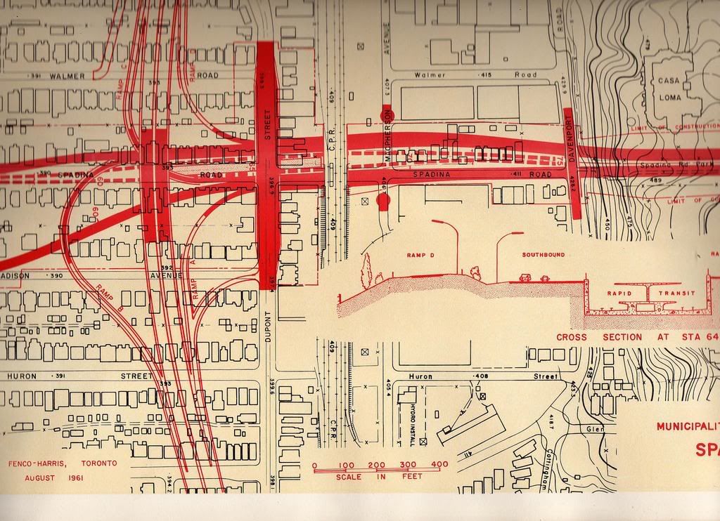
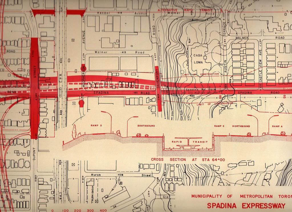
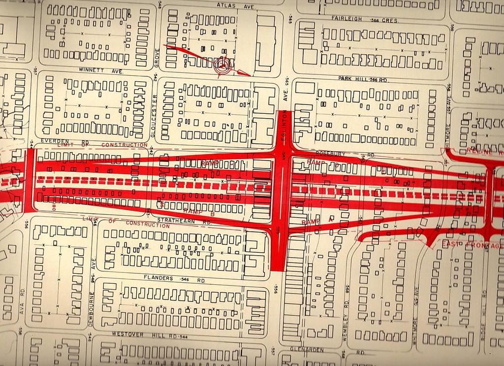
Near Casa Loma:
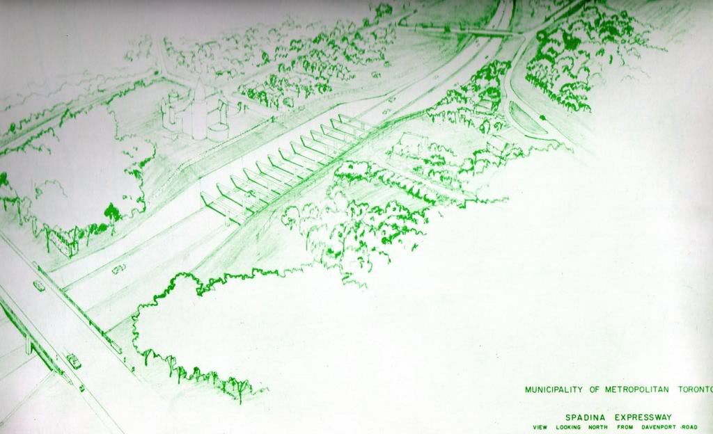
Spadina and Harbord:
And the 60's:
Near Casa Loma:
Spadina and Harbord:
Last edited:
Blovertis
Active Member
Absolute madness.
adma
Superstar
To today's perspective, at least.
But one interesting thing to note is how Marlee wasn't always "continuous"--it curved into Lyon at Roselawn--it only became a straightaway in, I guess, the late 60s when the apartment-tower node around Roselawn came into existence. (Whence it became a sort of "service road" for the Spadina/Allen Rd)
But one interesting thing to note is how Marlee wasn't always "continuous"--it curved into Lyon at Roselawn--it only became a straightaway in, I guess, the late 60s when the apartment-tower node around Roselawn came into existence. (Whence it became a sort of "service road" for the Spadina/Allen Rd)
Lone Primate
Active Member
Oh! Be still, my heart. What might have been. ")
I notice a couple of interesting things in the plan. First off, most of the buildings they had to remove on Elway Court don't even exist yet in the plan. Imagine that the plans were already in the works, and yet people went ahead and built about a half dozen structures inside the designated construction area. What would be the advantage in that? Could those places have made up the cost of building them just in the five or six years they would have stood?
Also interesting is the suggestion the city was planning to replace the Glencedar bridge across the ravine, presumably with traffic access in mind. The irony there is that we kept the original bridge and it was eventually spruced up for pedestrian use thanks to the people in the area. Funny how things turn out.
I hadn't noticed that Marlee once had a different course. The thing I principally remember about it is that Esther Shiner lived on it back when the Allen used to end at Lawrence and everyone choked Marlee every day continuing south. People couldn't get in and out of their driveways for long stretches of the day, and there were even issues about emergency vehicle access. Say what you like about the Davis Ditch, but no one fronts on it, and I'm glad she was able to budge the city and the province to at least make use of it.
Earlscourt_Lad
Active Member
I notice that it looks as tho' both Fraserwood and Elway were laid out in a manner that anticipated the construction. Those on Fraserwood backing onto the Allen look would have only lost their sheds for the most part, though they were removed entirely in the end. Elway seems to have only lost two properties. I assume that the province or Metro had assembled the relevant property long in advance of actually planning construction, and this would seem to support that assumption.
Looking at these maps, I don't want to imagine the traffic chaos at that Bloor termination. I would suggest it would be backed up to St. Clair, or worse if the Crosstown junction at Dupont had ever been built.
Looking at these maps, I don't want to imagine the traffic chaos at that Bloor termination. I would suggest it would be backed up to St. Clair, or worse if the Crosstown junction at Dupont had ever been built.
thecharioteer
Senior Member
I notice that it looks as tho' both Fraserwood and Elway were laid out in a manner that anticipated the construction. Those on Fraserwood backing onto the Allen look would have only lost their sheds for the most part, though they were removed entirely in the end. Elway seems to have only lost two properties. I assume that the province or Metro had assembled the relevant property long in advance of actually planning construction, and this would seem to support that assumption.
I wonder. That would assume long-term planning which wasn't evident in any of the other streets laid out during the same period between Eglinton and Lawrence west of Bathurst.
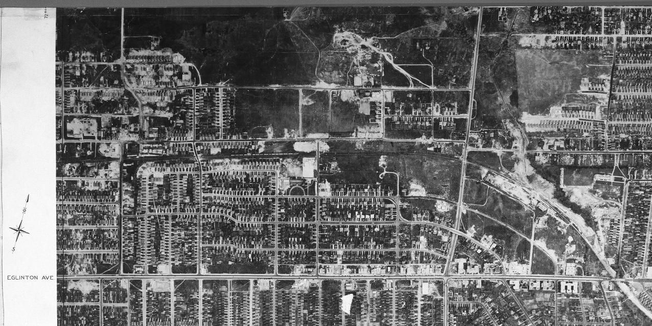
Perhaps it was more of the "do your own thing" school of subdivision as evidenced by the 1924 edition of the Goad Atlas:
By 1935, very little was developed:
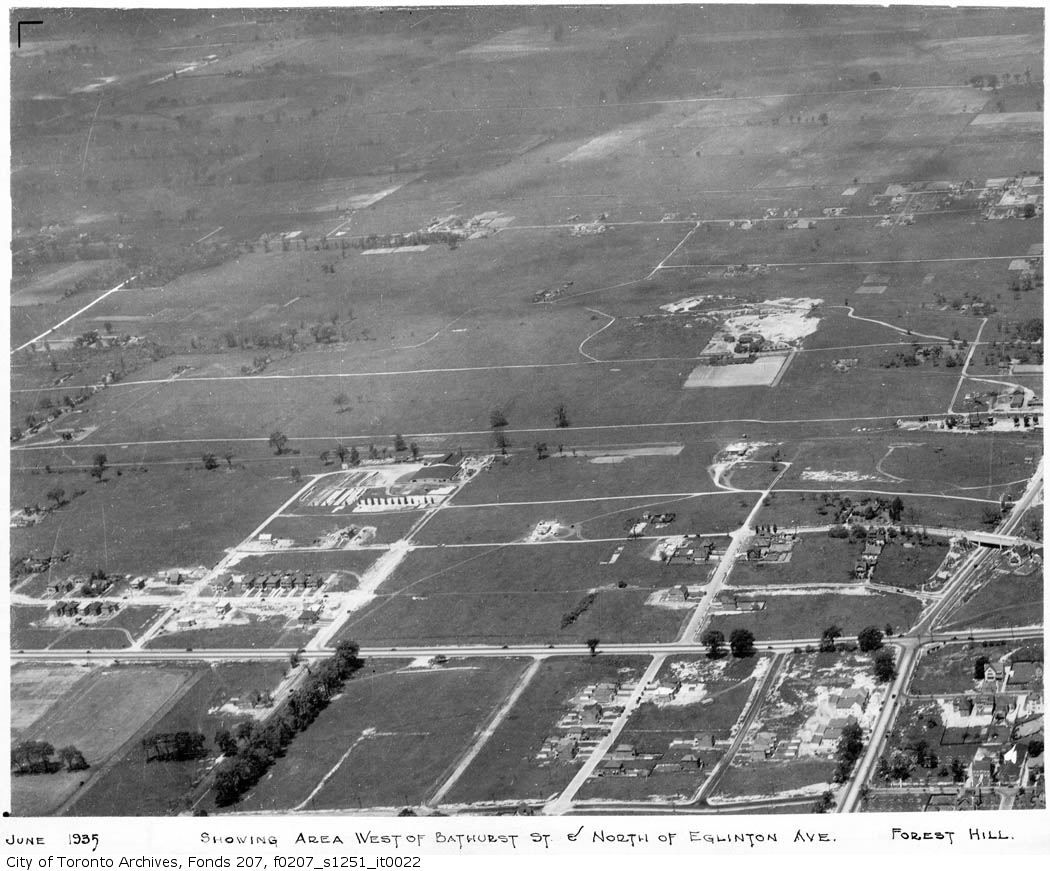
By 1942, Upper Forest Hill was emerging:
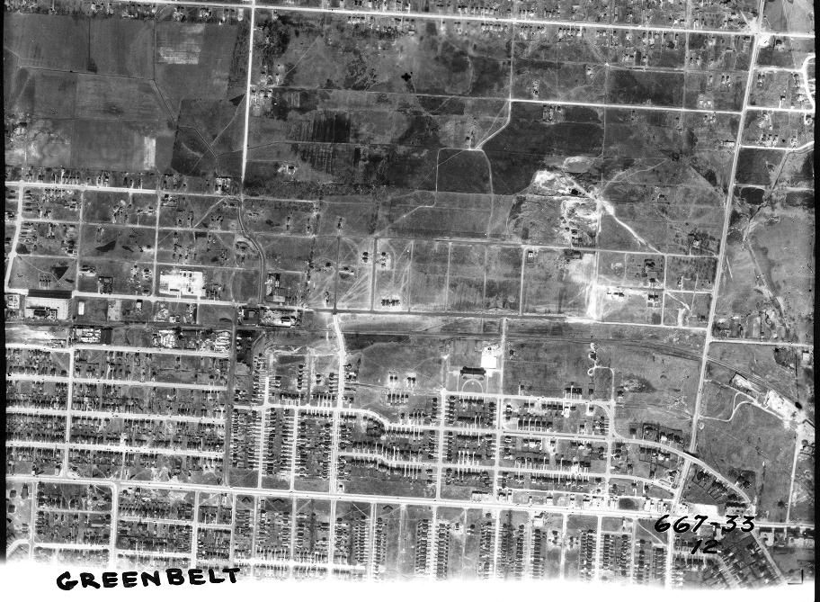
And in 1947 continues (disconnected from the lands to the west and north):