News   Nov 22, 2024
 345     1 
News   Nov 22, 2024
 769     4 
News   Nov 22, 2024
 2K     6 

Rare Maps of Toronto

thecharioteer began this fantastic thread,


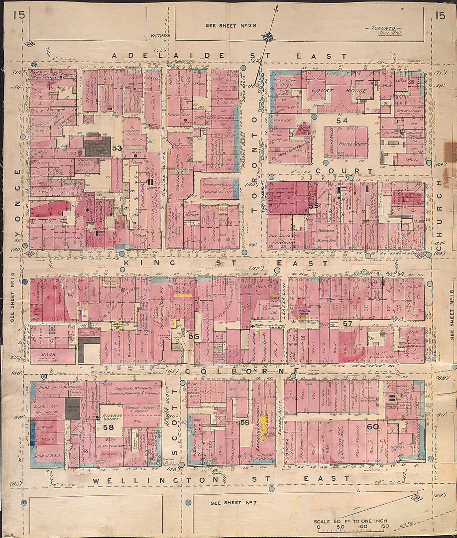
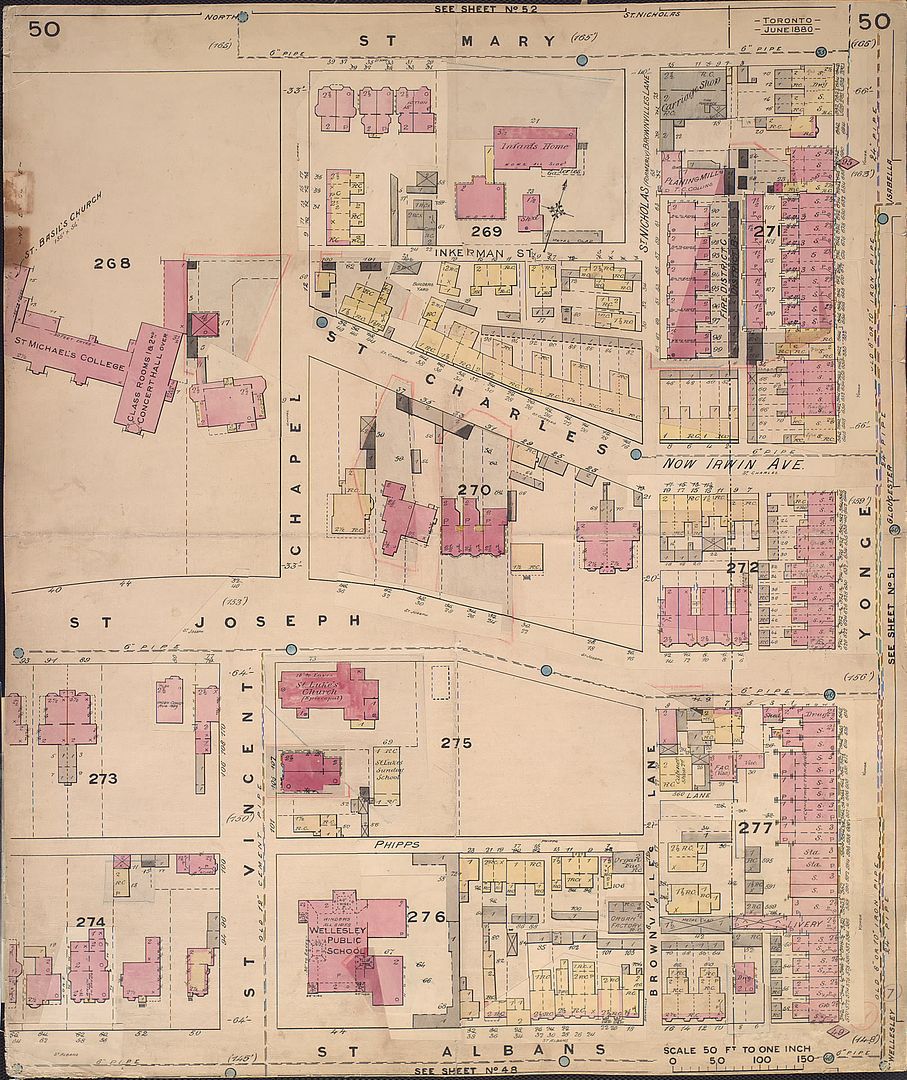
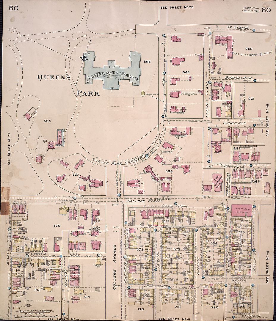
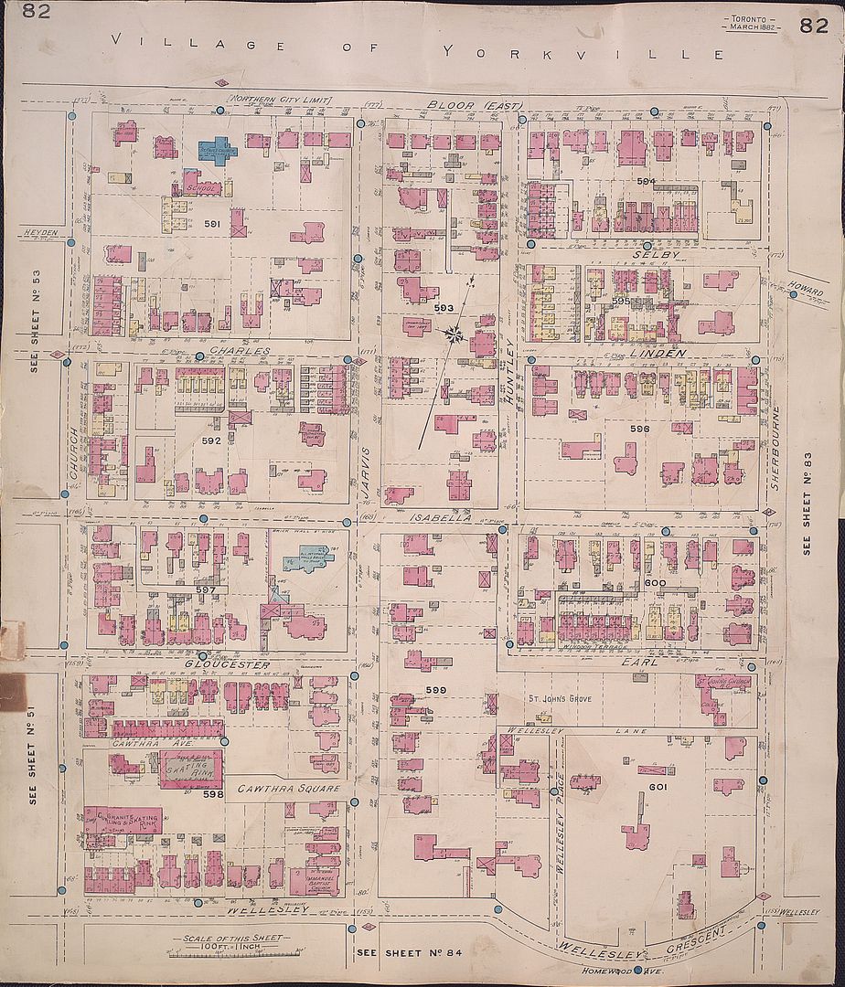
Like most of you, I have spent considerable time looking at, or tracking down specific plates of the Goad Atlas of Toronto. Aren’t they beautiful?
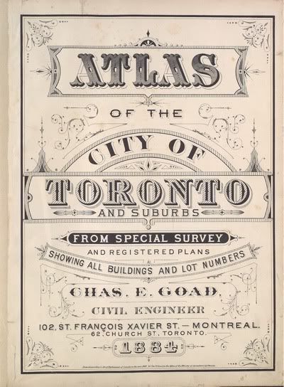
goad1884coversmall.jpg


I was excited to see Atlases put up by the TPL, but soon discovered that navigating their catalogue was painful, as the database titles don't include plate numbers, nor can you sub-sort results by plate. Meanwhile, the version put up by the Archives suffers from being trapped in a wretched file-format that is essentially unsupported on Linux and OSX.

I decided to put together a simple website to allow myself to easily locate and view the maps. The result -- isn't anything you haven't seen before, but it has sufficient advantages (and disadvantages!) that make it a rudimentary, but useful and complementary mode of accessing Goad’s Atlas (1884, 1890, 1893, 1899). You should be able to use any major browser, any platform, no extra software required.

Rather than keep the tool to myself, I’d like to share the work with you, and other Toronto heritage enthusiasts at large. I hope some of you will find it of use. (I know the maps aren’t 'rare' in the sense of not being familiar, and so technically this doesn't belong in this thread, but -- I trust you will indulge me.)

Here’s the introductory post to the site -- enjoy exploring Victorian Toronto!

Note: best viewed using a large monitor (a double monitor setup is even better)
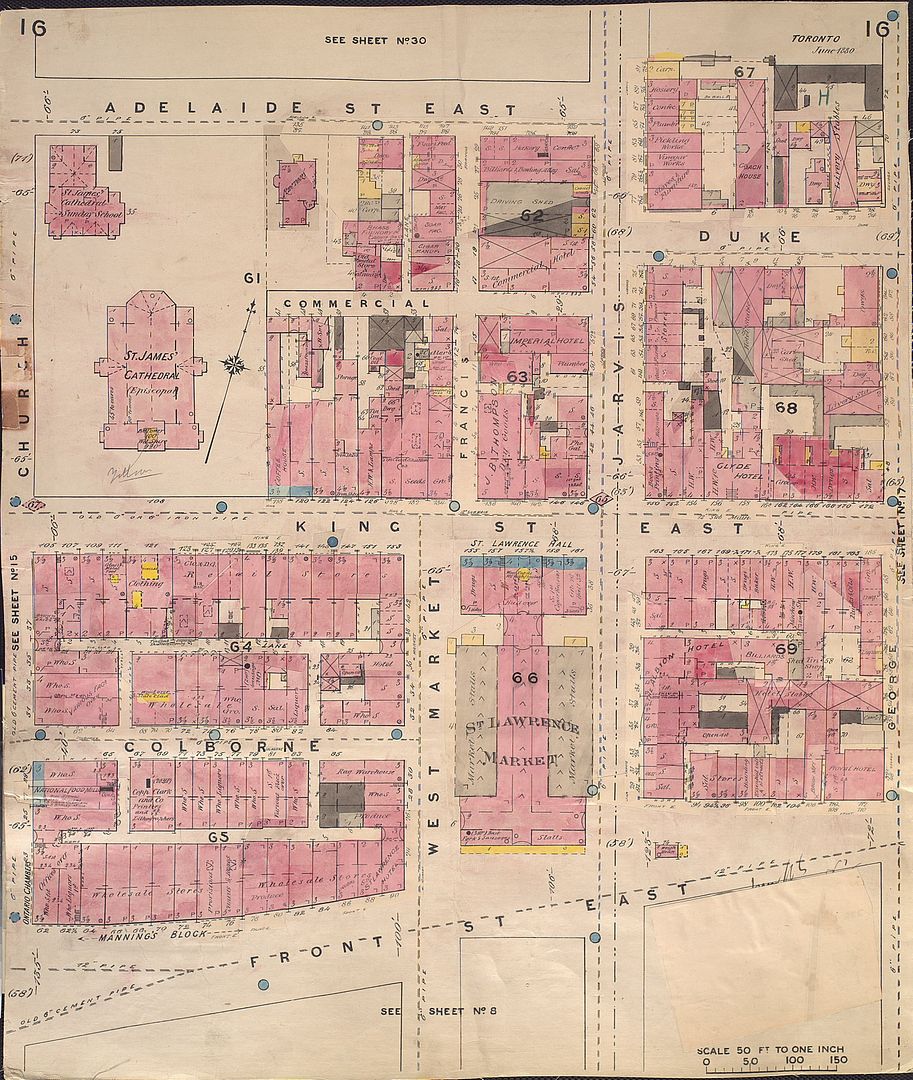
Great job, plink! Keep on going (the 1892 set is exquisite in terms of detail, particularly the 1"=50' maps).

94cc7924.jpg


9a0522d5.jpg


664afd0a.jpg


de3a9594.jpg


atlas-r-270.jpg
 
Last edited:


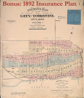
As a result of overwhelmingly positive feedback, I've updated the Atlas site to include the 1892 Insurance Plan of Toronto from Goad. As thecharioteer notes, many of the sheets possess a delightful amount of detail due to the scale.

Thank you for your attention and I hope people find the addition of use. Good day.
 
For anyone who is interested ... just to let you know that one of the dealers at the Sunday St. Lawrence Antique Market has, for the past three weeks, been selling single sheets from old Goad's street and fire insurance maps of the city - late 19th/early 20th century. I was tempted to buy one of my Riverdale neighbourhood, but it was in rather iffy condition. The dealer is on the east side aisle of the building, closer to the south side.
 
For anyone who is interested ... just to let you know that one of the dealers at the Sunday St. Lawrence Antique Market has, for the past three weeks, been selling single sheets from old Goad's street and fire insurance maps of the city - late 19th/early 20th century. I was tempted to buy one of my Riverdale neighbourhood, but it was in rather iffy condition. The dealer is on the east side aisle of the building, closer to the south side.
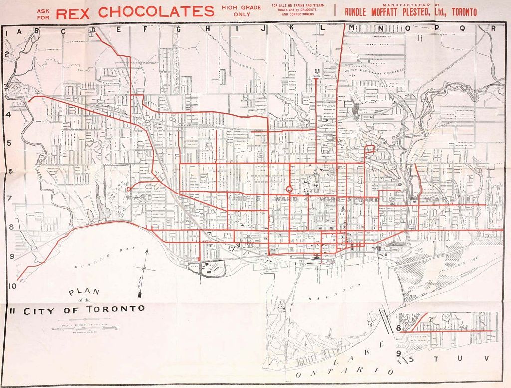
Cool info, thanks. I'm working on a period show set in 1900 and it's great to get these old maps. We already have a couple but it's always good to get more material. Totally different sensibility, appearance-wise, than a contemporary map. Really rather elegant windows onto lost eras. I was at an antique paper fair at St. Lawrence north a couple of months ago and managed to score some great paper goods to use as source material and reference for various hand prop and set-related stuff; our propsmaster is a regular down there and has scored some good city maps from the late 1800s and early 1900s.

We're also looking for money from that era. But it can get pretty crazy. According to my props guy, a nice four dollar bill in good condition can cost you a couple of grand on E-bay.
 
I have noticed over the years that Hydro refers to some of its Transformer Stations with older street names. There is the Duke TS at George and Adelaide (formerly Duke) Street. The Terauley TS on Bay (formerly Terauley) Street just south of Dundas and today I noticed that the station on the lower Don is called the Don-Fleet TS.

I cannot see any sign of an earlier Fleet Street in that last location (I assume the Don is from the river) and wonder if there are other "forgotten' street names still used by Hydro (or others)
 
Greetings all. Hope you are faring well! I'd like to mention a couple of items of possible interest...

The Goad Atlas project - updates
With respect to the Goad's Atlas site, I've slowly and incrementally managed to more than double the number of years available since I originally posted about it last April. The site now covers the years: 1884, 1890, 1893, 1899, 1903, 1910, 1913 and 1924. Also posted is the Insurance Plan of the City of Toronto for the years 1880 and 1889, as well as a special article on the Toronto Fires of 1904 and 1895. I thank you for your encouragement.

Historical Maps of Toronto
As a followup to that project, for some time I have been wanting to do a key map for the 1858 Boulton Atlas, which is in some ways a precursor to the Goad maps as it also shows building outlines and construction materials. There are 30 plates to the Atlas, which makes navigating it online aggravating if you haven't memorized what plate has what on it. I was also irritated by some other maps posted on the Toronto Archives site in a platform-restrictive format.

One thing led to another... and I wound up with a companion collection of maps, Historical Maps of Toronto. I've therein attempted to assemble a decent (but decidedly non-comprehensive) collection of 'major' (subjectively speaking) historical maps of Toronto, coupled with concise contextual commentary [cribbed from expert sources] where applicable.


Similar to the Goad site, my intent is to supplement existing online resources with a convenient access point. I just find searching the catalogues awkward ("oh gosh, what was the name of that map where it showed the crater location at Fort York... etc."), so I wanted to put together a simple list of my favorite Toronto maps.

You are cordially invited to stop by and browse around... Please forward, share -- or repost -- any map you enjoy :)

[Caveat one: browsing the site with a high-resolution monitor is recommended. 1024X768 users will not be happy.
Caveat two: I'm still fiddling around, so do not be alarmed if things move around or change between visits. But it's in a reasonable enough state that I feel I can share it with you folks]
 
Last edited:
“Wadsworth & Unwin's map of the City of Toronto [shewing real estate exemptions from taxation], compiled and drawn by Maurice Gaviller, C.E. & P.L.S., from plans filed in the Registry Office and the most recent surveys, 1872. Wadsworth & Unwin, P.L. Surveyors, Toronto, Sepr. 1st, 1872. City Engineers Office, Toronto, Jany 1878 [Signature illegible]. Copp, Clark & Co. Lith. Toronto. Entered according to Act of the Parliament of Canada, in the year 1872, by Wadsworth & Unwin, in the Office of the Minister of Agriculture.â€

http://data2.collectionscanada.ca/nmc/n0025641k_a1.pdf

http://data2.collectionscanada.ca/nmc/n0025641k_a2.pdf

http://data2.collectionscanada.ca/nmc/n0025641k_a3.pdf
 

Back
Top