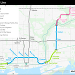
New bridges to carry Ontario Line trains over the lower Don River may soon join the ranks of iconic bridges in Toronto—at least, that's what Metrolinx hopes will happen when it opens the new subway line.
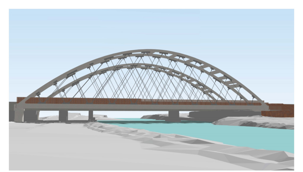 Looking northeast towards bridges planned to carry Ontario Line trains over the Don River, image via Metrolinx
Yesterday, the regional transit agency released details on the segment of the line between the Don and Danforth Avenue. This part of the rapid transit service will be mostly above ground, with trains operating parallel to the GO Transit tracks from just west of the river to just north of Gerrard Street East. Metrolinx will co-ordinate construction of this part of the Ontario Line with its ongoing activity to expand GO and provide frequent all-day, every-day service. North is to the right in the map below.
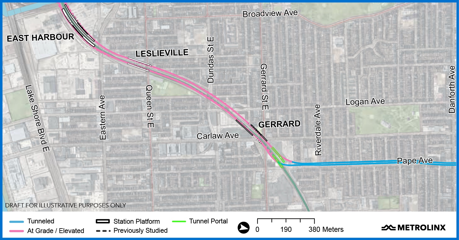 The eastern section of the future Ontario Line stretches between the Don River and Danforth Avenue, image via Metrolinx
A post on the Metrolinx news blog explains that, "The existing corridor provides an efficient use of resources, making it possible for Metrolinx to deliver more rapid transit to more people with a 15.5-kilometre route at only a slightly higher cost than to the previous Relief Line South proposal, which was less than half the length."
The blog post continues, "Since last April, when the above-ground section was first unveiled, a big focus for Metrolinx has been determining how it could bridge over the Lower Don River in a way that would benefit the surrounding neighbourhoods and respect Aboriginal treaty rights in the area. The plans released [yesterday] propose how that could be done."
The Ontario Line tracks will stretch on either side of four (three current and one new) GO train tracks. According to Metrolinx, "Significant design and engineering efforts have been made to ensure the six-track railway does not significantly impact bordering properties or other ongoing infrastructure projects. Using the existing rail corridor and streamlining Ontario Line construction work with planned GO Expansion means we can keep mostly within an existing footprint and minimize impacts to surrounding neighbourhoods".
Metrolinx will add a tied arch bridge on either side of the GO rail bridge across the Don River, each with space for track, westbound on the north bridge and eastbound on the south bridge. The current plan is to also provide pedestrian and cycling connections across the Don on the bridges. Early designs envision structures that are reminiscent of the iconic Humber Bay Arch Bridge in the west end of the city, adding a similar bookend in the east.
"Our approach to infrastructure design focuses on structures that are clean, simple, functional and elegant," said John Potter, Design Standards manager for Metrolinx in the post. "What will make these new bridges stand out is the fact that there will be two parallel structures that will always be seen together. As part of our detailed design process, we will want to keep the Lower Don bridges simple to avoid unnecessary visual noise that can be amplified by doubling up of the structures.”
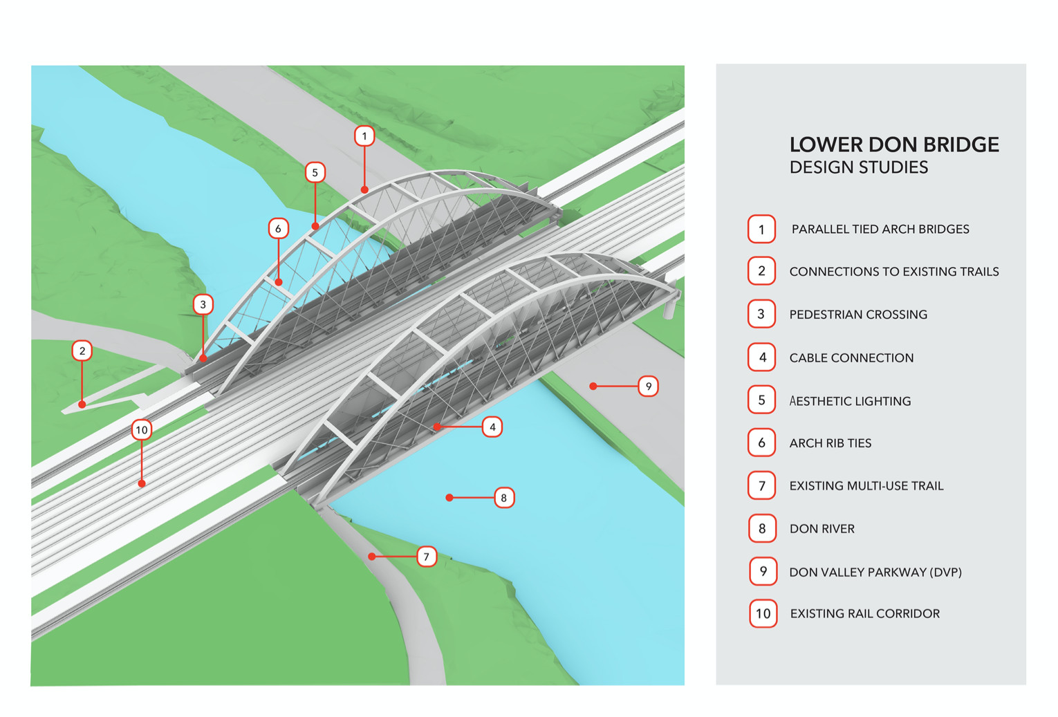 The bridges over the Don River include pedestrian and cycling connections, image via Metrolinx
Metrolinx says that efficiently bridging over the Don River saves money and removes the engineering challenges, environmental risks, and potential impacts to Aboriginal and treaty rights associated with building a massive tunnel under the river and its floodplain.
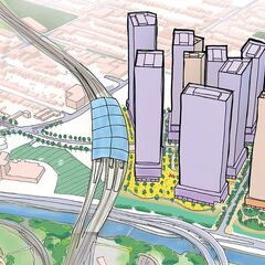
Just east of the Don River and between Lake Shore Boulevard East and Eastern Avenue, the future East Harbour Station will become an important transfer and interchange, accommodating GO trains, a future southerly extension of Broadview Avenue and its streetcars, and Ontario Line trains in a corner of the city that Metrolinx sees as "poised for growth." In many cases, people transferring between GO and Ontario Line trains will be able to walk straight across the platform from one to the other without having to go up or down a level. Metrolinx sees the easier transfer as an improvement over the previous Relief Line South proposal, which needed very deep tunnels—38 metres below ground—to reach under the Don, which, it says, added four-and-a-half minutes of escalator time to each transfer.
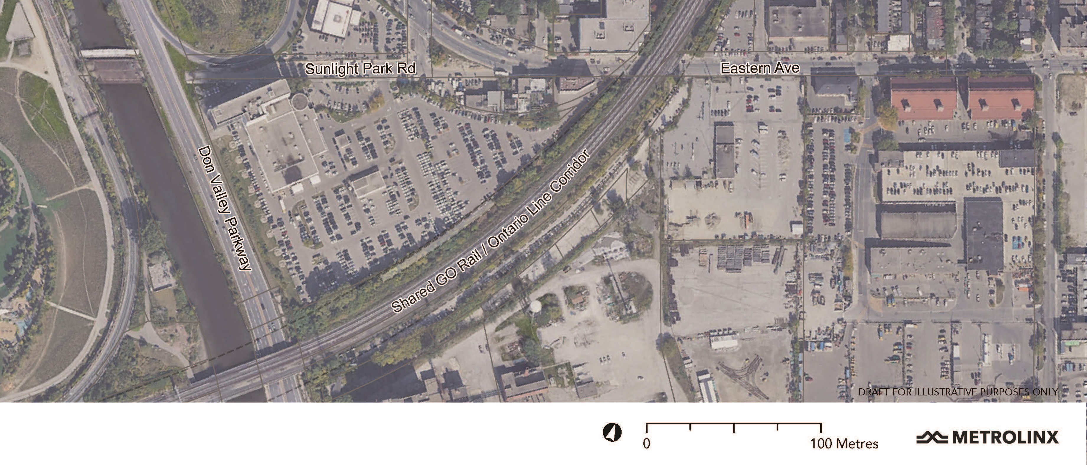 Aerial view of the site of the future East Harbour Station and development, image via Metrolinx
Metrolinx is working with developers of the site to deliver the East Harbour transit hub. The developer partner, Cadillac Fairview, will design the hub with Metrolinx transit requirements to integrate the station with the future local development.
In the joint corridor, Metrolinx expects to proceed with early work in 2021 before it starts station and track construction. For example, between Eastern and Logan Avenues, it is planning to:
-
expand the GO rail corridor;
-
install or upgrade vegetated slopes or retaining walls and noise barriers beside the corridor (more about that later);
-
relocate or protect utilities; and
-
build new Ontario Line bridges on each side of the Queen, Dundas and Logan bridges.
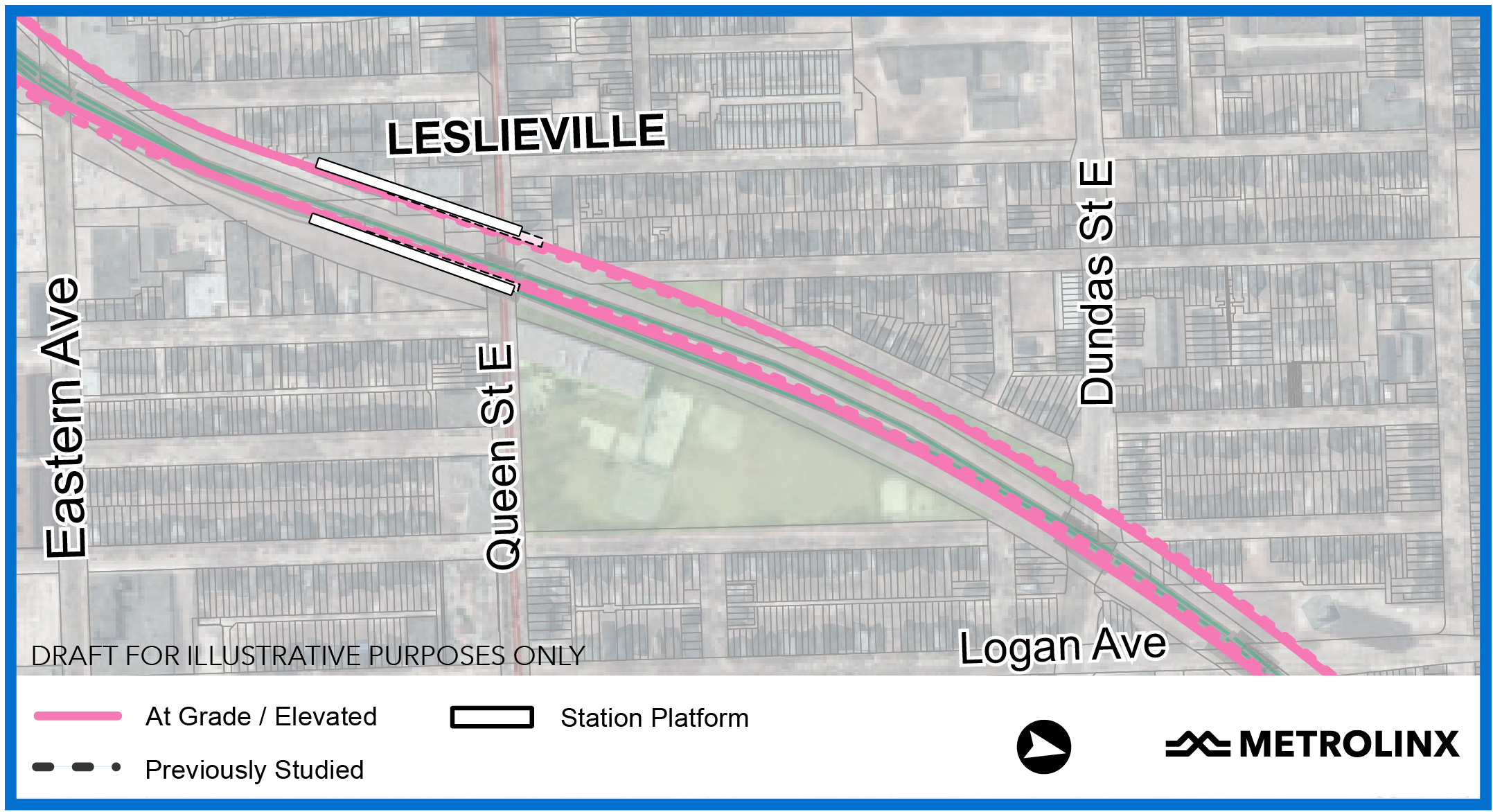 View of the joint rail corridor and the future Leslieville Station, image via Metrolinx
Metrolinx says these projects will proceed after an early-works environmental assessment and other community consultations, including with Indigenous communities. The blog post quotes Andre Marois, Director Corridor Infrastructure at Metrolinx, who says, "From Eastern Avenue to Gerrard Street, we’ve been able to optimize the track alignments and minimize impacts."
The new Leslieville Station, for example, near Queen Street East and De Grassi Street will bring rapid-transit service to its namesake neighbourhood and the nearby Riverside community. Since Metrolinx now plans to situate the station south of Queen East, construction–and operation–of the line won't impact the nearby Jimmie Simpson Recreation Centre. The new plan also preserves another neighbourhood icon – the Bonjour Brioche bakery will continue to operate at its longtime site on the northwest corner.
How will more tracks fit into the rail corridor? An aerial view of the Queen / De Grassi area offers the answer to that question. The new Leslieville Station will lie just south of the former Grand Trunk Railway’s Riverdale Station, which the railway built in 1896. (A plaque on Queen facing De Grassi Street commemorates the old station.) The Riverdale platform took up space between the tracks in the rail corridor that GO does not use.
"As we started designing, we weren’t sure if we were going to be able to use that extra-wide spacing of the GO tracks, but we needed to look into the feasibility of doing so because we know how important the recreation centre is to the community," explained Marois.
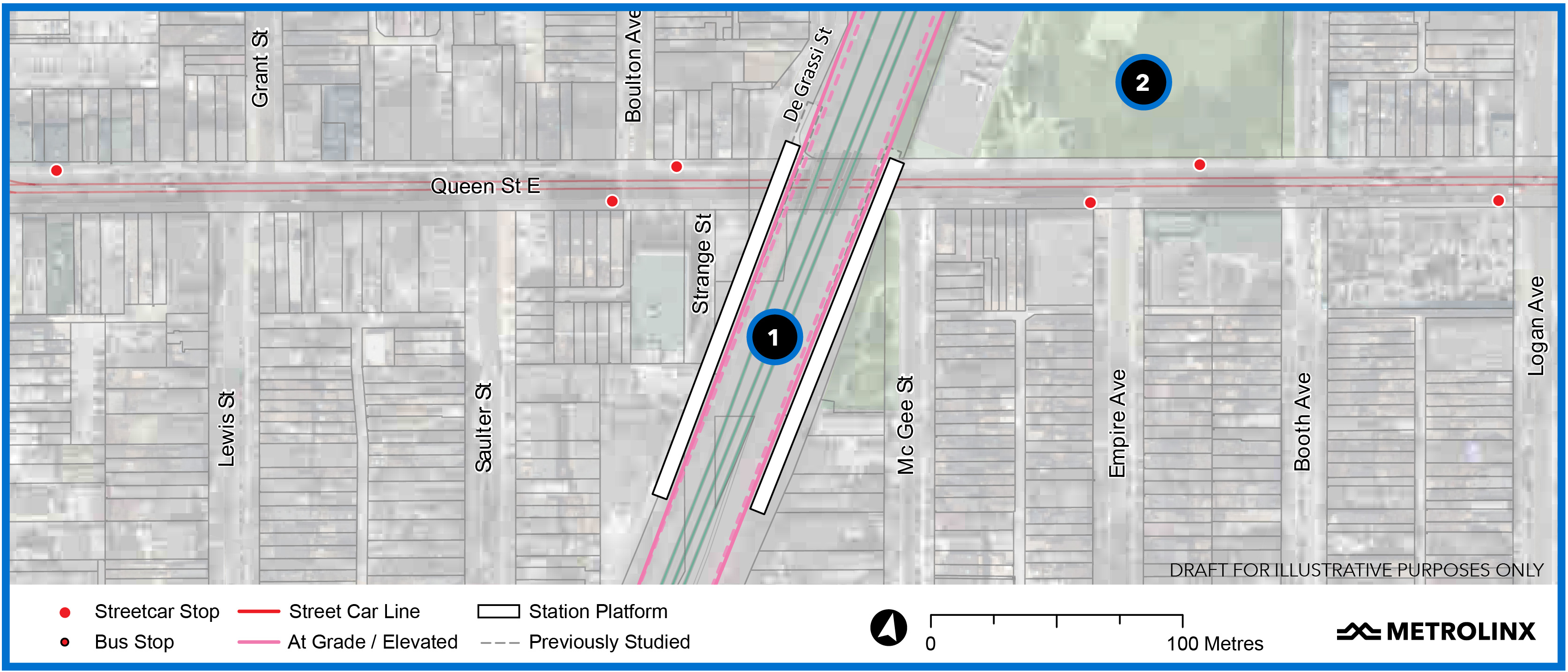 Construction of the future Leslieville Station (#1) will not impact Jimmie Simpson Recreation Centre (#2), image via Metrolinx
When it installs the new tracks as part of the Ontario Line and GO expansion projects, Metrolinx will take full advantage of that area, staying almost exactly within the current rail-corridor footprint. “We are maximizing our use within the GO property but some tiny slivers outside the current corridor boundaries will be impacted in the final buildout,” said Malcolm MacKay, Metrolinx Program Sponsor for the Ontario Line. "In most places, it will be as little as a foot [0.3 metres]."
Similarly, the new plan for a bridge over Dundas Street East will reduce impacts on properties around Dundas and Logan.
Metrolinx says it will integrate the new Gerrard Station and tracks with the bridges over Gerrard Street East and Carlaw Avenue. By slightly staggering the south platform, planners have designed the stop to accommodate the nearby tunnel portal and eliminate a wider curve to the east to accommodate the trains as they turn northwards. When the trains leave the station, they'll dip down into the tunnel to proceed under the GO tracks and continue underground toward Danforth Avenue and Pape Station.
Contractors will build launch shafts and portals on the north and south sides of the GO tracks to start the next portion of the Ontario Line tunnels. Metrolinx says "Much of the space to be used for the portal and construction is currently paved over for parking. Metrolinx will work with local business owners to minimize the impacts of construction on their properties." That "parking space" is also occupied by a Liquor Control Board of Ontario store on the north side of Gerrard East and the Riverdale Plaza on the east side of Carlaw.
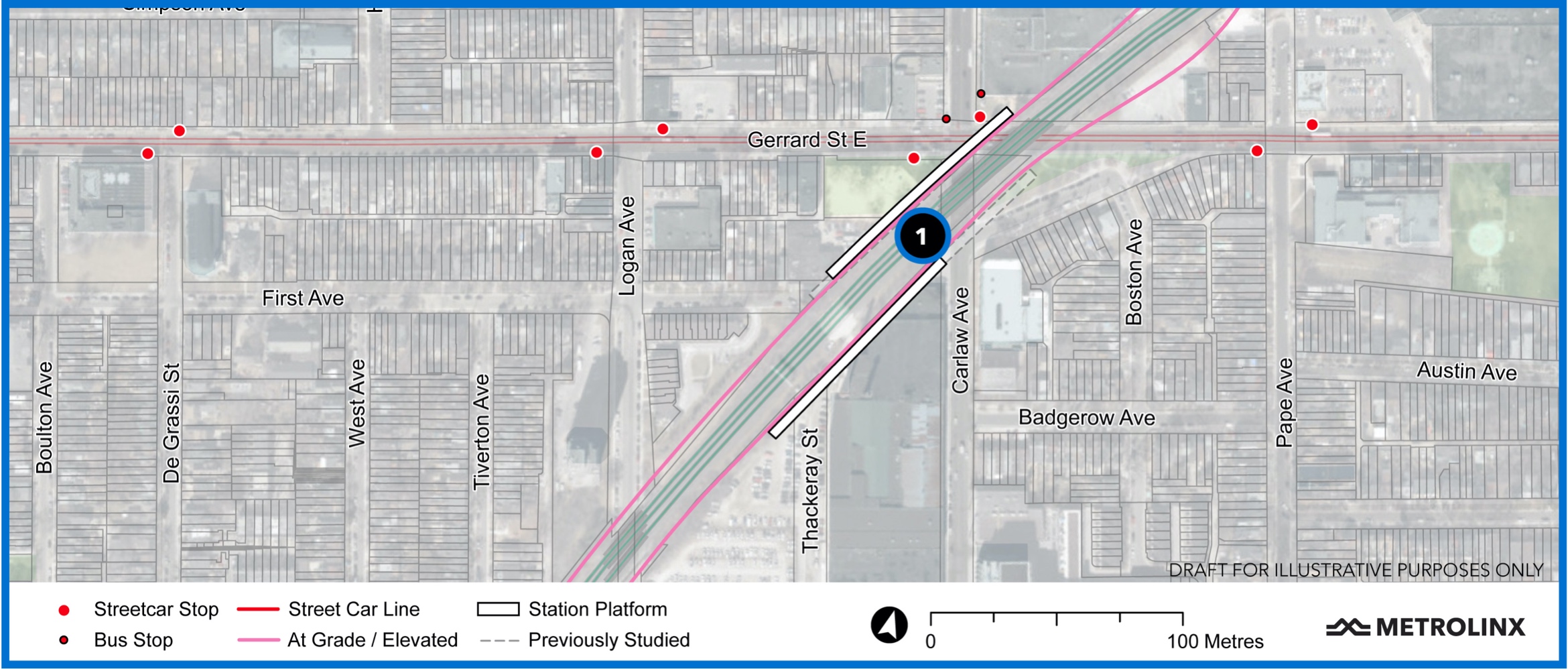 Gerrard Station straddles the intersection of Gerrard Street East and Carlaw Avenue, image via Metrolinx
By repositioning the station platforms at Gerrard Station, the design teams eliminated a wide loop to allow proper curvature before trains could turn towards Pape Station. This will reduce travel times and lessen property impacts. In the earlier design, tunnel would have extended as far east as Blake Avenue, before resuming an alignment under Pape Avenue. The team also expects the tunnel to impact a small corner of Pape Avenue Junior Public School’s yard. Metrolinx claims it will protect the property and maintain access and "robust safety standards" throughout construction.
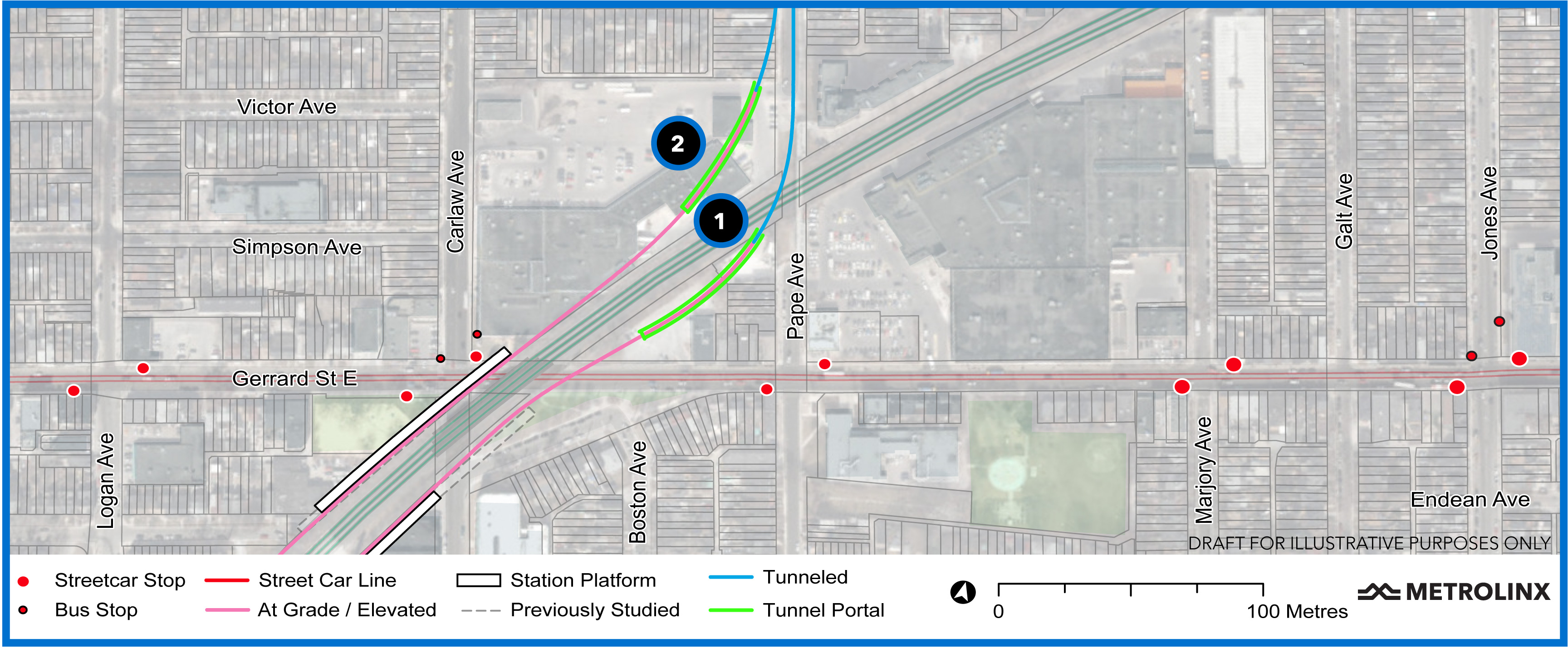 Metrolinx plans to build Ontario-Line tunnel portals south (#1) and north (#2) of the GO tracks, image: Metrolinx
Finally, Metrolinx has committed to building noise walls beside that part of the rail corridor where the Ontario Line and Lakeshore East GO trains will operate. Metrolinx explains that the walls and "state-of-the-art vehicle technologies and strict maintenance practices, will mitigate noise impacts" from all trains. The team will confirm exact locations and heights of noise walls as they continue to design them and Metrolinx says it will continue "to engage communities and seek feedback on those designs and other mitigation measures throughout the course of the project."
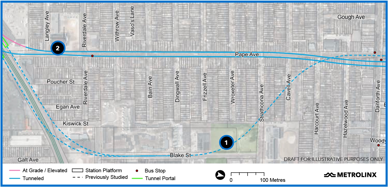 The latest plans allow Metrolinx to build the line directly under Pape Avenue (#1), instead of further east (#2), image via Metrolinx
Metrolinx has detailed other sections of the project over the past few weeks:
-
West - between Exhibition Place and Queen Street West / Spadina Avenue; and
-
Downtown – between Queen West / University Avenue and the Don River.
It proposes to release information on the final segment – between Danforth and Eglinton Avenues – soon.
You can review and comment on the plans for the Ontario Line at the Metrolinx Engage website.
You can also add your thoughts about the project in the space provided on this page or in our dedicated Forum thread.
* * *
UrbanToronto has a new way you can track projects through the planning process on a daily basis. Sign up for a free trial of our New Development Insider here.
| Related Companies: | Adamson Associates Architects, Entuitive, Urban Strategies Inc. |

 17K
17K 


