News   Apr 18, 2024
 228     0 
News   Apr 18, 2024
 551     0 
News   Apr 17, 2024
 1.9K     0 

TTC Cartography, Signage, and Wayfinding

We've had Metrolinx almost a generation now and there's still no unified map, or even unified thinking, about how to cartographically address rapid transit in Toronto. The parochialism is still pretty apparent when one looks at options to YYZ.
 
We've had Metrolinx almost a generation now and there's still no unified map, or even unified thinking, about how to cartographically address rapid transit in Toronto. The parochialism is still pretty apparent when one looks at options to YYZ.
The TTC System Map is posted all over the city, and clearly shows all the rapid transit that exists (Lines 1, 2, 3, 4, and the UP Express).

Perhaps this becomes more of an issue if there's ever any rapid transit far outside the city.

174399
 
But the rapid transit map doesn't show all rapid transit.
It shows all the rapid transit at TTC fares. Which is surely the point. The London Tube map still doesn't show all the rapid transit in London!

Do you even get the $1.50 discount for transferring to the UP to Pearson - or is that just for GO Trains.
 
Is it the point? Why surely?

I believe the GO-TTC discount works both directions. In theory at least.

There are London maps that show both, but for the sake of clarity they are often kept separate, although transfer stations are still indicated with national rail services. We wouldn't have the clarity issue in Toronto, due to the skeletal system. And London shows six different fare zones, not generally just zone 1-2, although those maps exist too.
 
I believe the GO-TTC discount works both directions. In theory at least.
It does - I've never tried to UP though before. And oddly, you only get the discount from GO, if your TTC tap was not an a pass ...

There are London maps that show both, but for the sake of clarity they are often kept separate, although transfer stations are still indicated with national rail services. We wouldn't have the clarity issue in Toronto, due to the skeletal system. And London shows six different fare zones, not generally just zone 1-2, although those maps exist too.
Offhand, I haven't seen any London maps that only show 6 fare zones. The Central London one has less than 6, but the others mostly seem to show at least 8 zones and often zone 9 and outside zone 9 as well.

It's funny, we complain about what we do here, but I see full TTC maps all over the city. I can't recall even seeing a full TFL map ever in London, showing buses. At best at a bus stop, you get a map that only shows the routes that stop there in some kind of line diagram, making planning transfers and routes difficult ... so unless you are very familiar with the system, you invariably end up on the tube, as at least you can see the entire network at once. There isn't even a tube map posted at most bus shelters!
 
I noticed that and appreciate it. But cmon Vancouver even has, "Transfer here for the 99 B-Line", GO LInes aren't changing every few months, no reason it shouldn't say Change for the GO Barrie Line at Downsview Park for example. Or change for Long Distance Rail and Coach services, and all GO transit and UP Express services at Union.

Meh, the simple station announcement is enough. And it's already stated twice, which imo is broaching on too much loud robot voice for my liking. For who's benefit should we announce Barrie GO's presence at Downsview Park, the 0.001% of commuters who don't know the system and can't look at a map? Should our announcements also bellow every intersecting bus route...which would actually be more helpful since they're way more well used. The updated subway map is pretty good, and on par with other subway maps. Maybe it could lose the non-LRT portions of the streetcar network.

The network map, although in every station and at many bus stops, maybe could become even more conspicuous. Perhaps on platforms too. Or to make everyone happy it can be plastered onto the ceiling of the train or something, which seems the only way to satiate people's desire to have every facet of the system shown while on the subway.
 
Last edited:
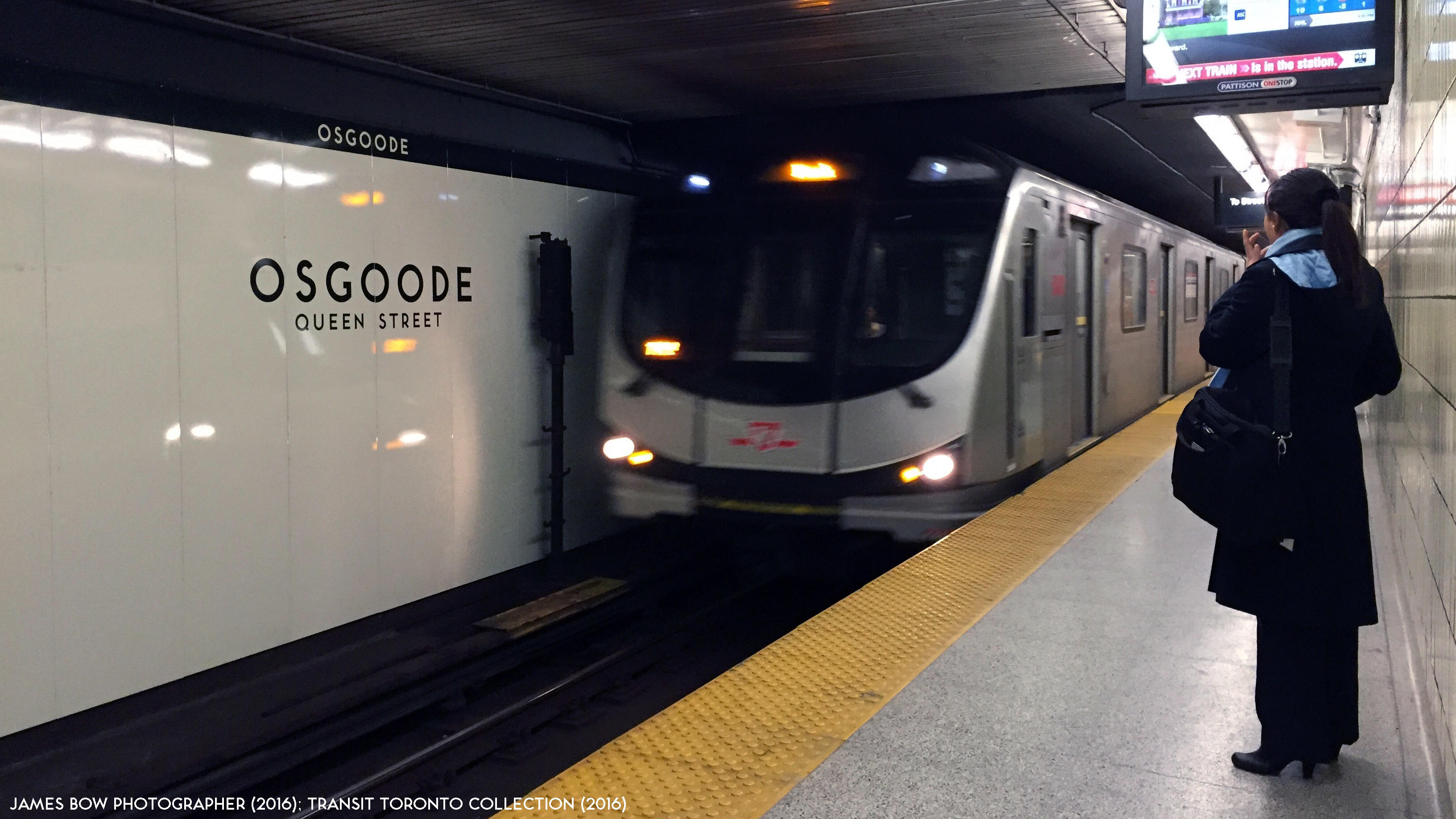
With the development of the "Don Lands," I wonder if Donlands station could have a station platform subtitle saying "Danforth Avenue," similar to Osgoode, to avoid confusion.

ttc-osgoode-station-tiles-20160220.jpg

Transit Toronto
 
With the development of the "Don Lands," I wonder if Donlands station could have a station platform subtitle saying "Danforth Avenue," similar to Osgoode, to avoid confusion.
Donlands is the crossroad. And a major one at that (say compared to Chester ... which being about the same distance from Logan as Greenwood station is from Greenwood, could have been named differently.

Putting "Danforth" at Donlands station would be like putting "University" at Osgoode station or "Yonge" at Dundas station.

Is it really causing much (or any) confusion currently? I haven't seen any confusion in the station and walking around the station area ... I get more people at Coxwell and Danforth wondering where Coxwell station is in my experience.

Also, Donlands is no longer the planned interchange location - they are now planning to use Pape instead.
 
Someone needs to spend more time over on the Relief Line threads!
I don’t understand why you guys are making fun of @mjl08. This issue is about signage at platforms of stations that have similar names of other locations. The Relief Line South doesn’t even have a station named “Don Lands” or a street at Donlands Ave. This is just a way to distinguish between a station/street name and the name of an area.
 

Back
Top