aquateam
Active Member
With all of the ideas for transit lines, if all were built, what would the city look like? I am not just talking the lines themselves, I mean the entire cityscape. What would Toronto look like with real transit?
Not too different from today I reckon. It can take decades for land uses to catch up with transit lines and much of the suburbs would have already been built as sprawl prior to those lines, if those lines were even built.
The trend to build downtown would still happen, development of the raillands and the waterfront would still be happening, STC and other regional sub-centres will still be failures.
Important to note too that it is not like that the large sum of Toronto is a transit desert. It might not be rapid transit, but all those suburban arterials contain very frequent, well-used bus routes with more than decent ridership levels. Transit already does exist, it is just bus rather than LRT or subway.
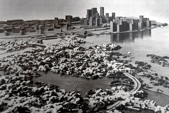
Well for one, that map shows "Proposed Island development" aka Harbour city, which would have had a huge impact on the city if it were built:

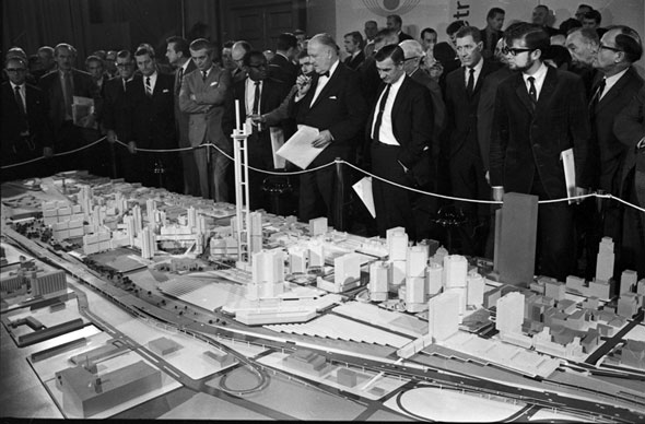
It also shows the "Proposed CN/CR development" aka Metro Center

In general, the worst GTA sprawl happened in the 1990s and 2000s, so having all that transit in place in the 70s would have helped compactify the GTA greatly and probably shift a lot of development to the 416 from the 905. The "City Centers" planning concept still wouldn't have been everything it was meant to be, but it would have been much more successful and you would see less office-park style development. In general, the built form of the GTA would be improved greatly and transit mode share would be a lot higher.
Toronto would be a much more interesting place to visit with it's own floating neighbourhood downtown and with Metro Centre the CN/CP lands would have become a new South Core instead of staying as parking lots for decades.


