Toronto Union Pearson Express | ?m | ?s | Metrolinx | MMM Group Limited

From Metrolinx's twitter:
BIPGlR3CQAI91UH.jpg
 
Last edited:
Which in turn isn't near as impressive as building the SkyBridge, a transit only bridge over the mighty Fraser.

Yes, SkyBridge is much larger and impressive in its own way. But the ride into the airport over the tangled web of roads on four levels and a monorail while looking out at the airport will be something I can wait to try out.
 
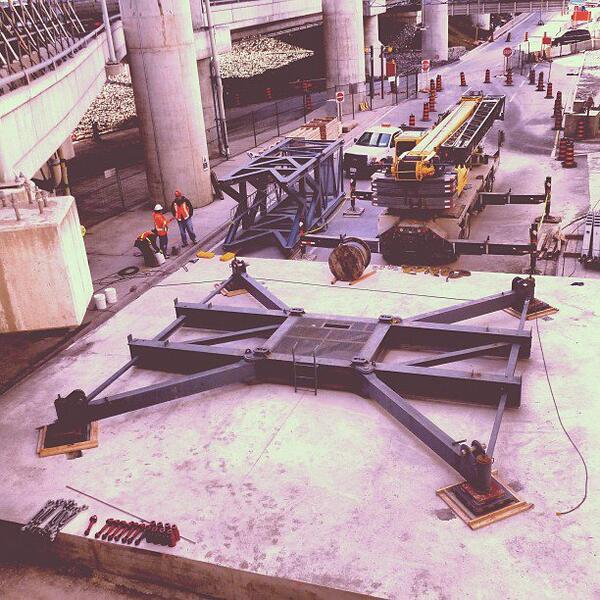
Took a weekend meander of the airport grounds, which is easier said than done because it's probably the most pedestrian-inhospitable place in the city. Snapped some photos to share.

The usual "holy crap they're building this fast" comment continues to apply. All but two of the piers have now been poured. Perhaps the most interesting thing was that the tower crane for the T1 station was in the process of going up, but I didn't get any decent photos of it.

To add some dorky icing to this cake, after taking these I compared with some older shots from various officialish sources (Metrolinx postings and tweets from contractors) where they show a pier in a certain spot and give its number, and I think I've cracked the code in terms of matching piers with the internal numbering system. We know there are 70 of them, and they seem to be counted from #1 (at the north end at Goreway) to #70 (the last one before it merges onto the people-mover's pillars). So I'm going to go ahead and use the numbers I extrapolated, and knowing my luck they'll be wrong and lead to future confusion later on in the thread, but oh well. :) As the guideway builds to its grand finale over the next few months it can't hurt to be able to talk about specific bits of work more easily.

01_garage_n.jpg

View of the guideway from the 7th floor of the T1 parking garage. The guideway had gotten that far when drum118 last visited a month ago so its onward march has been on a bit of a pause. The last pier with girders on it is pier 59. Counting right-to-left from the end of the guideway, the next pier to the left is pier 60 (with the forms still on its top), then there's a gap where pier 61 is missing. That one is immediately east side of Airport Road and is currently still just a foundation. Next comes 62 (forms on top) and then furthest to the left 63 (finished top), which looks to be the tallest point on the guideway.

02_viscount.jpg

Reverse angle from the Viscount parking lot

03_pier63.jpg

Pier 63. Tall.

04_pier64.jpg

Looking southwards at pier 64 squeezed into a tiny patch of space between the various roads and ramps.

05_pier64pier63.jpg

Looking northwards at 63 and 64, with the NB427-to-T1-Departures ramp in between them.

06_piers63to65.jpg

Getting closer to the terminal, pier 65 in foreground.

07_pier66.jpg

Closer still. Pier 66 is a bit of a laggard.
 

Attachments

  • 01_garage_n.jpg
    01_garage_n.jpg
    94 KB · Views: 513
  • 02_viscount.jpg
    02_viscount.jpg
    79.7 KB · Views: 456
  • 03_pier63.jpg
    03_pier63.jpg
    47.3 KB · Views: 450
  • 04_pier64.jpg
    04_pier64.jpg
    52.7 KB · Views: 446
  • 05_pier64pier63.jpg
    05_pier64pier63.jpg
    94.1 KB · Views: 422
  • 06_piers63to65.jpg
    06_piers63to65.jpg
    73.8 KB · Views: 457
  • 07_pier66.jpg
    07_pier66.jpg
    94.7 KB · Views: 445
Last edited:
08_garage2.jpg

Back to the parking garage. From R-L, piers 63, 64, 65, (gap for 66) and 67.

09_garage3.jpg

The remaining bit to go. From R-L, piers 67, 68 (no top), 69 (in form) and 70 (in form). Then comes the modifications they're making to the people-mover's existing piers, better shots in a sec. The people-mover track has been wrapped in black fabric to protect it.

10_piers67to70.jpg

67-70. Interesting how the 'T' is offset on 67, which I presume has something to do with its location on a fairly sharp turn.

11_pier70apm.jpg

So this is how the merge with the people mover is being handled --- they're double-decking the supports that went in 10ish years ago.

12_apmweave.jpg

Closer look. You can see how the people-mover track in the foreground flares out from inside of the pillar to outside of the pillar and climbs, while the new guideway will drop into the space in the middle.

13_garage4.jpg

More.

14_station1.jpg

Wood decking has begun to go down at the site of the station.
 

Attachments

  • 08_garage2.jpg
    08_garage2.jpg
    92.7 KB · Views: 459
  • 09_garage3.jpg
    09_garage3.jpg
    84.6 KB · Views: 462
  • 10_piers67to70.jpg
    10_piers67to70.jpg
    52.6 KB · Views: 432
  • 11_pier70apm.jpg
    11_pier70apm.jpg
    70.3 KB · Views: 441
  • 12_apmweave.jpg
    12_apmweave.jpg
    80.9 KB · Views: 455
  • 13_garage4.jpg
    13_garage4.jpg
    78.8 KB · Views: 441
  • 14_station1.jpg
    14_station1.jpg
    93.7 KB · Views: 450
Last edited:
Man, every time they build something at the airport, it's like they just drop another layer of bridges on top of what's already there.

I went out there on Sunday to have a look at what's going on, but didn't get nearly as good a view. :) I rode the Airport Rocket bus from Kipling. I hadn't been to the airport for a couple of years, and didn't realize that the Terminal Two parking garage was finally demolished. This makes the existing road network very odd though; there are quite a number of angles and curves and blocked accesses that no longer make sense now that the T2 access roads are all gone.

Any chance they'll kind of rationalize things a bit? It would be nice to have a more direct route in and out--I'm not sure of the purpose behind the route the bus took on Sunday.

(Actual pedestrian/bicycle access to the airport would be nice too. And a proper bus terminal while we're at it...)
 
Any chance they'll kind of rationalize things a bit? It would be nice to have a more direct route in and out--I'm not sure of the purpose behind the route the bus took on Sunday.

It seems like the 192 takes that weird loopy route in order to service the Jetliner Road stop. If the bus took the more direct route, i.e. the ramp straight off the northbound 427, it would (narrowly) miss the "Airport Roadway at Jetliner Road" stop on the overpass over Jetliner Road. But because of the loop it has to take, it actually ends up stopping at Jetliner Road *twice* before getting to the terminals -- once at ground level and then again on the overpass -- which is kind of annoying.
 
Last edited:
It seems like the 192 takes that weird loopy route in order to service the Jetliner Road stop. It the bus took the more direct route, i.e. the ramp straight off the northbound 427, it would (narrowly) miss the "Airport Roadway at Jetliner Road" stop on the overpass over Jetliner Road. But because of the loop it has to take, it actually ends up stopping at Jetliner Road *twice* before getting to the terminals -- once at ground level and then again on the overpass -- which is kind of annoying.
Hmm. The bus hit T1 first, where I got out, then later it somehow reached T3. I seem to recall it hitting T3 first in the past, then later T1, and hitting that pedestrian access stop as well without having to exit to Airport Road after the 427. Am I imagining things? I thought maybe the order was changed because of the construction blocking accesses.
 
Hmm. The bus hit T1 first, where I got out, then later it somehow reached T3. I seem to recall it hitting T3 first in the past, then later T1, and hitting that pedestrian access stop as well without having to exit to Airport Road after the 427. Am I imagining things? I thought maybe the order was changed because of the construction blocking accesses.

True, now that you mention it, the order did used to be different. Transit Toronto has a map from 2011 in which the order was T3 - Jetliner - T1. (Currently it's Jetliner lower - Jetliner upper - T1 - T3.) It was still pretty loopy, and took annoyingly long to get to T1.
 
I'm not quite sure how far along the T2 clean up is, or if it's actually completed. However the plan is to continue extending T1 into the area that T2 used to occupy. First with Tier H and on as needed.

As the Terminal is extended the parking structure will follow it as well (and a second T1 Link train stop). As of right now there are some airplane stands for smaller commuter airliners which do not use air bridges there. So I guess the road network will be sorted out once a) The cleanup of T2 is complete and b) expansion of the Terminal begins.

None of the plans I have seen show the parking structure being extended in the direction of T2, If that is what you mean, only another station for the Link train will be added, the terminal building will follow around the curve of the southern end of the parking structure,
 

Back
Top