Deadpool X
Senior Member
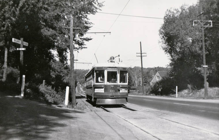
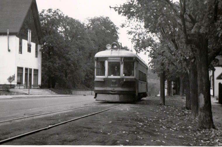
What is TTC doing in Aurora?
TTC had a much larger service area back in the day (they had interurbans running all the way to Hamilton, and they might've had some running to Niagara although I'm not too sure about that).What is TTC doing in Aurora?
the TTC took over operation of the Metropolitan Street Railway in the 1920s. it went all the way up to Lake Simcoe along YongeWhat is TTC doing in Aurora?
There was a gap between Port Credit where the Lakeshore ended and Oakville where the Hamilton lines (which never had TTC involvement) picked up.they had interurbans running all the way to Hamilton
The most common way to have a dual-gauge setup is with a common rail, yes.I could be wrong, but I don't think the tracks gauges are one inside the other. I think each gauge uses a common rail on the outside, and the standard/TTC gauge is based on the distance to which of the pair on the other side they use.
Now, why this configuration is using four rails instead of three, I'm not sure. But if I were laying rail for two separate gauges on the same corridor I'd try to cut my costs by only using three rails.
Along a right-of-way.the TTC took over operation of the Metropolitan Street Railway in the 1920s. it went all the way up to Lake Simcoe along Yonge
That makes total sense, and after looking at the photo again it also explains why the distance between the left pair looks slightly different from the right pair. Thanks for clarifying!The most common way to have a dual-gauge setup is with a common rail, yes.
In this case however, the gauge is so close together that it is impossible to use a common rail. The difference in gauge is about the width of the flange.
In the photo, the standard gauge trackage is the left rail, and the second rail from the right, whereas the TTC gauge is the right hand rail and the second rail from the left. They are interleaved.
Dan
TTC track gauge is 1,495 mm (4 ft 10+7⁄8 in).That makes total sense, and after looking at the photo again it also explains why the distance between the left pair looks slightly different from the right pair. Thanks for clarifying!
Ah, of course! That must be it! Thanks!I could be wrong, but I don't think the tracks gauges are one inside the other. I think each gauge uses a common rail on the outside, and the standard/TTC gauge is based on the distance to which of the pair on the other side they use.
Is this official? Some of the graphics they show seem bizarre.Interesting work from the folks at SmartDensity... https://smartdensity.com/ontario-line/
Is this official? Some of the graphics they show seem bizarre.
If you believe what's in the 10-minute walking distance, no where on Dufferin north of the Gardiner is a 10-minute walk from Exhibition station. And nowhere in Corktown, right across the river from East Harbour station is walking distance from the station? Also completely ignores the Broadview extension.
It depends which part of Corktown. (parts of which would be closer to the station near Parliament and King). In particularly I was thinking of Corktown Common - which surely is in the walking distance, unless they've changed the station design without telling anyone.Assuming the East Harbour station is south of Eastern and Broadview, it would be pretty hard to get to Corktown in 10 minutes at a slow pace. You have to go across the Eastern Bridge, then down the pedestrian switchback bridge. That would take most of 10 minutes unless you're a pretty fast walker. The next option is the Queen bridge, but it would definitely take 10 minutes to walk up to Queen and across the bridge.
