HHC
Active Member
Looks great, hopefully it stays true to the render though.
Given the proximity to the city I would have thought they'd have planned it to be more accessible by transit


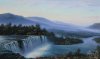
It must have been something when the valley wasn't marred with the DVP and Bayview Extension. Miles of unimpeded forest. If only there was a way to remove the roadways and relocate them elsewhere...I wish I was alive during the time it was relatively virgin, so I could have hiked it without the sound and barriers that are now extant.The Don Valley would make for an amazing central park if it were a blank slate today. Rethinking the transportation corridors that marginalize the space presently would allow us to move towards that goal.
It must have been something when the valley wasn't marred with the DVP and Bayview Extension. Miles of unimpeded forest. If only there was a way to remove the roadways and relocate them elsewhere...I wish I was alive during the time it was relatively virgin, so I could have hiked it without the sound and barriers that are now extant.
It must have been something when the valley wasn't marred with the DVP and Bayview Extension. Miles of unimpeded forest. If only there was a way to remove the roadways and relocate them elsewhere...I wish I was alive during the time it was relatively virgin, so I could have hiked it without the sound and barriers that are now extant.