News   Jan 06, 2026
 733     4 
News   Jan 06, 2026
 1K     8 
News   Jan 06, 2026
 845     1 

Toronto Eglinton Line 5 | ?m | ?s | Metrolinx | Arcadis

These vehicles have been in successful operation since June 21, 2019 in Waterloo Region with minimal, if any, issues regarding level boarding.
My concern was if the platforms here were each built to the correct height, which considering the other problems they've found
 
Wasn't there a station where the platform had to be torn out and redone due to incompatible platform height? Maybe that was on St. Clair, idk.
St Clair had some platforms redone for Flexitys as it was built for CLRVs. Same for some platforms along Roncesvalles. This isn't a full rebuilt but a spot where the ramp would load. The Freedoms don't have a ramp and won't have that problem.
 
Avenue station and Yonge station are still the two biggest visual culprits of the line not being completed. The plaza at Yonge still needs to be completed as well as replacing the road deck.
The roads outside of Avenue still needs to be replaced/completed.
Seating still needs to be added to the majority of the at grade stops
Oh and I guess the 3rd enterence which will be located inside of that new building at Bathurst n Eglinton needs to be completed. Not sure if that counts in this work or is the buildings problem
 
Toronto does not have a substantial enough rapid transit network to make it necessary to call out rapid transit stops specifically in the name of simplifying navigation, nor will it for the next 50+ years. This isn't Manhattan or central London, with a station on near every corner, the mere presence of a TTC logo is noticeable enough. With the Crosstown specifically the need is even less, as the line is well outside of the city centre. What are people in Scarborough going to confuse it with?

As I said before, it is a solution in search of a problem.
The size of the system doesn't change wayfinding best practices. When you're looking for any particular station, how many other stations exist isn't relevant. Plenty of small systems have unique signs for their metro stations, for example Rome, Helsinki, and even Ottawa.
 
Just a quick set from Laird's station.
20231016_184547.jpg
20231016_184553.jpg
20231016_184557.jpg
20231016_184559.jpg
20231016_184609.jpg
 
I have been always been critical of Metrolinx’s wayfinding approach. That said, at some point:
  • You kill the entire idea
  • OR, you fully commit to it and roll it out over the region and all transit services
Unfortunately (probably due to $$$) we have neither approach, so we’ll be left with another wayfinding standard to add to the plethora we have.

(Side-note: I do like the pillars; am torn on the suggestions for improvement.)
 
I have been always been critical of Metrolinx’s wayfinding approach. That said, at some point:
  • You kill the entire idea
  • OR, you fully commit to it and roll it out over the region and all transit services

As conceived, the Kill option is the correct one. I would legislate the bill to be split 10% to Phil Verster, 20% to the Mx Board, and 70% to the consultants who proposed the idea. The gov't will pick up the balance, replacing every single pillar with standard TTC signage.

***

I note your like of the pillars; I have no problem w/them in principle, the problem I have w/them, if you look at them, is that the icons/logos/detailed info on them is so small as to be unreadable/recognizable at any distance.

The pillars are really designed to be seen at a distance, but in that context, you want a logo that is universal, easy to understand, and one you can clearly identify a block away. The TTC's existing subway signage better serves this purpose, and could simply get a height lift if desired.

Once you're at the station, you might benefit from more detailed information (Line numbers, station name, area map, retail services inside), but none of that fits sensibly onto a pillar/pylon and would be better displayed in another form.

***

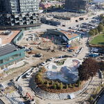
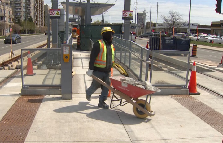
Line 5 has the added complication of the large surface sections and the underground; and importantly, the surface sections in the east end which will get minimal, if any transit priority. I'm not a champion of underground everywhere, but aside from mismatching the enormous density now proposed at the Golden Mile; the inconsistency in line format means the east end really is not rapid transit, merely intermediate capacity transit; and I would argue the two distinct sections of line really ought not to be identified in the same fashion in that context. Line 2 is both surface and underground, but it is always grade-separated (no traffic lights/intersections shared with auto traffic). So many bad decisions here.
 
Last edited:
According to this document, the wayfinding system on the Crosstown will slightly differ from Metrolinx's standard's as the Crosstown contract was signed before Metrolinx finalized their wayfinding standard in 2019. The main difference's would be the prominence of the TTC logo and also that the Crosstown would have a distinctive "Light Rail" icon, which Metrolinx wants to replace with a generic "Rapid Transit" icon (Ion also has the "Light Rail" icon).

ECLRT Wayfinding
 
The slightly different version of “Metrolinx Standard” is also used by UP Express at Pearson Airport.
 

Back
Top