News   Nov 22, 2024
 558     1 
News   Nov 22, 2024
 1K     5 
News   Nov 22, 2024
 2.7K     8 

Toronto Crosstown LRT | ?m | ?s | Metrolinx | Arcadis

Looking at this video, my first thought is all of Eglinton is really going to gentrify. It'll be quite the change a couple decades out from the time the line opens.

It shows how much of the area surrounding the stations need to be redeveloped and intensified - the current land use around them is an utter waste of the increased accessibility.

AoD
 
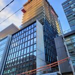
Most of these photos (including all the ones with the GFL excavators) are of the condo project, not the station project.

The station project officially includes two entrances, one in the NE corner of Bathurst and Eglinton and one where the House of Chan was, and both are well above grade and about as close to being finished as any other Crosstown structure in this part of the world. So safe to assume they're on track to open whenever the rest of the line is ready.

The condo incorporates a bonus entrance (that will come via a knock-out panel) that was never really expected to open with the rest of the line. If anything, the delay to the Crosstown means it may lag behind the rest by a fairly small margin in the end.
the developer is Centrecourt too who builds at super fast speeds so it likely won't be far off at all.
 
Also - good to see Keelesdale so close to substantial completion. Notice the lane restrictions are gone and the first bit of Eglinton Connects is built too!
 
This picture shows how much Eglinton Connects needs to be implemented sooner than later. It's nice that Metrolinx is putting in the bicycle lanes at the stations, but the connections between stations will be sorely needed. If you're cycling eastbound, after the bicycle lane ends, you need to merge into traffic then navigate around parked cars.
The "bicycle lanes" could connect with the Beltline Trail going north at Caledonia Station and east, except that the Allen Road is a barrier. Cyclists and pedestrians have to detour around it. There used to be a berm used by the belt line railway, but the powers-that-be removed it when they transformed the Spadina ditch into the Allen Road.

989b4f7401ec24c1a23e7e31b89d9050
From link.
A break existed in the ditch for the old Belt Line railway right-of-way just north of Eglinton Avenue. Here it is in 1971.

They should bridge the Allen Road.
 
^The reduction in the number of orange pylons on Eglinton is impressive.

Hopefully the folks along Eglinton will get their street back soon.

- Paul
 
June 16
The westbound curb lane and sidewalk being built between Black Creek and Weston Rd on Eglinton. Looks like the westbound Weston Rd connection will be wider and a longer crossing for pedestrians. Traffic was real backup going east and westbound was a bitch at Black Creek with the left turning lane being the only lane open.

Turning lane for eastbound at Black Creek and sidewalk torn up to be rebuilt. I guess the final connection to NO Frills driveway and Eglinton can finally be completed after a year wait.

Handrail still missing for all of the guideway as well at the portal.

The removal of pylons east of Black Creek has allow traffic to flow better as well becoming a race track

As a note to Keelesdale Station, I counted 5 mid landings for the stair for the south east corner and became too dark to say if there are more of then. One hell of a climb. It deeper than the main entrance unless the main entrance is not telling the whole story.
 
> Accessibility best-practice suggests that all messaging should be in mixed-case lettering. Mixed-case makes it easier to tell different characters apart, particularly for those with low vision.

Wait what?

idk about you guys but I always found mixed case harder to read especially on signage. Also mixed case looks really weird and awkward when placed on a banner especially on an entranceway.
 

Screen Shot 2021-06-17 at 3.24.06 PM.png


This is so incredibly stupid. As if riders are supposed to differentiate a "side view" LRV from the "front view".

Standards are 'frozen' early on in projects delivered through the Alternative Finance and Procurement (AFP) model as means of managing costs and avoiding on-going revisions or changes.
Due to this set up and some contractual quirks, the Metrolinx Wayfinding team does not have review rights over Crosstown signage. This review is conducted by a technical advisor working directly on the project.
This should be a massive red flag. I hope this is not indicative of a general inflexibility to change due to the Crosstown's management structure.

Screen Shot 2021-06-17 at 3.31.24 PM.png

Yea, the "Line 5" iconography will appear everywhere but the exterior of the station, where we're stuck with the illegible "LRV" iconography.
 

Eglinton Ave W - Weston Road & Black Creek Drive

52f41d03-2cb2-ed57-bea9-fbd1a52d78c7.jpg
889806a5-fb94-683a-45f9-b24575c1d10f.jpg


Between June 17 and June 25, crews will be conducting nightly closures of the east and westbound lanes of Eglinton Avenue W between Black Creek Dr and Weston Rd to facilitate wet utility connections work. Closures will be in place between 8:00 pm and 6:00 am, on the evenings of June 17, 18, 20, 25, and 25, 2021. Vehicles will be detoured south on Black Creek Dr and Weston Rd. Please carefully review ‘Lane Closure Details’ and ‘What to Expect’.​


What to Expect​


Crews will be performing wet utility connections work on Eglinton Ave W on the evenings of June 17, 18, 20, 25, and 25, 2021. Lane closures will be in effect between 8:00 pm and 6:00 am. Vehicles will be detoured south on Black Creek Dr and Weston Rd. A PDO will be present to direct traffic.​


Hours of Work​

  • Work will take place on the evenings of June 17, 18, 20, 25, and 25, 2021
  • Work will take place between 8:00 pm and 6:00 am
  • Work may be rescheduled due to unforeseen circumstances
  • The contractor may not always work during the permitted hours but may do so at its discretion
  • This work may take longer or shorter than expected

Traffic Details​

  • East and westbound lane closures will be in effect on the evenings of:
    • June 17, 24 & 25
  • Westbound lane closures will be in effect on the evening of:
    • June 18
  • Eastbound lane closures will be in effect on the evenings of:
    • June 20
  • Vehicles will be detoured south on Black Creek Dr and Weston Rd

Pedestrians Details​

  • The east crosswalk at the Weston Rd intersection, and the west and north crosswalks at the Black Creek Dr intersection will be closed for the duration of all east and westbound lane closures
  • The east crosswalk at the Black Creek Dr intersection will be closed on June 18 & 20, 2021

Transit Information​

  • Advanced notification signs will be installed on Eglinton Ave W, Weston Rd and Black Creek Dr.
  • Please review the TTC detour maps below for details of the temporary TTC routes and TTC bus stop relocations on the specified evenings.
 
Wait what?

idk about you guys but I always found mixed case harder to read especially on signage. Also mixed case looks really weird and awkward when placed on a banner especially on an entranceway.

Designers usually reach for mixed-case on signage – research has shown it to be more legible, possibly because lower-case letterforms are much more varied – the ascenders and descenders mean that from afar (or in low light, or for people with low vision), words have distinctive shapes, as opposed to using all upper-case, where words are all just rectangles. (There's some research that suggests that word-shapes are recognized before letter-shapes, which is kind of neat. For example, in the screenshot in TheTigerMaster's post above, the text is blurry, but I can still tell that the signage in the rendering says "Eglinton Avenue West" from the shape of the words.)

Of course, using all upper-case, the letters are larger, and bigger type is more legible from a distance, but that can be offset to a degree by using a typeface with a larger x-height and counters (which was the reasoning behind the creation of Clearview for highway signs).
 
...Yea, the "Line 5" iconography will appear everywhere but the exterior of the station, where we're stuck with the illegible "LRV" iconography.

The reason the "Line 5" bullet doesn't appear on station exteriors is because, from Metrolinx's wayfinding standards, the approaches or entrances to stations are to only denote the mode of transports available at the station. This is a breakdown from their standards pdf on how passengers are to follow the signage:
Capture.PNG


I see the logic in it as this looks like a copy and paste of London's wayfinding standards. However, I agree that the transport modes iconography seem difficult to distinguish from a distance unlike TfL's roundel which are distinguishable through their colours.
 

Back
Top