sixrings
Senior Member
Bickering here won't do anything. The new residents on Eglinton complaining to their councillors will be the only thing that does anything.
Most buses integrate with the subway, so that point is redundant. Most underground LRT stations apparently won't even have faregates, so bus integration won't likely occur at Caledonia, Keelesdale, and Science Centre.This would just add unnecessary confusion to the public. The system map is designed for navigability not technical correctness. Although the LRT lines would be slower, they are designed to integrate with Subway/RT system with underground connections at Kennedy (Line 5) and Finch West station (Line 6). They are designed to move more riders than the local streetcar/bus with more frequent services.
You mean like this?
View attachment 244449
And the actual train that goes directly to the airport is nowhere to be found.
It maybe own by Metrolinx, but the City Transportation calls the shots for traffic signals. Until City Transportation changes its thinking, transit will remain 3rd class to them.Because it's not owned by the TTC it's owned by Metrolinx.
I was referring to why the up express isn't on the TTC map and the TTC having the airport rocket on it.It maybe own by Metrolinx, but the City Transportation calls the shots for traffic signals. Until City Transportation changes its thinking, transit will remain 3rd class to them.
Then try riding ION system and look at the mess traffic gates kills the speed of the system.
The Green Line of Minneapolis runs very faster and a lot better than a TTC streetcar line ROW.
You can only put so much on a map on a line system, before confusing riders. Yes for a total system map.I was referring to why the up express isn't on the TTC map and the TTC having the airport rocket on it.

I understand that completely hopefully whatever map they put up is better designed then the one they put up on line 2You can only put so much on a map on a line system, before confusing riders. Yes for a total system map.
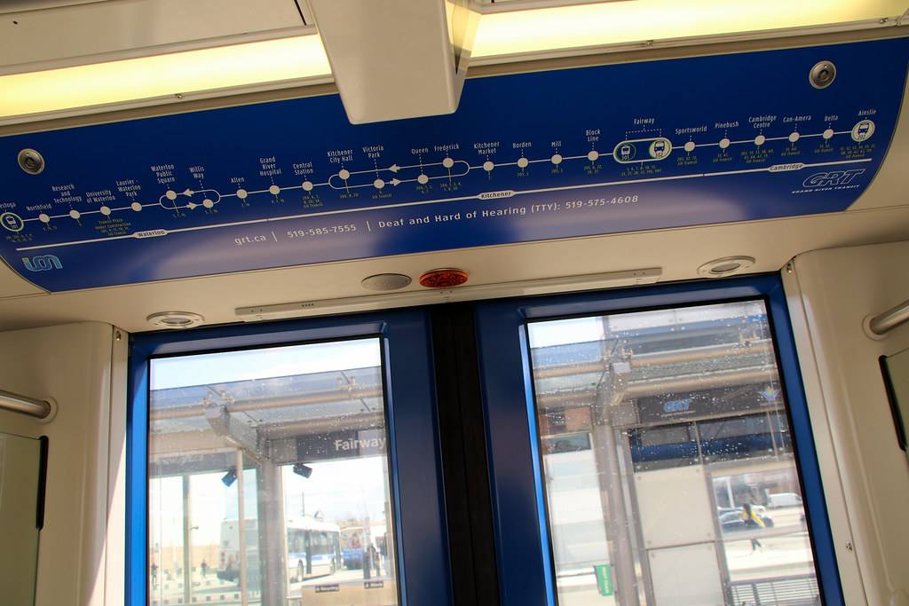
ION has a nice map on their LRV that is line to what can be found in Europe and something TTC needs to look at.

Nope because the city is too stupid to implement it. Unless we have some real leadership down the line.Signal priority is something that could be (relatively) easily added down the road, perhaps we can stop bickering?
I actually don't mind the Line 2 map that much. What's so wrong with it?I understand that completely hopefully whatever map they put up is better designed then the one they put up on line 2
Signal priority is something that could be (relatively) easily added down the road, perhaps we can stop bickering?
How on earth do the traffic gates kill the speed of the system? The waterloo spur and Huron Park spur sections are the fastest on the line. The Line doesn't yet have ATP, which kills the speed.Then try riding ION system and look at the mess traffic gates kills the speed of the system.
So? Most rapid transit maps show commuter and airport lines, including cities with much more complicated systems than Toronto's. This will get more important as GO expands RER and plays a larger role in urban transportation. Who owns what should be irrelevant.Because it's not owned by the TTC it's owned by Metrolinx.
Yes, cramming the entire system map above the doors becomes less and less sustainable as the system expands.You can only put so much on a map on a line system, before confusing riders. Yes for a total system map.
ION has a nice map on their LRV that is in line to what can be found in Europe and something TTC needs to look at.

There are a number of locations where the LRV has to come to a halt or crawl up to the crossing as the gates are so slow coming down. It was that way before opening day, opening day and last week.How on earth do the traffic gates kill the speed of the system? The waterloo spur and Huron Park spur sections are the fastest on the line. The Line doesn't yet have ATP, which kills the speed.
It's great if you know what the yellow circle with a 1 in it means and where the line goes from there. What they should have done is put a light coloured line going up or down from them saying where line 1 goes. Many people have said that people can use the full system map that can be found by the door, however most of the trains I've been on there isn't one to be found as they all have advertising on them.I actually don't mind the Line 2 map that much. What's so wrong with it?
—You mean like this?
View attachment 244449


