News   Apr 26, 2024
 1.6K     4 
News   Apr 26, 2024
 356     0 
News   Apr 26, 2024
 918     1 

Roads: Ontario/GTA Highways Discussion


Ontario will also upload 174 in Ottawa.

Any bets now on whether the Linc/RHVP and E.C. ROW are up next? The province is already paying for a new interchange on the EC ROW..
I guess they don't want people to note that this will be a 're-upload' since it used to be Hwy 17.

I'm a wee bit surprised of the timing. I would have thought this - and maybe the two you cite, would be announced during a municipal election or held for the next provincial ones.
 
I guess they don't want people to note that this will be a 're-upload' since it used to be Hwy 17.

I'm a wee bit surprised of the timing. I would have thought this - and maybe the two you cite, would be announced during a municipal election or held for the next provincial ones.
The big reason for the upload is because many of the bridges are reaching EOL and need replacing, something that is very expensive and Ottawa doesn't have the money for. This is basically a gift for the city similar to uploading the Gardiner.

Unless E.C Row and RHVP have similar issues I don't see them being uploaded.

Wasn’t much of the 174 recently upgraded along with the Orleans LRT extension?
 
Coming home from the us today, all highways in, around and near Buffalo have signs up warning travelers to expect delays on April 8

Heading to Detroit on Sat, had a look at the roadwork west of Hwy 8 for the centre bridge as well the new roadwork. Photos will follow this coming week.

I see they finally put in the poor use HOV lane for all the new sections in Cambridge and what a waste.

Saw an unmarked OPP car pull over a single driver in the HOV on the QEW with tons of single drivers passing it. Unless you were not willing to do 130+ in that HOV lane, you were not welcome in it as cars were flipping around them illegally doing lane changes where they were not to do it.

They really need to widen the 403 to 4 lanes from the QEW as it is a pain to crawl up it until you get to the 407/403 split.
 
No timeline on the 413 or Bradford Bypass.

This is progress of the Yonge interchange for the Bradford bypass from earlier today.

1000017926.jpg
 

Ontario Advances Construction to Expand Garden City Skyway​

Province building two, four-lane bridges to help fight gridlock and move people and goods across the Greater Golden Horseshoe
April 05, 2024
Ministry of Transportation
ST. CATHARINES – The Ontario government has issued a Request for Proposals to advance the expansion of the Queen Elizabeth Way (QEW) Garden City Skyway, marking another milestone in the province’s plan to reduce gridlock, connect more people to jobs and provide a crucial link between Ontario’s international border crossings and the Greater Golden Horseshoe.
“With Ontario’s population growing at a historic rate, we need to ensure our transportation infrastructure keeps pace,” said Prabmeet Sarkaria, Minister of Transportation. “The new and expanded Garden City Skyway will be a game-changer, meaning less congestion and faster travel for the people of St. Catharines and Niagara Region.”
The Skyway expansion includes construction of a new four-lane, 2.2-kilometre bridge across the Welland Canal, as well as the rehabilitation and full deck replacement of the current bridge. Once complete, each bridge will have four lanes with the new bridge carrying Toronto-bound traffic and the upgraded existing bridge carrying Niagara-bound traffic.
“The Request for Proposals (RFP) is an important step on the path to expanding the Garden City Skyway. With the projected increases in population and jobs throughout the Greater Golden Horseshoe in the coming years, this expansion will allow people and goods to travel more freely through Niagara,” said Mat Siscoe, Mayor of St. Catharines. “The City of St. Catharines is looking forward to the completion of this project and the economic growth that will accompany it.”
The expansion of the Garden City Skyway is among the more than 100 actions identified in the government’s Connecting the GGH: A Transportation Plan for the Greater Golden Horseshoe.

Quick Facts​

  • On average, 106,000 vehicles cross the Garden City Skyway bridge daily.
  • By 2051, the Greater Golden Horseshoe’s population is estimated to grow from 10 million to almost 15 million people. Over the same period, the region’s employment figures will grow from almost five million to seven million jobs.
  • The Greater Golden Horseshoe sees $1.16 trillion in goods transported annually on its highways.
  • The government of Ontario has committed more than $3 billion in funding for the 2024–25 Ontario Highways Program, which features 650 expansion and rehabilitation projects.

Quotes​

"Ontario’s highway infrastructure is critical to the growth and economic prosperity of our province. As part of our plan to build Ontario, our government is continuing to invest in essential infrastructure like the Garden City Skyway to make it easier for people to travel, while supporting businesses that rely on Ontario’s highways and bridges to deliver goods."
- Kinga Surma
Minister of Infrastructure

"Our government is delivering on its plan to build by investing in critical infrastructure like the Garden City Skyway. Drivers know that under the leadership of Premier Ford, our government is getting it done by building better roads to reduce gridlock and get people moving. By strengthening the link between the Greater Golden Horseshoe and U.S. border crossings, we’re supporting our province’s supply chain, strengthening our economy and building a better Ontario."
- Sam Oosterhoff
MPP for Niagara West
 
Tangentially related to Highway 3/4 in St. Thomas - the city of St. Thomas has released its Environmental Study Report for the Major Arterial Roadway that will run south of the VW/PowerCo battery plant, acting as a functional extension of Highway 3 along the former ROW reserved by MTO.

The ESR recommends a staged freeway-like design, with a 15m median (slightly narrower than the design for Highway 3), with a roundabout at a new street intersection adjacent to the Hydro One substation, and traffic lights at the Yarmouth Centre Road intersection. Speed limits on this section will be 80 km/h.

IMG_0203.jpeg


IMG_0204.jpeg

IMG_0205.jpeg

IMG_0206.jpeg

IMG_0207.jpeg
 
Coming home from the us today, all highways in, around and near Buffalo have signs up warning travelers to expect delays on April 8

Heading to Detroit on Sat, had a look at the roadwork west of Hwy 8 for the centre bridge as well the new roadwork. Photos will follow this coming week.

I see they finally put in the poor use HOV lane for all the new sections in Cambridge and what a waste.

Saw an unmarked OPP car pull over a single driver in the HOV on the QEW with tons of single drivers passing it. Unless you were not willing to do 130+ in that HOV lane, you were not welcome in it as cars were flipping around them illegally doing lane changes where they were not to do it.

They really need to widen the 403 to 4 lanes from the QEW as it is a pain to crawl up it until you get to the 407/403 split.
The QEW is the only highway where people seem to generally go less than the limit in my experience. (minus the HOV usually)

Also took the Gardiner with the closure today, added a lot to my commute. Can't imagine for the people who leave later.
I guess we get to see if induced demand really works here :rolleyes:
 
I decided to do some digging around tonight on any information pertaining to the plans from the early 2000s regarding London's long-planned "Ring Road" network. I was able to find a wealth of interesting (at least I find it that way lol) content relating to the planning process in two documents. The first document is the 2001 London Long-Term Transportation Corridor Protection Study, and the second is the 2007 Veteran's Memorial Parkway Interchange Class EA. Both documents have been long-since deleted from the City of London website, but executive summaries and info from Public Information Centres (and design plates for interchanges on the VMP) have been archived.

Starting with the 2001 LTTC Protection Study, the aim of the study was to identify transportation options for what was considered "full build-out potential" of London at the time, which was identified as a city population of 675,000 people (2x the approximate population of 336,539 in 2001, and now 1.6x the approximate population of 422,324 in 2021) based on land availability, servicing ability, and city planning policies. Population growth was identified to most likely be concentrated in the north/west parts of the city, and employment growth was identified to most likely be concentrated in east London, downtown, and along the 401/402, even taking into account for a future of increased work-from-home, as well as London's goal of achieving 15% reduction in single-occupancy vehicle usage. It was identified that the vast majority of London's infrastructure was going to be insufficient due to a multitude of factors, including limits on road widening in many areas and lack of complete through-corridors that could be practically addressed. The study ultimately recommended a very large slate of infrastructure upgrades to meet demand once this "build-out potential" is reached, including the implementation of 3 rapid transit corridors (Oxford Street from Hyde Park to VMP, Dundas Street-Riverside Drive from Hyde Park to VMP, and Richmond Road-Wellington Road from Sunningdale to HWY 401, some of which were even identified to possibly support LRT), 2 freeways/expressways (VMP freeway conversion from Clark Road to HWY 401, and a new western freeway along Westdel Bourne/Woodhull Road from Oxford Street to HWY 402 or 401), and multiple suburban roadway widenings to 4 or 6 lanes. Interestingly, a northern freeway segment was not considered necessary, as future widenings along Fanshawe Park and Sunningdale were considered adequate.

LST-1.png

LST-2.png

LST-3.png

LST-4.png


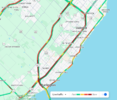
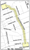
Following this was the 2007 VMP Interchange Study, which appeared to be the start of implementing a portion of this plan to address future demand, using the same "build-out potential" population as the 2001 LTTC Protection Study. Worth noting as well that this study also contains a 2027 population projection, which was estimated to be 421,200 (arguably, not a bad prediction), which was already exceeded in 2021. A number of options were studied, including a 4-lane arterial and a 6-lane arterial, but the 4-lane freeway option was ultimately chosen for maximum traffic benefits. Interchanges were planned for Bradley Road, Hamilton Road, Gore Road, Trafalgar Street, Dundas Street, Oxford Street, Huron Street, and Clarke Road, all of which would be in a Diamond configuration with the exception of Bradley Road, which was designed in a Parclo AB2 configuration. Interestingly enough, however, the chosen interchange designs were only anticipated to perform at a "poor to fair" level of service.

VMP-3.png
VMP-4.png
VMP-6.png
VMP-7.png
VMP-8.png
VMP-9.png

VMP-10.png

VMP-11.png

VMP-12.png


To tie this up, it is interesting to see what has been planned juxtaposed with what has actually been built so far with around 100,000 more people in the city. The only rapid transit lines to make it into construction so far include the Wellington South BRT spur and a hybrid Dundas-Oxford West BRT spur (along with the Downtown BRT loop). Almost none of the 6-lane road widenings have occurred, with the only proper 6-lane section of road in the city being a portion of Wellington Road South. Some of the 4-lane widening has happened, predominantly in the north and west, and a small number of these projects are currently in planning (such as the Bradley Road widening/extension). Little has happened regarding any of the freeway plans either, with the exceptions of a new interchange on HWY 401 with Wonderland Road in 2014, an interchange upgrade on the VMP at HWY 401 in 2018 to provide southbound access to Wilton Grove Road, and a 2-lane extension of the VMP past Huron Street to Clarke Road in 2020. London appears to have, at the very least, protected some ROW for the VMP interchanges, as well as future widening of the new north section of the VMP, but has done nothing so far regarding the western freeway. It’ll be interesting to see how much London will build in the time it takes to reach its "build-out" population of 675,000 people, but it is likely that this number has increased significantly with changes to the Official Plan since 2001.
 

Attachments

  • VMP-2.png
    VMP-2.png
    70.5 KB · Views: 4
  • VMP-1.png
    VMP-1.png
    165.8 KB · Views: 5
Last edited:

Back
Top