News   May 08, 2024
 37     0 
News   May 07, 2024
 547     0 
News   May 07, 2024
 475     1 

Planned Sprawl in the GTA

Scarborough has around 800 metre wide concession blocks for the east-west direction, but the north-south direction remains at 2km.

Scarborough north of the 401 has several east-west arterials which break up the 2km gaps though, with Huntingwood and McNicoll.

Most of the GTA operates on a much larger concession grid than Scarborough, with varying levels of attempts to introduce new arterial roads within them. York Region is probably the worst offender with almost no new arterials to break it up and a concession grid which is in itself pretty disconnected with a lot of gaps.

One of the best things a city can do is shrink it's arterial grid size in my opinion. It just makes it a more pleasant city for everyone. Less traffic, better for transit, density, and walking, etc. I find the severity of traffic in any given part of the GTA corresponds fairly closely to how large the arterial road grid is.

2kmx2km:
- All of York Region
- Toronto
- North York
- southeast Mississauga
- Burlington
- Oakville
- Northern Durham Region

3km x 1.25km
- Brampton
- Rest of Mississauga
- Halton Hills
- Caledon

1.5km x 1.5km
- Milton

2km x 1km
- Etobicoke

2km x 800m
- Scarborough
- Pickering
- Ajax
- Whitby
- Oshawa

and the winner for smallest concession grid:

1km x 800m
- Hamilton

Hamilton Mountain, despite being just as suburban as any other part of the GTA, notably has no real 6-lane roads and indeed many of the concession arterials operate perfectly fine as 2-lane roads with bike lanes, and minimal real traffic issues. Even the 4-lane roads are usually built to much lower design speeds and designed to have much lower volumes than other GTA municipalities as each arterial simply needs to handle far less traffic.

Hamilton also sees very high suburban transit ridership and has a dense bus grid providing frequent service.

It's a similar storey for north-south arterials in Scarborough, which have a dense bus grid, lower design standards for lower vehicle volumes, basically no traffic, and some of them have never needed to be widened to 4 lanes.

Now compared to the mega-beast roads in Mississauga and York Region which have to shove tons of traffic onto a very small grid of arterial roads... HIghway 7 through downtown Vaughan is a total traffic sewer as it's the only east-west arterial for 6 kilometres between Steeles and Rutherford! That same distance in Hamilton would have 6 different arterial roads to disperse the traffic!
You know, I had to actually bite my tongue to mention how fitting Hamilton’s grid is. I’m from the city so I’m quite familiar with it and how useful it is for getting around. It also makes Hamilton feel much bigger; hitting an arterial every km or so gives the impression your covering a very large distance. I was in for quite a shock when I lived in Toronto for the summer.

The benefits of such a grid are obvious. I like to point out to folks that YRT has the same yearly ridership as HSR, despite York Region having nearly 3x the population. The only thing holding back the HSR from really competing with the TTC on bus service quality (in the suburbs at least) is funding.

Our tight grid is also very ideal for intensification. Way more corridors you can choose from in a smaller area to prop up density. Another benefit is you have many options for rapid transit corridors- ceding a road like Mohawk to LRT/BRT is easier to stomach when there are 4 parallel concessions on the mountain alone and a highway just in case.

I have worked in a small handful of these municipalities, and they cannot seem to pin down how to service the suburbs inside the 2x2 blocks without compromising arterial service (not that they really try). I think it is obvious where this is the case without having to go into too much personal detail. It is mostly their agencies insisting they must service the areas within, and yet there is no easy way to do that nor plans for new arterials/collectors in future subdivisions to fix it.

I think one of the morals of this is that municipalities should, but do not learn from how Hamilton has operated amidst forced austerity. Good bones go a very long way.
 
To be clear, Hamilton hasn't done anything in particular to support a tight grid, it was simply blessed by early 19th century surveyors with a very small concession grid.

Brampton is talking about smaller arterial grids in their latest secondary plans, which is refreshing. Brampton is already one of the best municipalities in terms of introducing new arterials through their concession grid though, with Sandalwood, Humberwest, WIlliams, and James Potter not being concession roads.

Projects which close arterial gaps like the planned Langstaff Road bridge over the MacMillan Yard in Vaughan or Wyecroft Road extension in Oakville are extremely expensive but very worthwhile for municipalities in my mind as they provide critical arterial road connectivity.

The Langstaff Road connection alone would completely transform traffic and transportation patterns in Vaughan massively, and take huge volumes of trucks off of Highway 7 through VMC specifically.
 
Isn't at least part of the problem the construction unions artificially restricting hiring to force up wages?
Not true at all, every union I work with is struggling to find people. Most of the union's know they are at the start of a retirement apocalypse, and if they don't hire new blood, they will not have anyone paying into the pension any longer.
 
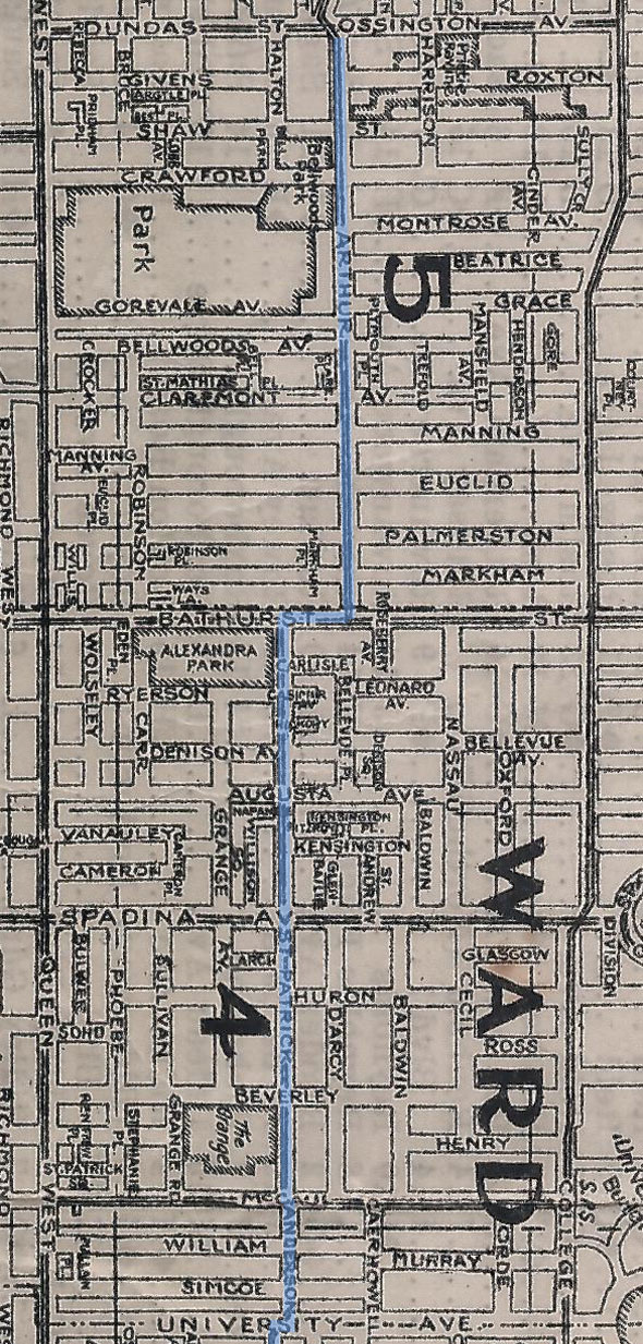
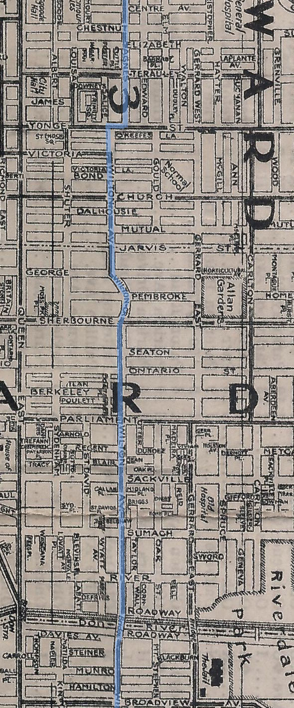
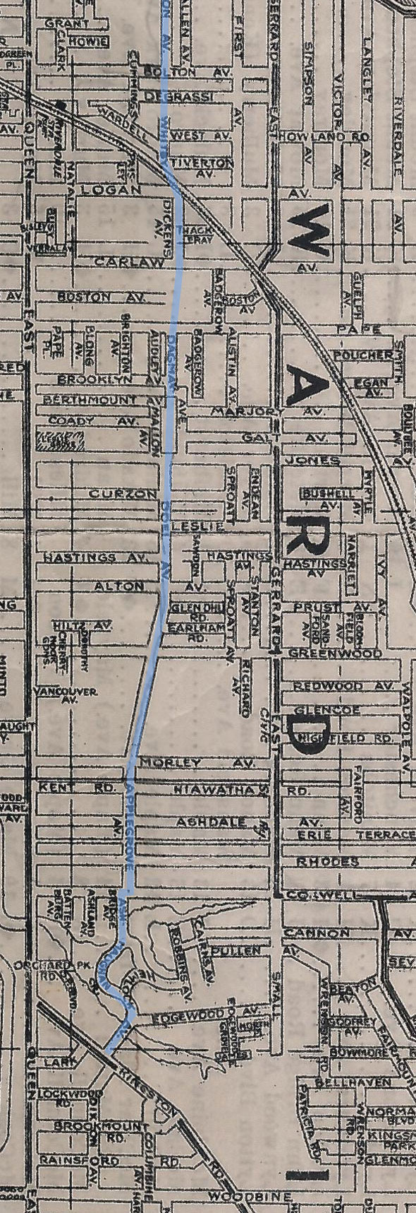
They could "create" new arterial roads using roadway jogs, Dundas Street is such an arterial road, made up of several streets using jogs.

See

The many streets of Dundas

at this link.

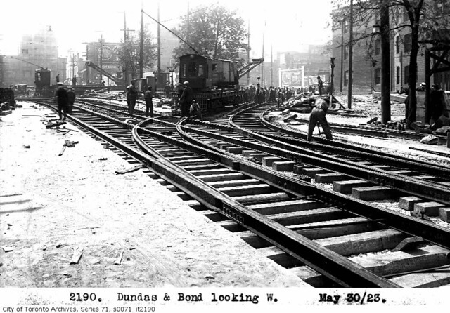
6239795480_a72af161df_z.jpg

TTC work crews laying new tracks on Dundas Street Diversion east of Yonge Street in 1923, linking former Agnes and Wilton Streets, and in the process, creating the triangular parcel that later became Dundas Square. Image: Toronto Archives Fonds 16, Series 71, Item 2190.

See also
https://www.blogto.com/city/2012/09/a_brief_history_of_what_is_now_known_as_dundas_street/

20120929-Dundas-Map-oss-uni.jpg

20120929-Dundas-Map-uni-broadview.jpg

20120929-Dundas-Map-broad-wood.jpg
As the article says, Dundas was originally a military road and was surveyed to stay back from the shoreline. On a map, you can see how it swings north in the vicinity of Humber Bay.

North-south jogs were quite common on roads such as Finch - I remember them clearly when I was a kid. I don't remember if they were correcting survey errors or it was where old townships met.
 

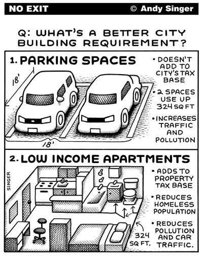
MapLab: How Much Space Does Your City Dedicate to Parking?

Maps show just how much space parking occupies in 50 (US) city centers.

From link.

800x-1.png

32% of the central city of Las Vegas is dedicated to parking.
Credit: Parking Reform Network

How much space in your city is dedicated to parking? The Parking Reform Network just published a series of more than 50 maps that lets you find out.

The project is intended to put a fine point on just how much developable land in the US is occupied as space for nonmoving cars, and to provide a tool for advocates as more cities reconsider reforming their parking policies.

At the root of many cities’ parking footprints are minimum requirements, which mandate “that any new building that comes up or any new building that is renovated has to include a set number of parking spaces,” explains Thomas Carpenito, volunteer coordinator who spearheaded the project for the nonprofit.

These requirements, which have been in place for decades, are what parking guru Donald Shoup has called “ almost an established religion in city planning.”

But lately, the policies have been increasingly scrutinized, and the effort to repeal them is often bipartisan. Last November, the city of Anchorage, Alaska, passed a bill to end all parking mandates citywide. The bill was championed by a progressive candidate, and co-sponsored by conservatives. The Parking Reform Network has identified over 300 cities that have implemented, proposed, passed or planned some kind of parking reform, and 50 cities that have repealed parking minimum requirements citywide altogether.

“We have tons (...) of different cities around the country realizing that this really unknown piece of zoning regulation is something that has contributed immense damage to our urban fabric,” said Carpenito. “If you make it illegal to build walkable, dense places, they won’t be built.”

Take Las Vegas, for example, a city with no parking reform underway at the moment: Thirty-two percent of its central city is dedicated to parking. In Clark County, where Las Vegas is located, a hotel of less than 500 rooms must provide one parking spot per guest room. A resort is required to have six parking spaces per 1,000 square feet of public space.

The Parking Reform Network compiled the percentages to come up with a parking score from 0 to 100. The worst-performing city analyzed is Arlington, Texas, with a parking score of 100, and 42% of the central city dedicated to parking.
At the opposite end of the spectrum, San Francisco dedicates 4% of its central city to parking. The city tops the rankings with a parking score of 4. In Portland, the city where the Parking Reform Network started its advocacy, 11% of the central city is occupied by parking.
800x-1.png

4% of San Francisco central city is dedicated to parking.
Credit: Parking Reform Network

In its analysis, the Parking Reform Network defined the “central city,” the area these maps cover, as a “blanket term for a city’s Central Business District, Downtown, Financial District, or adjacent connecting neighborhoods of interest.” In other words, parts of the city that might be considered particularly valuable for purposes other than parking.

1680454649487.png
 
EDFBF2B1-6998-4834-A501-D18F3D4B8288.jpeg

I commented asking for Steve to expand on what he meant here, primarily the third tweet, but got no reply. Perhaps we can further discuss what he’s describing here?
 
indeed - the lines are very much under construction. There aren't many MTSA areas that I'm aware of being planned for without dedicated construction funding for the line it's associated with.
 
indeed - the lines are very much under construction. There aren't many MTSA areas that I'm aware of being planned for without dedicated construction funding for the line it's associated with.
It sounded to me like he’s saying we’re building lines to nowhere. Which, maybe from a COVID doomer perspective, sure. Compound with exorbitant costs, it makes transit look like something to throw money at for its own sake. And maybe it is… but even then, much of what we are building now is either long overdue for alleviating the existing system or as an upgrade for (still) well-used bus or rail lines (Eglinton, Finch, GO Electrification, etc).

I do think Steve is reading into the various changes/axing of the Growth Plan. I’m not too versed there, but consider at least 40% of the GTHA’s growth is now densification vs. 60% sprawl. Ford may have greased the wheels on sprawl, but he has done the same for densification.

Perhaps he is alluding to the “next phase” of transit expansion, which he is implying will be halted as these current projects fail to live up to their own hype. Meanwhile, sprawl can continue unabated. It has happened before.

But I don’t know about all this. I believe we are building so much transit in part because on an institutional level we have realized we cannot facilitate all this growth with conventional sprawl alone anymore- there will never be enough road capacity in the regions core to support it (there already isn’t). If this is the mindset, then transit expansion will continue unabated, because every new line creates new chokepoints, new feeder routes with higher demand, and so on… if a critical mass of voters are on transit, this is impossible to ignore.

Edit: it’s not like we’re facilitating just downtown-bound trips either. Many lines being built/planned for are for suburb-to-suburb travel. The 407 TransitWay will be the ultimate culmination of this. Would Steve say we should fast-track that?
 
Edit: it’s not like we’re facilitating just downtown-bound trips either. Many lines being built/planned for are for suburb-to-suburb travel. The 407 TransitWay will be the ultimate culmination of this. Would Steve say we should fast-track that?

You should ask him. You could tag him here, but probably easier to shoot him an email/message on his site or on social media.
 
Last edited:

Back
Top