News   Mar 28, 2024
 190     0 
News   Mar 28, 2024
 201     0 
News   Mar 28, 2024
 257     0 

Orangeville-Brampton Railway (OBRY)

Service is ending on the line for freight. We know that and there isn't any way to really avert that. The manufacturers that use the line have made their decision.

The real question is what value does the corridor have remaining for rail-based uses? For transit, we already have Hurontario LRT filling this role. What would GO be able to do with it?

I don't think we will see any excersise in corridor preservation here simply because there aren't any takers. Perhaps if anyone thinks it is they could contact Metrolinx with their concerns but all indications show that they aren't interested.

Now I am focusing on the positive. Mississauga are going to get a reallt good trail out of this and I certainly will use it quite often.
We have lots of “good trails” already. Hurontario isn’t a good thing for longer distance service. It’s more for shorter, local trips. The Owen Sound sub goes through some decent areas (specifically downtown Brampton) and south Caledon is supposed to get a decent amount of development along the Brampton border, plus there’s Brampton-Caledon airport, demand for that could rise in the future. I honestly would not be opposed to the idea of a trail if the rails could be reactivated in the future. Having the corridors/infrastructure saved is good because it lowers the costs of future projects. Scarborough for example had a rail corridor that could have been used to get Line 2 to STC for cheap, but because no one bothered to preserve it the opportunity is gone
 
Last edited:
Hurontario is just for local service. Maybe the LRT ROW could be used by express buses to provide faster express connectivity. Otherwise some kind of fast connection between the GO lines in Peel would be valuable.
 
We have lots of “good trails” already. Hurontario isn’t a good thing for longer distance service. It’s more for shorter, local trips. The Owen Sound sub goes through some decent areas (specifically downtown Brampton) and south Caledon is supposed to get a decent amount of development along the Brampton border, plus there’s Brampton-Caledon airport, demand for that could rise in the future. I honestly would not be opposed to the idea of a trail if the rails could be reactivated in the future. Having the corridors/infrastructure saved is good because it lowers the costs of future projects. Scarborough for example had a rail corridor that could have been used to get Line 2 to STC for cheap, but because no one bothered to preserve it the opportunity is gone
Hurontario is just for local service. Maybe the LRT ROW could be used by express buses to provide faster express connectivity. Otherwise some kind of fast connection between the GO lines in Peel would be valuable.
Then perhaps it might be worth it to contact Metrolinx. There seems to be a wide amount of support to see this corridor preserved in certain circles but Metrolinx doesn't seem to recognize its worth, otherwise they would have jumped on it by now, but then I tend to agree with them. Perhaps they could be convinced the other way with community input.
 
From a friend:

I just picked up a copy of ‘In the Hills’ — a magazine focused primarily on life in Caledon. Over the years they’ve had a couple of articles on the CVR/CPR/OBRY line through the Forks of the Credit.

Anyway…..

This particular article is about the tiny village of Belfountain, which, especially during the pandemic, is overrun every week by tourists, motorcyclists, racers, and so on. It doesn't mention the railway. What caught my eye was the map accompanying the article and its indication of proposed gravel quarries near the OBRY rail line. Back in 1984, there were efforts to save the easternmost four miles of the Elora Sub so that it could service quarry operations. That never happened, and anyone who lives along a sideroad connected to a pit can tell you that it’s a day-long parade of gravel-toting semi’s going up and down those roads.

I know the “horse has left the barn” on this one, but it would have been nice if some foresight had prevailed and an OBRY option to ship gravel had been considered. That, after all, was the reason the Highland Group sought to purchase the railway from the town several years ago, as part of its larger plan to develop quarries around Dundalk.

https://www.inthehills.ca/2021/06/belfountain-under-siege/

As far as the thrust of the article goes, I would concur with the author’s resistance to the “grow or die” mantra often embraced by multiple levels of government, which to my mind usually comes with a cascading list of unintended consequences.
 
I checked out the damage recently. Exactly 1 km was pulled on the section between CR 16 and Broadway. It was pretty clean too,with only small chunks of ties along the path. I think this is as much as they can pull before access to the industrial spur is obstructed. Either way assuming complete cleanup, a bit of surplus land has now been made available to the Town on its major road. I personally feel it's a bit premature to remove the track.

The town near the station still has signs saying the Credit Valley Train straight ahead (Townline+Cardwell) and in the station window there is a small advert promoting it as well as the entrance sign at the station itself. If I didn't know any better I would've thought the service was just temporarily suspended because of COVID. There's a nice blue plaque across from the station site which describes the efforts and why the town opted to purchase and preserve the railroad. Someone want to make copies of that inscription and mail them out to the critics? I could think of at least one local politician.

As a recreational trail I don't think it'd be as amazing as some think. Yes, it does go through some really nice parts of Caeldon. However there are things such as the Forks of the Credit trestle that would require significant work to be safe enough for recreational use (if at all), which means the trail would be cut in half until this would be resolved. The trail also goes through the Osprey Valley, Caledon and Orangeville Golf/Country Clubs and I don't know how much opposition they could give to the concept of a public trail going so close/into their golf clubs.. Also some people in the local communities near existing trails are not a fan of the amount of cars that currently line up their streets, parking/blocking along the side of the road. The fact that Orangeville politicians are selling this as a big attraction for the town is absurd as only determined cyclists may take this thing up to Orangeville and spend any money in town.
 
If the Brampton CN third track goes in, doesn't the option to curve the OBRY onto it and sever the southern portion become more attractive given the need to replace the diamond with an even more expensive one in both money and operational compromises? They could look at a grade separation I guess to retain the CP routing but that would be challenging to put it mildly.

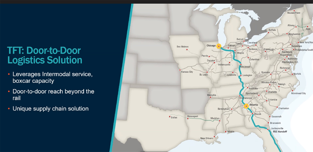
Here is something they could adopt to save their railway by partnering with a trucking company.

Too bad there is no vision.
 

Here is something they could adopt to save their railway by partnering with a trucking company.

Too bad there is no vision.
Norfolk Southern is a Class I. The comparator here is CPR, with loads being trucked to their yard, no?
 
Norfolk Southern is a Class I. The comparator here is CPR, with loads being trucked to their yard, no?
I would say in some ways that these examples all strengthen the case for Orangeville town council's plan for the railway.

Both cited examples are multimodal methods of freight transport. In this case, a strong presence of recently opened nearby intermodal yards and transload terminals will allow industries in Orangeville to access rail freight without the OBRY.

Perhaps the OBRY's overarching purpose could have been interpreted as an interim measure to allow multimodal transload sites could be developed nearby.
 
Last edited:
I would say in some ways that these examples all strengthen the case for Orangeville town council's plan for the railway.

Both cited examples are multimodal methods of freight transport. In this case, a strong presence of recently opened nearby intermodal yards and transload terminals will allow industries in Orangeville to access rail freight without the OBRY.

Perhaps the OBRY's overarching purpose could have been interpreted as an interim measure to allow multimodal transload sites could be developed nearby.

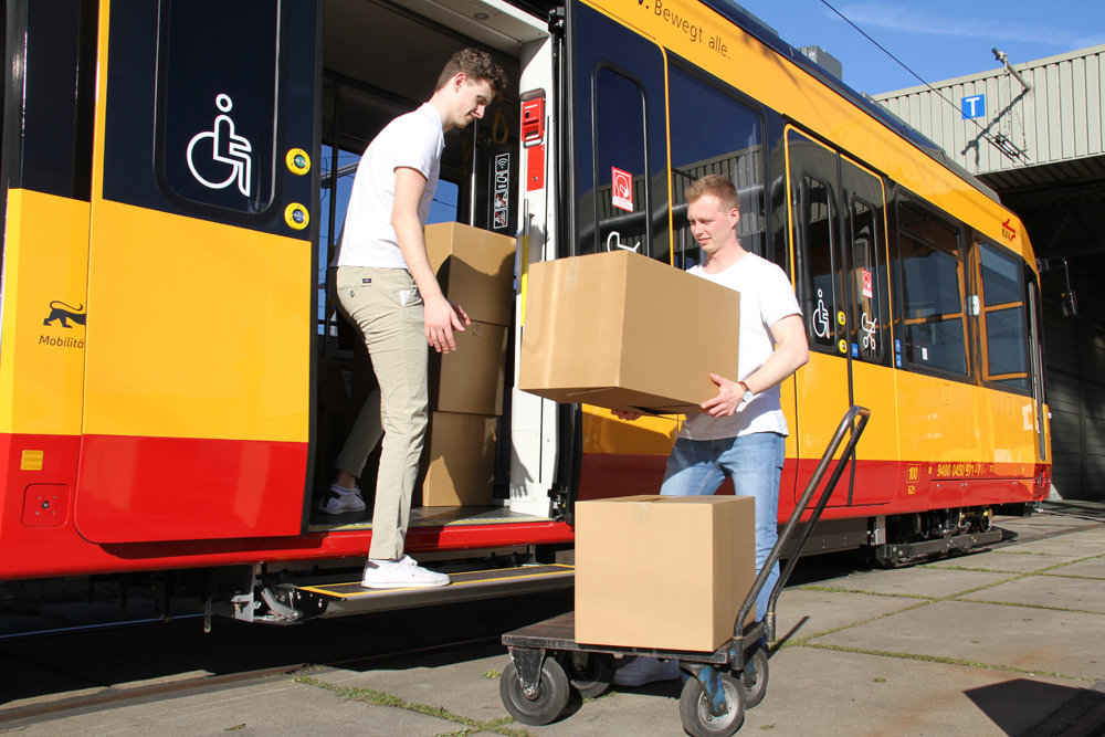
At least in Europe they have the right idea...
 
I checked out the damage recently. Exactly 1 km was pulled on the section between CR 16 and Broadway. It was pretty clean too,with only small chunks of ties along the path. I think this is as much as they can pull before access to the industrial spur is obstructed. Either way assuming complete cleanup, a bit of surplus land has now been made available to the Town on its major road. I personally feel it's a bit premature to remove the track.

The town near the station still has signs saying the Credit Valley Train straight ahead (Townline+Cardwell) and in the station window there is a small advert promoting it as well as the entrance sign at the station itself. If I didn't know any better I would've thought the service was just temporarily suspended because of COVID. There's a nice blue plaque across from the station site which describes the efforts and why the town opted to purchase and preserve the railroad. Someone want to make copies of that inscription and mail them out to the critics? I could think of at least one local politician.

As a recreational trail I don't think it'd be as amazing as some think. Yes, it does go through some really nice parts of Caeldon. However there are things such as the Forks of the Credit trestle that would require significant work to be safe enough for recreational use (if at all), which means the trail would be cut in half until this would be resolved. The trail also goes through the Osprey Valley, Caledon and Orangeville Golf/Country Clubs and I don't know how much opposition they could give to the concept of a public trail going so close/into their golf clubs.. Also some people in the local communities near existing trails are not a fan of the amount of cars that currently line up their streets, parking/blocking along the side of the road. The fact that Orangeville politicians are selling this as a big attraction for the town is absurd as only determined cyclists may take this thing up to Orangeville and spend any money in town.

Driving through Orangeville last week, I noticed that part of the ROW has already been paved and residents using it to walk and cycle. Here's the town's press release:

Posted on Tuesday, July 20, 2021

The rail removal at Veteran’s Way has been completed, making way for the first phase of the future cycling/walking trail from the western boundary to the south end of Orangeville.

The track has been removed from Veteran’s Way to 300 feet north of Broadway as part of the first phase of the trail system running from Veteran’s Way to Town Line. The first phase known as the Veteran’s Way Trail connection is scheduled to begin in the month of July and be completed by September 2021.

The second phase will include a boardwalk that will join this section once the remainder of the tracks can be removed. This will not occur until the Town receives approval from Credit Valley Conservation and the tracks are decommissioned at the end of December 2021.

The estimated cost to remove the tracks and to construct the trail in addition to a boardwalk portion (once approved by Credit Valley Conservation) is $600,000.

The goal of the trail is to connect Orangeville through alternative means of active transportation. The Cycling and Trails Master Plan, approved by Orangeville Council, included plans for this trail system and it was included in the capital budget in 2020-2021 with projected trail funding within the future 10-year capital infrastructure plan for the Town.

The Orangeville trail network will connect to trails to the north/south and east/west of Orangeville.
 
Driving through Orangeville last week, I noticed that part of the ROW has already been paved and residents using it to walk and cycle. Here's the town's press release:
It's ironic that orangeville opposes the GTA west highway, but they tear up railway lines? huh, quite interesting.

At this rate we'll end up stuck using the automobile to move around in this province.
 
Though it is still passable by trains (I just missed the northbound train today), the right of way has the appearance of a railway already abandoned, but before the crews come to lift the rails and remove the ties.

This is looking south and north at Nelson St West, on the west edge of Downtown Brampton. The second track, on the west side, is a former freight siding. The grassy hump on the east side in the first photo is the old station building site. There were a few tracks here for LCL (less than carload) freight and car storage.

IMG_5697.JPG
IMG_5698.JPG


Here's the diamond. OBRY trains slowly cross above the rails of the dominant CN corridor as the wheels are lifted by the flanges. For a lightly used rail line, it works okay. There was once a manned interlocking tower where the pole at centre now stands.

IMG_5701.JPG
 

Back
Top