


Xav
Active Member
I love how you're talking about moving the line away from where people actually live and want to go as "good news".
The only people who win here is the government/CDPQ who get to save a bit of money, and Mercier-Ouest who now have a transit line closer to them. From a transit perspective, Mercier-Est doesn't win anything.
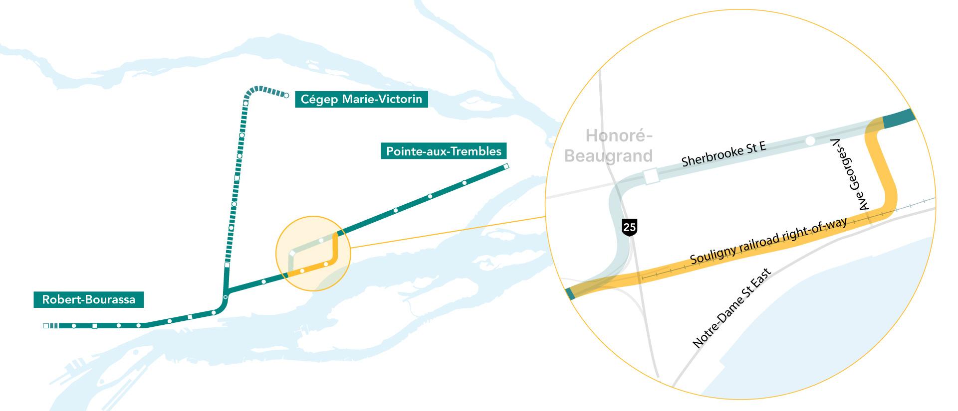
Mercier-Ouest (also called Longue-Pointe) doesn't win anything, since nothing changes for them (Autoroute 25 is the eastern boundary, and the announcement today only concerns the portion east of A25).
Tétreaultville (or Mercier-Est) was historically built along rue Hochelaga and rue Notre-Dame, which are closer to the new alignment. The area is much denser along the new route and more populated than the northern alignment. There's also already a railway there (that's what CDPQi is buying), which makes it just a bit easier to integrate. CDPQi also said they would involve the community with regards to integration.
To be honest, what's the point... the two lines go to the same place... if anything they should put this money into building a true transfer station near Berri-UQAM...And now we don't even give the southern branch of REM B a direct connection to the green line.
Apparently they're buying the ROW from CN. What's under analysis is where stations will be located.EDIT: On the official REM Est website, it shows this alternate route as "Under Analysis", so unlike the burial of Robert-Bourassa and Cegep, it seems like they haven't committed to this change.