News   Jun 14, 2024
 1.9K     1 
News   Jun 14, 2024
 1.4K     1 
News   Jun 14, 2024
 764     0 

Miscellany Toronto Photographs: Then and Now

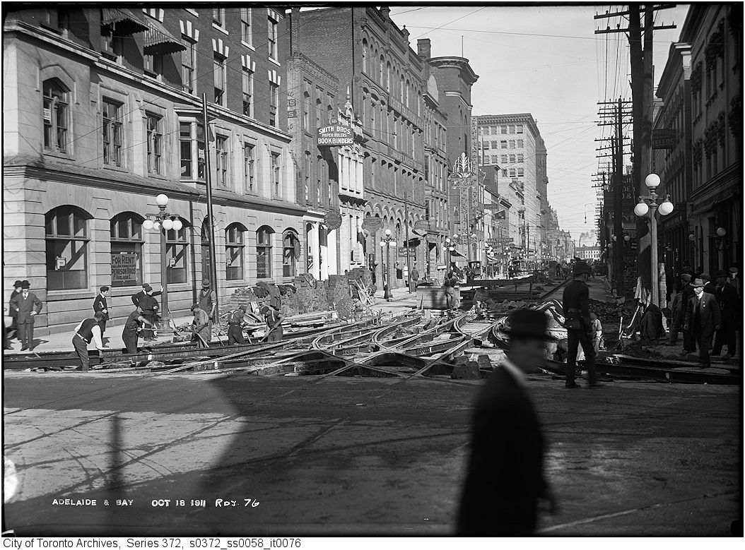
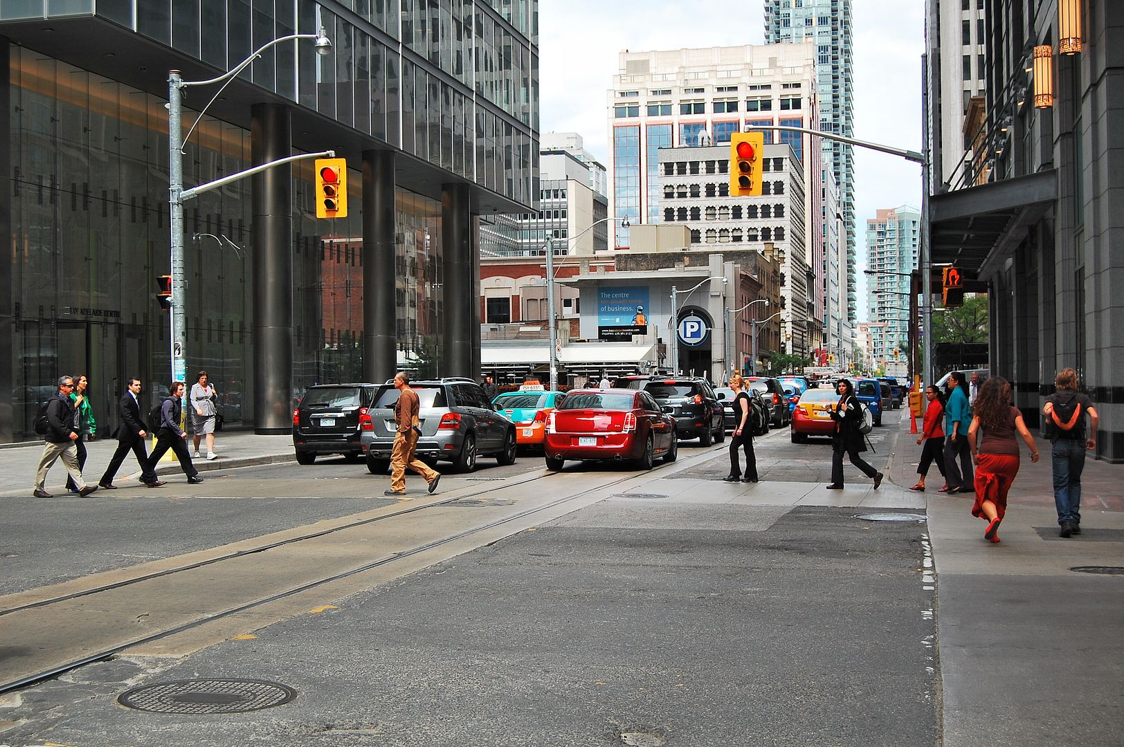
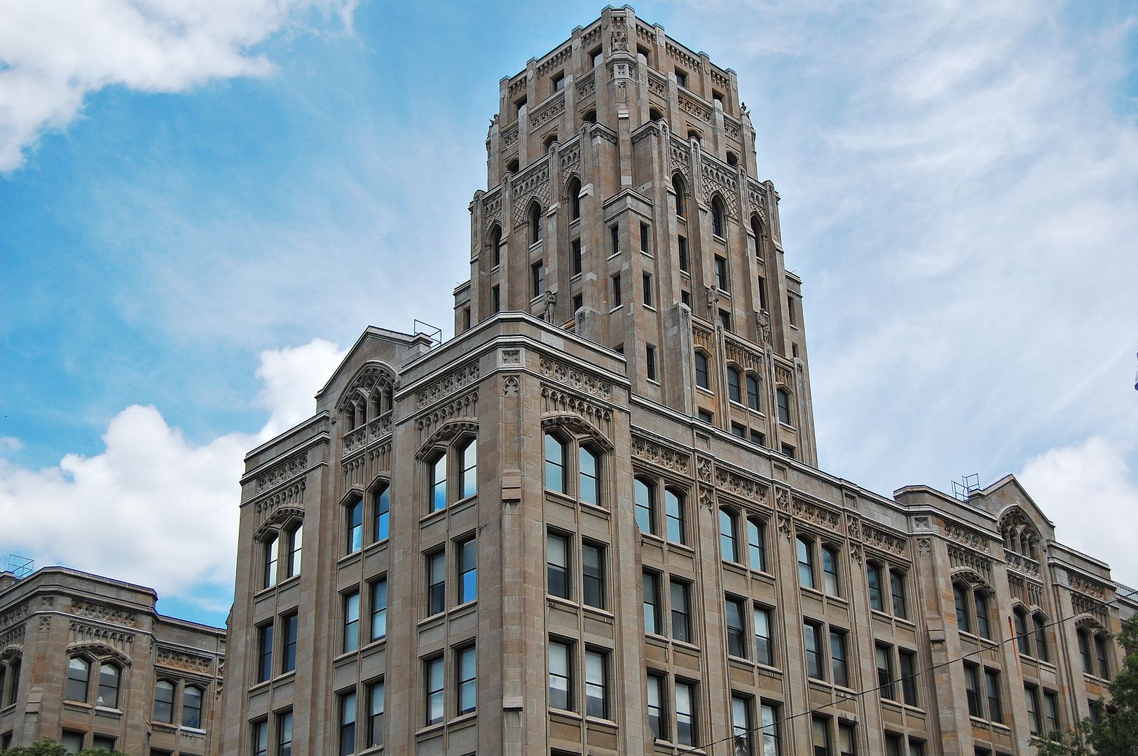
One other detail I've always wondered about: the metal curb on the east side of Bay south from Queen. I have never seen that anywhere else in the city (or in any city save New York).

I’ve wondered about that myself. It also runs east on Richmond from Bay for a bit. I have seen this in one other location: south side of King, east of Parliament, in front of Little Trinity Church.
 
I’ve wondered about that myself. It also runs east on Richmond from Bay for a bit. I have seen this in one other location: south side of King, east of Parliament, in front of Little Trinity Church.
Another on north side of King opposite Sackville Street. They have them in Montreal on locations where snow ploughs are likely to destroy the concrete curbs or the curb is very thin due to hydro vaults etc (they still install them there) and I had always assumed it was same here but none of these locations look terribly prone to snow plough scraping. (Certainly not this year!) Another mystery similar to why the City puts a layer of bricks at the edge of roads beside some sidewalks and not others! (And why, when they spot repair these roads, they never put them back again!)
 
I once talked to someone from Transportation Services about the bricks, and he explained that they're a permeable joint when grades to catch basins are not always sufficient. But I don't know if he was sure himself. One has to also acknowledge that they're an attractive urban detail. In some cities in the world they use granite setts for the same purpose. Red bricks are our vernacular, though I wouldn't mind seeing some granite as well, and also expanding the use of the bricks beyond the old city of Toronto. As for why they're not restored when roads are repaired (usually involving utility cut patches), I think it's just crude repair work that the city shouldn't tolerate.
 
Then and Now for December 14, 2012.


Then. Oct. 18, 1911. Adelaide and Bay; looking E across Bay along Adelaide. A photographic panorama of Toronto workaday life and detail frozen across the unfathomable gulf of time. Yes, I know, Urban Toronto might do well to seek a professional writer to craft better prose to accompany these old pictures; but in the meantime, I'm it. :)

I'm also wondering if the arcane knowledge to construct those streetcar track interchanges is passed down through some sort of secret ceremony.

884.jpg


Now. July 2012.

885.jpg
 
Then and Now for December 14, 2012.


Then. Oct. 18, 1911. Adelaide and Bay; looking E across Bay along Adelaide. A photographic panorama of Toronto workaday life and detail frozen across the unfathomable gulf of time. Yes, I know, Urban Toronto might do well to seek a professional writer to craft better prose to accompany these old pictures; but in the meantime, I'm it. :)

I'm also wondering if the arcane knowledge to construct those streetcar track interchanges is passed down through some sort of secret ceremony.

884.jpg
Another shot of that interesting tall mid-block building :

24adelaidewestmay271918.jpg
 
Last edited:
Fort Rouille monument at CNE c.1917 and 2012
How many of us know anything about this historic site?
The fort was perhaps the first building in what would finally become Toronto (1750).

CNEmonumentc1917.jpg


CNEmonument2012.jpg
 
Fort Rouille needs a better landscape design perhaps incorporating archeology to commemorate this profoundly historic site from the 1700s. Currently, it's somewhat dull and few people go out of their way to visit it.
 
Fort Rouille needs a better landscape design perhaps incorporating archeology to commemorate this profoundly historic site from the 1700s. Currently, it's somewhat dull and few people go out of their way to visit it.

The monument itself has weathered time unchanged. The old artillery is maintained to a high standard; so even though it's not top-of-mind for most people, even those of us interested in this sort of thing; it's nice to see the care applied.
 
Heya, how's the holiday shopping going? :)


For those interested in old film camera technology; below is a old Minox camera I used in the late 80s to take a picture of Hepburn Block.

CSC_0325.jpg


Minox picture.

867hepburn.jpg


Modern digital picture.

868.jpg


What's the point? Film photography was agony compared to digital. :) Waiting for the pictures to be returned; only a rough idea of how it might turn out, the expense of processing...

Hepburn Block is a beautiful building in detail and scale isn't it? I admire it every time I go by it.
 
Correction, Mustapha: it's the Whitney Block. Would anyone know if it's still empty due to code issues (as reported in 2007)?

6243003363_d2bab90a9b_o-1.jpg


4020280687_600968bd44_o.jpg


7963276582_4611ba807c_o.jpg


(photo by .JCM. on Flickr)
 
Last edited:
Fort Rouille monument at CNE c.1917 and 2012
How many of us know anything about this historic site?
The fort was perhaps the first building in what would finally become Toronto (1750).

CNEmonumentc1917.jpg


CNEmonument2012.jpg

Map in the TPL from 1816:

map1816.jpg


Four pics from the TPL of Fort Rouilee:

A sketch from 1936 (described: "After the line block in "Toronto" by W.A. Deacon in Canadian Geographical Journal, Montreal, May 1931 (v.2, no. 5), p. 343, t., which in turn is "From the Public Archives of Canada." Fort Toronto or Fort Rouille was built 1750-51 in the grounds of the present CNE. It was burnt in 1759. See also TORONTO/MILITARY BUILDINGS/FORT TORONTO (1751-1759)
Inscribed in pencil, l.l.: Fort Toronto 1749. III; l.r.: Hans Jensen"):

fortrouille1936sketch.jpg


Erection of the monument in 1884:

fortrouille1884.jpg


1900:

fortrouille1900.jpg


1910:

fortrouille1910.jpg


From the plaque:

fortrouilleplaque.jpg


The outline of the fort has been created around the monument as can be seen on Google Earth:

fortrouillegoogleearth.jpg
 
Last edited:
A sketch from 1936 (described: "After the line block in "Toronto" by W.A. Deacon in Canadian Geographical Journal, Montreal, May 1931 (v.2, no. 5), p. 343, t., which in turn is "From the Public Archives of Canada." Fort Toronto or Fort Rouille was built 1750-51 in the grounds of the present CNE. It was burnt in 1759. See also TORONTO/MILITARY BUILDINGS/FORT TORONTO (1751-1759)
Inscribed in pencil, l.l.: Fort Toronto 1749. III; l.r.: Hans Jensen"):

fortrouille1936sketch.jpg

Excellent additions, charioteer. Thank you.
I never expected to see a picture of Toronto's first 'building.'
 
Actually, the French Fort Toronto by the Humber would have been Toronto's first permanent building in 1720, though at that time the French encountered temporary native villages built along the Humber. The French were the first to use the name "Toronto". (Like Fort Rouille, though, it barely lasted a decade.) When the British settled here, they wanted to distance themselves from the area's history of French settlement and chose the name York. Fortunately, we got rid of that overused colonial name in 1834.
 

Back
Top