News   Jun 14, 2024
 1.9K     1 
News   Jun 14, 2024
 1.4K     1 
News   Jun 14, 2024
 781     0 

Miscellany Toronto Photographs: Then and Now

Very neat indeed! The landfill went in around 1960 to 64. It was to stop erosion and extend the backyards of the houses on the east side of Donlands and north side of Davies cres. north of O'Connor. In the early eighties a vacuum system was installed to control methane that was being found in the basements. The vacuum structure can be seen in this google streetview link. The entire slop behind is monitored quite well as every other backyard has a test well that is read monthly.
 
From another East York neighbourhood:

TNPickfordbungalow.jpg

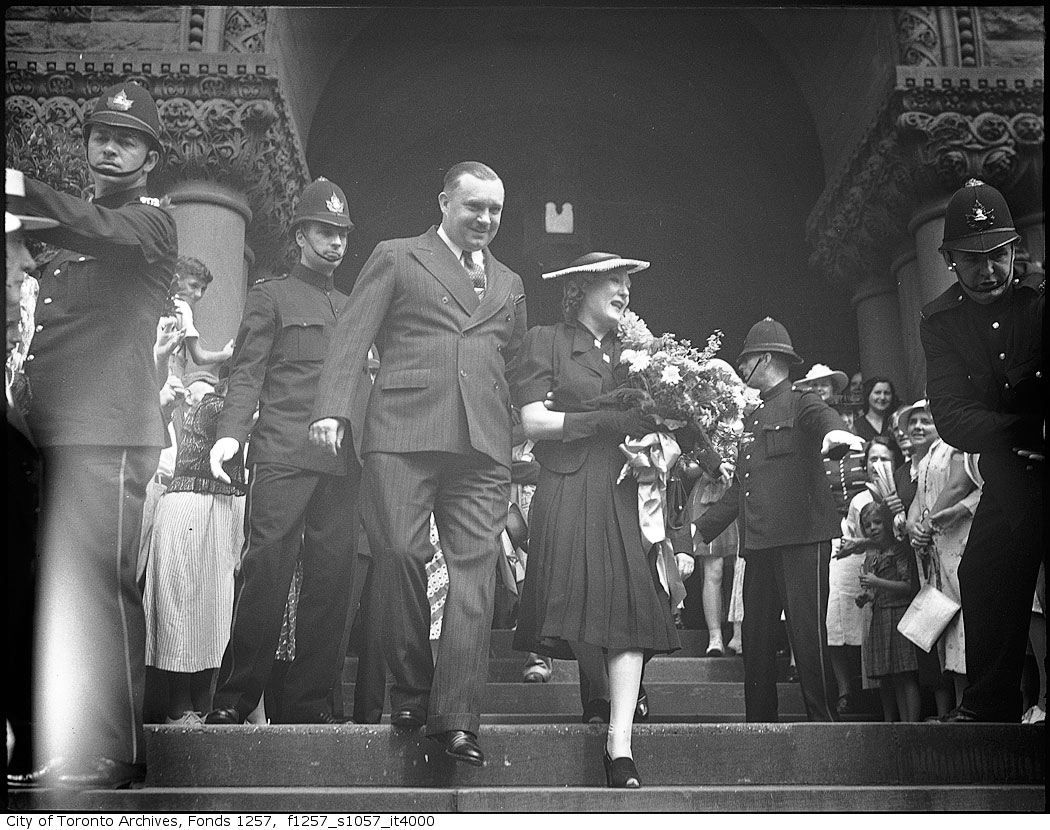
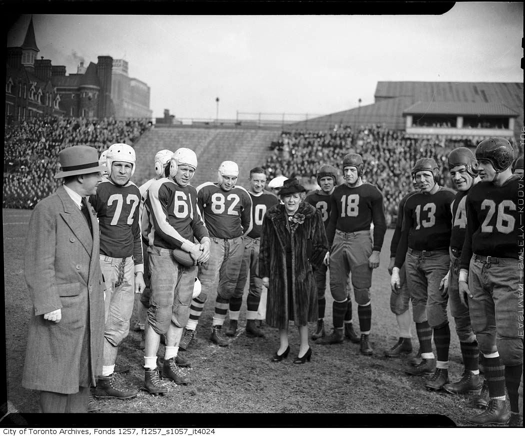
Mary never forgot her hometown:

marypickford.jpg


marypickfordvarsitystadium.jpg
 
Last edited:
Is it just my Firefox browser?
I cant seem to be able to use my 'ImageZoom' add-on for zoming in on pics that we post.

I notice there is a new format to the page. Has the picture scaling been truncated?

Hi TIMFX, I use the 'Ctrl' and scroll wheel on my mouse to do this in Firefox...
 
Daily Miscellaneous Then and Now for Wednesday May 18, 2011:


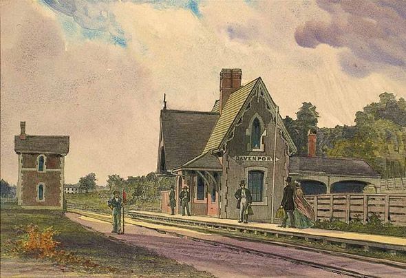
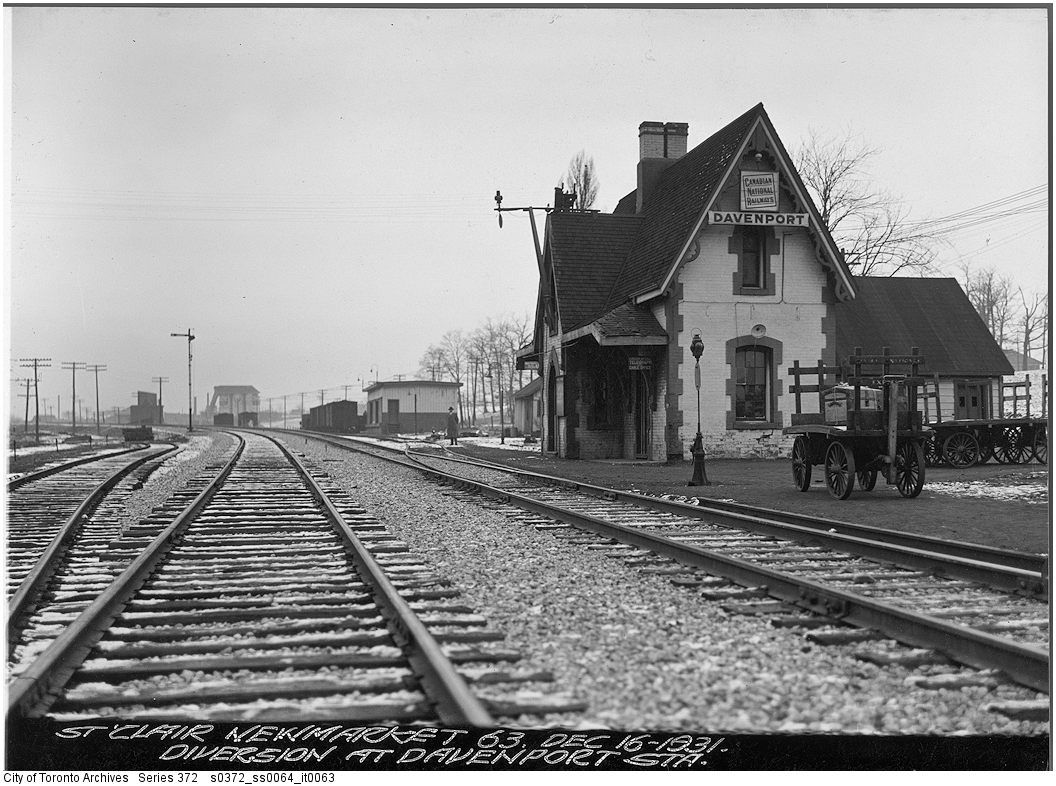
Then. Two views of Davenport station. The painting is from the Toronto Public Library's online collection.

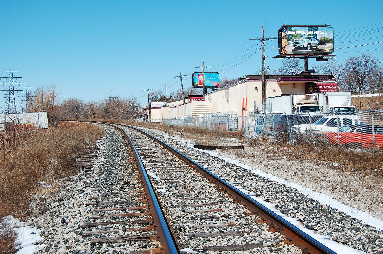
We are standing on the rail line about 60 yards NNE of the intersection of Caledonia Park Road and Davenport. Davenport Station serviced the commuters of nearby Carleton Village from 1857 to about 1934-ish. Davenport Road had been steadily loosing influence as the areas main street to St. Clair Avenue. When a new station was built at St. Clair Avenue in 1931 (it also no longer exists), Davenport Station was demolished.


2011125--Davenport_Station_1863.jpg


s0372_ss0064_it0063.jpg


Now. April 2011.


I would guess the "footprint" of Davenport Station to occupy where that dark piece of lumber is lying to the right of the tracks. The factory on the right has added a southern addition since the 1931 picture so, while I would appear to be too close to it, I am not. Interestingly, the rail car in this picture is marooned there. The rail siding trackage that allowed it to be delivered and parked there has been ripped up.

Also, there are bits of overgrown and disconnected lengths of rail in the former yard area, if that is your thing. The yard is to the left (west), out of view. This can be examined on foot by walking north on nearby Wiltshire Street and then walking east into the yard opposite #150 Wiltshire. Watch you don't twist your ankles. Honestly there isn't much to see unless you are a dyed in the wool train buff. :)


DSC_0130-1.jpg


http://ve.torontopubliclibrary.ca/stclairmap/station.html
 
It's very neat that those two marooned rail cars appear in the "then" picture as well. Makes one wonder if they possibly could be the same ones.
It's been said before and I'll say it again, great thread! I have read every post!
 
Yes.
That method zooms the whole page.
The add-on ImageZoom works on just the picture. hover over picture, hold down right mouse button and scroll.
It used to make the picture as large as you wanted, now it gets to a certain size and starts stretching.
Only since the new page format...:(
 
Mustapha said:
We are standing on the rail line about 60 yards NNE of the intersection of Caledonia Park Road and Davenport. Davenport Station serviced the commuters of nearby Carleton Village from 1857 to about 1934-ish. Davenport Road had been steadily loosing influence as the areas main street to St. Clair Avenue. When a new station was built at St. Clair Avenue in 1931 (it also no longer exists), Davenport Station was demolished.

Actually, it's an interesting walk towards St. Clair along those railway tracks. The marooned boxcar is cool, and there are several other abandoned railway connections. Once you get to the overpass at St. Clair, you find the narrow platform of the dismantled railway station that replaced the one at Davenport, with steps to St. Clair (now fenced off at street level). The overpass has some of the nicer railings among Toronto railway overpasses and a great view of St. Clair. It could make for an interesting public space one day, or even a new GO station.
 
Last edited:
Hey-ya people,

I might add that you MUST keep as far as possible from the tracks when walking along rail corridors - if you must do so at all. Trains extend several feet beyond the tracks themselves. And I would not do it unless you possess nimble reflexes and have keen sight and hearing. There is also the possibility of having your presence being radioed to the police by train crew.

Also bear in mind that there is NO space on a bridge or trestle for the train and YOU. In fact, if you are caught out there on a bridge or trestle, it's game over.

A safer alternative to walking along rail corridors is the: http://en.wikipedia.org/wiki/West_Toronto_RailPath

With greatest respect to junctionist - love you bro' - I recommend all to just enjoy the pictures here.
 
Last edited:
I've explored railway corridors since my early adolescent years, but that's a fair warning. Nonetheless, there's a lot of interesting things to encounter along those corridors and perspectives rarely seen by anyone like the above-mentioned overpass platform on St. Clair.

Ideas for public use come to mind. Canadian Pacific's midtown corridor has enough space for a West Toronto Railpath-style path through a large part of the west end. It's already used that way informally, and a bike ride last summer from Bartlett Avenue near Dupont and Lansdowne to Yonge revealed such diverse users such as a family out for a walk, people walking their dogs, tramps waiting perhaps for a freight train, people smoking joints, and one person reading a book. It seemed to be a funky version of the nearby public spaces, more informal and more "Kensington Market" :cool: .
 

Back
Top