News   Jan 08, 2025
 235     0 
News   Jan 08, 2025
 406     0 
News   Jan 07, 2025
 1.6K     3 

Miscellany Toronto Photographs: Then and Now

This source you've listed... interesting how directories would even list your employment. I'm reminded of the Returning Officers' practice of publicly posting federal electors lists on hydro poles - a practice that died out sometime in the late 1960s I think. The curious could read the names of everyone on their street; and yes, their occupation too.

And they would say something like:

Mustapha..............Architecture and Infrastructure Change Specialist

and the neighbour ladies would say - but all he does is run around the city taking pictures!
 
I believe they stopped listing occupations towards the end, but I remember those hydro pole lists in the 70's (and possibly even the early 80's).

I must admit to reading the occupations of the residents of my street - with some delight!
Today, unfortunately, such information is protected by "privacy" laws.
 
I believe they stopped listing occupations towards the end, but I remember those hydro pole lists in the 70's (and possibly even the early 80's).

I always wondered about the occupation "labourer" in those old directories. Did the enumerator write that down after you told him you worked stacking ties at the TTC Wychwood barn, or did the "labourer" self describe from some sort of self awareness of the value of their contribution of labour in a capitalist political economy? :) I'm betting on the former.


And they would say something like:

Mustapha..............Architecture and Infrastructure Change Specialist

and the neighbour ladies would say - but all he does is run around the city taking pictures!

And Mustapha would say to the ladies: "Outta my way ladies; today is Sunday picture taking day and I must run as I have a weekly quota of seven pictures to take before nightfall". The ladies would swoon as one as his Valentino-esque animal grace swept away in a blur of red and yellow silks, a sight of delight for the eyes, and dare he say it, other senses, only occasionally marred by Mustapha's habit of eating while walking and wiping his mouth on his sleeves. :)


July 8 addition. A little more of the Lost Neighbourhood that is now St. James Town, Then pictures courtesy as usual by the tireless people at the Toronto Archives.

1b.jpg


1a.jpg


For you out-of-towners, the St. James Town complex is on the left.

CSC_0174.jpg
 
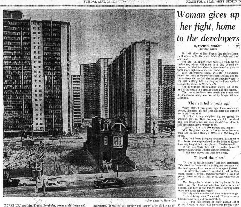
She and her husband lived in the wrong neighborhood - three separate incidences of living in the path of big development! Incidentally, she parked her husband in Fudger, which is conveniently located next to a funeral home. One stop shopping.
 
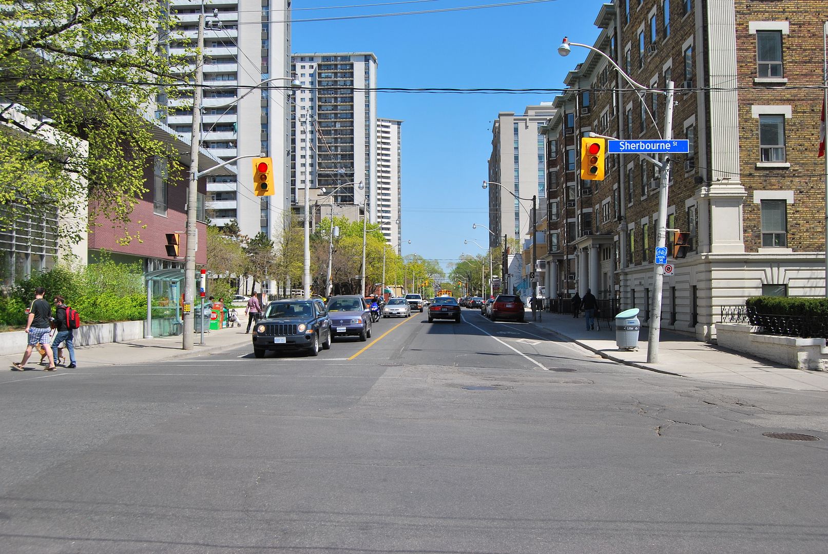
Interesting w/the Wellesley street widening, the intersection w/Sherbourne went from stop-sign to traffic llights...
 
Sherbourne, north of Wellesley 1971:

Thanks for that article! I live in St. James Town, and I find these two images particularly interesting:

https://gencat4.eloquent-systems.co...source//ser372/ss0033/s0372_ss0033_it0625.jpg

https://gencat4.eloquent-systems.co...source//ser372/ss0033/s0372_ss0033_it0626.jpg

In the second image, on the very right, one can see the St. George’s Society Monument in St. James Cemetery, just above the car. Pine Terrace would have been just west of today’s 670 Parliament, or maybe even within its footprint.
 

Attachments

  • 1910pl27c.jpg
    1910pl27c.jpg
    77.7 KB · Views: 426
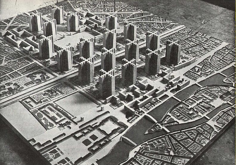
Le Corbusier's Plan Voisin Paris 1925:

leplanvoisin.jpg


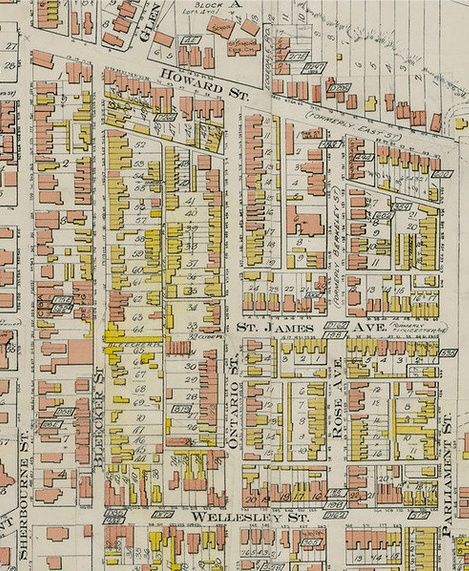
The St. James Town blocks 1910:

1910-1.jpg


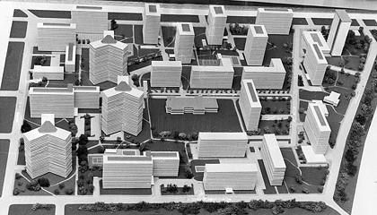
Model of St. James Town 1965 (from the Toronto Star):

2084600817.jpg


" City within a city is shown in this artist's conception (looking west) of St. James Town - a $40 milion apartment development projected for the area bounded by Parliament, Bleeker Wellesley and Howard Sts. Covering 32 acres, it would contain 5,000 housing units with a population of about 16,000. The apartment buildings would range between 16 and 25 storeys and be linked by an underground street system. Board of Control has deferred acction two weeks. "

Last Published: 1/14/1965
Release: NOT RELEASED
Photographer: Dick Darrell/GetStock.com
 
Last edited:
Although I wonder whether said proto-PATH would have been more along the lines of the utilitarian pedestrian-service-tunnel networks knitting together campuses like Carleton, Laval, etc--would York have had one, too?--seems pretty treacherous on personal-safety grounds...
 
July 10 addition.


So this will be the last picture set to close up our little tour of Wellesley street and the southern margin of St. James Town.


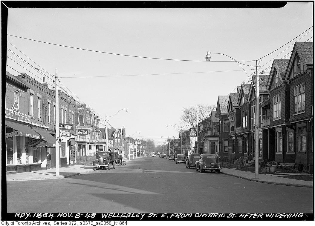
Then. Wellesley street looking E from Ontario street. March 23, 1948.

2a.jpg


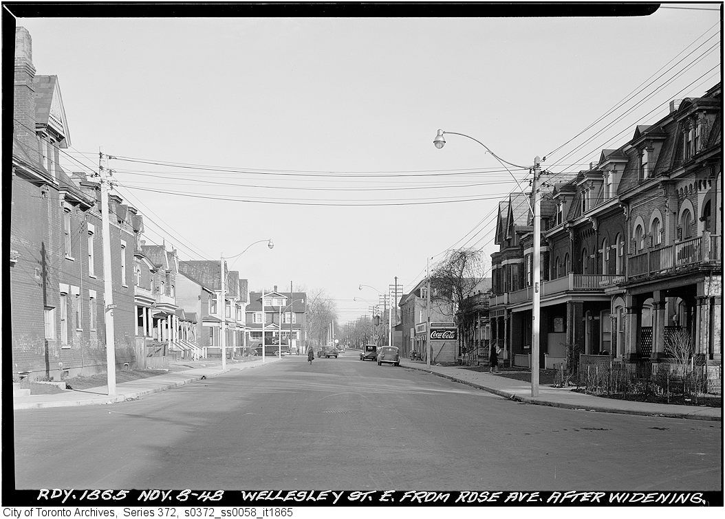
Later. As above. November 8, 1948. In the intervening six months between the two photos and the road widening, Mr. Joliffe the plumber has already decamped (his sign has come down). The corner grocery has expanded into the vacated space.

2b.jpg


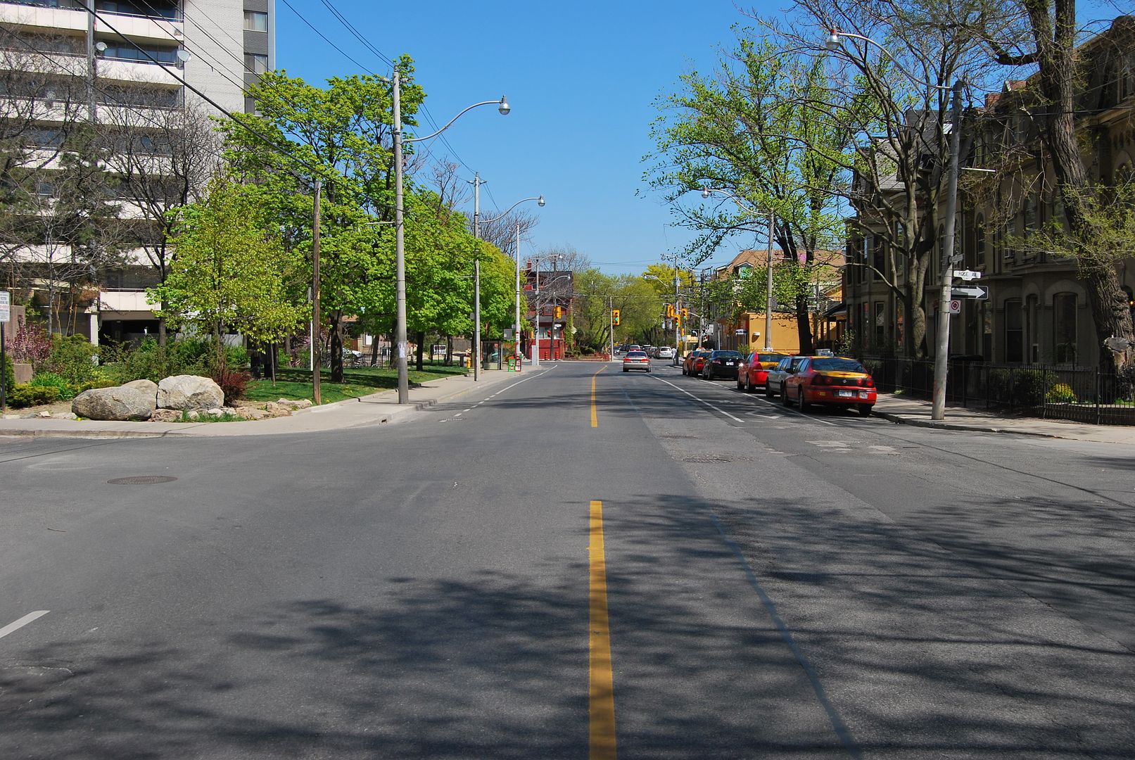
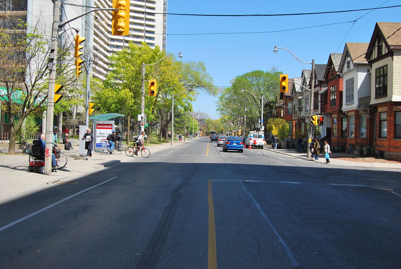
Now. June 2010.

CSC_0171.jpg
 
So this will be the last picture set to close up our little tour of Wellesley street and the southern margin of St. James Town.

This 1965 photo from the series 'Bloor-Danforth subway from the air' shows St. James Town construction in mid-stream. The two buildings across the Don valley are also under construction.

s0648_fl0180_id0031.jpg
 

Back
Top