News   Dec 20, 2024
 1.1K     5 
News   Dec 20, 2024
 860     2 
News   Dec 20, 2024
 1.7K     0 

Miscellany Toronto Photographs: Then and Now

Original site of Danforth Road

I was surprised to find this notation of Danforth Road (attached detail of an 1857 map of Toronto).
I don't believe I've previously seen Danforth Rd. identified at this location on other maps - east side of the Don River, an extension of Don Street, which in turn seems to be an extension of Gerrard St.
Fascinating! -------- or boring, depending on one's interests.
 

Attachments

  • Danforth Road 1857.jpg
    Danforth Road 1857.jpg
    123.5 KB · Views: 682
I was surprised to find this notation of Danforth Road (attached detail of an 1857 map of Toronto).
I don't believe I've previously seen Danforth Rd. identified at this location on other maps - east side of the Don River, an extension of Don Street, which in turn seems to be an extension of Gerrard St.
Fascinating! -------- or boring, depending on one's interests.

Here's the same view in 1910 (just before the construction of the Viaduct):

goad1910east-1.jpg
 
the mysterious route of Danforth Road

Here's the same view in 1910 (just before the construction of the Viaduct):

goad1910east-1.jpg

Yes, in 1910 the name has been changed to Gerrard St. East. That's what puzzles me - because Danforth Road (currently) continues over near Warden Ave.

Was Gerrard St. East (east of the Don) once called Danforth Rd. all the way to Warden?
 
King & Queen

I thought this was an interesting 1900 view of the King-Queen intersection at the Don River.
Who'll get there before me to shoot the "NOW" version?
 

Attachments

  • King-Queen intersection at Don River 1900-Arthur F. Rust CTA.jpg
    King-Queen intersection at Don River 1900-Arthur F. Rust CTA.jpg
    116.8 KB · Views: 1,095
I was making a sketch map of St David's Ward from a similar map to the one Goldie shows us just a few weeks ago and also noticed Danforth Road in what I thought was a peculiar place. There were other roads with names that surprised me up at the northern end of the ward and I wondered if the mapmaker got his labelling right.

However, I have just remembered that either in Caverhill's City Directory of 1859 or Mitchell's Directory of 1864, there is mention of more than one property with the address Don & Danforth. The Danforth Road circa 1860 and the Danforth Avenue, as we know it, may have been different places altogether. There was a Goad series around 1895. How were things named then?
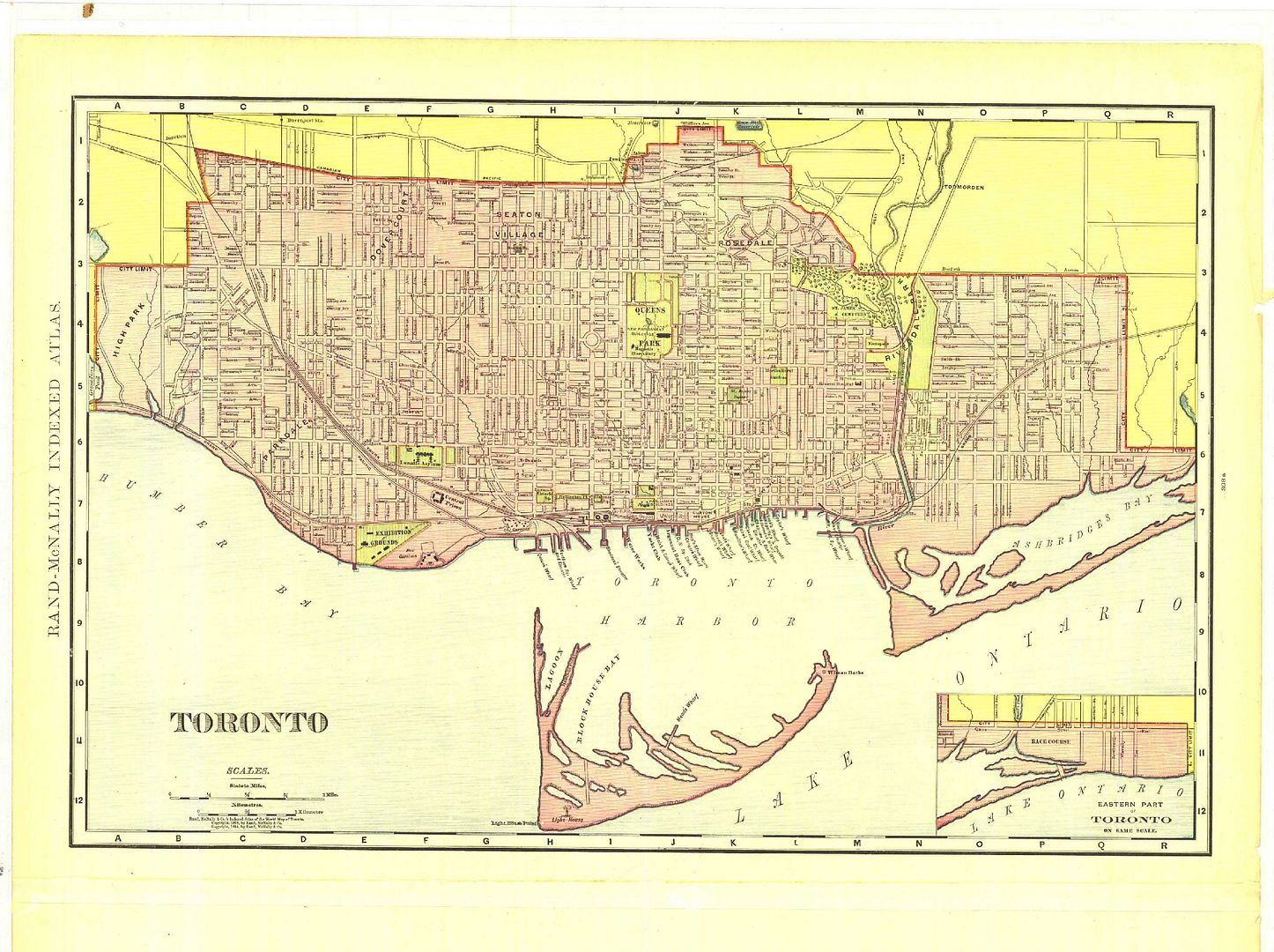

Here's a map dated 1898 showing Danforth Avenue (reached via Winchester):
Historical_Map_of_Toronto-1.jpg
 
Danforth Ave/Rd

I was making a sketch map of St David's Ward from a similar map to the one Goldie shows us just a few weeks ago and also noticed Danforth Road in what I thought was a peculiar place. There were other roads with names that surprised me up at the northern end of the ward and I wondered if the mapmaker got his labelling right.

However, I have just remembered that either in Caverhill's City Directory of 1859 or Mitchell's Directory of 1864, there is mention of more than one property with the address Don & Danforth. The Danforth Road circa 1860 and the Danforth Avenue, as we know it, may have been different places altogether. There was a Goad series around 1895. How were things named then?

I'm quite certain that Danforth Avenue and Danforth Road were originally two different streets.
Danforth Road may have originally been known as Military Trail, and was part of the Kingston Rd. route to Kingston (through east Toronto).
 
I thought this was an interesting 1900 view of the King-Queen intersection at the Don River.
Who'll get there before me to shoot the "NOW" version?

Interesting. slickrick's series of this intersection one page back (page 107) has an almost exact modern day perpective of this scene, but his 'Then' picture is not as old as yours.

Was on Elizabeth Street the other day. What a dead zone compared to what was once there.
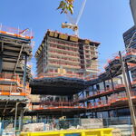
One City Hall condo has brought residential and business life back to Elizabeth, after a fashion. If you're missing the Chinese neon signage, then yes, it's a dead zone.:)


September 24 addition.


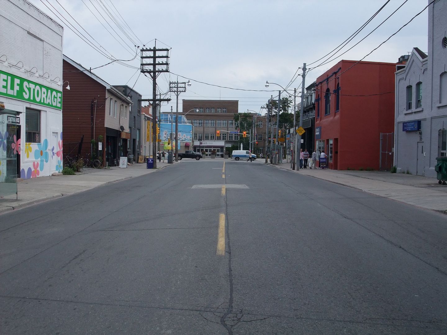
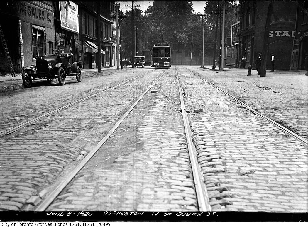
Then: Ossington looking S, Queen in the distance. June 8 1920.


fo1231_f1231_it0499.jpg


Now: August 2009.

DSCF1101.jpg
 
Mustapha:

This is the most amazing thread with so much useful - and surprising - information but I worry that one day, like many sites, UT will vanish and it will be lost (or at least difficult to retrieve). I hope you are keeping an archived copy and that maybe the Toronto Archives are too (since many of the 'now' pictures match older photos from their collection.)

I also wish there was a better way to navigate the thread as (unlike the progress of a new building) there is no rationale in the order of the postings.

Thanks to you for starting it and to you and others for continuing it.


Thank you DSC. I was inspired in June 2008 to start this thread when our city's 175 birthday was looming. I started it as a lark - an occasional then daily visual 'snippet' of a random Toronto location. I imagined it as an online cocktail party with like minded friends standing around an old style carousel slide projector, delighting as the next image twigged old memories or a discussion of what was lost, or perhaps, even gained.

I realize that the sheer volume of pictures - I try to add one a day - and the posts from others have added up to something approaching an informal resource. I save it as a showthread.php_file from time to time, but I am not sure this is the right way to archive it. I host all the pictures (the 'Thens' as well as the 'Nows') from my Photobucket account. I have the pictures on two thumb drives as well.

I could recreate - after a fashion - this thread by making a web page of my own, but the contributors [Anna, goldie, Aladone, androiduk, thecharioteer, adma, doyenne - what's-her-name, et al, if I didn't mention you, I love you all;)] are what gives this thread its life. It sure isn't the quality of my photos - taken with a 'point and shoot' and inconsistent at best. Or my (lack of) research - the Historicist pages at Torontoist is the place for substance.

I've never been in contact with the Toronto Archives nor they with me.

You wrote: "I also wish there was a better way to navigate the thread as (unlike the progress of a new building)there is no rationale in the order of the postings". ---- Quite right, and I have my regrets about this. My shot gun approach to finding pictures at the Toronto archives has from the beginning consisted of nothing more that a random inspiration for a new keyword for the search field. Street names were the first to be exhausted. :) As I said, a lark. Work pressures prevent anything resembling planning.

At some point, the interesting pictures from Toronto Archives will be exhausted and this thread might settle down a bit. But with the posts of maps and postcards, personal reminisces, etc., that may be a awhile. Let's hope.

The owners of UT make all this possible. I contributed $ awhile back, just beer money, really. Ok, two cases of beer money. If any of you can, please contribute.
 
September 24 addition.


Then: Ossington looking S, Queen in the distance. June 8 1920.


fo1231_f1231_it0499.jpg


Now: August 2009.

DSCF1101.jpg

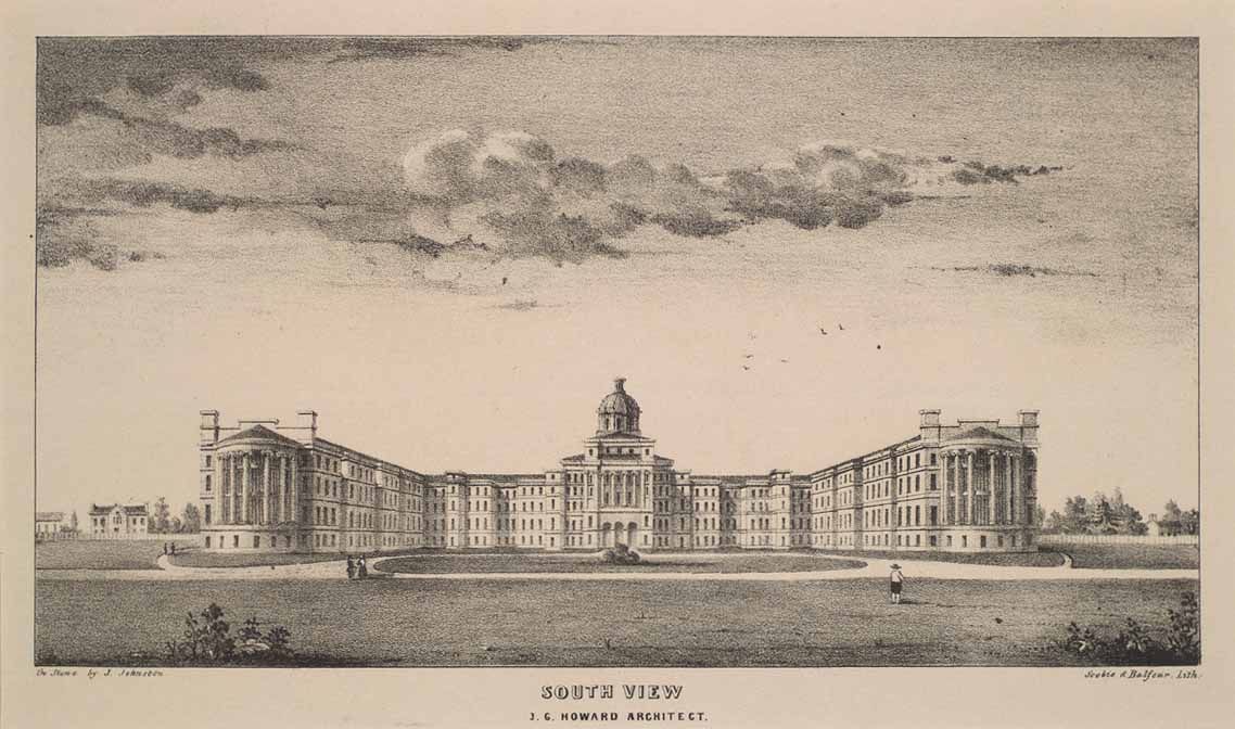
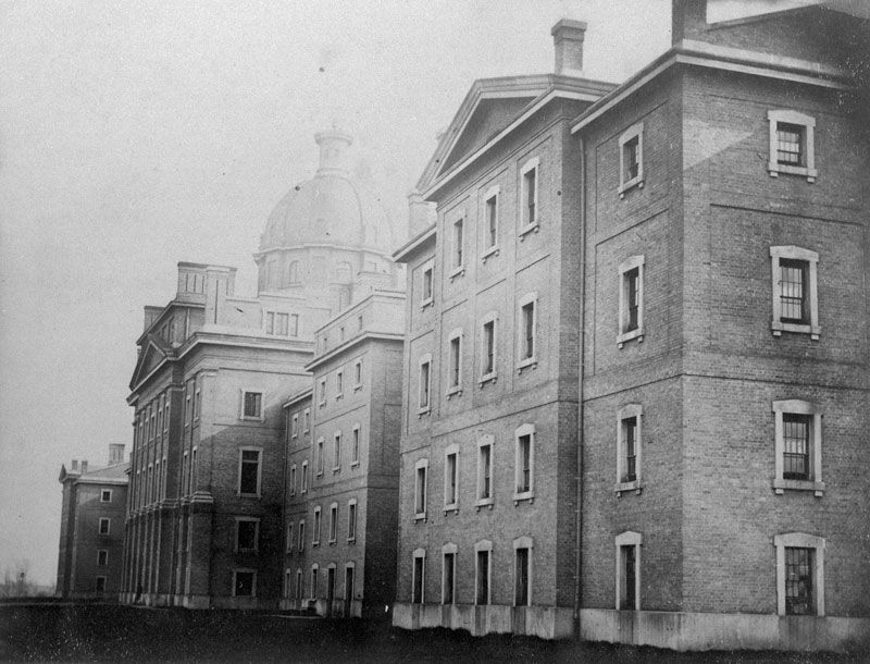
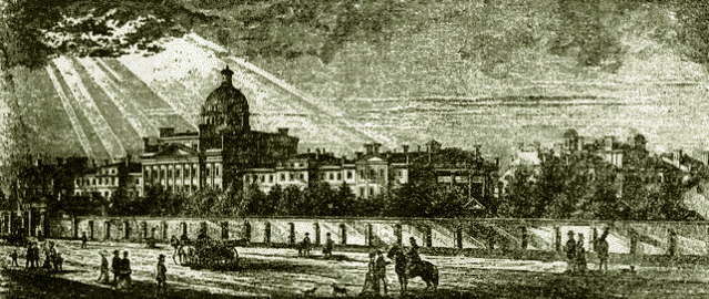
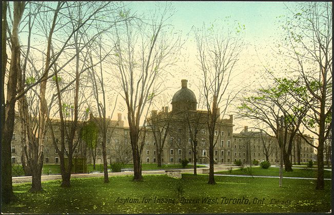
Let's not forget how the central portion and dome of the old 999 Queen building (the Provincial Lunatic Asylum designed by John Howard) used to close the Ossington axis. To paraphrase Anne Michaels in Fugitive Pieces, another example of "the presence of absence". Couldn't find any pics of the old view down Ossington.

1849
Provincial_Asylum_Toronto.jpg


1867:
Provincial_asylum_Toronto_1867.jpg


1001longasylum-1.gif


1910:
1910asylumforinsanecx1-1.jpg
 

Back
Top