News   Jul 12, 2024
 1.1K     0 
News   Jul 12, 2024
 957     1 
News   Jul 12, 2024
 361     0 

Historic photos from Toronto on this day

Down the street on the right (east side) the four storey building with white near the top looks like the old Wrigley building. It is still there.

Thanks Donoreo, a condo since the 1990's apparently.

November 6th: One photo of a streetcar safety island in the middle of St. Clair west at Bathurst in 1924. We're looking east here towards the ravine, with the fence around Robert John Fleming's estate on the left side of the picture. More pictures of the property is available on the Forest Hill Historic Photos page.

s0071_it3535.jpg
 
I wonder if those United Appeal things are newer versions of the cross-in-shields I've seen in earlier street views...
 
I wonder if those United Appeal things are newer versions of the cross-in-shields I've seen in earlier street views...

I'll have to watch for them!

November 9th: Five photos, from five different years, all over the place:

99 Years ago today, in 1911, they were filling in the ravine to build St. Clair west to Bathurst. Here's a photo of the temporary bridge they built at the south-west end of Forest Hill, to get rail cars across, to then dump lots and lots of fill. I assume we're looking west towards Bathurst, with another view of Robert John Fleming's estate on the right, that we saw back on Nov 6th (in 1924).
s0372_ss0062_it0033.jpg


Then a year later, in 1912, we have a view north in Riverdale Park with railway lines on both side of the Don River:
s0372_ss0010_it0054.jpg


In 1917 we have a rather bleak looking set of condemned Houses on the southeast corner of Eastern Avenue and Trinity Street just north of the Distillery District... between the bare tree on the right, and the three small childen mid-left, we have the start of a Grimm's fairy tale.
s0372_ss0032_it0546.jpg


To break things up, we have a sketch of the fieldhouse in the Grange Park, dated 1933:
s1188_fl0001_it0057.jpg


But then back to reality in 1936, and a 'before' picture of the back of 38-44 Bright Street in disrepair in Corktown.

s0372_ss0033_it0079.jpg


Details and locations for all these pictures on the November 9th Historical page
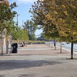
 
I had never heard the term "Garden District" used before on here. What area does it cover?

DSC's link to Wikipedia is the best answer... "Carlton Street to the north, Yonge Street to the west, Sherbourne Street to the east and Queen Street to the south" Used to be 'Moss Park'. I didn't realize it was a new name, from 2001... I thought it was an older name, from the days when the streets were full of trees, the houses were exclusive, and of course when Allan Gardens was at it's best.

By the way, I've been using the Toronto Star map of neighbourhoods (at http://www3.thestar.com/static/googlemaps/starmaps.html?xml=090120_shapetool_neigbourhoods.xml ) for my list of neighbourhoods http://wholemap.com/historic/toronto.php?neighbourhood

I'll add lots of historic Nov 11th photos to the thread soon.
 
November 11th, 1918: We'll start with all the 1918 Armistice photos from today:

A streetcar with crowds on Spadina Crescent:

f1244_it7110.jpg


Crowds outside the Star building watching the news:
f1244_it1558.jpg


f1244_it0891d.jpg


f1244_it0891.jpg


Crowds at Queen and Yonge:
f1244_it0893.jpg


f1244_it0890.jpg


Queen and Terauley (Bay) Street
f1244_it0889.jpg


And finally, my favourite, a tank crushing a car on University Avenue (why would there be a tank in Toronto?).

f1244_it0733a.jpg
 
This is the most pathetic and provocative image I've ever seen regarding the "Great War." (Warriors Day Parade, CNE, 1920)

cannonfodder.jpg
 
Last edited:
This is the most pathetic and provocative image I've ever seen regarding the "Great War." (Warriors Day Parade, CNE, 1920)

Not sure if anyone else noticed the name of the photo...

November 11th (part 2 of 3) More Remembrance day photos - two from 1924:

Flowers outside City Hall for Remembrance Day:
s0372_ss0041_it0146b.jpg


And Honourable George S. Henry, laying a wreath at Soldiers Tower at the U of T:
f1266_it4058.jpg


Then in 1925 we have another shot of the Cenotaph, City Hall - decorated with wreaths for Remembrance Day:
s0372_ss0041_it0548.jpg
 
One last set of photos from November 11th, this time from 1913: Looking north up Walmer Road from Davenport Road (Casa Loma stables in background) with only part of the stone wall built;
f1231_it1778.jpg


Then two photos, again from 1913, of the west side of University Avenue across from where the Armouries once stood (the writing on the photos say east side...):

s0372_ss0058_it0248.jpg


s0372_ss0058_it0249.jpg


Details on ALL these photos on the November 11th Historic Toronto Photos page.
 
November 12: Two sets of photos, the first from 107 years ago, today, in 1903 of manual labour on King Street West at Wilson Park Road - the 2 houses (with a totla of 4 peaks) are still there today:
s0376_fl0004_it0012.jpg


Then more work on King Street, this time at Cowan:
s0376_fl0004_it0013.jpg


Then to the Distillery District and 2 photos of the ground floor mill showing machinery for driving millstones and rolls in 1918:

f1583_it0070.jpg


f1583_it0069.jpg


Details for these photos is available on the November 12th Historic Photos page.
 
November 13th: Another range of photos today, starting way back in '13-11-01' of the corner of Cluny Avenue and Crescent Road looking east 109 years ago in Rosedale. I assume this is the 'before' picture of running the street along the path in the centre of the photo.

s0376_fl0003_it0030.jpg


Then in 1922, 88 years ago, we have a huge 'Lest We Forget' banner on Old City Hall
s0372_ss0041_it0126.jpg


Then a more working-class photo of garages, laundry, and cars at the back of 12-28 Power Street in Corktown in 1936

s0372_ss0033_it0096.jpg


And we end the photos in 1945 with a rather derelict photo of 'Major structural damage at 305 1/2 Clinton St.'
in Bickford Park:
s0372_ss0033_it0938.jpg


All the details on all these photos are available on the Historic Toronto Photos of November 13th page.
 

Back
Top