News   Jul 12, 2024
 1.1K     0 
News   Jul 12, 2024
 958     1 
News   Jul 12, 2024
 361     0 

Historic photos from Toronto on this day

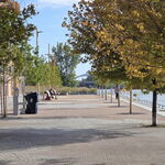
October 27th: It turns out that a number of these St. George photos from 1949 around the U. of T. were mislabeled in the City of Toronto Archives - they all seem to be from Oct 26th, but here's one last one, St. George Street looking south from Sussex:

s0372_ss0058_it2021.jpg


The in 1950 we have a view of the Queen Street subway station under construction. There are a LOT of subway construction photos in the archives, I certainly won't include them all in this thread... In this case there are 5 photos in the set, "before the passenger platforms have been built. They document the station tunnel, showing the steel beams supporting the roof."

s0381_fl0081_id7458-5.jpg


s0381_fl0081_id7458-1.jpg


Details on these photos are available here.
 
October 30th: Lots of pictures today... Starting back in 1914, 96 years ago, of Chesnut Park and Roxborough in Rosedale:
s0372_ss0058_it0343.jpg


Then Jarvis and Wilton (now Dundas) in the Garden district in 1916:
s0372_ss0041_it0057.jpg


In 1924 they were almost finished the St. Clair Ave bridge in Moore Park, with a rather amateur "Keep Off - This Means You" sign! (Follow the Moore Park neighbourhood link to see all the photos of the bridge construction, not to mention the earlier bridge it replaced.)

s0071_it3490.jpg


We leave October 30th on a bit of a low note... The rear of the service station on Dundas Street, south side, opposite Sterling Road back in 1934 in The Junction:
s0372_ss0001_it1300.jpg


Details on all these photos, including their locations, available here.
 
I wouldn't be surprised if things have changed surprisingly little w/that service station backside...
 
Auto Envy

I'd love to own (and drive) one of those old cars today!
 

Attachments

  • old car.jpg
    old car.jpg
    63.5 KB · Views: 324
I'd love to own (and drive) one of those old cars today!

Funny you should say that... I just bought a standard car, and it got me thinking to how many controls these old-old cars had... I remember an old family Datsun wagon that had a manual choke - pull it out to start, then push it in, bit by bit as the car warmed up. How many controls would these cars have while driving? Spark plug timing? Mixture? Gas and brake and gears...

And yeah, adma, in many cases the City of Toronto Archives have the 'before' and 'after' photos of buildings being cleaned up, but this gas station doesn't really need much work.
 
November 1st: There are a lot of wonderful old buildings that have been lost in Toronto, but it's safe to say THIS isn't one of them... Slum housing in the 'Garden District' - at the back of 263-269 Church Street in 1916

s0372_ss0032_it0464.jpg


Most of the photos I've geo-tagged and included are from the excellent City of Toronto Archives, but another more recent set of amazing photographs comes from 'collations' Flickr stream, like this photo of Julies Snack Bar - at 202 Dovercourt Rd in Beaconsfield Village back in 1998. I'm not sure where 'Historic' starts... maybe the fact the photo is in black-and-white is enough?

3583206291_de5448e967_z.jpg


Details and links for these two photos available here.
 
November 3rd: We start back in 1924 of the old Avoca Avenue bridge on the right, along with the new St. Clair bridge in Moore Park, looking east 86 years ago:

f1231_it1924.jpg


Then in 1933 we have three photos from Lawrence Park of the ravine on the east side of Yonge Street which managed to survive without being turned into a garbage dump like so many similar ravines around the city. Three photos from around Lympstone Avenue:

s0372_ss0052_it1607.jpg


s0372_ss0052_it1608.jpg


s0372_ss0052_it1609.jpg


Details and map locations for these pictures available here.
 
November 4th: A whole bunch of photos from today from the 1930's and 1940's. We start with exactly 80 year and about 2 hours ago today, with two timed photos of the traffic on Yonge Street between 3:45 and 4:15 in 1930. First looking south from Dundas St:
s0071_it8158.jpg


Then looking south from Trinity Square, which was just south of Dundas.

s0071_it8156.jpg


Lots of interesting store names here... Midway Cigars, Black and White Tailors, Aladdin Novelty Hosiery (!!!), Robert ? Expert Hairdresser, Beaver Billiards, J.W. Johnson Jewellery, One Minute Lunch, Cattos, Loews... Lots of photos in that area here

Then in 1933 we have a set of photos from Fort York, or 'The old fort' as some of the pictures call it:

The Centre Block House:
f1231_it0808.jpg


Inside the Powder Magazine building:
f1231_it0807.jpg


The north barracks:
f1231_it0806.jpg


Speaking of forts - there is also a set of photos of war-time security being around the Rosehill Reservoir in 1942:

s0372_ss0072_it2012.jpg


s0372_ss0072_it2013.jpg


Then finally, in 1946, we have one photo of men working away on a retaining wall at Oakwood and Regal Road in Regal Heights:

s0372_ss0058_it1719.jpg


Details on all of these sets of photos available here.
 
What the hell are "novelty hosiery"? Exploding socks? I'm not going to start on Beaver Billiards :->

I play the straight-man here... I'll lob them over the net for you guys to fire them back ( to mix my metaphors ).

November 5th: One photo today looking north up Carlaw Ave. from Queen Street east in Leslieville, after the street was widened, in 1948.
s0372_ss0058_it1845.jpg


If you take a look on the map of that corner you can see the same location from April 7th, before the street was widened, and before the Speede's Grill ( and window above the Coca-Cola sign ) was added. The building on the right still stands with Celline Garden Restaurant, and a cool looking mural, as do other building on the east side. The west side of Carlaw, however, is now a new Shoppers Drugmart and parking lots.


Details on this photo are available here.

Down the street on the right (east side) the four storey building with white near the top looks like the old Wrigley building. It is still there.
 
Definitely--and the lowrise in front of it is the present-day Printing Factory Lofts base...
 

Back
Top