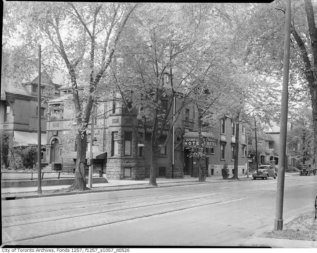
Great set! For a city that prides itself on its trees, we were very careless about the trees which once lined practically every street downtown.
NW corner of Sherbourne and Isabella 1945:
That's a great photo too. Notice how close the trees were to the street even then...
June 23rd: One more photo from Sherbourne Street in
1953, of the houses, trees, and some ornate wood-work to the right, at 609-611:
Leaving Sherbourne, we'll jump back to
1922 and the north-east corner of Dundas and Spadina, 88 years ago on a Friday:
And the alleyway behind the theatre. I assume that is graffiti on the far left, even back in :
You can see more
photos of the theatre, and corner on this map
And while not historic
yet, I've posted a few photos from the mural by EGR and Horus, commissioned by Chinatown BIA this year,
2010, in this alley ( I suspect it won't last too long, I guess ).
Start at
http://www.seemsartless.com/index.php?pic=2167 and keep moving to the right to see more images from the mural, including a fish painted on the (now paved) ground.