News   Nov 22, 2024
 680     1 
News   Nov 22, 2024
 1.2K     5 
News   Nov 22, 2024
 3.2K     8 

Evocative Images of Lost Toronto

George Playter gate house at head of Parliament St. Built circa 1818. Municipal address: 110 Howard Street. Owen Staples, 1914:


pictures-r-3916.jpg


s0372_ss0010_it0087.jpg


s0372_ss0010_it0111.jpg


s0372_ss0010_it0112.jpg
 
George Playter gate house at head of Parliament St. Built circa 1818. Municipal address: 110 Howard Street. Owen Staples, 1914:


pictures-r-3916.jpg


s0372_ss0010_it0087.jpg


s0372_ss0010_it0111.jpg


s0372_ss0010_it0112.jpg

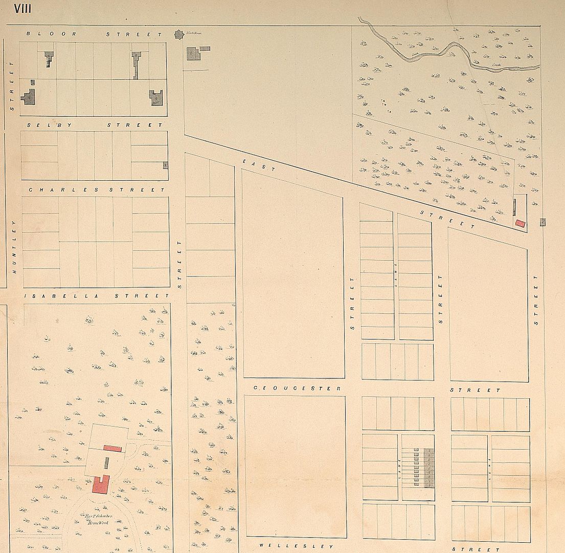
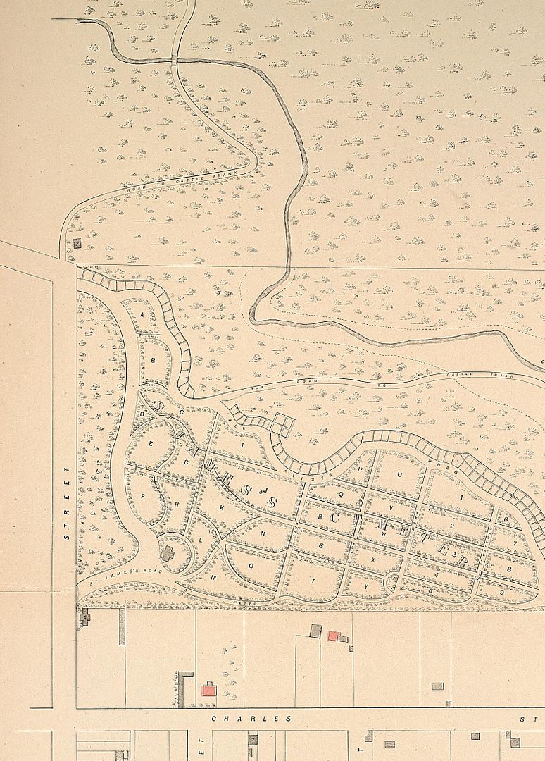
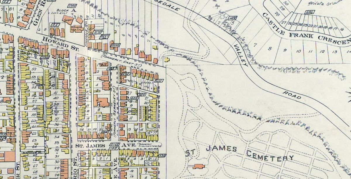
Very nice, wwwebster! of course this building being a gatehouse can only be understood in the context of the area pre-Prince Edward Viaduct in which Bloor Street did not exist east of Sherbourne and Howard Street was one of the main route from east downtown to the north:

1858:


1858: The gatehouse is to the right of the path at the top of Parliament Street:


1910 (the gatehouse is the yellow building on the east end of Howard):

 
Last edited:
Very nice, wwwebster! of course this building being a gatehouse can only be understood in the context of the area pre-Prince Edward Viaduct in which Bloor Street did not exist east of Sherbourne and Howard Street was one of the main route from east downtown to the north:


1858: The gatehouse is to the right of the path at the top of Parliament Street:


I'm wondering if that path, "Road to Castle Frank," was connected to Pottery Road, further N. in the valley.
 
I'm wondering if that path, "Road to Castle Frank," was connected to Pottery Road, further N. in the valley.


In the 1924 Goad map, the paths are still shown to some extent (the one going east linking up with Rosedale Valley Road), but the gatehouse is gone.

 
Last edited:
The 1924 map seems to suggest that property owners on the north side of Howard continued to own their (noncontiguous) ravine land on the other side of the newly-built Bloor Street extension. I'm guessing this is sloppy map-making -- the city must have also expropriated everything to Rosedale Valley.
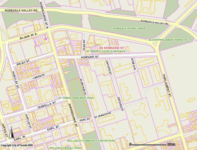
 
The 1924 map seems to suggest that property owners on the north side of Howard continued to own their (noncontiguous) ravine land on the other side of the newly-built Bloor Street extension. I'm guessing this is sloppy map-making -- the city must have also expropriated everything to Rosedale Valley.

Looking at the lot-lines on TO Maps, I think you're right:

 
Last edited:
Nice find! But as you were probably thinking it matches the print awful closely - right down to the drape of the curtain. I guess it might have the same original source.


Here's another view of the later hall - this time with the tower! Some time 1910-11, by the election signs.

screen-shot-2013-02-18-at-7-18-20-pm.png

Wow, thanks for digging up the photo of the post-1841 hall with the hose tower. A very rare view, indeed. The tower looks to be constructed of wood. I'm not surprised that it didn't last as long as the rest of the hall. No matter what photo I've seen of the post-1841 hall, it never seemed to show well. Perhaps it was the dissimilar apparatus-bay doors that gave it a shabby look.

To help with, or add to, the confusion regarding the early fire brigade presence at Bay & Temperence, I dug into some fire dept. historical research that was done for the 1998 amalgamation. According to that source: A volunteer ladder company was organized at that intersection in 1835 to help protect the larger western area of the city that had been annexed the previous year. Obviously, there would have need been quarters for this company, so I'm assuming that the earlier hall in the painting was built in and around 1835. Four years later, in 1839, a second company was added to the hall, Engine 3 with a hand-drawn pump and hose reel. I can only assume that the original quarters was insufficient for the two companies, causing the newer building to be constructed in 1841. According to dept. records, at least two more engines were organized in those quarters between 1849 and 1856. Remember that the whole dept was volunteer until 1874, so there would have been some rivalry between the individual companies. The bigger the hall the better, in those circumstances.
 
The 1924 map seems to suggest that property owners on the north side of Howard continued to own their (noncontiguous) ravine land on the other side of the newly-built Bloor Street extension.

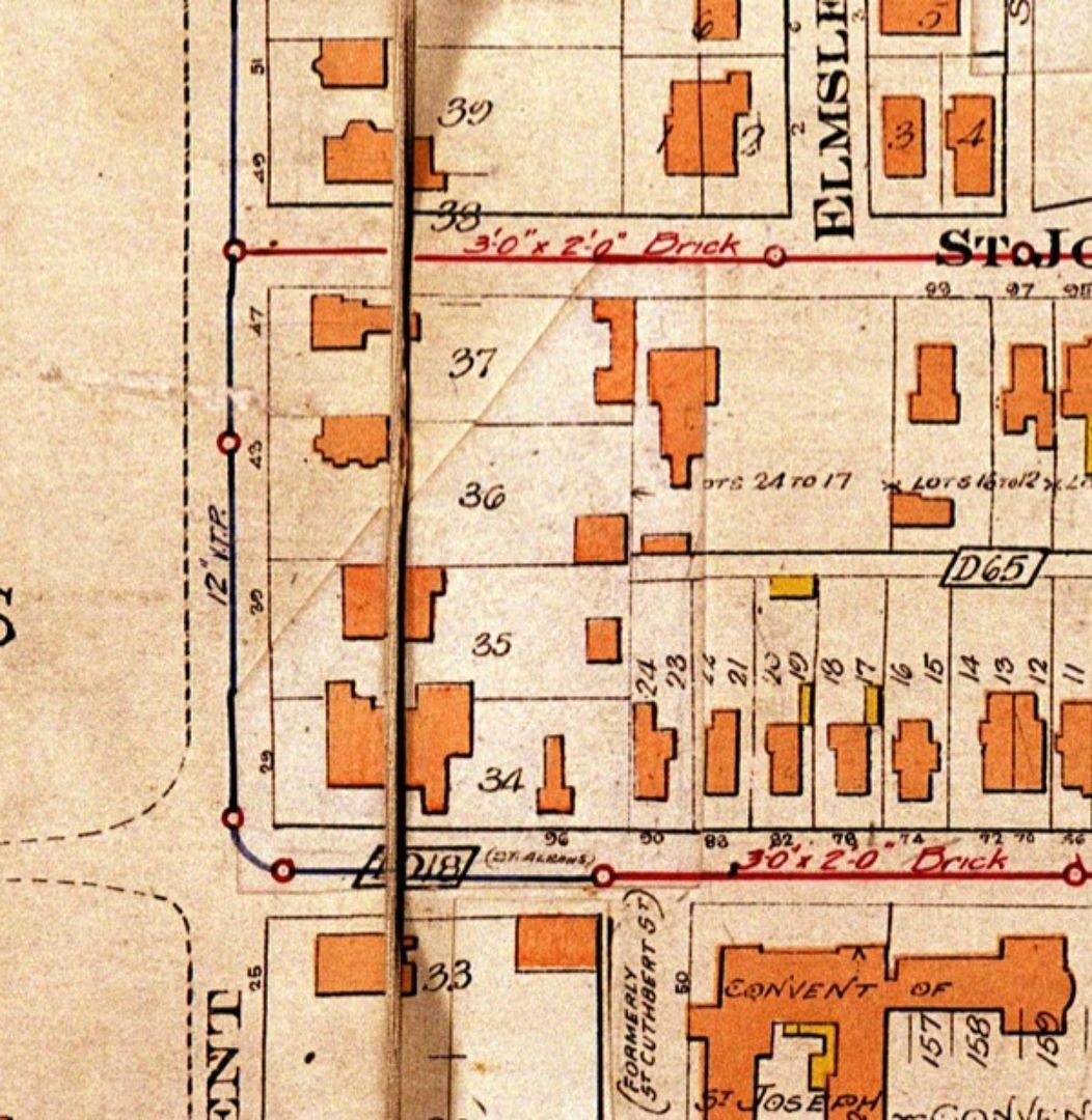
Not necessarily, or at least, not as I understand it (though I’m no expert). Even after the lots were severed by Bloor, the Registered Plan number and Lot numbers would remain valid legal descriptors of the properties (though now as “Part Lotsâ€) until a new Plan was registered, which would only be necessary if they were further subdividing the land from Bloor north to the Concession Line.

The mystery for me is that the same 14 lots appear to be part of both Plan D295 and D297, as seen on the 1884 Goad:

http://data2.archives.ca/e/e431/e010772061-v8.jpg

Plan D295 was registered in 1879 by Allan McLean Howard, but I have no information about D297. Perhaps it was to correct an error in D295.
 
Not many of the old homes on Danforth are still visible. This one remains behind a storefront near Dawes Road (2726 Danforth).

oldhouseat2726Danforth_zpsd6cdf883.jpg
 
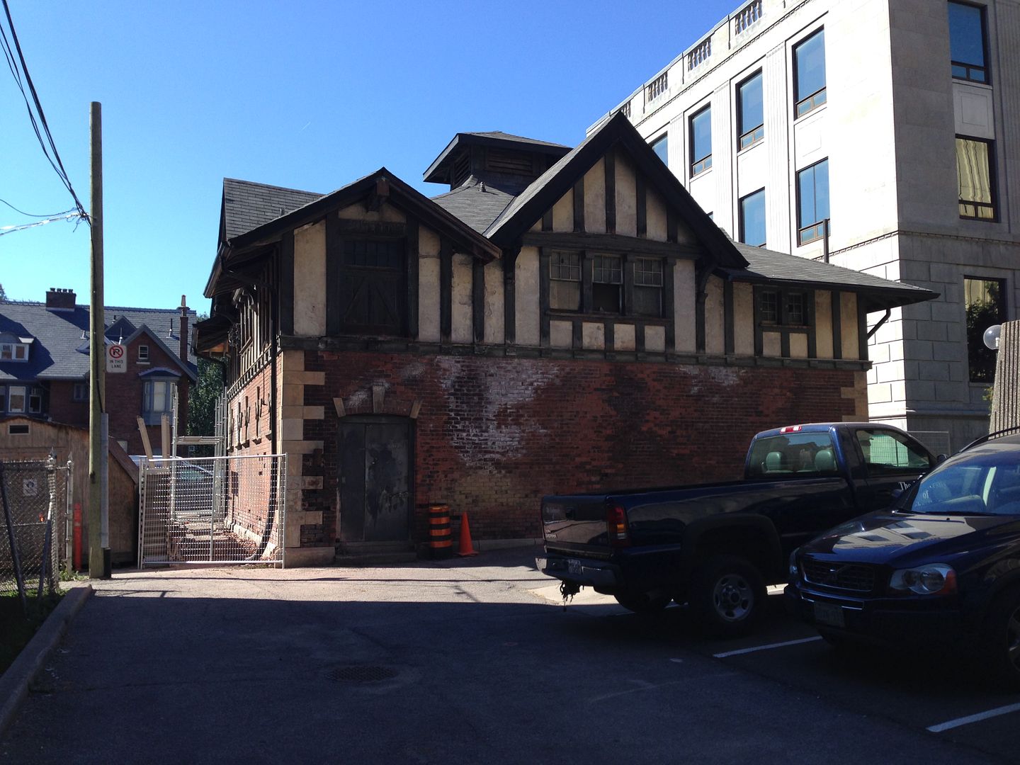
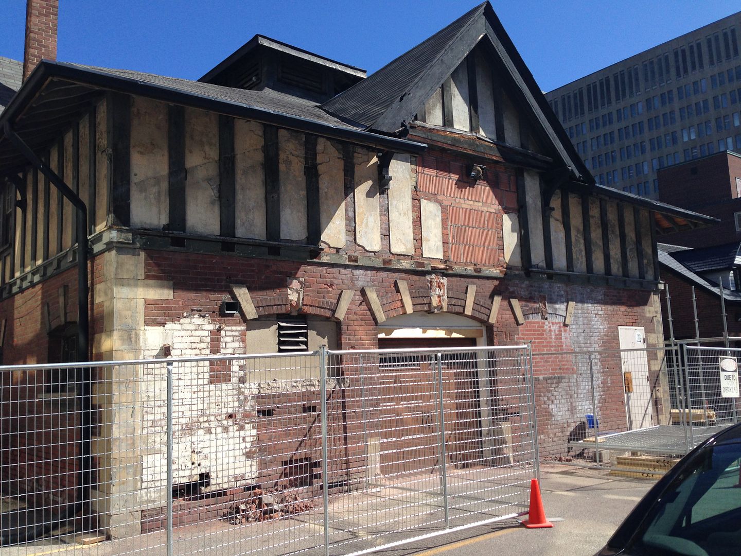
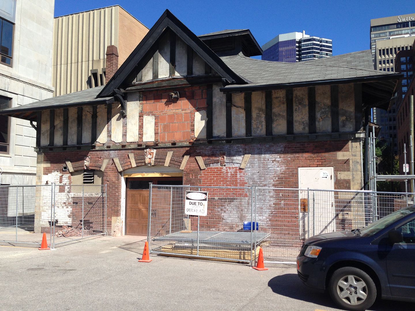
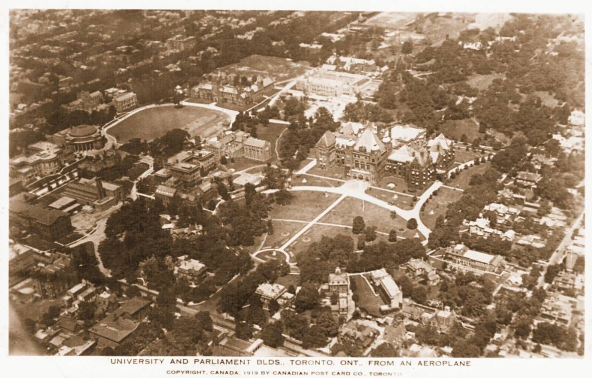
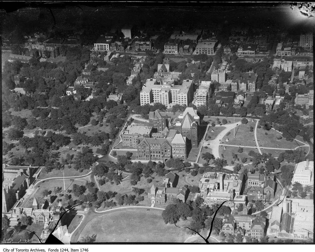
Behind 43 Queen's Park Crescent, between Wellesley and St. Joseph, stands an abandoned coach-house, a remnant from the days when Queen's Park Crescent contained some of the grandest homes in the City:

1924:


Today:


1912, looking north from Wellesley:

f1244_it7233.jpg


Mr. Christie's House:

f1231_it0414.jpg


1919:


Lost houses:

f1244_it3180.jpg


f1244_it3052.jpg


f1231_it0756.jpg


View in 1930:


The coach house may be the building in the the centre:


Attachments

  • f1244_it7233.jpg
    f1244_it7233.jpg
    98.6 KB · Views: 837
  • f1231_it0414.jpg
    f1231_it0414.jpg
    98.8 KB · Views: 858
  • f1244_it3180.jpg
    f1244_it3180.jpg
    96.9 KB · Views: 814
  • f1244_it3052.jpg
    f1244_it3052.jpg
    94.3 KB · Views: 828
  • f1231_it0756.jpg
    f1231_it0756.jpg
    99.6 KB · Views: 821
Last edited:

Back
Top