News   Apr 23, 2024
 1.6K     5 
News   Apr 23, 2024
 542     0 
News   Apr 23, 2024
 1.3K     0 

Ellesmere Road, 1952-2009

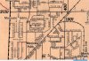
It's to ensure that everyone gets the same-size lot. The closer you get to either pole, the more lines of latitude converge; a vice-versa as you approach the equator. In Canada what that means is that if you start at, say, Eglinton and draw two lines due north, by the time you reach Lawrence, they're slightly closer to one another than they were a at Eglinton. It may not seem like much but it does add up and it's not long before you're short-changing people a quarter of an acre. So, periodically, little adjustments are made in the concession roads so that the distances, and thus the lots that they define, remain constant. In the days of horse-drawn carts or a handful of cars an hour, doglegs like this aren't all that bothersome. You'll still find them if you drive far enough up in York Region. But as you get to the point that several cars a minute have to negotiate these turns, that's when municipalities tend to smooth them out. Drive north in Scarborough or North York and you'll notice broad sweeping curves as you approach major east-west streets like Sheppard and Finch (for example). When you do, you'll know you've reached one of those former doglegs.

They do happen on east-west streets, but less often. In those cases they usually represent different surveys, or a kludge around some other anomalously in trying to create fair and equal lot sizes.


Interesting.

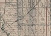
And of course the east/west streets did not line up at the [former] [North] York township and Scarborough township border because there was no reason for them to. York township was surveyed with the concessions (and concession roads) numbered east and west from Yonge while the Scarborough concessions (and concession roads) were numbered north and south of Lawrence.


York Scarborough.jpg
 

Attachments

  • York Scarborough.jpg
    York Scarborough.jpg
    102.8 KB · Views: 994

Attachments

  • No Parkwoods Vill..jpg
    No Parkwoods Vill..jpg
    93.2 KB · Views: 839
  • Before Bridge.jpg
    Before Bridge.jpg
    103.1 KB · Views: 879
I found this photo on City of Toronto Archives Arial photos East Toronto of the Warden-Ellesmere bridge under construction.You can clearly see the curved bypass track and the two bridges.Ellesmere now goes straight east/west and Warden goes north/south.
 

Attachments

  • New Bridge and bypass track.pdf
    1.2 MB · Views: 575
I found this photo on City of Toronto Archives Arial photos East Toronto of the Warden-Ellesmere bridge under construction.You can clearly see the curved bypass track and the two bridges.Ellesmere now goes straight east/west and Warden goes north/south.
You wouldn't happen to be Ross Wixon, would you?
No. Wright
 
Just to add more info about the Warden-Ellesmere arial photo.
It is on City of Toronto archives-Arial photos-Series 12-1963-Map 140
(I found this photo on City of Toronto Archives Arial photos East Toronto of the Warden-Ellesmere bridge under construction.You can clearly see the curved bypass track and the two bridges.Ellesmere now goes straight east/west and Warden goes north/south.)

New Bridge and bypass tracks.png
 

Attachments

  • New Bridge and bypass tracks.png
    New Bridge and bypass tracks.png
    1.3 MB · Views: 711

Back
Top