

Goldie
Senior Member
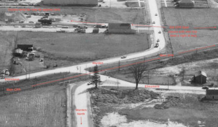
That's an amazing aerial, Ross W - thank you.
I had no idea that it was such a complex intersection.
|
|
|

I am wondering if anyone has photos of the Warden-Ellesmere intersection under construction around 1966-1968.This is the dual CPR overpass bridges that corrected a terrible traffic problem when trains came to cross the intersection.This must have been voted the worst intersection in Metro Toronto before the new bridges for traffic congestion.I have 2 photos of the intersection before the bridges were built.Both photos are from the Scarborough Archives.In the first photo,I have marked which road is which because looking at the photo without the identification of each, is confusing seeing it for the first time.The actual track crossing is shared by both roads.
I'm sure the Toronto archives have all the photos,contractors etc,but I couldn't find where to start looking for the right section.
The new dual bridge overpass dated on the N/E wall is 1968.
Anna says:<I can't read what you have written about the road (Canadian?) south of the railway tracks - what does it say?>
It is the old spur line that branched off the main line.It crossed Warden Ave.,then went south between Warden and Birchmount,crossed Lawrence Ave.e. then served the industrial area to the south.
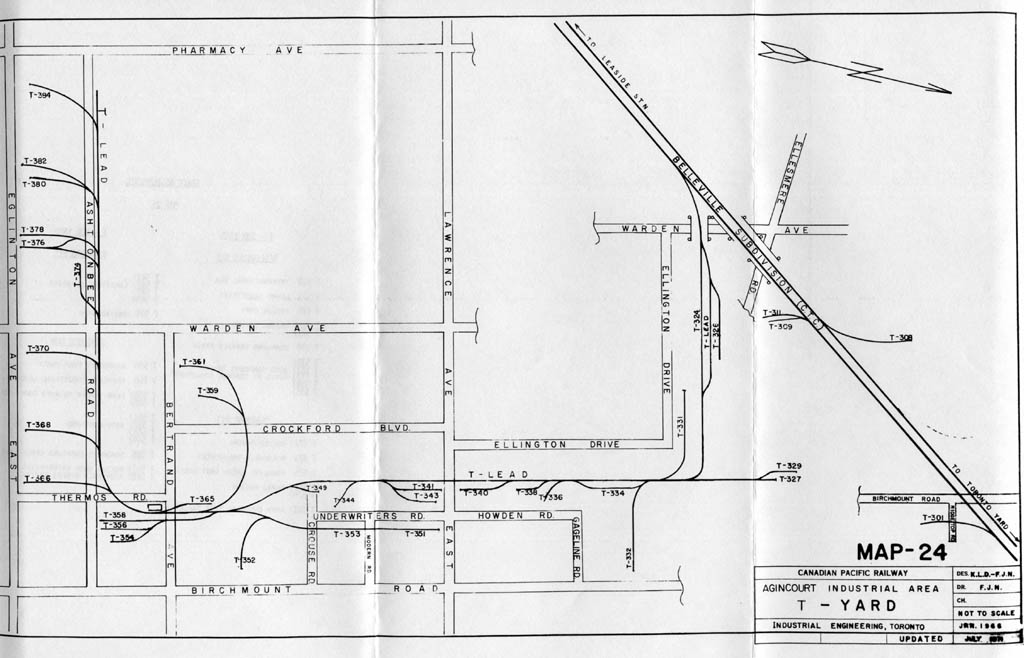
Right, thanks. I remember it crossing Lawrence. Don't know if you have seen this at Old Time Trains
http://www.trainweb.org/oldtimetrains/CPR_Toronto/LEASIDE.htm
What's I find so amazing about that pic is how quiet the rural areas just outside the city were in those days. Now, even most rural roads in places like Caledon and northern York Region are busy. I'd think only highways like 7 and 27 had traffic back then. Though Hwy. 27 was likely even busier than now before the 400 was built..
Before the DVP and Bayview extension were built that part of Toronto was quite isolated from the old city. That's why Don Mills is relatively young compared to areas of the city much farther away from downtown.