News   Apr 18, 2024
 249     0 
News   Apr 17, 2024
 1.5K     0 
News   Apr 17, 2024
 408     0 

Historic photos from Toronto on this day

November 14th: One photo from Thursday, November 14th, 1929 at 11:20AM, 81 years ago in the Junction, of a train waiting to cross Lansdowne north of Dupont, before the 'subway' was dug out under the tracks:

f1231_it1321.jpg


(Details and location of this photo is available on the November 14th Historic Photos page.)
 
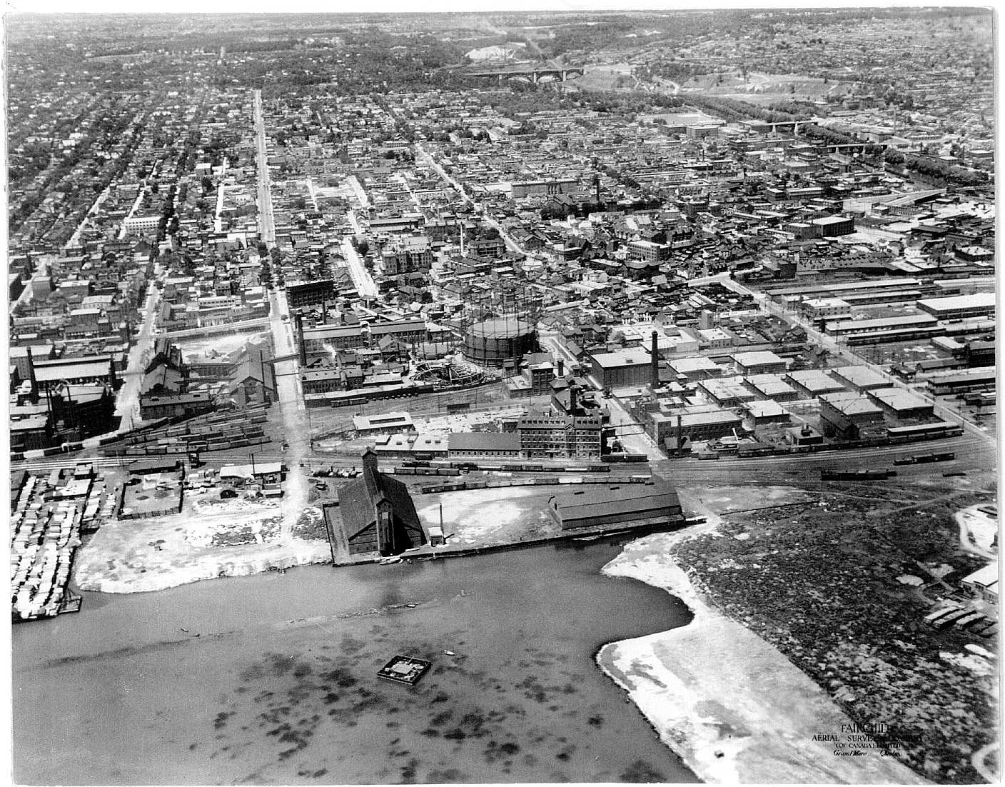
I’ve seen various years attributed to this image, from 1926 to 1929; however, historian Sally Gibson alleges it was taken on November 17, 1926:


aerial6_1927.jpg


If so, the same is likely true for the other 5 Fairchild Aerial Surveys images trainweb.org has identified as being 1927:

http://www.trainweb.org/oldtimetrains/CPR_Toronto/TORONTO.htm

As a reference point, I cite the following image, from April 28, 1927, in which one can see a brand new Consumers Gas holding tank that is not visible in the aerial image:


s0372_ss0079_it0208.jpg
What is the large round building just north of the Distillery? Looks like it is on the corner of Front and Trinity.
 
I’ve seen various years attributed to this image, from 1926 to 1929; however, historian Sally Gibson alleges it was taken on November 17, 1926:

Thanks for that 1926 aerial image.
So much detail to be examined.
I found Winchester Ave., that odd street that once led to Danforth/Broadview (top of photo).
Also was pleased to be able to identify the famous Canary Restaurant (bottom circle).
But what's that long building near the centre? It reminds me of a jail.

Torontoaerial.jpg
 
Sydenham St.

Close. :) Park School on Shuter (then Sydenham):

Thanks again, wwwebster.
My curiosity regarding Park School has revealed this interesting image which, coincidentally, shows both gas tanks that you previously mentioned.
I wonder what that huge supply of boxes was for.
 

Attachments

  • south from Park School.jpg
    south from Park School.jpg
    98.7 KB · Views: 503
Last edited:
Isn't that "brand new Consumers Gas holding tank" actually one of the molasses (?) tanks that used to stand in the Distillery, on the site where the first condo went up a couple of years ago?

Also, where's the Distillery's hulking Rack House "M" ( which is given a construction date of 1927 ) in that aerial photo?
 
What a great photo! I've added two green blocks:
toronto-parliament-1926.jpg

On the far west side of the photo is the site of the Canadian Stage Company and Canadian Opera Company, with Berkeley Castle just off the picture, I assume. Then just east of that is 51 Parliament St, the old Consumers' Gas Co, Station A As our firend Collations wrote: " Built in 1898, Bond & Smith, Architects. Added to the City of Toronto's list of heritage structures in 1973, and designated in 1978. This is now home to 51 Division of the Toronto Police Service." Here's his excellent montage of the building back on March 7, 1998 from Flickr:

4559157221_c94f722a44_b.jpg
 
The Mystery Tank

Isn't that "brand new Consumers Gas holding tank" actually one of the molasses (?) tanks that used to stand in the Distillery, on the site where the first condo went up a couple of years ago?

Could this be a foundation for the "brand new Consumers Gas holding tank" ? (see circled area on attached photo).
It appears to be on the Consumers' Gas property.
 

Attachments

  • tank foundation.jpg
    tank foundation.jpg
    64.9 KB · Views: 426
(more) November 17th: Three photos from 1897, 113 years ago in Beaconsfield Village of the men and horses building the subway under the tracks along Queen Street at Dufferin.

s0376_fl0002_it0010.jpg


s0376_fl0002_it0008.jpg


s0376_fl0002_it0009.jpg


Lots of interesting details in these photos, like the Union Hotel and the original top of the tower on the Gladstone Hotel. Interesting to visit there on Google Maps, and see that most of this stonework survives. Here's a close up of the south east corner from Google Street view:

1897-queenst-subway.jpg


I've geo-tagged more historic photos that you can see here on the map.

For links to the City of Toronto Archive details on these photos, see the Nov 17th Historic Toronto photos page.
 
Isn't that "brand new Consumers Gas holding tank" actually one of the molasses (?) tanks that used to stand in the Distillery, on the site where the first condo went up a couple of years ago?

Well, I suppose it might be for something other than gas, but it’s on the north side of Mill Street:

s0372_ss0079_it0661.jpg


Some additional images:

https://gencat4.eloquent-systems.co...esource/ser372/ss0079/s0372_ss0079_it0662.jpg

https://gencat4.eloquent-systems.com/webcat/systems/toronto.arch/resource/fo1583/f1583_it0062.jpg

http://www.distilleryheritage.com/PDFs/photos/1915.pdf

http://www.distilleryheritage.com/PDFs/photos/1937_ariel.pdf

Also, where's the Distillery's hulking Rack House "M" ( which is given a construction date of 1927 ) in that aerial photo?

Perhaps I'm misunderstanding the question, but I believe the photo is from November 17, 1926.
 

Back
Top