


TJ O'Pootertoot
Senior Member
If I had a full tank of petrol, and later found out I couldn’t get any more, the last thing I’d do is carelessly ‘drive my car on the tank that’s in there’. A tank can only go so far, and it’d “stop dead” pretty quick. If I had any sense, I’d conserve the fuel by storing it in the garage, then plan ahead by looking at other fuel options available. Or see about combining it with non-petroleum based additives such as ethanol (to make it last as long as possible). Only the wayward and clueless would burn everything they have right away. Or cry to ma and pa for a bit more cuz now they're focused on the future, and that this time will be different.
Look, as I've said before, I have issues with how quickly Vaughan opened up its whitebelt lands, but you're still mixing metaphors here.
Land is not petrol (PETROL? Are you British - if you, I've learned something!). We think the Greenbelt makes land finite but of course it's not that simple. Firstly, Places to Grow already left plenty of already-approved greenfield sites that are now being developed and then there's the whitebelt lands which are really "there if needed" but which the development industry regards as unzoned greenfield sites. Moreover, even in an ideal scenario, Places to Grow envisions the majority of development (60% in most municipalities) is still outward expansion. so, the law of the land is "most development can be greenfield development."
I might agree with you, as a matter of principle, that these municipalities should be slamming on the brakes but it's naive to think any of them are just going to pull over to side of the road. Markham and Waterloo were the most aggressive municipalities and they went to 60% so STILL a big chunk of development is on the urban fringe even though new guidelines will make it generally less inherently sprawly than what's come before.
You're stretching the metaphor a bit the ethanol thing but if my typical fill-up is 15% Ethanol, that still pales in comparison to Vaughan where 45% of their new development is infill. (And that 45% is still better than Mississauga and Brampton and, indeed, almost every other municipality in Places to Grow's umbrella, since very few went above the 40% minimum, treating it as a maximum.)
so, I wish developers weren't driving the agenda as hard as they are.
I wish Vaughan's city council wasn't more or less the same today as it was 15 years ago
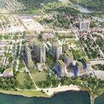
I wish they were setting near-Langstaff zoning for VMC, since they've been gifted the subway.
I wish they hadn't opened up new whitebelt lands before seeing how much infill density they can get.
I wish the OMB was substantially reformed and I wish we all had jetpacks that allowed us to fly around above traffic, for that matter.
You're still using this singular example to rant about a municipality which, on balance, is doing better than most here, especially within a short timeframe of a planning change that (as I've said before) will take decades to fully materialize. In the meantime, Vaughan is building 30+-story towers and, generally speaking, doing better than they've done in past decades. We all want better but I'm not sure what more you can realistically expect.
No one anywhere has "slammed on the brakes" the way you describe because neither democracy nor urban planning nor development moves at the same speed as a car on the highway. You might as well complain about people still being petroleum-fuelled cars even though we believe global warming is happning or drinking Coca Cola when they know it makes them fat or even, just as an example, that Toronto is actually debating whether it makes sense to tear down the east part of the Gardiner.
When will they learn?
Eventually.
Last edited: