News   Apr 19, 2024
 356     2 
News   Apr 19, 2024
 678     3 
News   Apr 19, 2024
 741     1 

Planned Sprawl in the GTA

Clearly we beg to differ on Langstaff but to compare it to Doug Ford's vision (a hotel you can park your boat at!) is grossly insulting. We both know Doug Ford doesn't know WTF a streetcar suburb is and he wouldn't know Ebenezer Howard from Howard the Duck.

On the other hand, Langstaff aside, the combination of factors you describe are perfectly encapsulated in Calthorpe's vision of transit-oriented new urbanist communities. I wasn't talking about Langstaff specifically, anyway, as much as NU-TOD as a re-visioning of the Garden City, which is most certainly explicitly is. Again, read Fishman's intro to The Regional City.

Calthorpe also did work in Markham Centre, updating the original plan and whether or not that meets your definition, I don't know. But specific local developments aside, if you're looking at a 21-st Century version of the Garden City and streetcar suburbs (i.e. a balanced, polycentric urban whole with ample green space and development concentrated along transit corridors), that's Calthorpe in a nutshell.

I initially thought the Doug Ford plan was beyond preposterous – particularly the boat-in 5 Star hotel at the mouth of Canada’s third most polluted river. And IMO his "backroom vision" as a whole was definitely silly. But to be fair, a good portion of the plan was grounded in reality. To the best of my knowledge the hotel location would be at the old Home Depot lands, where there is an ongoing plan for something major. And although the idea of a boat-in hotel does seem crazy, some of it is factually correct. We already have ferries in use in TO, and water taxis. As well, WTO’s plans do acknowledge future ferry use for the Port Lands. Even John Tory brought up the idea during the election.

But long and short, Doug’s plan was backed by developers and stakeholders who are in fact planning a major retail/residential project for that site - regardless of WTO’s governance.

urbantoronto-7343-25090.jpg

http://urbantoronto.ca/database/projects/3c-waterfront

Re: Langstaff Gateway,
I can understand why the subway is wanted so much for the site. Yes, it’s to boost land values. But I think it’s ultimately because there’s SFA about LG that’s even remotely interesting or of value. If there was a geographic feature, or a key intersection, or...anything - I could understand it being specifically chosen or worthy of becoming an ultra high-density downtown-esque pocket. But there’s virtually nothing. LG can't even claim that it's on the happening and burgeoning Yonge Corridor, considering it's vastly E-W with very little of the site actually fronting onto Yonge

IMO it doesn’t matter what form of planning is chosen, there’s gotta be a proverbial nucleus. NYCC had a city hall, and a possible telecommunications tower. And specific to Markham: even the oddball subdivision that is Cathedraltown at least has a cathedral.

***
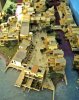
I guess the next part of this post is taking things really off topic (but what is the "topic" of this thread, really?). Earlier I was talking about Towers in the Park, the Garden City movement, or what could exist if we chose to develop our islands. I’m sure some are aware of these plans. But if not, they’re pretty cool to look at. The plan was called HarbourCity, and it was a Jane Jacobs-backed proposal to develop the Island Airport, and create a series of inhabited islands out in the lake. I like the idea behind it: medium density residential, ample parkland, connected by rapid transit, and heavy use of non-auto transportation (e.g - personal watercraft). Not to mention that it's exceptionally unique (for TO, but also for North America). It seemed like a cool idea that I think would be just as good now as when it was first proposed.

1000405724-1000406337.jpeg

http://www.canadianarchitect.com/news/harbour-city-revisited/1000405724/?&er=NA

20100916-harbour_city1.jpg

http://www.blogto.com/city/2010/09/remembering_harbour_city_torontos_unbuilt_town_on_the_lake/
 

Attachments

  • urbantoronto-7343-25090.jpg
    urbantoronto-7343-25090.jpg
    52.3 KB · Views: 1,232
  • 1000405724-1000406337.jpeg
    1000405724-1000406337.jpeg
    46.3 KB · Views: 1,243
  • 20100916-harbour_city1.jpg
    20100916-harbour_city1.jpg
    120.5 KB · Views: 1,246
I initially thought the Doug Ford plan was beyond preposterous – particularly the boat-in 5 Star hotel at the mouth of Canada’s third most polluted river. And IMO his "backroom vision" as a whole was definitely silly. But to be fair, a good portion of the plan was grounded in reality. To the best of my knowledge the hotel location would be at the old Home Depot lands, where there is an ongoing plan for something major. And although the idea of a boat-in hotel does seem crazy, some of it is factually correct. We already have ferries in use in TO, and water taxis. As well, WTO’s plans do acknowledge future ferry use for the Port Lands. Even John Tory brought up the idea during the election.

The problem with Doug's plan is as at least as much where it came from as what it entailed. Hotels and other entertainment uses may well be fitting long-term uses for that area but it's not a random city councillor, whose brother happens to be mayor, to sit down with private developers and draw up a plan as if neither the city nor Waterfront TO planning processes are underway.

You could even make an argument that a big ferris wheel would fit there; Chicago, London and now New York all have these things after all. But Doug presented everything as cartoonishly extreme. A monorail! the WORLD'S BIGGEST FERRIS WHEEL! A hotel you can park your boat at!!

Suffice it to say, this is not how you plan cities and certainly not on some of the most valuable (financially and in terms of its geographic location) land in the country. Its redeeming factors are thus essentially besides the point. The fact that developers and stakeholders backed it is precisely the problem, not a mitigating factor in its favour.

You keep going back to Langstaff, ignoring that I only mentioned it incidentally. YOU said that you'd like to see a newer version of the streetcar suburb/garden city ideal and I said that Transit-Oriented Development, and Peter Calthorpe's work overall, precisely captures this ideal (regardless of whether the unique circumstances of Langstaff strictly fit the mold).

As for a community needing a "nucleus," you can make that. North York City Hall was no nucleus; not until they tore down everything around it and built Mel Lastman Square, the library etc. In Cathedraltown, very ironically, the shuttered Cathedral has become an obstruction to building an actual nucleus. Obviously it's ideal when you have an organic nucleus to build around but whether you're talking about Markham Centre, Langstaff Gateway or the Canary District (or North York Centre, or even Mississauga where, despite City Hall and the performing arts centre, they need to forge a proper nucleus), there is no reason to think you can't build one from scratch over time.

You can't do that with a bunch of individual towers isolated in parks, however. You do a bunch of those and you get Regent Park or Pruitt-Igoe or any number of famous failures. Which brings us back to how Calthorpe's ideals differ greatly from someone like Courboisier, regardless of subways and Yonge Street.

I found this on Google books; rather captures my point well. I can't seem to paste the test but see the bottom of P.22.
 
Last edited:
@44 North, by a modern rendition of the tower in the park/transit oriented development do you mean something like Ørestad district in Copenhagen?

If that is the case, then I am not particularly impressed with the results thus far. From what I gather of Ørestad, it is economically unsuccessful, has failed to create a sense of community, is not very walkable and still has many of the (negative) symptoms of tower in the park developments.


I am trying to find a counter-example of Copenhagen region's plans to build a transit-oriented community from scratch along one of their S-Train's that did impress me from the renders and descriptions. From the renders I saw, it did succeed in creating a central 'place' or nucleus (around an elongated but walkable park no less!) with residential areas surrounding it and the S-Train station and some retail uses at the heart. I think this model of transit-oriented development is significantly better than the tower-in-the-park, I've spent the past 20 minutes trying to find it but with no luck, maybe someone on here knows what I am talking about. (I remember it was on one of the S-Train's heading west from Copenhagen)
 
Last edited:
Re: Langstaff Gateway,
I can understand why the subway is wanted so much for the site. Yes, it’s to boost land values. But I think it’s ultimately because there’s SFA about LG that’s even remotely interesting or of value. If there was a geographic feature, or a key intersection, or...anything - I could understand it being specifically chosen or worthy of becoming an ultra high-density downtown-esque pocket. But there’s virtually nothing. LG can't even claim that it's on the happening and burgeoning Yonge Corridor, considering it's vastly E-W with very little of the site actually fronting onto Yonge

IMO it doesn’t matter what form of planning is chosen, there’s gotta be a proverbial nucleus. NYCC had a city hall, and a possible telecommunications tower. And specific to Markham: even the oddball subdivision that is Cathedraltown at least has a cathedral.

I don't think Langstaff will ever be comparable to NYCC. It will be comparable to the high density areas around High Park or the Humber Bay. It may even be similar to how the Six Points area in Etobicoke is developing, but it's not going to be a "ultra high-density downtown-esque pocket". Despite the target for mixed development I think it will be primarily a residential community with some local retail and maybe one or two office buildings.
 
From Human Transit, at this link:

transit to business parks


A transit planner in a suburban agency asks an eternal question:

Do you have any examples of best practices in transit service in large business parks? I am looking for some creative solution, such as a transit to vanpool connection, or a site redesign for accessibility.

If you have an opportunity, please share some examples, thoughts, etc.…


Yes, everyone wants "creative" solutions in transit. But too often, "I want a creative solution!" means "You need to change the facts of math and geometry to suit my interests!"

As with so many transit issues, the real answers start by understanding the geometry and math problem that business parks present.


  • Disincentives to driving are very low, due to abundant parking and site plans designed on the assumption that all important visitors are motorists.
  • Business parks often want long-haul peak commute service, usually one way, which is massively expensive for the transit agency in both staff time (short shifts, long deadheads to return to origin) and fleet requirement.
  • Street and development patterns at business parks tend to be hostile to fixed route service because either (a) fixed routes must meander in ways that deter through riders or (b) people must walk long distances from the straight path of a fixed route, usually through a pedestrian-hostile environment.
  • The pedestrian-hostility of the business park environment consists largely of (a) buildings far from the street, forcing long walks across parking lots, and (b) buildings facing fast and wide streets often at points where is no safe way to cross. Most cost-effective transit runs two way on major streets, stopping on the opposite sides in the two directions, so every round trip requires crossing the street either morning or evening. If you can't cross the street safely you don't have effective service.

These are geometric facts and "creativity" won't change them.

For these reasons, fixed route transit to business parks is always unproductive. Vanpool programs are usually more effective, and a transit agency role must be limited to helping organize and in some cases owning and insuring the vehicles -- all still a small cost compared to fixed route operations.

Longer term solutions, driverless cars and taxis, will thrive in the business park environment and further reduce demand for conventional transit there. This will be better for all concerned. Still, all solutions have costs, and the question will be "who pays?"

There are ways to make business parks incrementally better for transit, but they lie mostly in site selection, site planning and traffic planning. Once it's built, the geometry problem has been created, and the only interesting question is whether it will be solved by the developer and employer who created the problem, or by the taxpayer through demands for unproductive service from the transit agency. That's why employer-funded shuttles are part of the real answer to suburban business parks. These already exist at many scales, including not just the famous geek-shuttles of the Bay Area but also the simple shuttles operated, for example, by Federal Express in Indianapolis, moving low wage workers between FedEx's transit-hostile headquarters and the nearby airport terminal, which the fixed route network can serve.

It's not by accident that the most robust thinking about business parks, and some of the best planning for them, happens in California where state law requires employers to participate financially in solving the commute problem that their location choice has created. It also becomes easier for a California employer to choose a transit-friendly location, because the commute problem that will arise from the location choice will be, in part, their problem.
 
How long will Toronto actually allow automobiles to continue to come into downtown Toronto without getting some revenue from them to help pay for maintaining the roads they ride on. If we keep the Gardiner, will we continue to let the 905 automobiles use for free?

In Europe, the cities are fighting their own war on the car. There is an article in The Guardian, see link, on
End of the car age: how cities are outgrowing the automobile


Cities around the world are coming to the same conclusion: they’d be better off with far fewer cars. So what’s behind this seismic shift in our urban lifestyles? Stephen Moss goes on an epic (car-free) journey to find out

It's a long rather long article, so better go to the link.

However, here's a synopsis on it that long article, that appears in Planetizen, from this link:

European Cities Try to Make Cars Unwelcome


Many cities in Europe are rediscovering their pre-automobile roots, using new technologies like ride-sharing and congestion pricing and old-fashioned ones like demolishing parking lots and dense development. Car ownership is dropping precipitously.

With their cozy streetscapes and mature public transit systems, European cities already have relatively low rates of automobile use. But that doesn't stop them from going big. Cities from Lyon to Birmingham to Munich are aggressively introducing programs and development patterns to make driving harder and car-sharing, walking, biking, and riding public transit easier.

“Sharing is the new paradigm of urban mobility. Tomorrow, you will judge a city according to what it is adding to sharing. The more that we have people sharing transportation modes, public space, information and new services, the more attractive the city will be.”

"'Multi-modal' and 'interconnectivity' are now the words on every urban planner’s lips. In Munich, says Bore, planners told him that the city dwellers of the future would no longer need cars. Bikes and more efficient public transport would be the norm; for occasional trips out of the city, they could hire a car or join a car club that facilitated inter-city travel.

The statistic everyone trots out is that your car sits outside, idle and depreciating, for 96% of its life. There has to be a more efficient way to provide for the average of seven hours a week when you want it."

"The statistic (London neighborhood) Hackney is proudest of is that more than 15% of its residents commute to work by bike. “It’s about creating an environment where it’s easier for people to cycle or take the bus, so they’re not relying on cars,” Demirci says. Car ownership in the borough has dropped over the past 10 years: whereas a decade ago 56% of households did not own a car, that figure now stands at 65%."


Full Story: End of the car age: how cities are outgrowing the automobile
Published on Tuesday, April 28, 2015 in The Guardian

Maintaining the Gardiner Expressway, or replacing it with a hybrid, only keep sprawl going on, and will not get rid of traffic congestion. Time for Toronto to discourage the automobile from coming into downtown, and to encourage the use of public transit (which includes a Yonge Relief Line).
 
How long will Toronto actually allow automobiles to continue to come into downtown Toronto without getting some revenue from them to help pay for maintaining the roads they ride on. If we keep the Gardiner, will we continue to let the 905 automobiles use for free?

In Europe, the cities are fighting their own war on the car. There is an article in The Guardian, see link, on
End of the car age: how cities are outgrowing the automobile


It's a long rather long article, so better go to the link.

However, here's a synopsis on it that long article, that appears in Planetizen, from this link:


Maintaining the Gardiner Expressway, or replacing it with a hybrid, only keep sprawl going on, and will not get rid of traffic congestion. Time for Toronto to discourage the automobile from coming into downtown, and to encourage the use of public transit (which includes a Yonge Relief Line).
I mentioned this elsewhere, the majority of people driving in and to downtown are not from the 905 but from the 416, at least when it comes to peak period work trips.

http://www.thestar.com/news/gta/tra...t-heaven-will-be-paved-with-facts-james.html#

Looks like most of the drivers in downtown are not 905ers as I suspected and unlike many people believe.

About 3 times as many people commute into downtown by transit as by car, and that ratio is about the same for the 905 as for the 416, however, there's a lot more downtown workers from the 416 than 905, hence more drivers coming in from the 416.

There's (very slightly) more people driving into downtown from North Toronto (south of 401) than the entirety of Peel during the morning peak...
There's also (very slightly) more people driving to jobs downtown from downtown than the entirety of Durham during the morning peak...
Of the more than 80,000 morning rush-hour auto trips into downtown Toronto each day, 53,000 originate inside Toronto; York and Peel contribute fewer than 10,000 each; Durham, 4,558; Halton, 3,134; and Hamilton, 498.
 
Relevant article in The Star: http://www.thestar.com/news/gta/2015/05/17/can-town-and-country-coexist.html
Long and short, it's York Region and its wayward towns/cities putting dollars ahead of smart or forward-thinking planning. No surprises here.

Can town and country coexist?
A Vaughan farmer is here to stay but worried about her new suburban neighbours.

gill-and-marlowe.jpg


By: Noor Javed News reporter, Published on Sun May 17 2015

The cows at Upper Cold Creek Farm are not used to the sight of visitors.

Fifty of so of them are quietly grazing on one of the forested hills of the picturesque 100-acre farm off of Pine Valley Dr., in the heart of Vaughan, as farm owner Gillian Evans walks towards them.

They look up at her, startled. Some walk towards her, and then suddenly jump back. Others moo loudly.

“The little ones are curious,” says Evans. “The older ones…well, you know what they say, never get between a mother and her baby,” says Evans, offering a half-warning.

It’s this interaction, between the urban dweller and the farm animal that has become Evan’s biggest worry. The family-run beef farm — one of the few active farms left in the southern part of the city — is getting ready for the inevitable: a housing development being built right next door. But what Evan’s has been searching for, to no avail, is clarity from the city and York Region on rules around appropriate buffers between an active farm with livestock and the new human neighbours planning to move in next door.

“Obviously development is going to take place and we can’t stop it,” said Evans, who lives on a home on the property. “But what we are asking them to do is provide a suitable buffer between this dense urban development and our cow pasture, which is right next door,” said Evans.

“We have argued safety, we have argued incompatible land uses, we just want to know what’s the protocol? Well, apparently there is no protocol in Vaughan.”

What makes this case even more unique is that the farm is part of the Ontario Greenbelt — which means it will be around forever.

“For many years, we have dealt with temporary urban-agriculture interface where perhaps a farmer through development has marched northwards through York Region,” said Valerie Shuttleworth, Director for Long Range Planning at the Region. “This is not a temporary situation because this farm is in the Greenbelt, its not ever going to be sold for urban or commercial development. This is a permanent interface situation,” she said.

She says the region put forward a report asking the province to look at such situations as part of their submissions in the upcoming reviews of the Greenbelt Plan and provincial growth plans, because while it’s a unique scenario, “there will likely be others.”

Vaughan says it uses a provincial policy called the minimum distance separation guidelines, which calculates a distance using type of livestock facility, size of farm operation, manure handling practices, and form of development, either existing or proposed. The policy is meant to deal primarily with issues relating to odour, but not many other complaints such as noise, dust, smoke and strong odours.

Vaughan has also created policy relating to this specific subdivision which states that “compatibility measures be considered at the plan of subdivision stage.”

But Evans feels such a policy puts the decision in the hands of the developer and gives little protection to the farmer. She says she has tried to compromise: suggested to the city that they use the subdivisions’ storm water pond as a natural buffer or “aggressive vegetation” to create a buffer. In a deputation to the city from 2014, the landowner, Joseph Pandolfo, suggested a six foot fence between his property and the farm. Pandalfo did not respond to requests for comment.

“If this goes down, and we don’t get a buffer, urban farmers don’t stand a chance,” said Evans.

The Upper Cold Creek Farm was originally owned and operated by Evan’s grandfather, Grant Glassco a businessman and “gentleman farmer” who managed the beef cattle farm until his death in the late 1960s. In his will, Mr. Glassco gave almost 500 acres of the land to the Ontario Heritage Trust, to be protected as a natural landscape in perpetuity. The trust is now managed by the Toronto Region Conservation Authority.

A cohort of developers purchased the land north of the farm before the Greenbelt legislation was implemented, and due to grandfathering provisions, they have been allowed to proceed with their development to build nearly 1,400 single detached homes and townhomes on what is mostly Greenbelt lands.

Environmental lawyer David Donelley, who represents the farm, says that policy such as the Greenbelt legislation does lay down rules to protect farmland, but municipalities are hesitant to implement them.

“I don’t think its right to say the policies aren’t in place, said Donnelly. “It’s just that nobody has done anything to protect farms,” he said. And the numbers seem to back him up. According to new numbers crunched by the environmental group, Environmental Defence, between 2002 and 2014, 19,000 hectares — 70 per cent of it Class 1 farmland —has been destroyed by sprawl in the Greater Golden Horseshoe region.

In Halton and Peel region, Agricultural Impact Assessments are required to evaluate development proposals that may impact existing and future agricultural activities. Donnelley says no such assessment was ever done by the city or the developers for the Evan’s farm — and no such requirement exists in York Region.

Evans says she is not against the development, but it is concerned about trespassing, lack of privacy, littering and the risk of humans living so close to cows, which roam freely on the land. She also wants provisions in the contracts of future homebuyers about the risks of living so close to a farm, to save her farm and the city from headaches in the future.

After years of trying to negotiate with the city, Evan’s is eventually heading to the OMB to force a resolution on the matter. She says leaving the farm is not an option.

“We were here first,” said Evans, who grew up on the farm. “We are committed to preserving and conserving our farm,” she said. “We want to keep it the way it is.”
 

Attachments

  • gill-and-marlowe.jpg
    gill-and-marlowe.jpg
    26.2 KB · Views: 759
From The Star, at this link:

McMansion tax coming to Mississauga

Mississauga introducing new fee that will see "McMansions" pay more for storm water management.


Mississauga — a city known for asphalt, an iconic sprawling shopping mall at its centre and suburban-style monster homes — has a message: if you want to keep paving paradise, get ready to pay more.

In a move that’s a first for the GTA, Canada’s largest suburb and its sixth largest city will soon charge home owners and businesses for storm water costs based on how much of their property is covered. If you have a very small house that causes little run-off water, you will pay nothing. But if your home is in the highest of five size categories, it will cost $170 in 2016 for your share of the city’s storm-water management costs. It’s an approach that Toronto is also looking at ahead of its 2016 budget process, according to a city spokesperson.

At a Mississauga committee meeting Wednesday, the new funding system was passed unanimously and will likely get final approval next week. The new approach will raise millions more each year, as flooding in the city from major rainstorms over the last decade provided proof that its storm water infrastructure can’t handle climate change and all the increased run-off from so much covered land.

missi-0.jpg


“You allowed too much asphalt and too many homes,†said Councillor Nando Iannicca, claiming that residents will call council members “morons that didn’t manage things well†once the new charge shows up on dedicated utility bills for single family units starting in 2016. City staff said the replacement value of the storm water system is $1.8 billion, which can’t be covered by the property tax bill. Much of the infrastructure is in need of replacement.

“You built Square One (the city’s downtown shopping mall) and that’s your problem,†said Iannicca, trying to predict what residents will say to him.

“It’s the environmental factors that are the issue,†he said, in the city’s defence. “There’s floods everywhere, in places that have never experienced floods.â€

Storm water operating costs represent 1.6 per cent of the city’s portion of Mississauga’s property tax bill; this means homeowners, on average, are paying about $25 annually. (This does not include the capital cost).

Councillor George Carlson, council’s resident environmentalist, has championed the innovative approach since it was first examined in 2011. He recognizes the impact of climate change, but said development trends are also at the root of the problem. “You can’t use pipes the size of Dixie straws when we need massive concrete culverts,†he said after the meeting. “There were streets in Mississauga that looked like Venice in July of 2013 (when a major storm event wreaked havoc across the GTA).â€

“But look at all the asphalt and parking lots and McMansions in this city. All of that covered land is sending more and more run-off water into pipes that were probably already too small. I can see the king and queen needing to live in a castle, but does every third person have to?â€

Carlson is doubtful that $170 for the largest homes will curtail “McMansions†right away, but he said it’s about changing the attitude.

“I foresee in Mississauga, in a world of dwindling, finite resources and lower wages, the market for these houses is going to shrink. I can’t see, voluntarily, people wanting to hold onto these white elephants as all the costs for them rises and rises. And now this new charge is another cost.â€

Christine Van Geyn, the Ontario spokesperson for the Canadian Taxpayers Federation, said the new charge will be just another tax.

“Creating a new and separate tax dedicated to paying for storm water infrastructure could cause the overall tax burden for the people of Mississauga to go up.†She said adding the new storm water charge “is going to drive people and businesses out of Mississauga and Ontario and into more affordable jurisdictions.â€

Charges to businesses will be based on a formula that measures the total covered amount of space, but they will be able to save up to 50 per cent of their fee by putting in measures such as catchment basins and permeable material to prevent storm run-off.

Regarding the dedicated storm water fee, Van Geyn said “the city is just looking for a way to hike it to raise revenue.â€

Staff agreed with that assessment Wednesday during the committee meeting, admitting that the capital needed to cover the $1.8 billion storm water infrastructure replacement costs can’t be found in the property tax base.

Finally, they see that single-story buildings are a problem. They should also go after the acreage used for asphalt driveways and parking lots.
 
From The Star, at this link:


Finally, they see that single-story buildings are a problem. They should also go after the acreage used for asphalt driveways and parking lots.
This should be extended to commercial, industrial, and institutional properties as well, given the size of these properties, especially Oxford Properties' Square One, as well as the numerous warehouses in Mississauga's industrial parks and Pearson Airport, the single largest piece of asphalt in Mississauga.
 
This should be extended to commercial, industrial, and institutional properties as well, given the size of these properties, especially Oxford Properties' Square One, as well as the numerous warehouses in Mississauga's industrial parks and Pearson Airport, the single largest piece of asphalt in Mississauga.

I thought the same thing. It's to see them tying infrastructure needs to costs in such a direct way but it's pointless if you're not taxing business parks and other huge sources of "roofing." (That said, the airport is different, as its federal land.) You can't do much with your McMansion but indust/commercial sites can look into whether it's worth doing a green roof instead of paying the higher usage rate and the city can offer rebate programs to encourage them.
 
The old combined sewers in older parts of Toronto can lead to flooded basements, because the rainwater flows into the combined sewers. If the downspouts are connected to the sewers, there is more chances of basement flooding. (I think if the downspouts are still connected to the sewers, the "McMasion" tax should be doubled. Disconnect the downspout to avoid basement flooding.)

Downspout-connected-to-a-combined-sewer-system1.jpg
August+20th+2011+060.JPG


While separated sewers (one for sewage, the other for storm water) is better, the runoff from roofs, driveways, and roads can lead to the streets being flooded.

sewer_separation_drawing.jpg
cherie-varrin-ave-e-and-21s.jpg


The larger the roof, the larger the driveway, and/or the larger the roadway, the more likely there would be flooding.

To fix it, money would have to be spent on separate sewers, larger sewers, and runoff control. Money that has to come from...
 

Attachments

  • Downspout-connected-to-a-combined-sewer-system1.jpg
    Downspout-connected-to-a-combined-sewer-system1.jpg
    10.2 KB · Views: 704
  • sewer_separation_drawing.jpg
    sewer_separation_drawing.jpg
    70.1 KB · Views: 718
  • August+20th+2011+060.JPG
    August+20th+2011+060.JPG
    993.9 KB · Views: 1,629
Last edited:
Relevant article in The Star: http://www.thestar.com/news/gta/2015/05/17/can-town-and-country-coexist.html
Long and short, it's York Region and its wayward towns/cities putting dollars ahead of smart or forward-thinking planning. No surprises here.

I'm not sure I understand your criticism here. The areas currently being developed in York (and Peel, Halton and Durham) were always planned to be developed. Planning and investments for urban development need to proceed the actual construction by up to twenty years. If you had a car and were told there would never be any more gas for sale you could continue to drive your car on the tank of gas that's already in there. It wouldn't stop dead immediately. The greenbelt has effectively stopped unfettered urban expansion (leapfrogging is another issue), but the "white belt" areas inside the greenbelt have always been available for development (e.g. gas in the tank). The line of the greenbelt was largely set by what lands were already in the twenty-year planning process.

What the article is talking about is the problem that now there were be a clear and unmoving line between urban development on one side and working farms on the other, and that will cause conflicts due to noise, odours and other things. In the past there was often a ring of "farms" - that were actually just empty fields owned by developers waiting for their turn to develop - which acted as a buffer.
 
Last edited:
I'm not sure I understand your criticism here. The areas currently being developed in York (and Peel, Halton and Durham) were always planned to be developed. Planning and investments for urban development need to proceed the actual construction by up to twenty years. If you had a car and were told there would never be any more gas for sale you could continue to drive your car on the tank of gas that's already in there. It wouldn't stop dead immediately. The greenbelt has effectively stopped unfettered urban expansion (leapfrogging is another issue), but the "white belt" areas inside the greenbelt have always been available for development (e.g. gas in the tank). The line of the greenbelt was largely set by what lands were already in the twenty-year planning process.

What the article is talking about is the problem that now there were be a clear and unmoving line between urban development on one side and working farms on the other, and that will cause conflicts due to noise, odours and other things. In the past there was often a ring of "farms" - that were actually just empty fields owned by developers waiting for their turn to develop - which acted as a buffer.

If I had a full tank of petrol, and later found out I couldn’t get any more, the last thing I’d do is carelessly ‘drive my car on the tank that’s in there’. A tank can only go so far, and it’d “stop dead” pretty quick. If I had any sense, I’d conserve the fuel by storing it in the garage, then plan ahead by looking at other fuel options available. Or see about combining it with non-petroleum based additives such as ethanol (to make it last as long as possible). Only the wayward and clueless would burn everything they have right away. Or cry to ma and pa for a bit more cuz now they're focused on the future, and that this time will be different.

Now, back to the article. IMO it’s pretty straightforward in what Vaughan/York Region are doing wrong. And although it doesn’t explicitly state that it’s because they’re more interested in dollars than smart planning, that was at least my takeaway. Some highlights:

-what Evan’s has been searching for, to no avail, is clarity from the city and York Region on rules around appropriate buffers

-we just want to know what’s the protocol? Well, apparently there is no protocol in Vaughan.

-Evans feels such a policy puts the decision in the hands of the developer

-tried to compromise: suggested to the city that they use the subdivisions’ storm water pond as a natural buffer or “aggressive vegetation” to create a buffer. ...the landowner...suggested a six foot fence

-policy such as the Greenbelt legislation does lay down rules to protect farmland, but municipalities are hesitant to implement them.

-“I don’t think its right to say the policies aren’t in place, said Donnelly. “It’s just that nobody has done anything to protect farms,”

-In Halton and Peel region, Agricultural Impact Assessments are required to evaluate development proposals that may impact existing and future agricultural activities. Donnelley says no such assessment was ever done by the city or the developers for the Evan’s farm — and no such requirement exists in York Region.
 

Back
Top